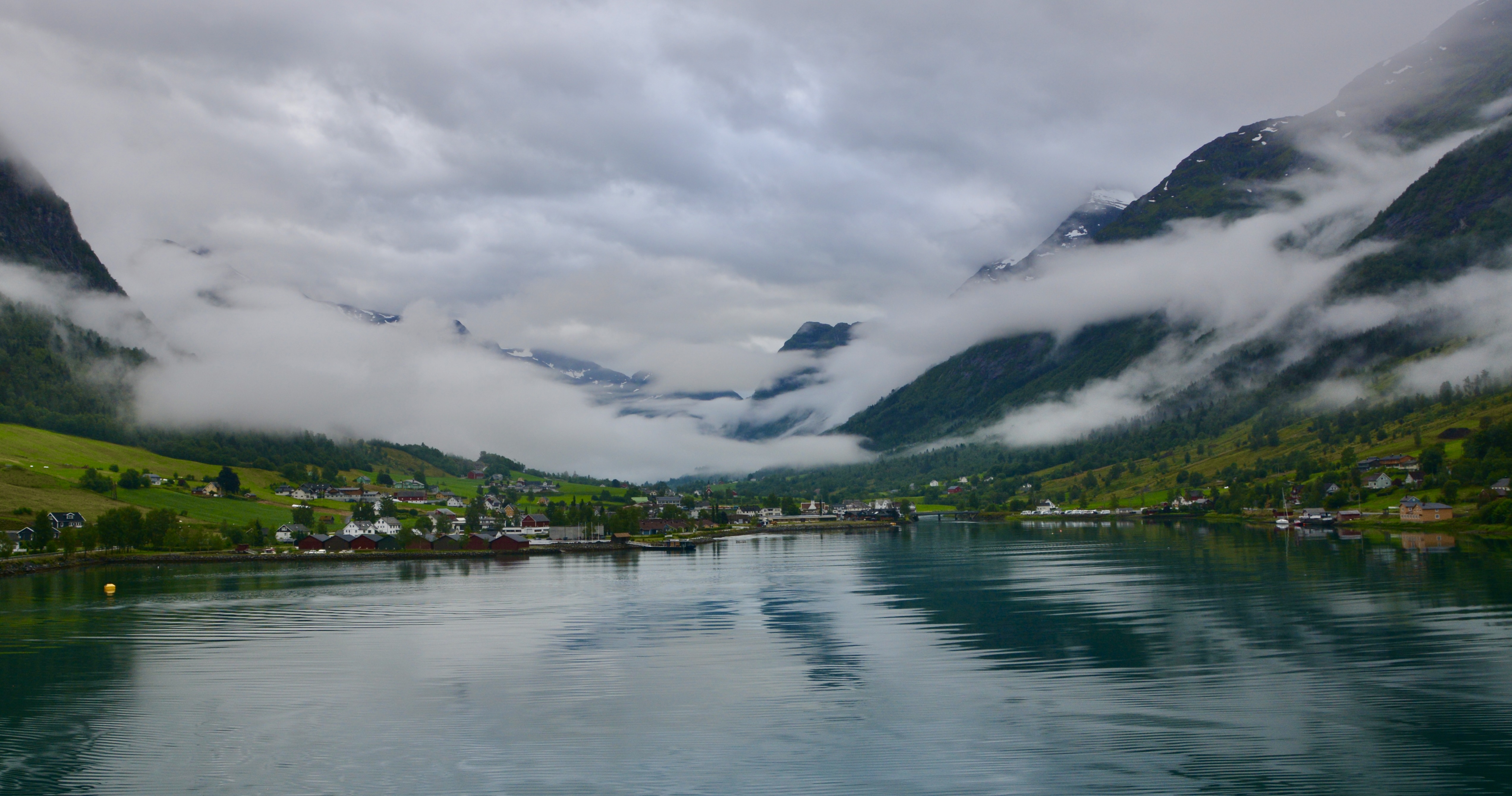
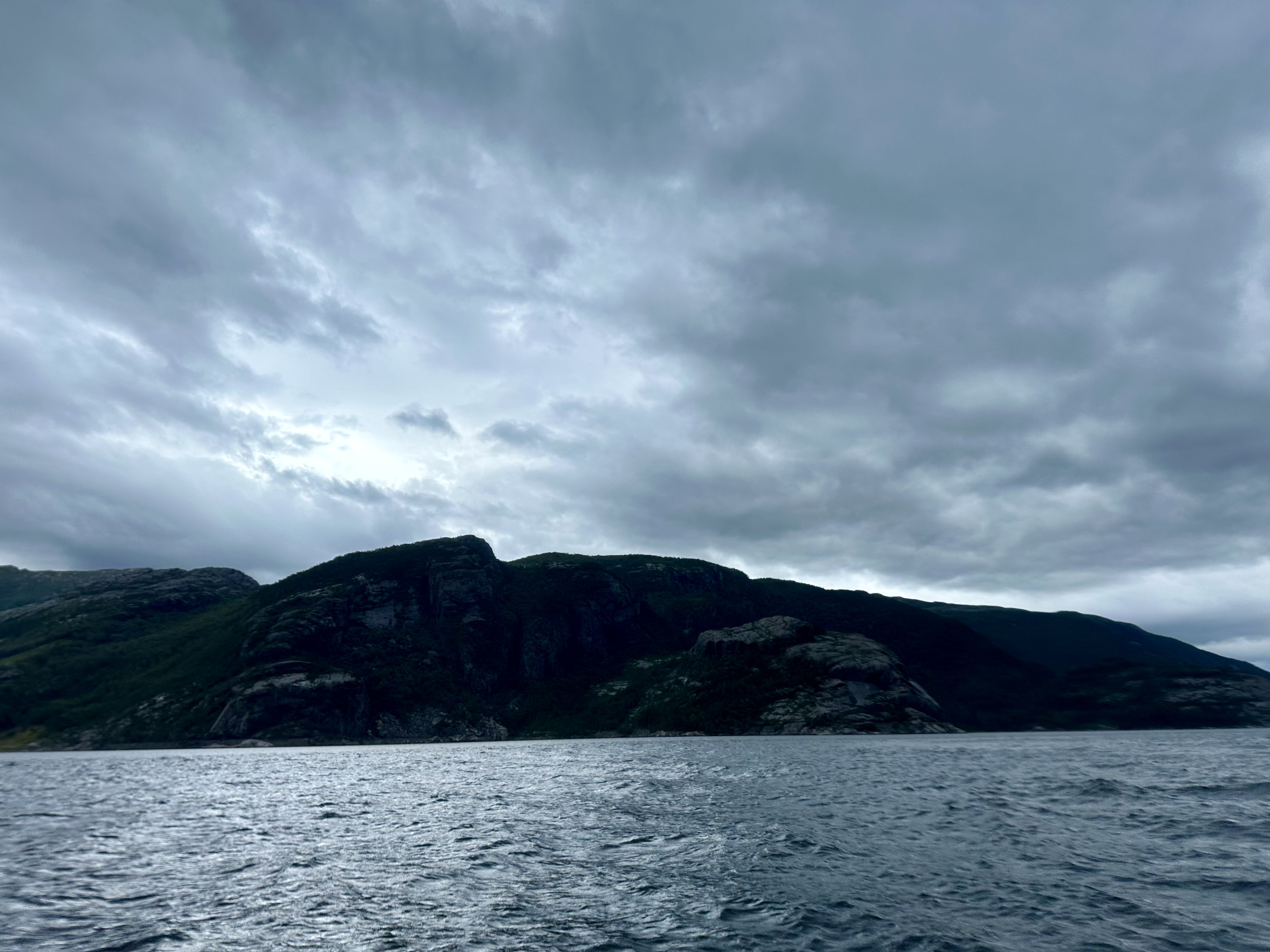
Today’s stop aboard the Celebrity Apex is Olden Norway. Boris and I are actually going on an excursion together. The two-hour sail in through the fjord on our way to Olden was breathtaking. Why would anyone want to take a cruise to Norway? Because there is natural beauty everywhere. You are surrounded by it.
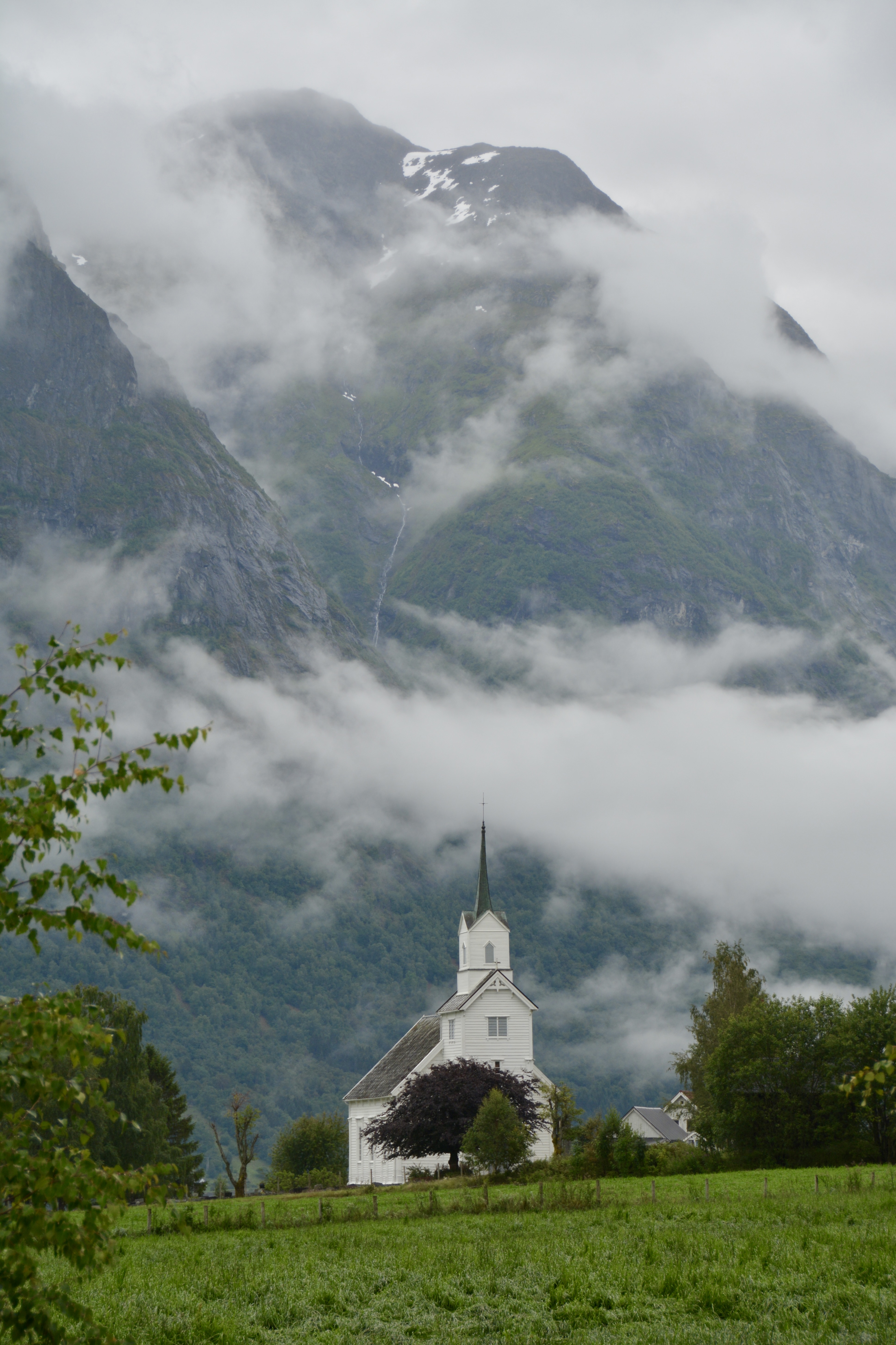
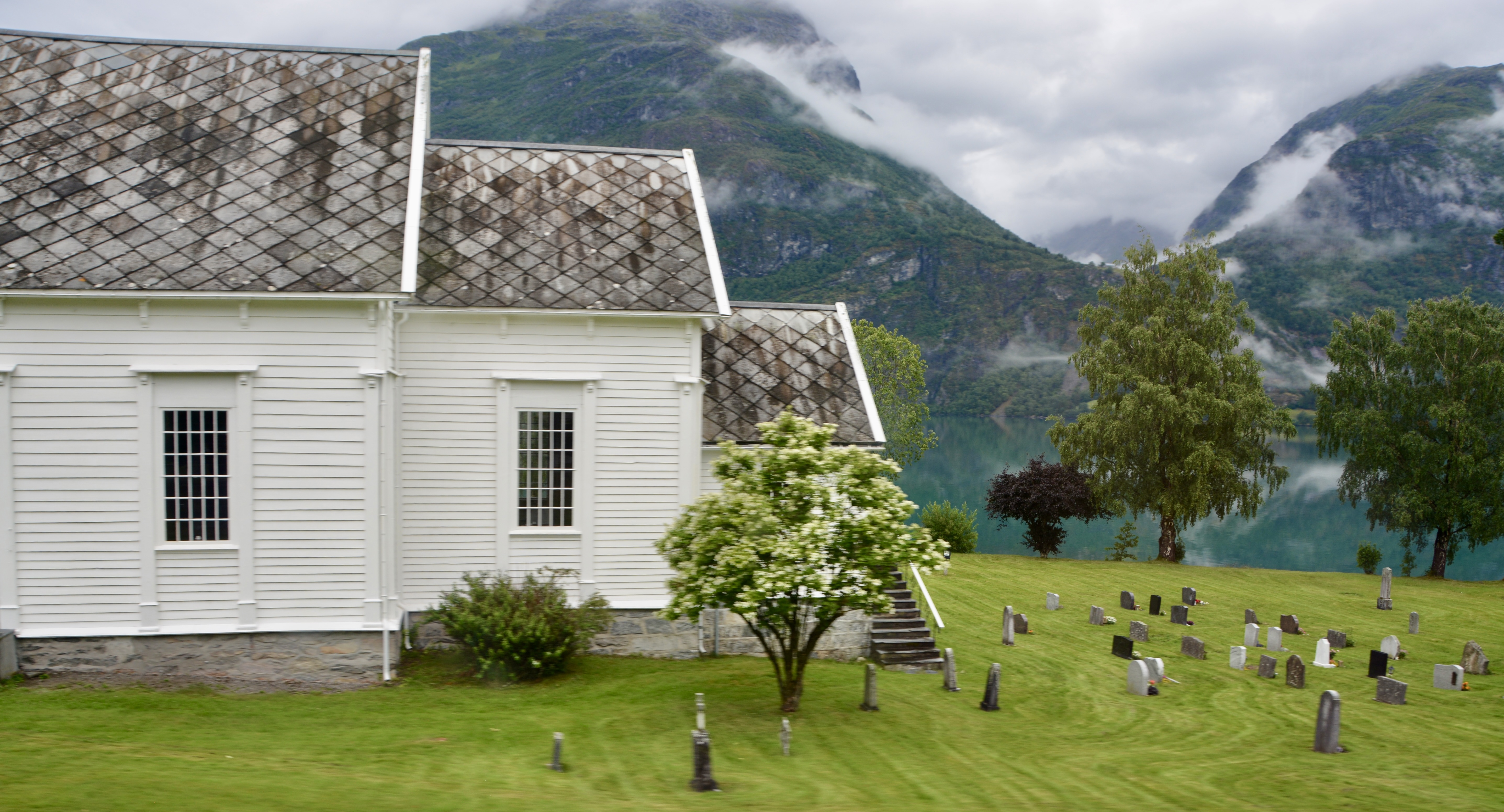
Olden is a picturesque town featuring many historical sites. It sits at the tip of the Nordfjord. You can wander around the town a bit seeing the mix of old and new, maybe making a stop at the Old Church built in 1759 on the site of the original stave church that had sat on that site since the 14thcentury. You can also visit the home of American painter William Singer in Olden.
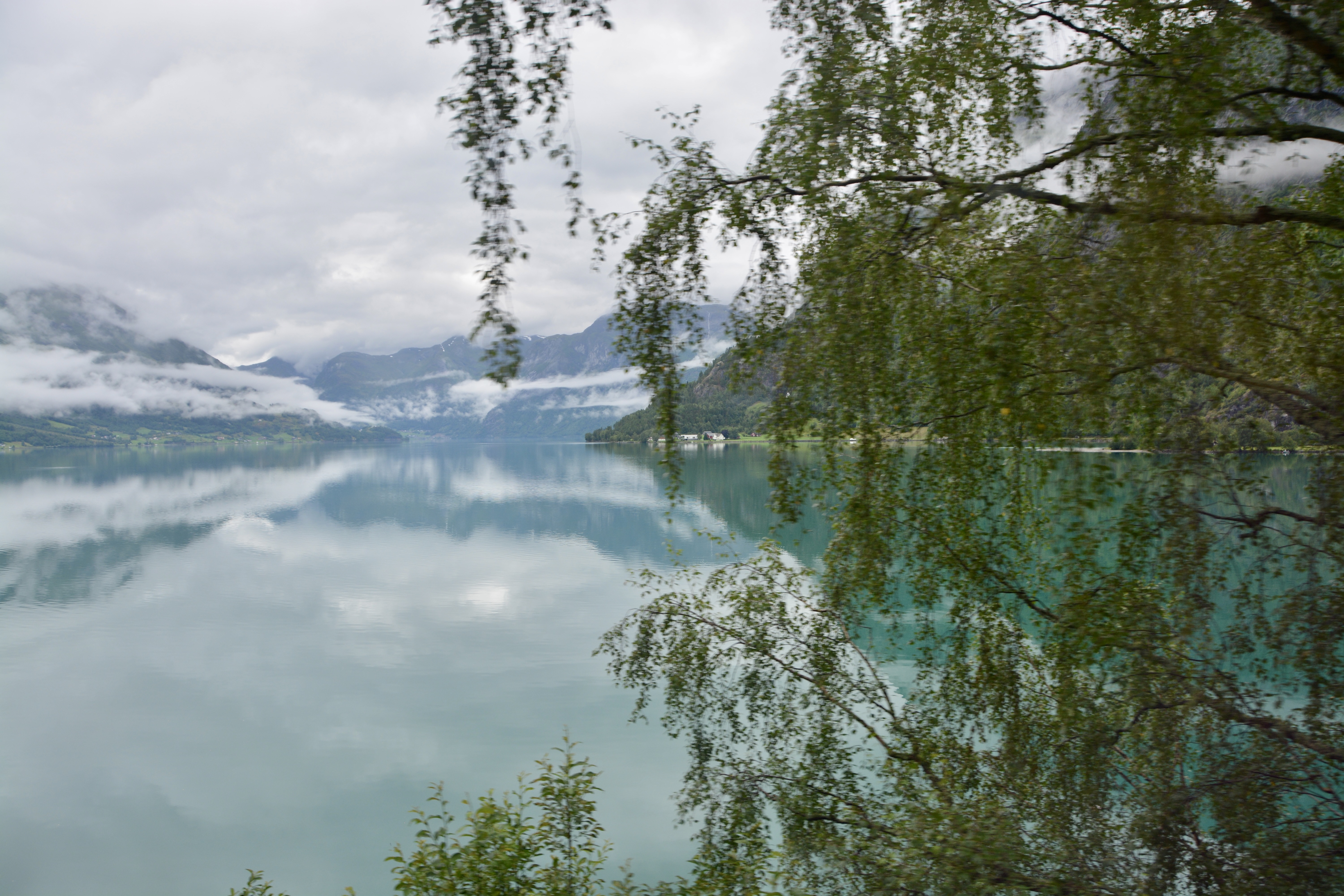
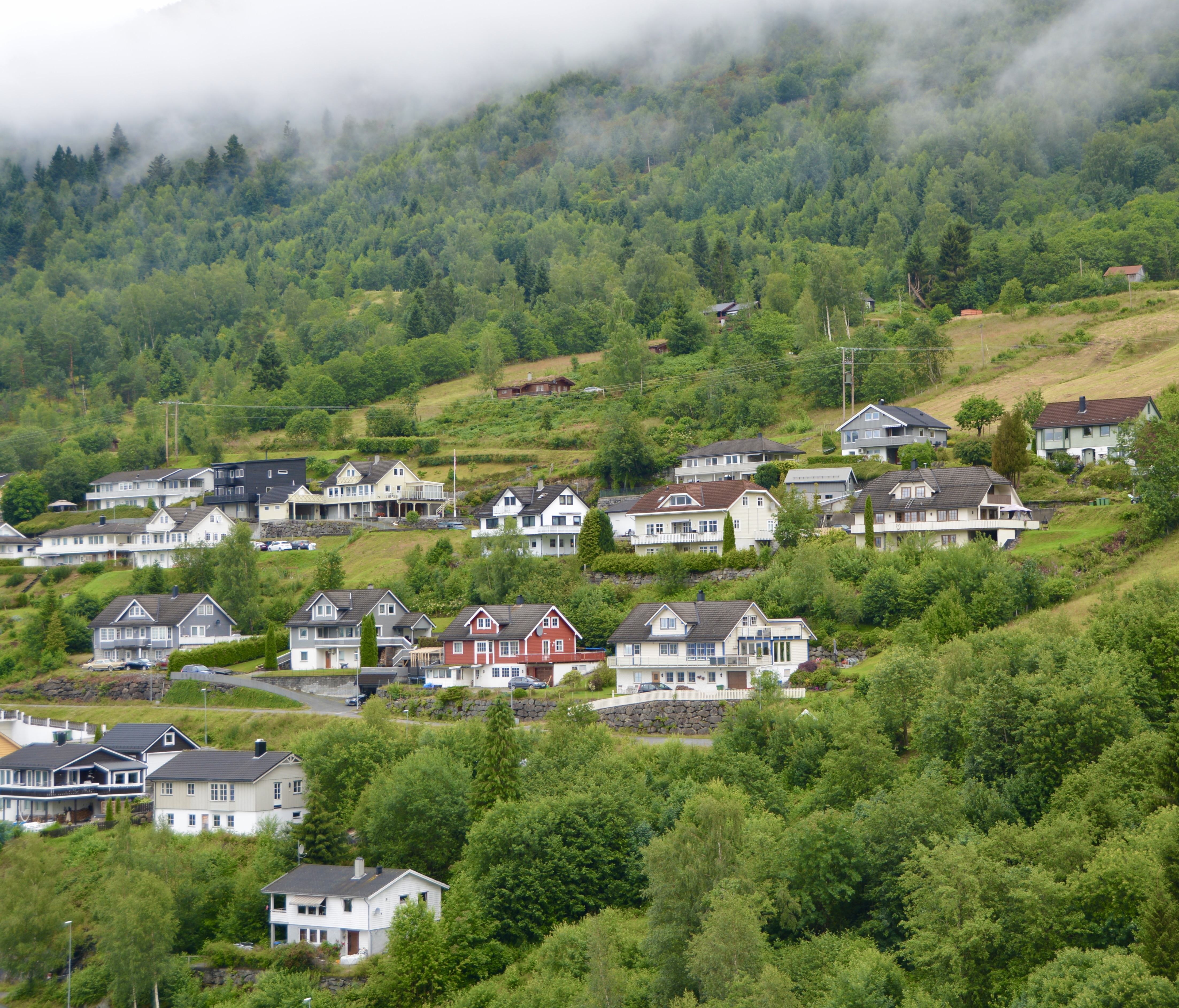
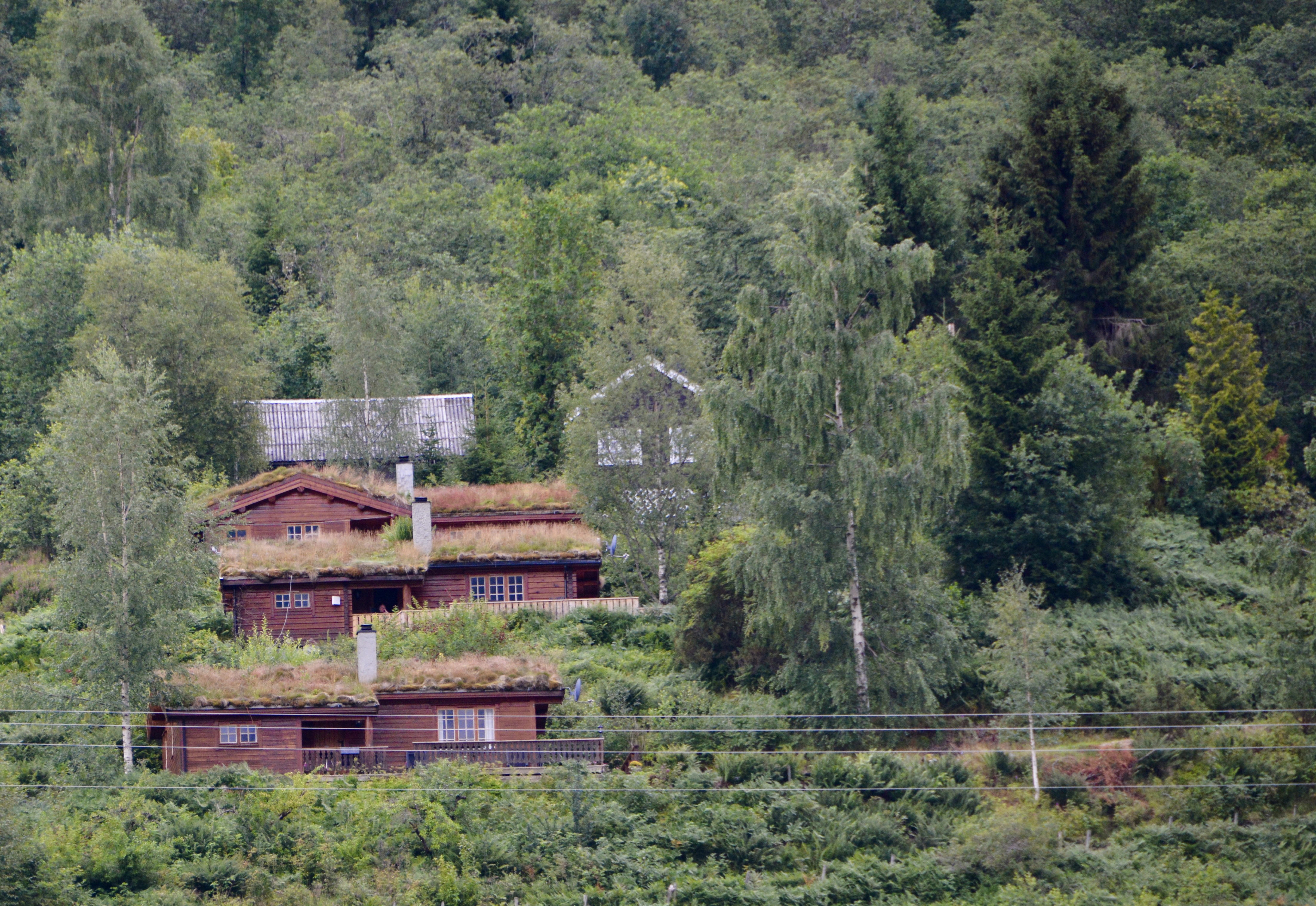
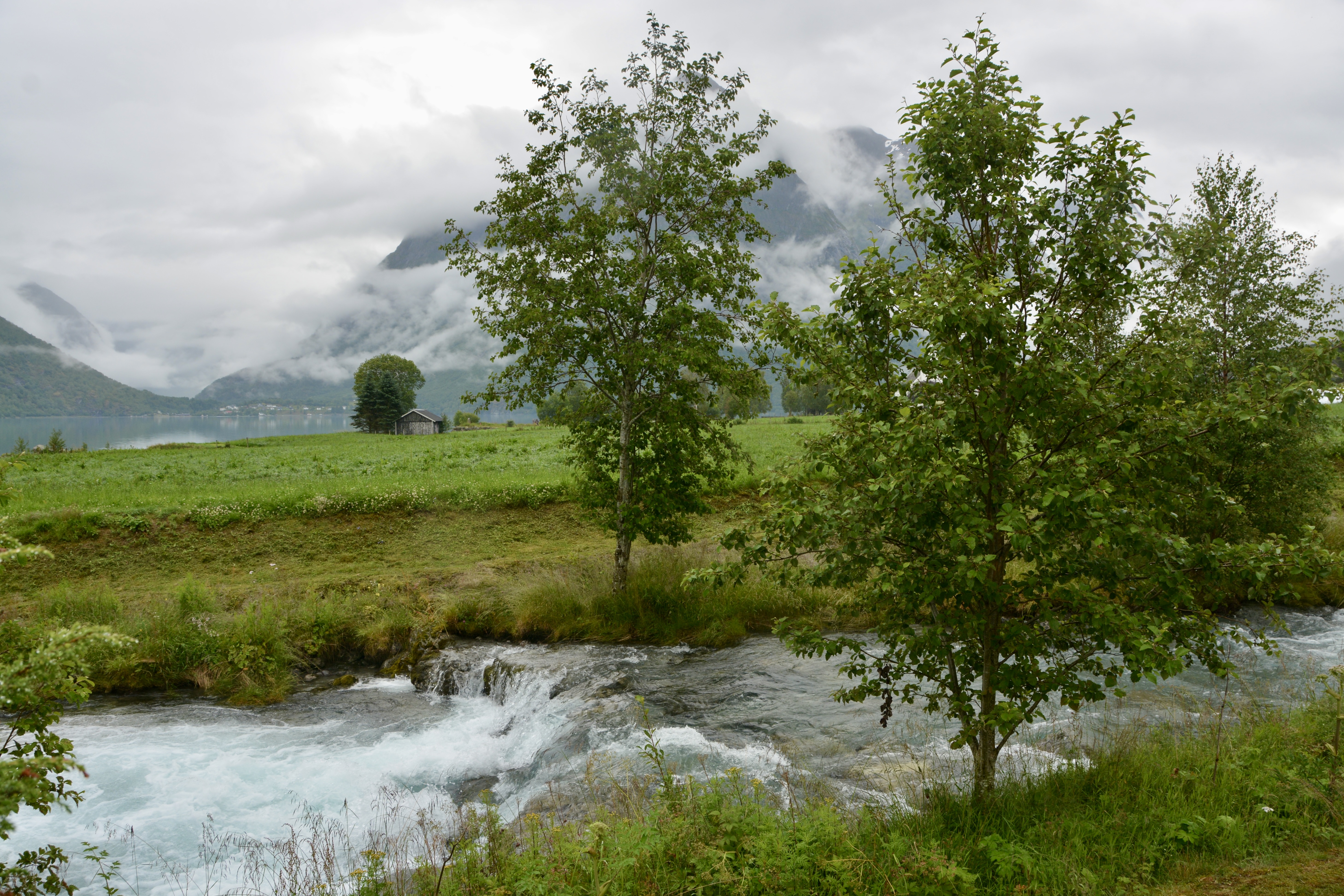
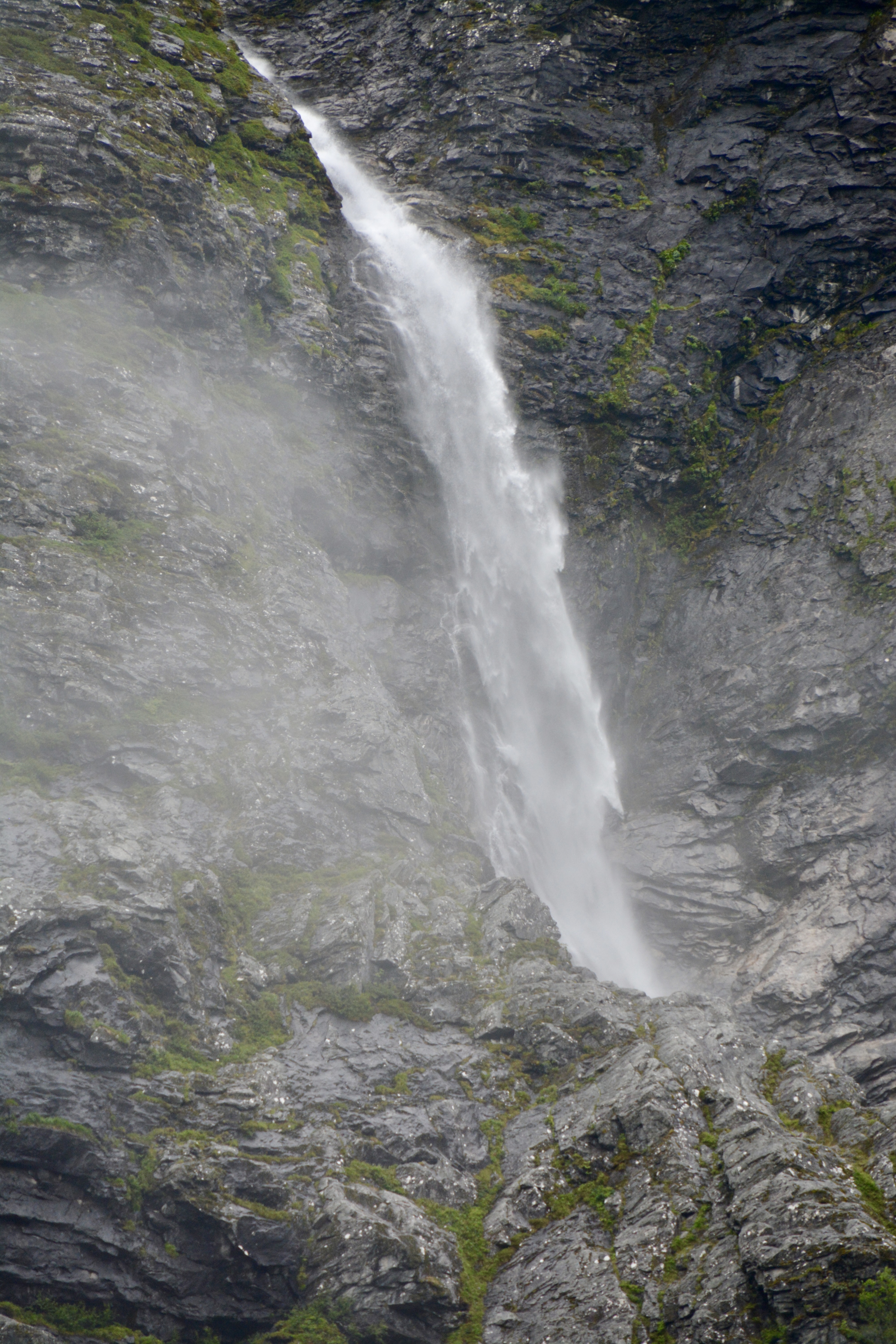
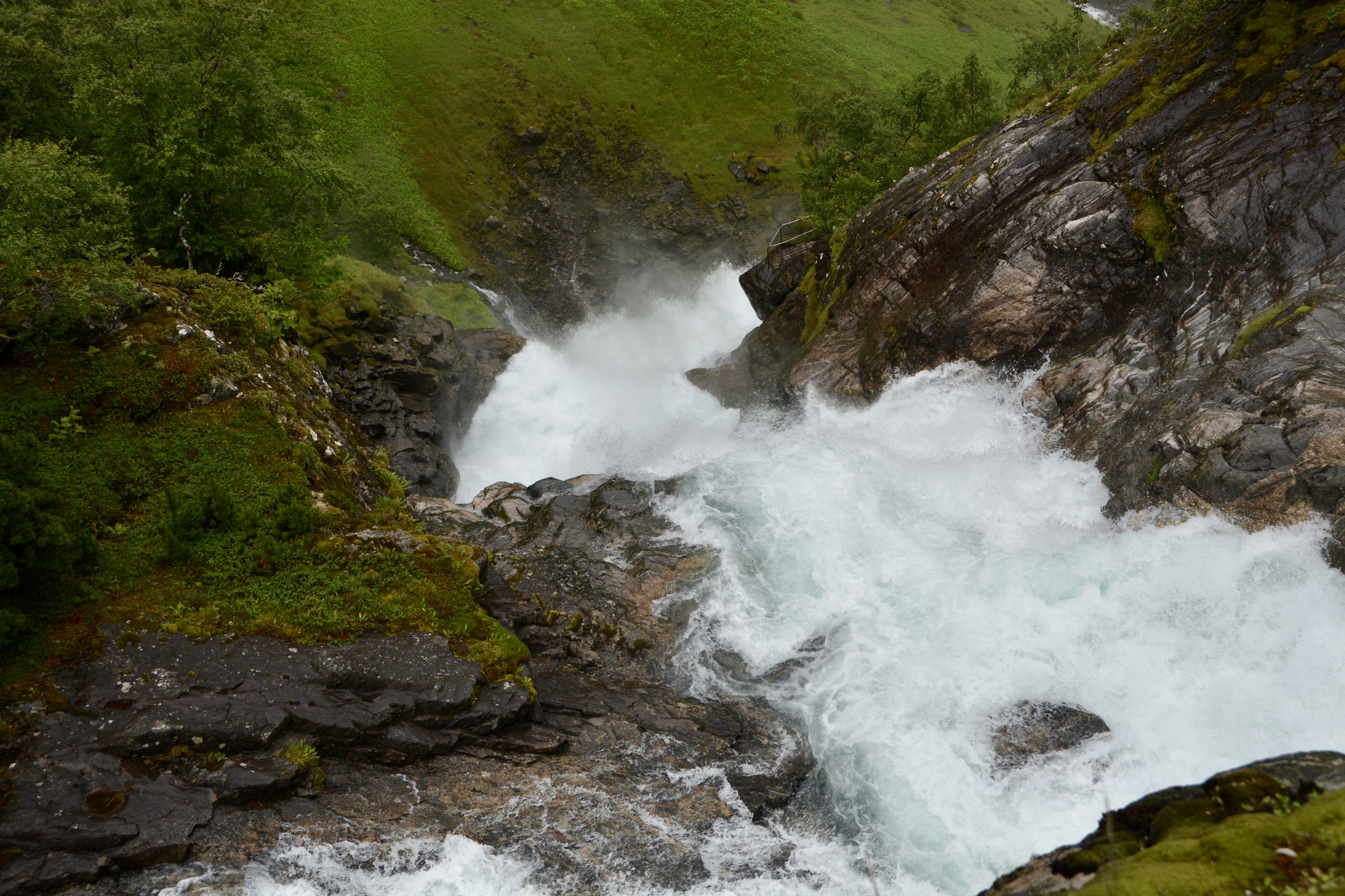
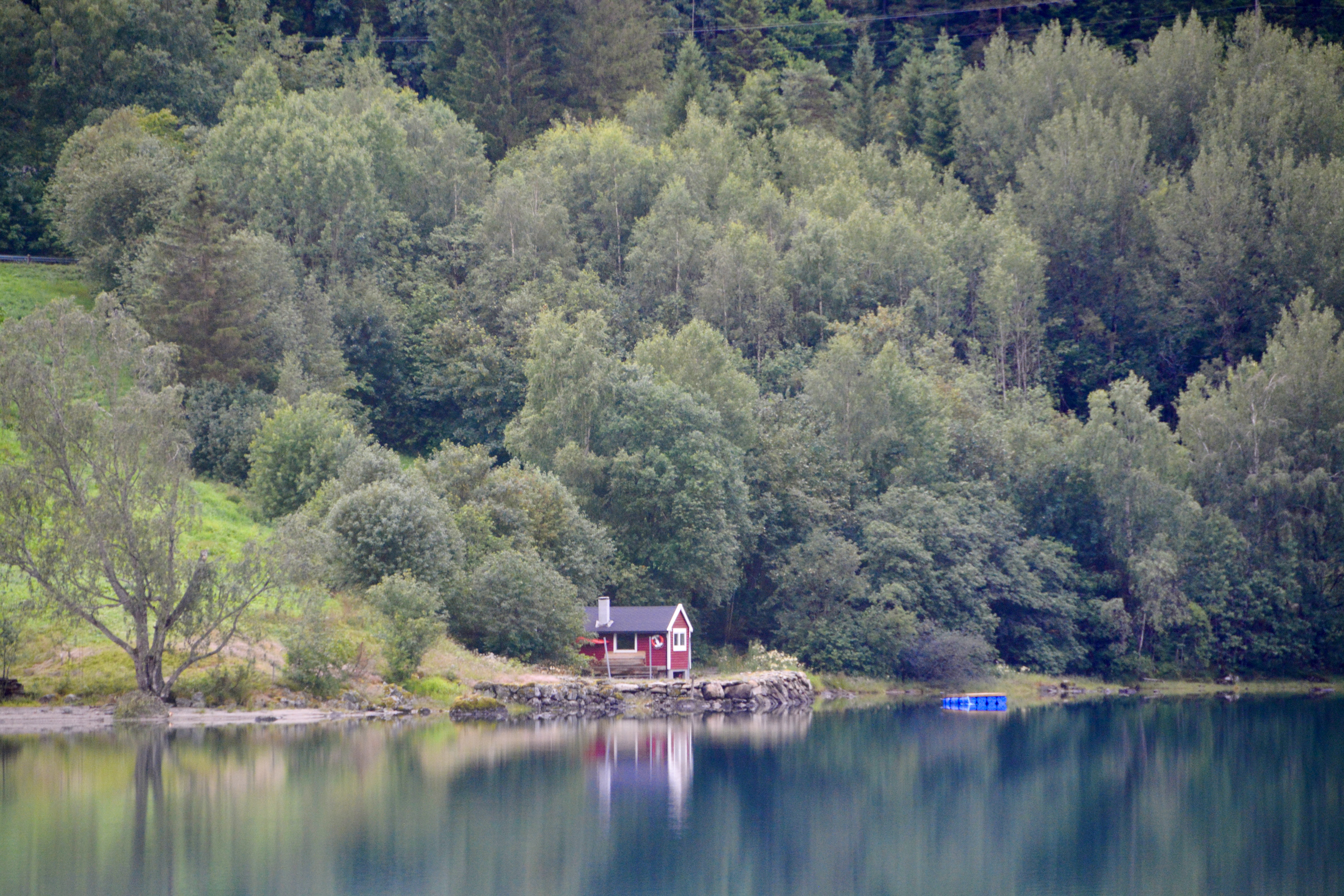
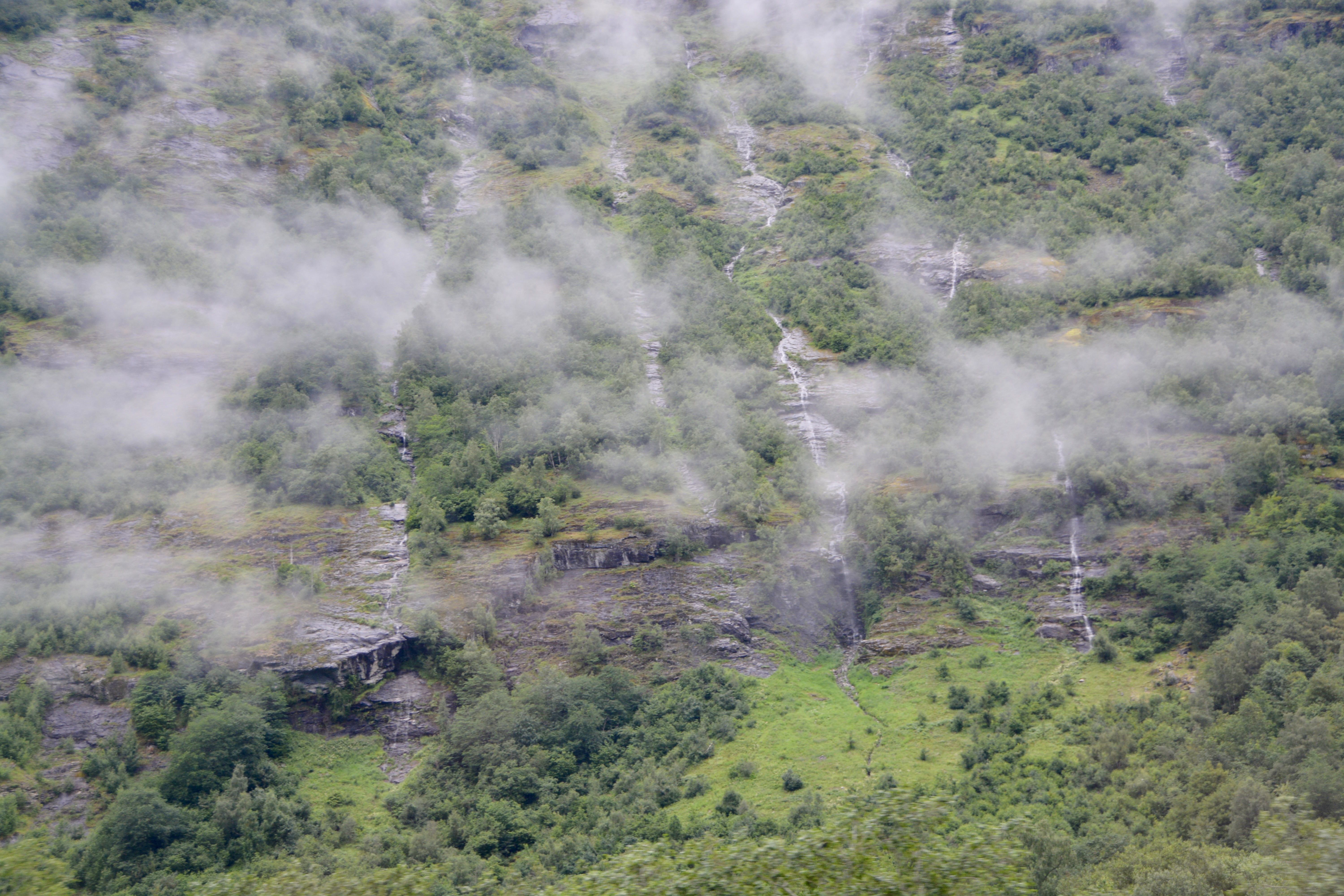
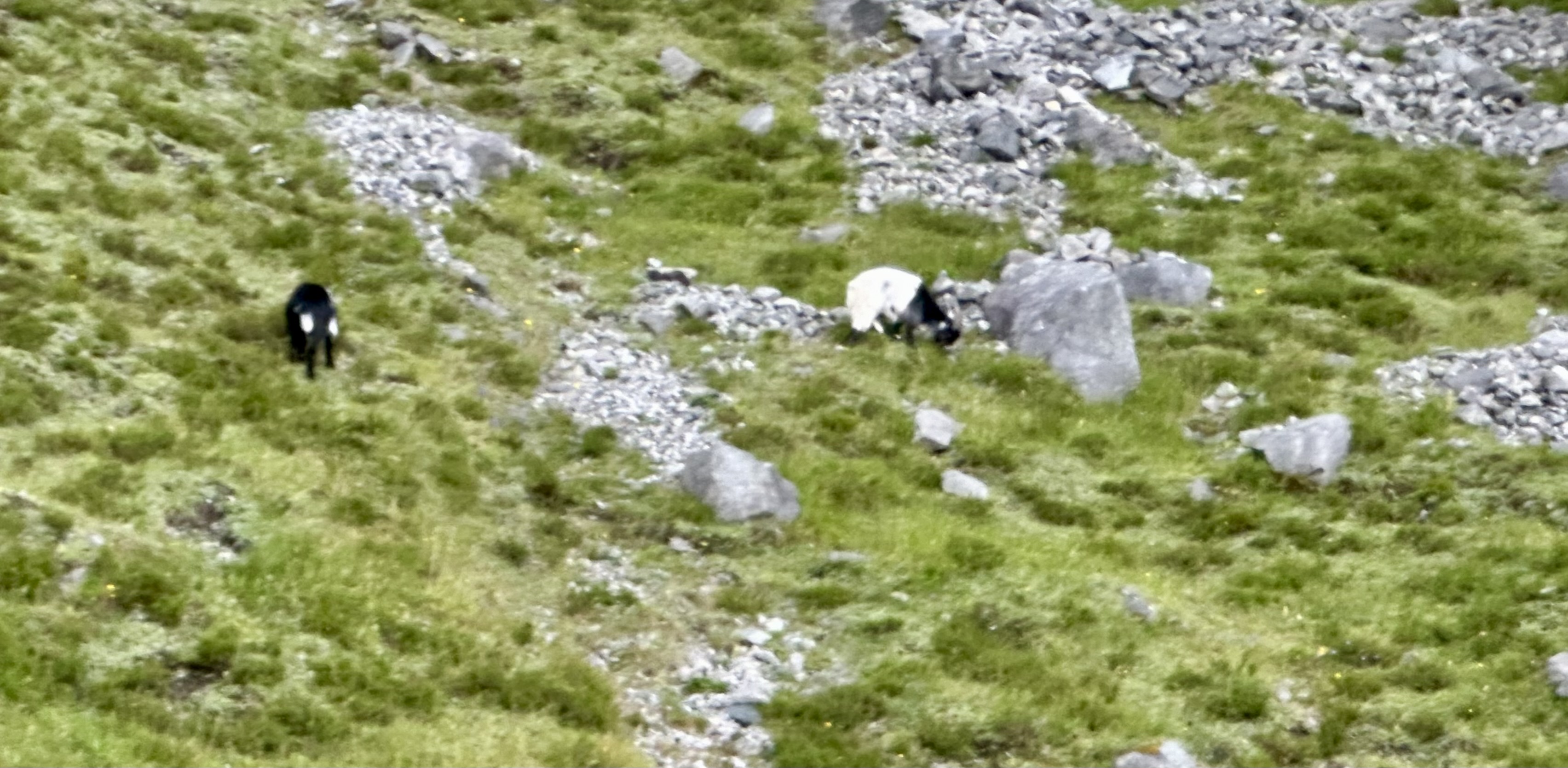
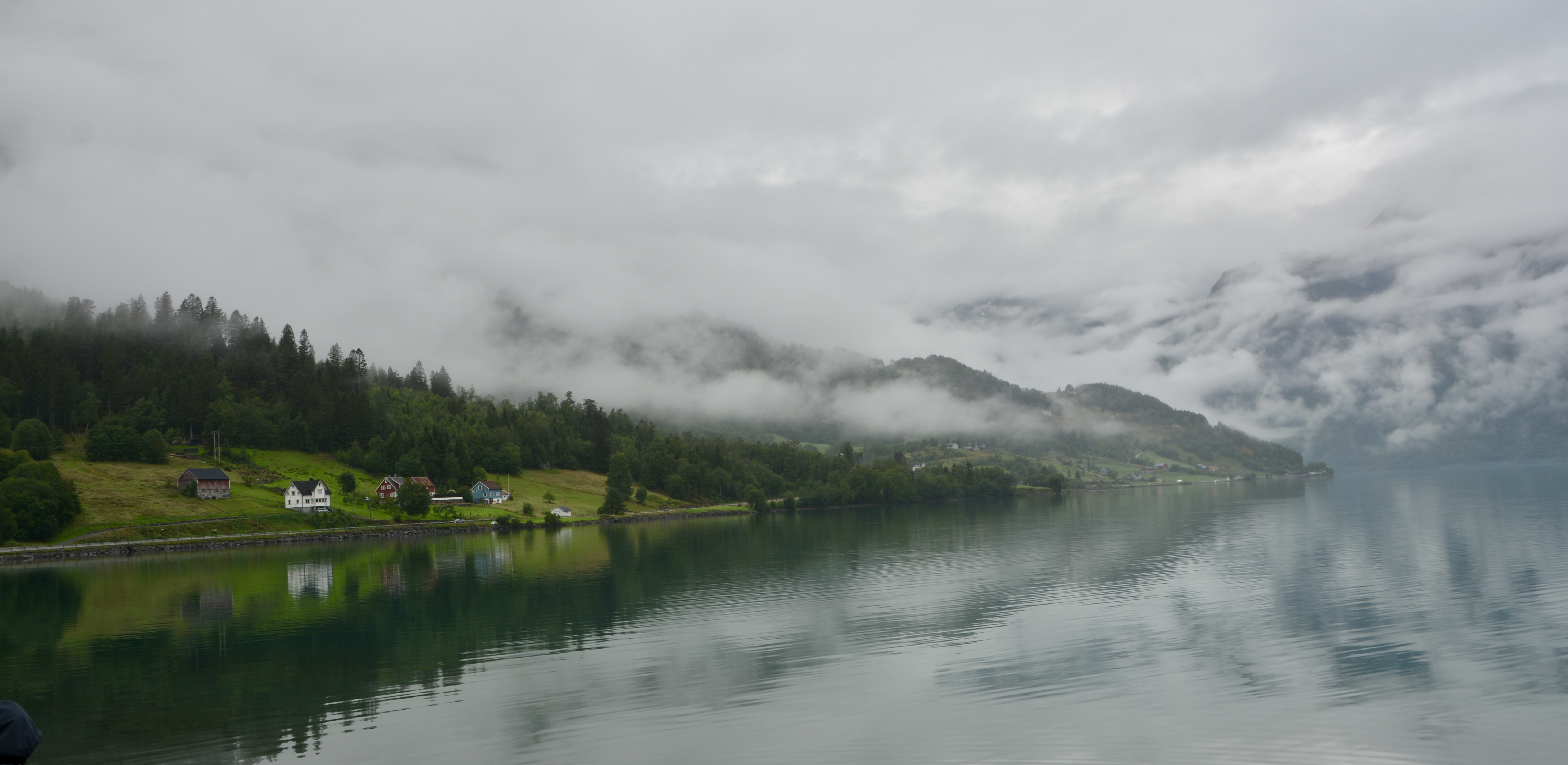
We are using the city as a jumping off point to visit the beautiful area around Lake Stryn. We had an early departure after our sit-down breakfast. We passed through Olden and traversed between rugged peaks. The scenery was amazing. There were lovely towns and villages, even the boathouses on the lake were charming. All along the drive were spectacular waterfalls from the melting glacier ice.
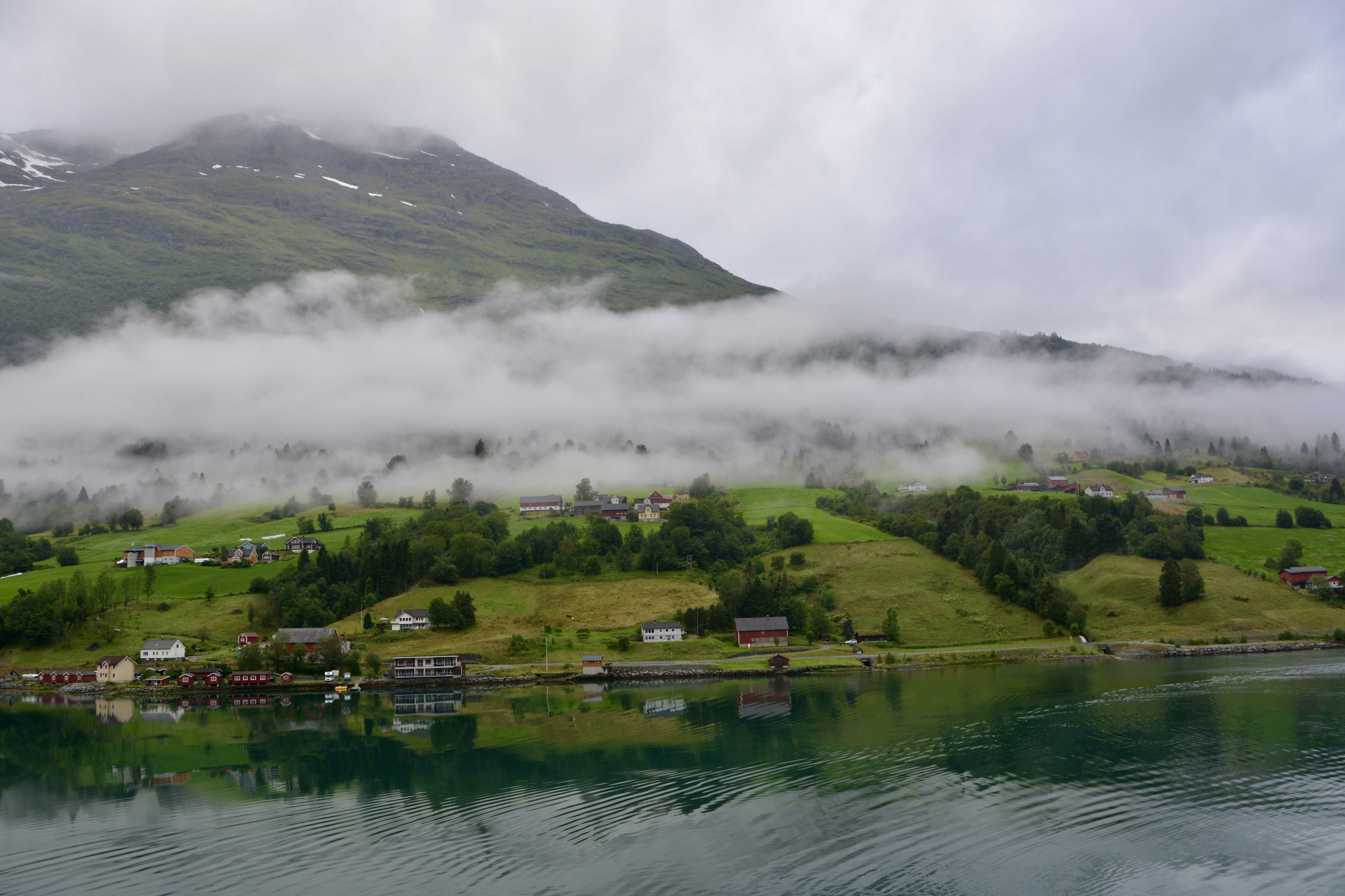
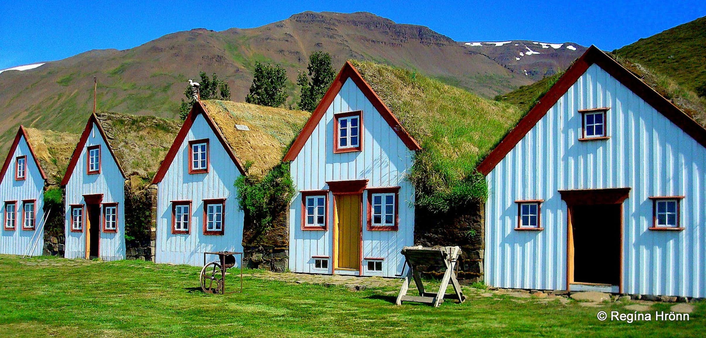
One of the things I noted was that many of the structures had a live roof. There was turf, grass, moss or other plantings on top instead of the shingles I am used to.
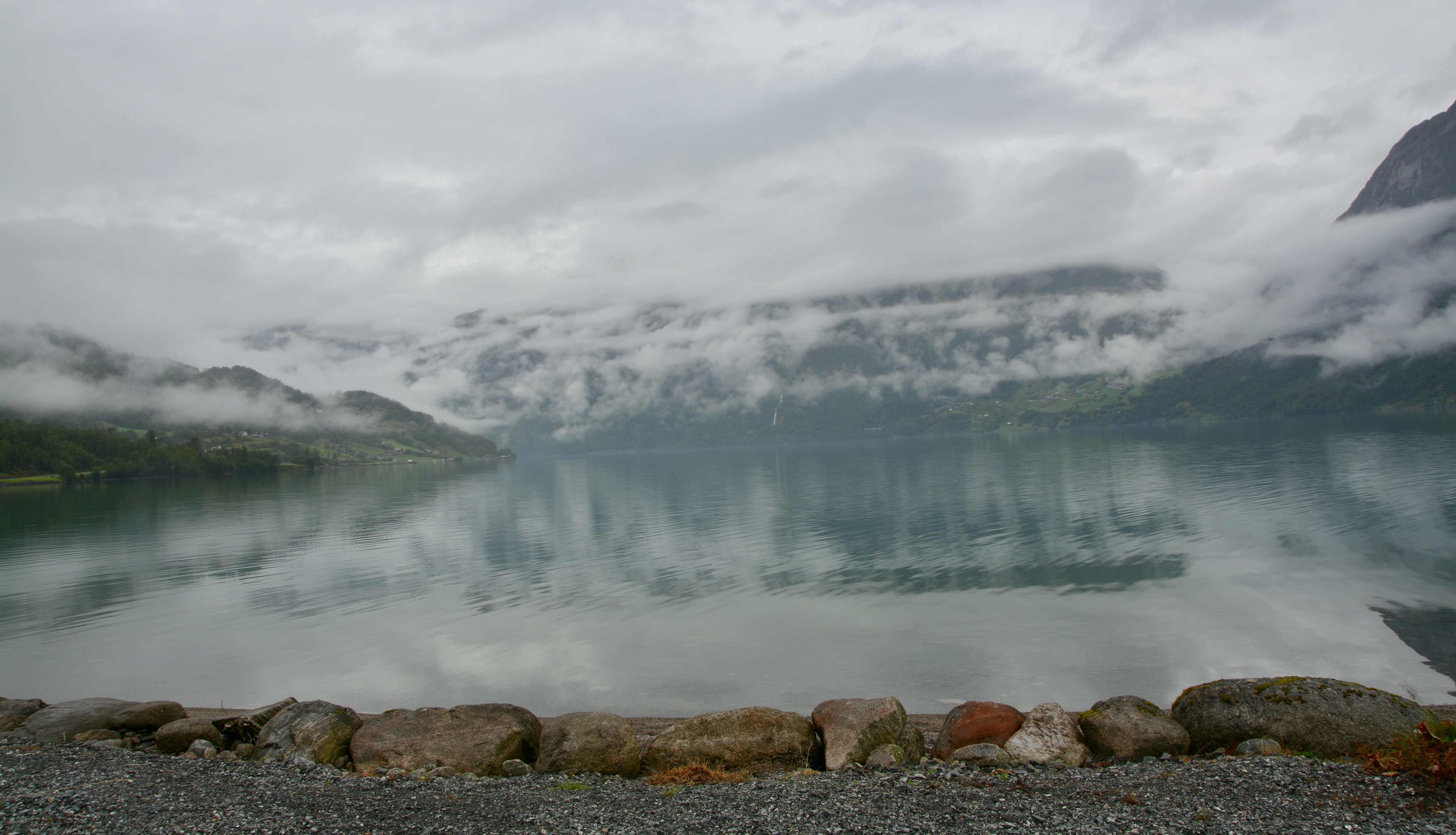
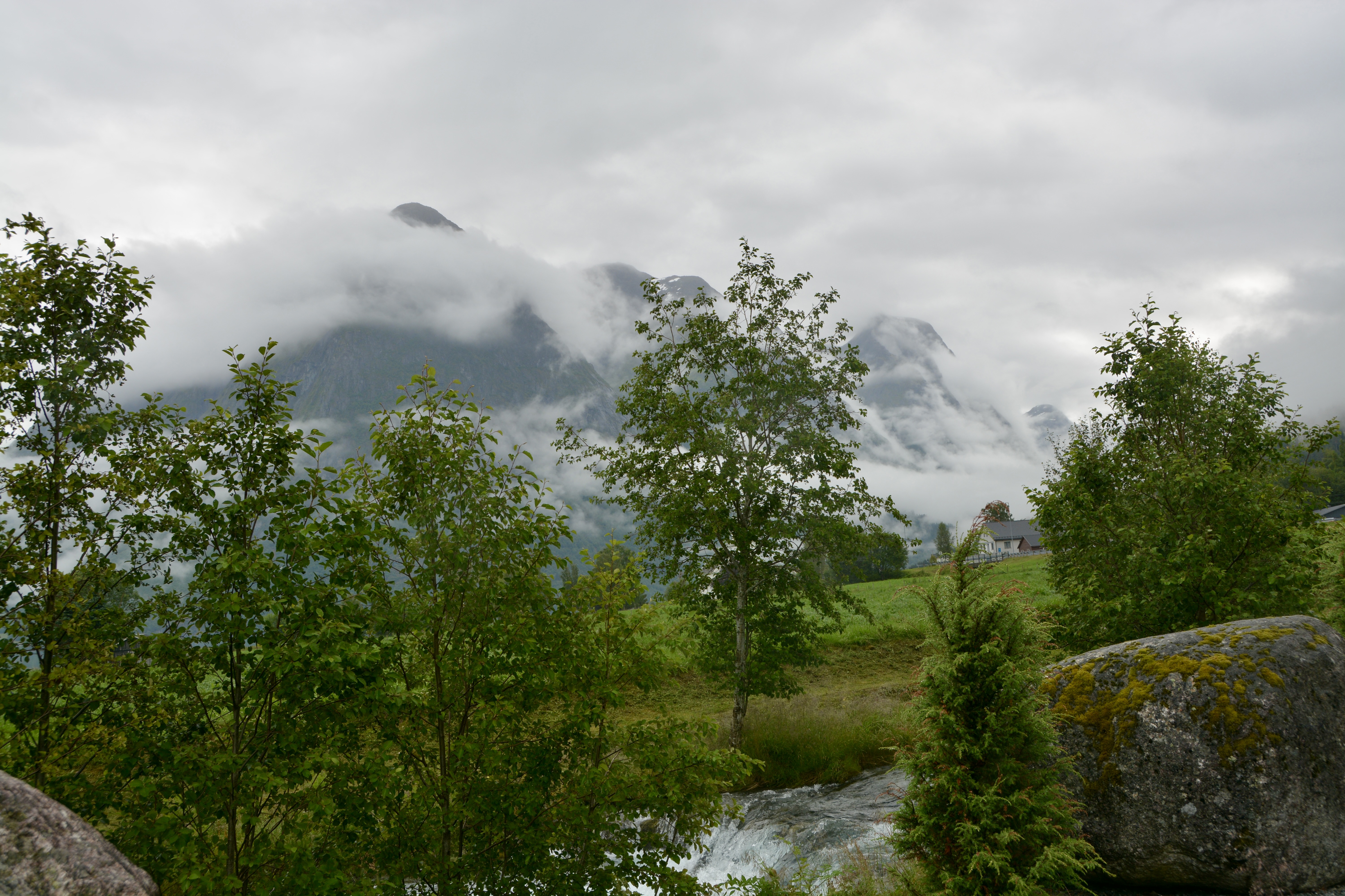
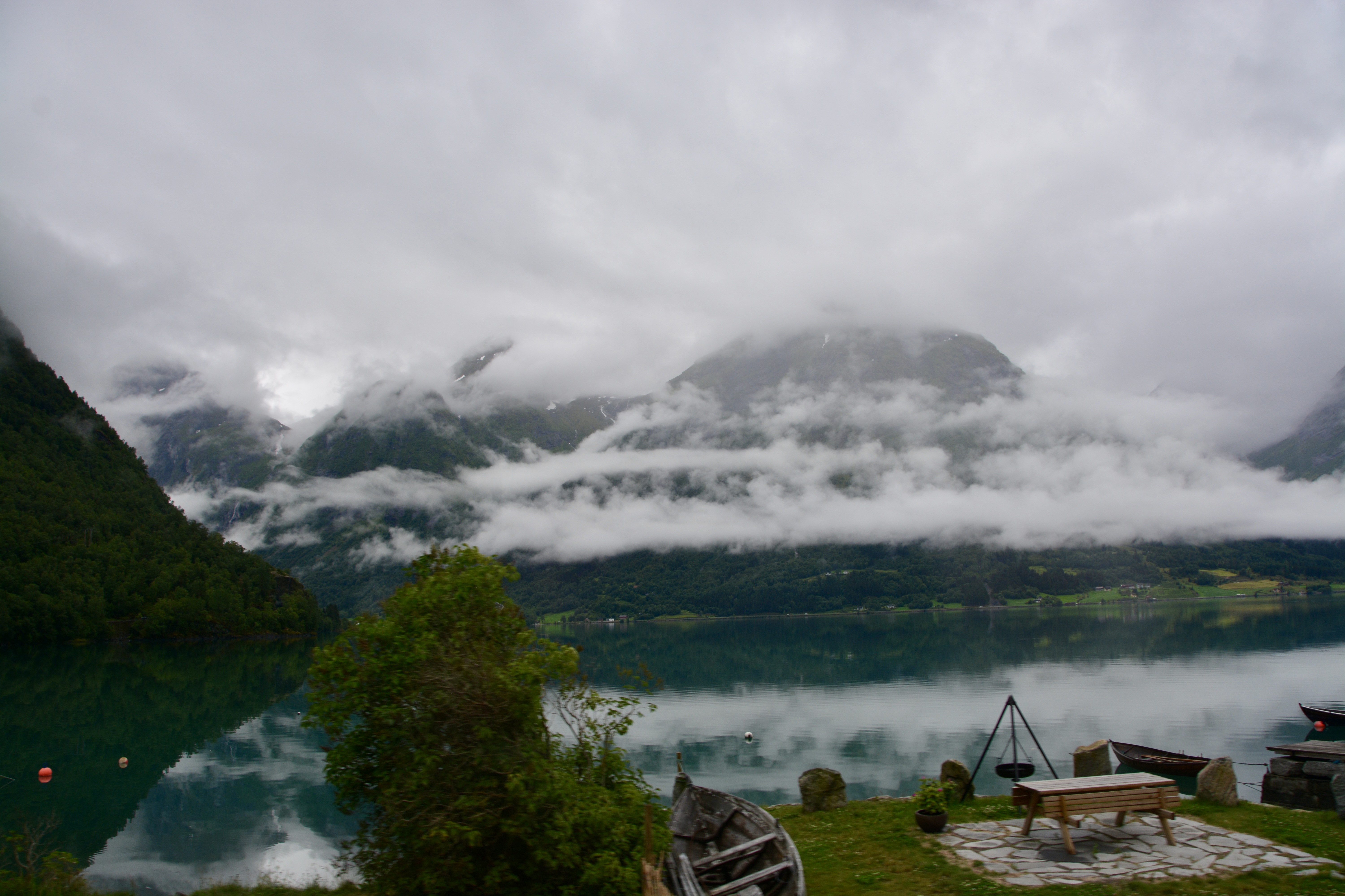
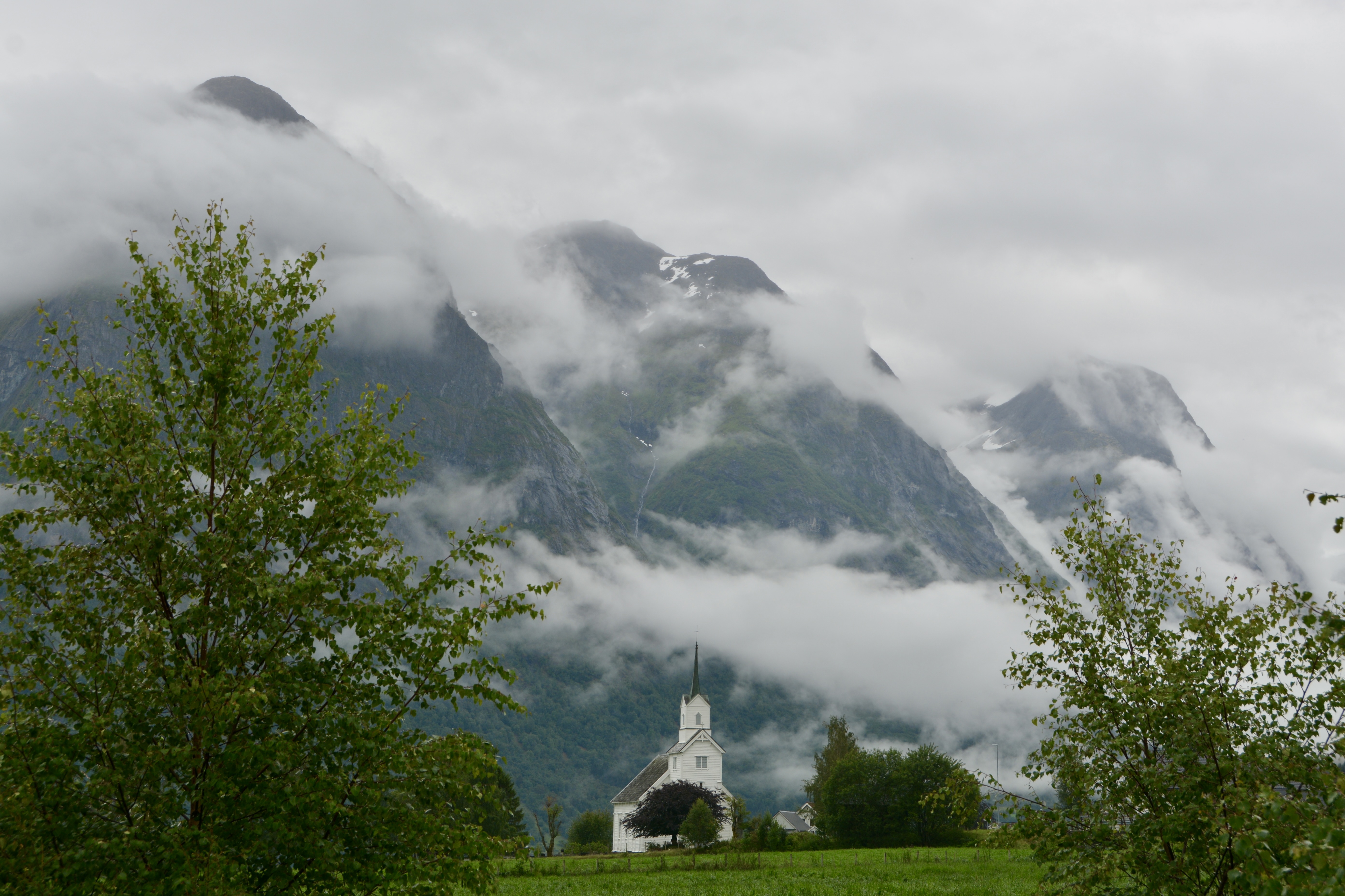
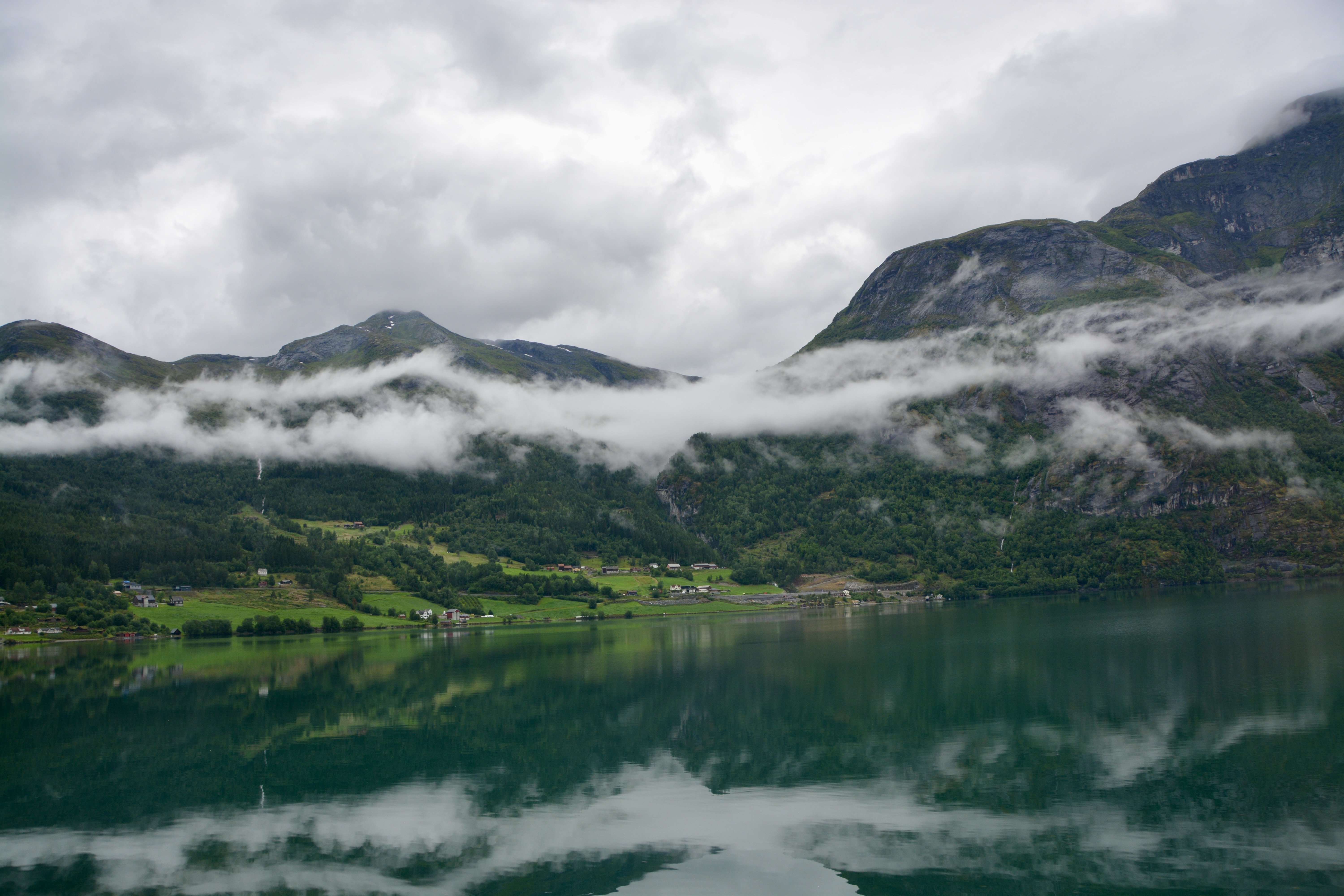
We made a stop at the Jostedalsbreen National Park Center. There were fabulous views of the lake, a local church, and in the distance, the glacier. One of the most wonderful gifts of nature was the mist created by the humidity in the area. The fog or low-lying clouds made for the most wonderful pictures.
Inside the park center we were treated to the national delicacy, the Norwegian pancake. It is served with sour cream and jam, rather than the butter and syrup I would see at home. After enjoying our pancake with coffee or tea, we watched a video about the glacier, the largest in mainland north Europe. It was made 20 years ago and while much of the information is still accurate, the glacier itself has receded quite a bit in the last two decades.
After leaving the park center behind, we continued up the winding road to a spectacular waterfall and had a photo stop so we could get pictures. We had been teased with views of the waterfall along the switchback road leading to it.
Our return trip to the ship took us back along the same road. A lovely couple from Vancouver that sat across from us asked what our ticket read on the way back. They had paid for view of Lake Stryn from the Loen Skylift in Olden and had been given the wrong tour sticker and had been directed to the wrong bus. I felt really bad for them, although I had enjoyed their company along the way. Chris and Stella were a charming couple. All of us encouraged them to go by guest relations and seek a refund and even a ride to the skylift for an afternoon run up the mountain.
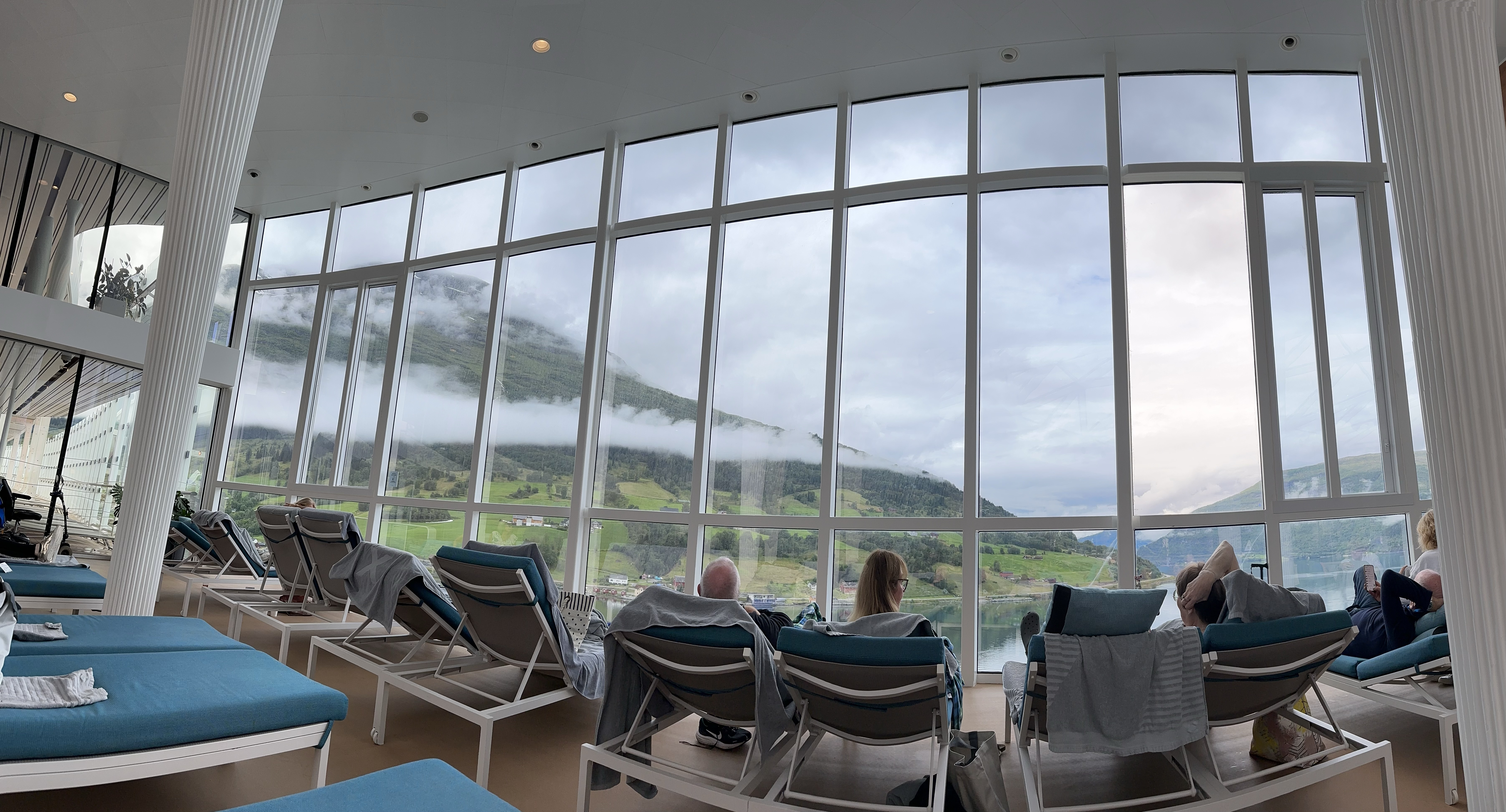
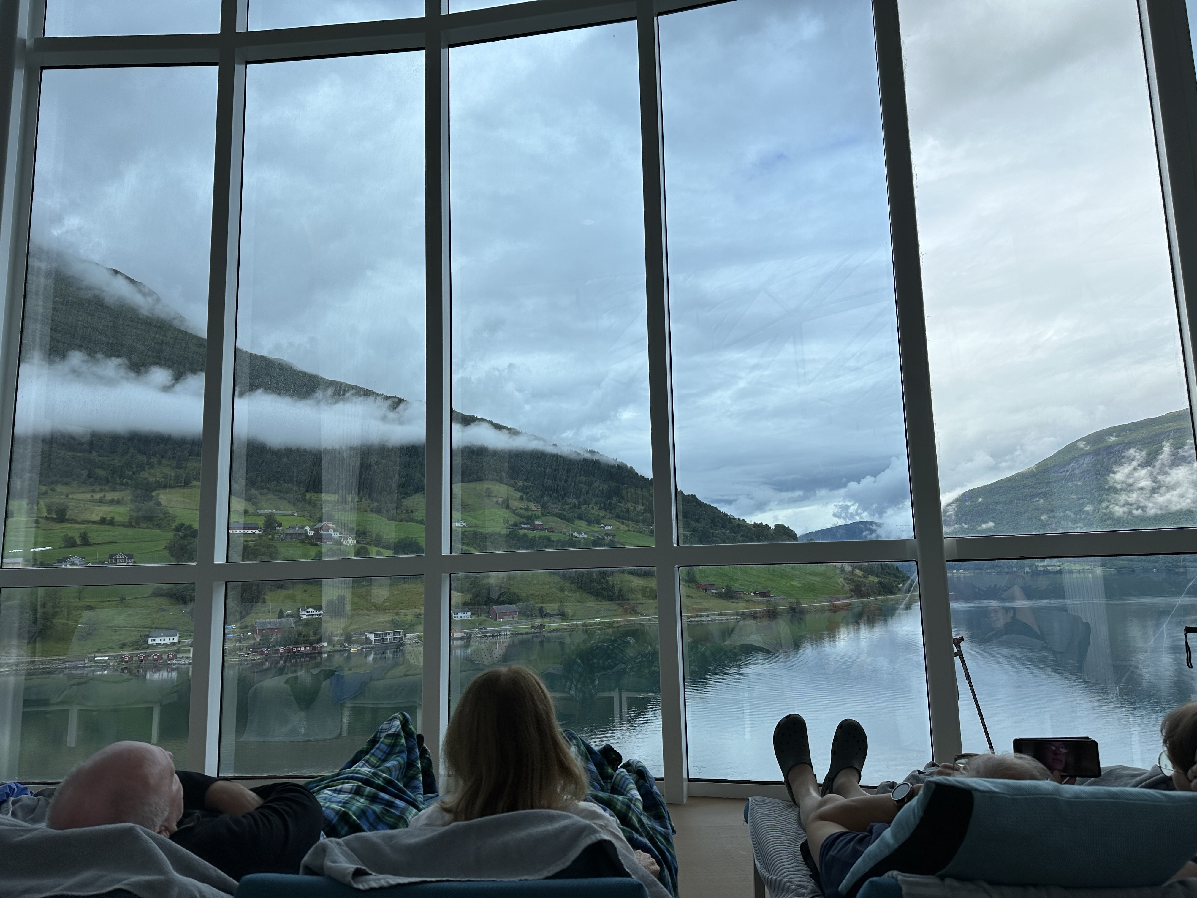
We made it back to the ship and enjoyed a late lunch on the magic carpet that was positioned at deck 14 right by the Mast Grill; think burgers and hotdogs. After food and drinks on the carpet, we wandered into the solarium and I noted the larger size, the availability of seats, and the amazing views out the two-story windows. I went back to the cabin and immediately put on my swimsuit and headed back up to deck 14. The air in the solarium was warm enough to feel comfortable in the suit. Boris even joined me, and we read while enjoying the view until it was time to get ready for dinner. We want to get to dinner early so we can get a table by the window and enjoy the sail out along the fjord.
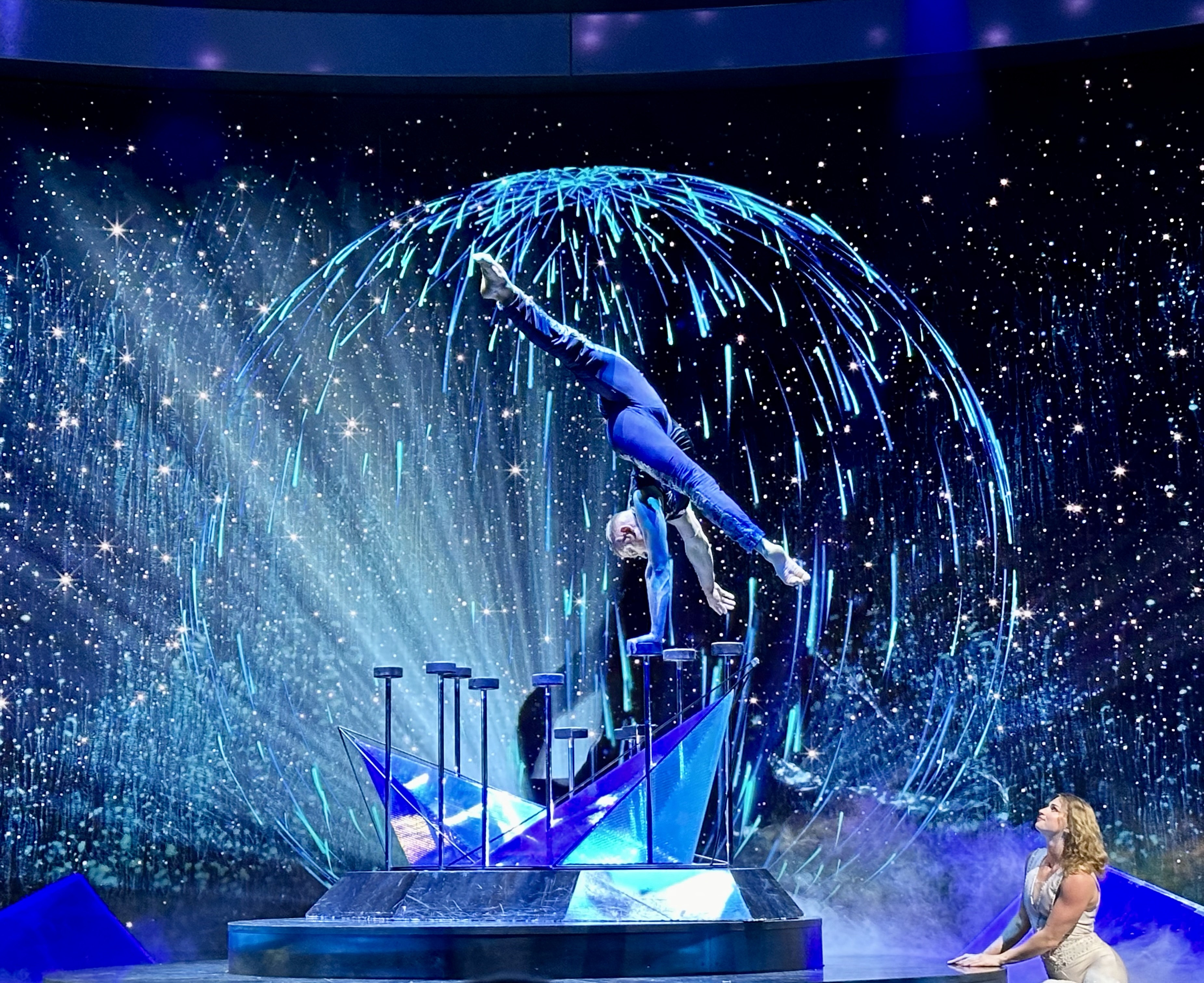
Tonight is the first big production show in the theater. It is called Crystalize. It was a strange production featuring singers, dancers, and aerialists. I am not sure you could say there was a story, and the music was not recognizable, but it was clear the whole show was designed to showcase the new production abilities of the theater from a large, frosted cylinder that descended to the stage (an aerialist performed inside) to the giant screen that created the mood for the set. I am not sure I could say I liked the show, but it was innovative. I was impressed by the theater and the performances of the aerialists, particularly the couple.
Tomorrow, we dock in Flam Norway. This includes another beautiful sail in through a fjord. The excursion I am most looking forward to is in Flam, a trip up the mountain on their famous railway. Boris and I are splitting up again. He wants to go a Viking village.
Today is our first stop on our cruise to the fjords of Norway including passage into the Arctic Circle, all aboard the Celebrity Apex. This in depth visit to Norway’s western coast has been on my bucket list for a while, but it was not until after our great trip from Iceland to Greenland to Eastern Canada to Boston aboard Celebrity last year that I was able to convince Boris to commit to a cruise through the Norwegian fjords. Norway features some of the world’s most expensive ports for the ships to dock at and that is what drives cruise pricing. I had to convince Boris the scenery was worth the price.
There was a six-hour time difference for us from our departure city of Southampton, England. On yesterday’s sea day we moved another hour forward so we are now seven hours ahead of Houston. At least we have gotten some sleep.
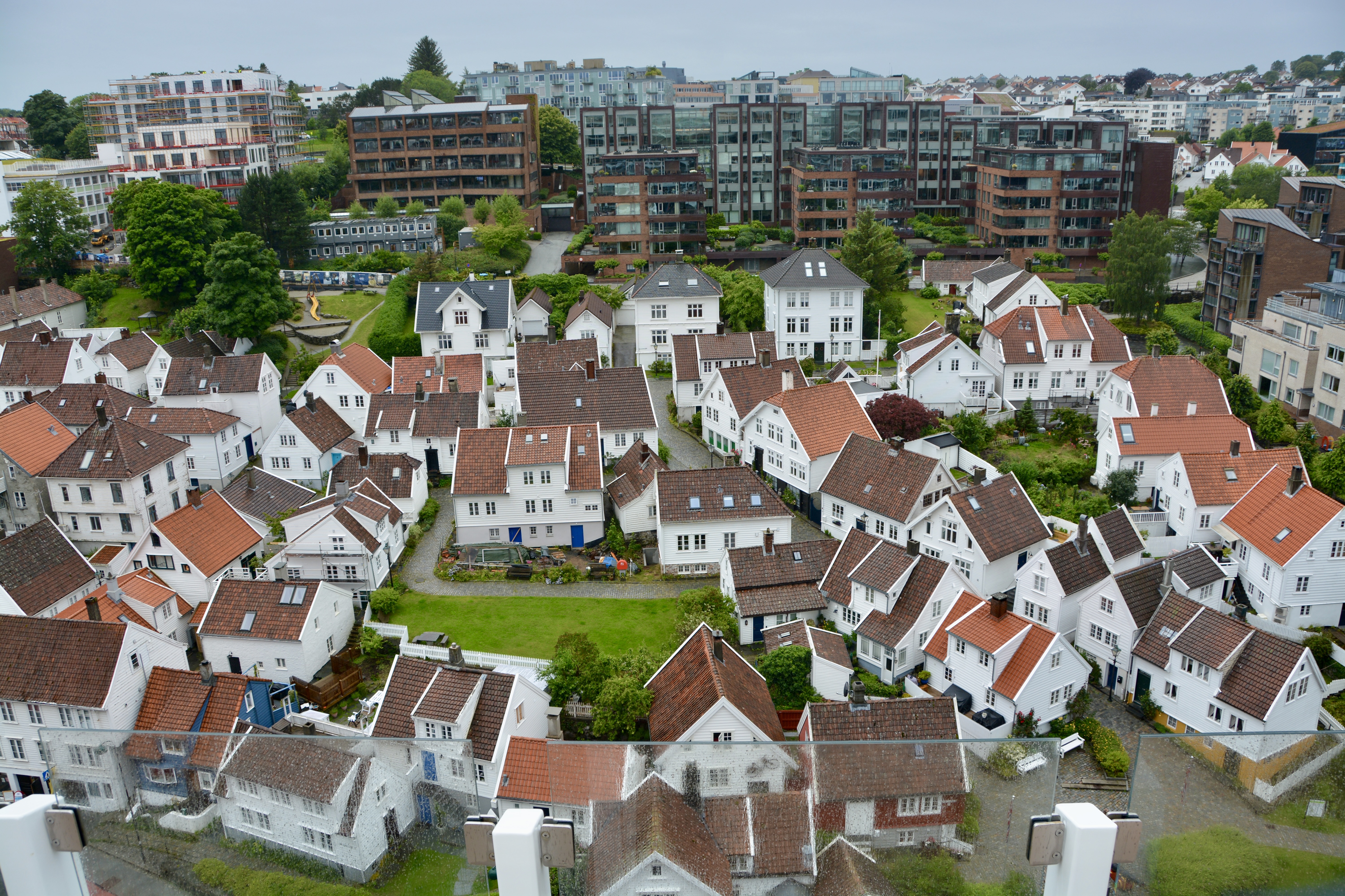
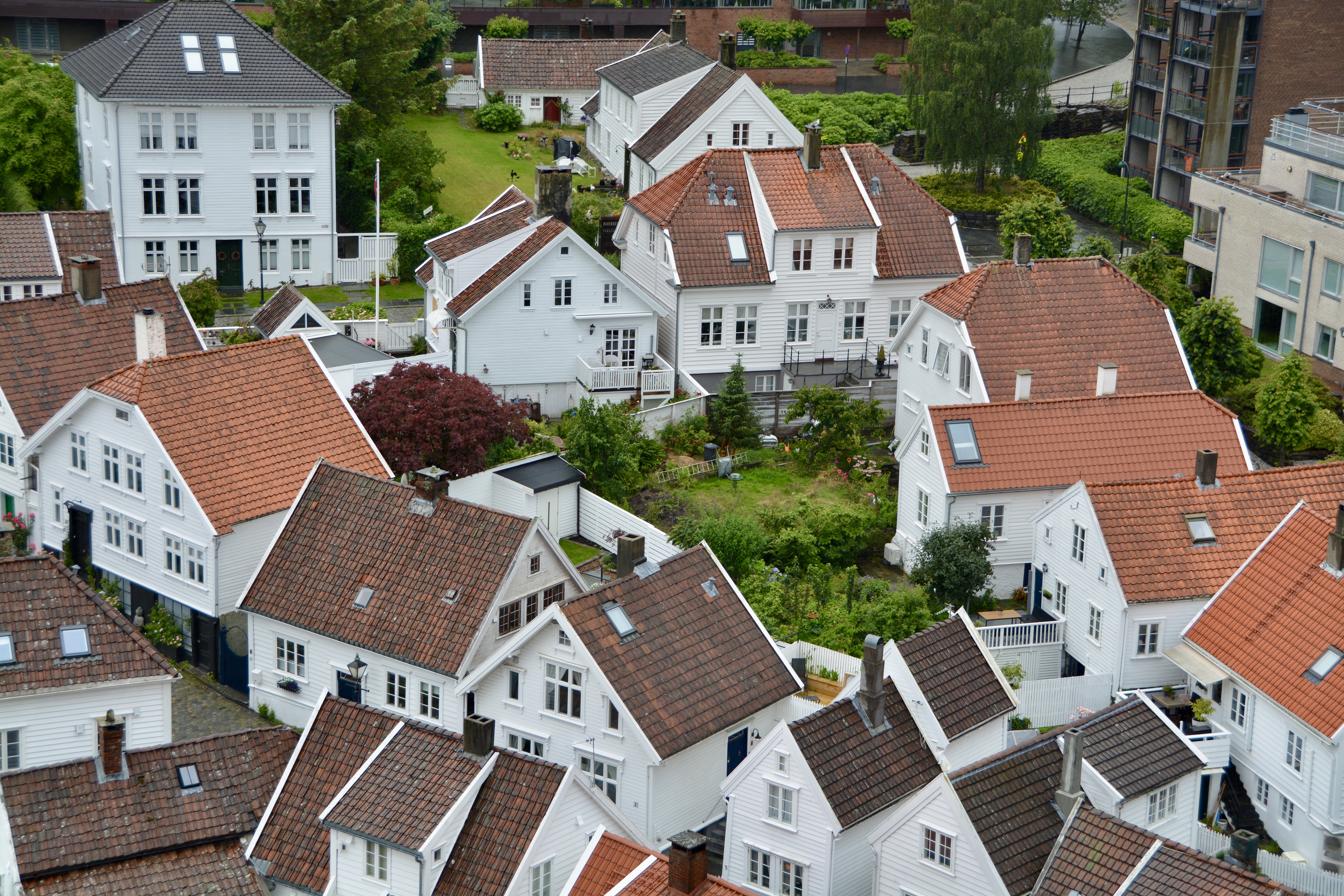
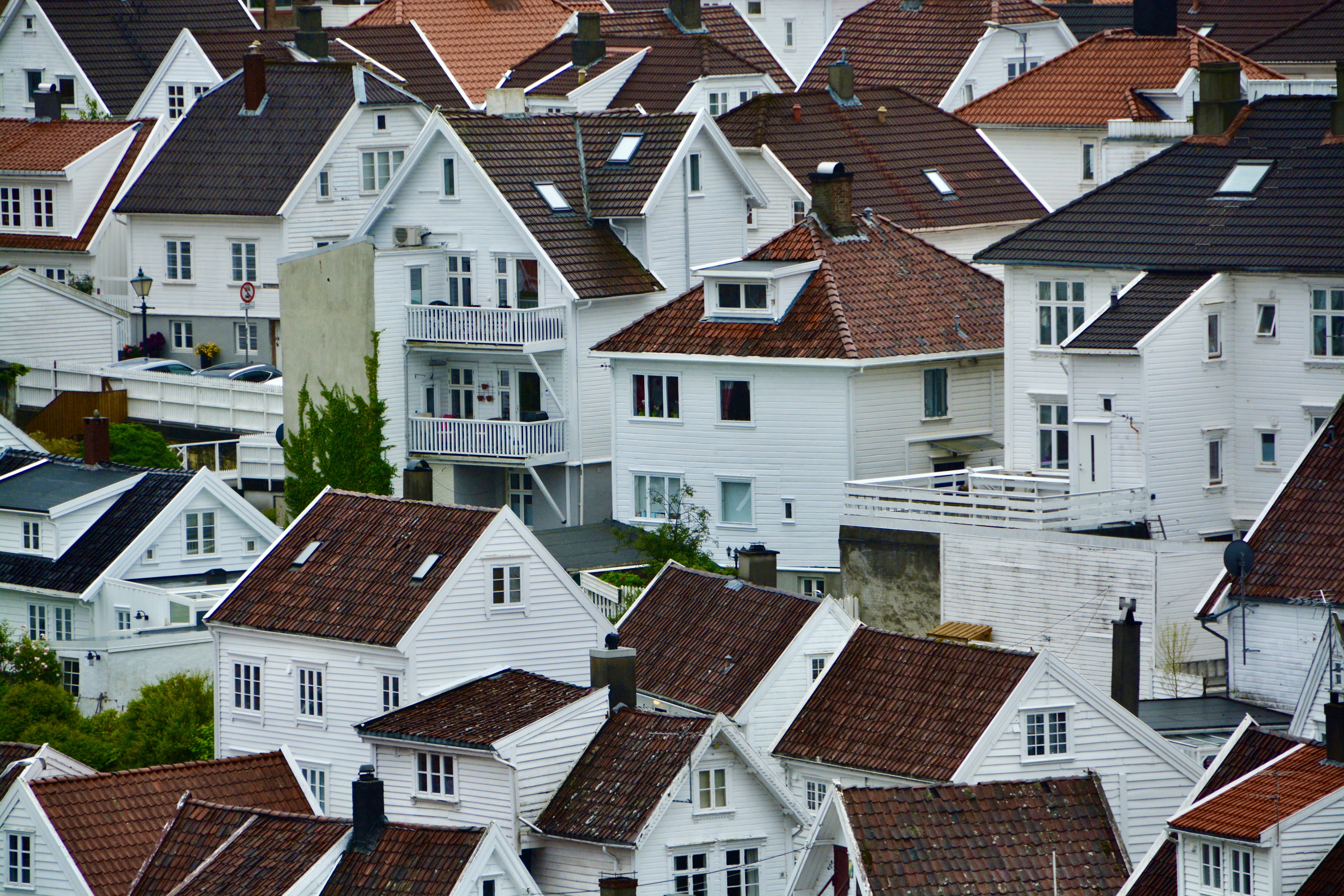
When Boris and I first looked at what to do in Stavanger, we decided just to do a self-guided tour. I particularly wanted to photograph the streets with the rows and rows of traditional white houses. Stavanger dates to the 12th century and is one of the oldest cities in Norway. It has historical ties to the monarchy, Christian priests, and the Vikings. It has always been an important port city due to its natural harbor; it remains a strategic port along the shipping route of Norway’s western coast.
With strong ties to the oil industry, Stavanger is the sister city to Houston (Texas, USA) where we live. Norway’s Petroleum Museum is here on the waterfront.
Boris at Sverd i fjell (Swords in Rock). “The three bronze swords stand 10 meters (33 ft) tall and are planted into the rock of a small hill next to the fjord. They commemorate the historic Battle of Hafrsfojord which took place there in the year 872, when King Harald Fairhair gathered all of Norway under one crown. The largest sword represents the victorious Harald, and the two smaller swords represent the defeated petty kings.”- Wikipedia
A few weeks before the cruise, I found out that Boris had booked his own tour to see the iron age fort and the statues of three buried swords. Although I wasn’t particularly excited about this excursion, I checked into it and found it was already completely sold out. I was rather relieved.
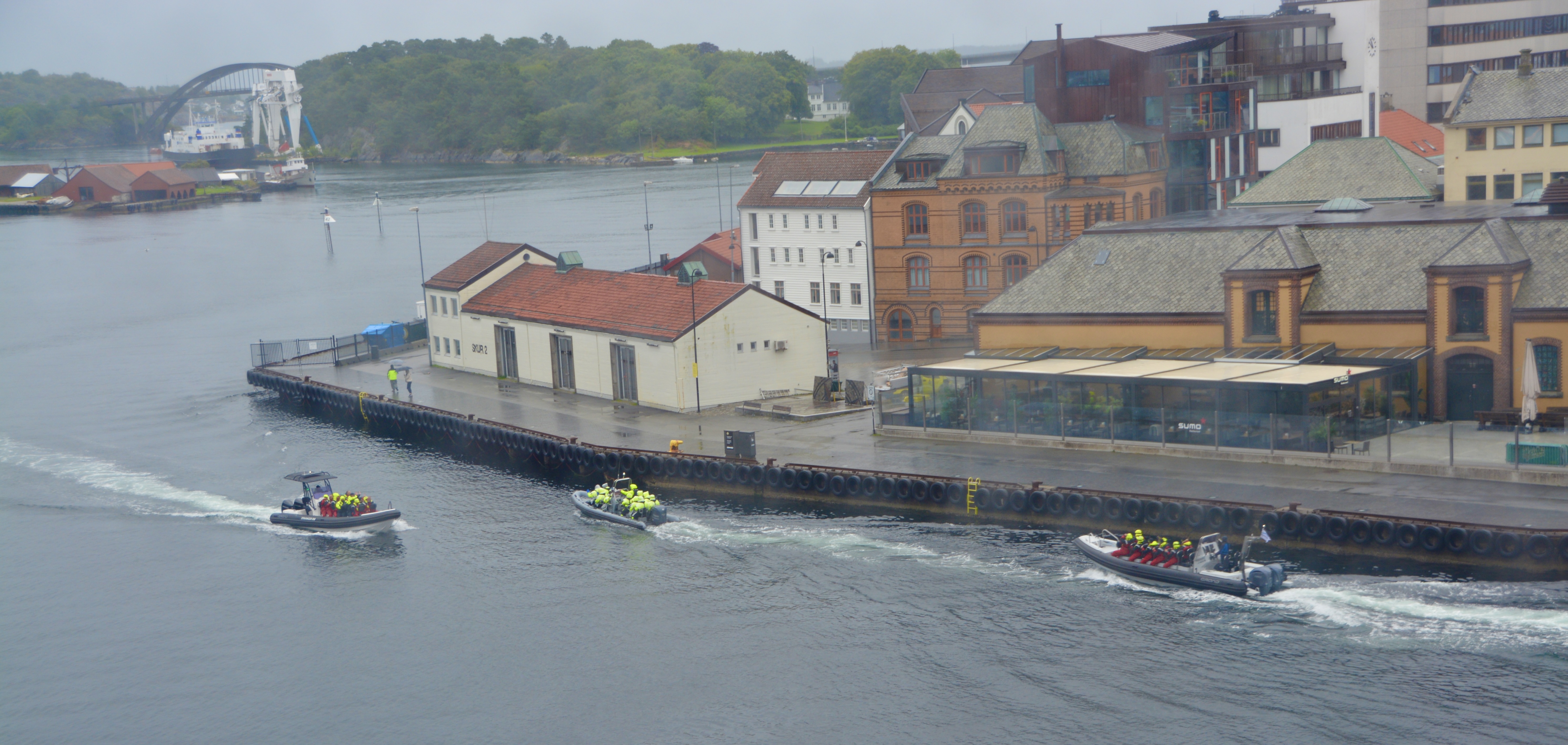
Boris left early in the morning for his excursion. I went down to breakfast a little later and was ready to head out to do some photography, but it was a rainy morning and there was little I could do to protect the camera on my own. Holding an umbrella over me and a camera while trying to take pictures is tricky. If I had thought ahead to bring a plastic grocery bag for the camera that might have worked. As it turned out the white houses were just across from the ship, so I headed to the upper deck and took pictures between showers.
Since I was on my own, I also went ahead and booked my own excursion. I took a RIB (rigid inflatable boat) tour. Not for the faint-hearted, the boat traveled from the Stavanger pier (just a short distance from our ship) to a popular fjord at speeds of 60 miles per hour.
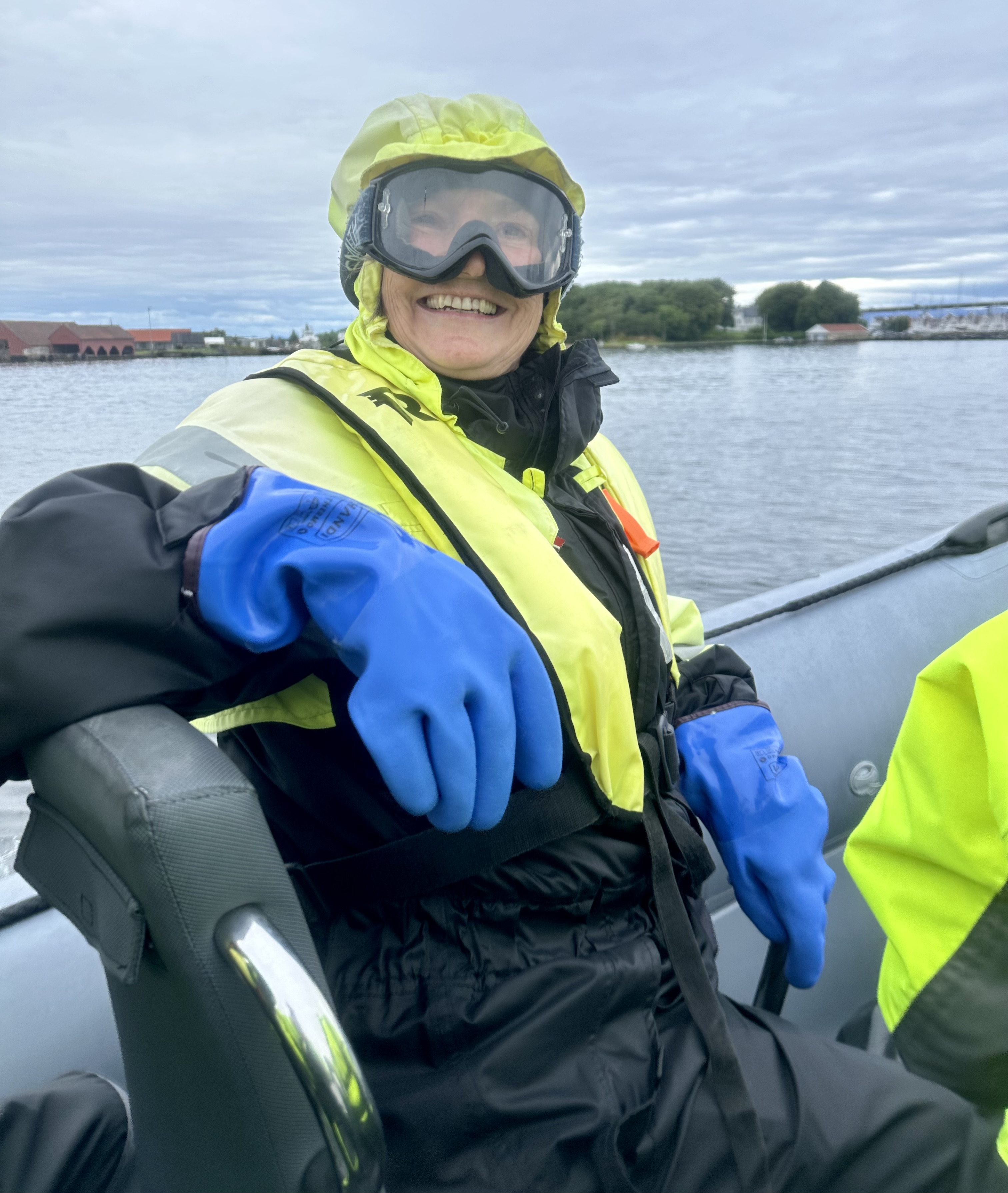
Natiasha in full gear after the RIB ride. I look awful, but boy was it fun. The Celebrity Apex is in the background in Stavanger, Norway
To ride the RIB, you have to outfit yourself in a large, unattractive suit and add a floatation device that clips between your legs. The suits are not the easiest thing to get on especially if I didn’t want to sit on the rain-soaked benches or take my shoes off to put it on. However, the suits do keep you warm and dry.
The boats only hold about 12-16 people, and everyone gets a (narrow) seat directly beside the water for fabulous viewing. They are actually pretty easy to get in and out of if they have the bars like this one did.
After the ride I was looking a little worse for the wear, but Skipper Jamie, well…
The crew matched the participants with the boats and since I was on my own, the skipper pulled me into the first boat to fill it. My young handsome skipper was exactly what you would expect a big, brawny, Norwegian fisherman or sailor to look like. For some reason, poor Natasha, on her own to gear up, needed help loosening the vest to fit over her breasts and finding the clip to attach the strap that went between her legs. My Norwegian Jamie Fraser* was happy to help me secure my safety gear. That will teach Boris to schedule his own tour without me.
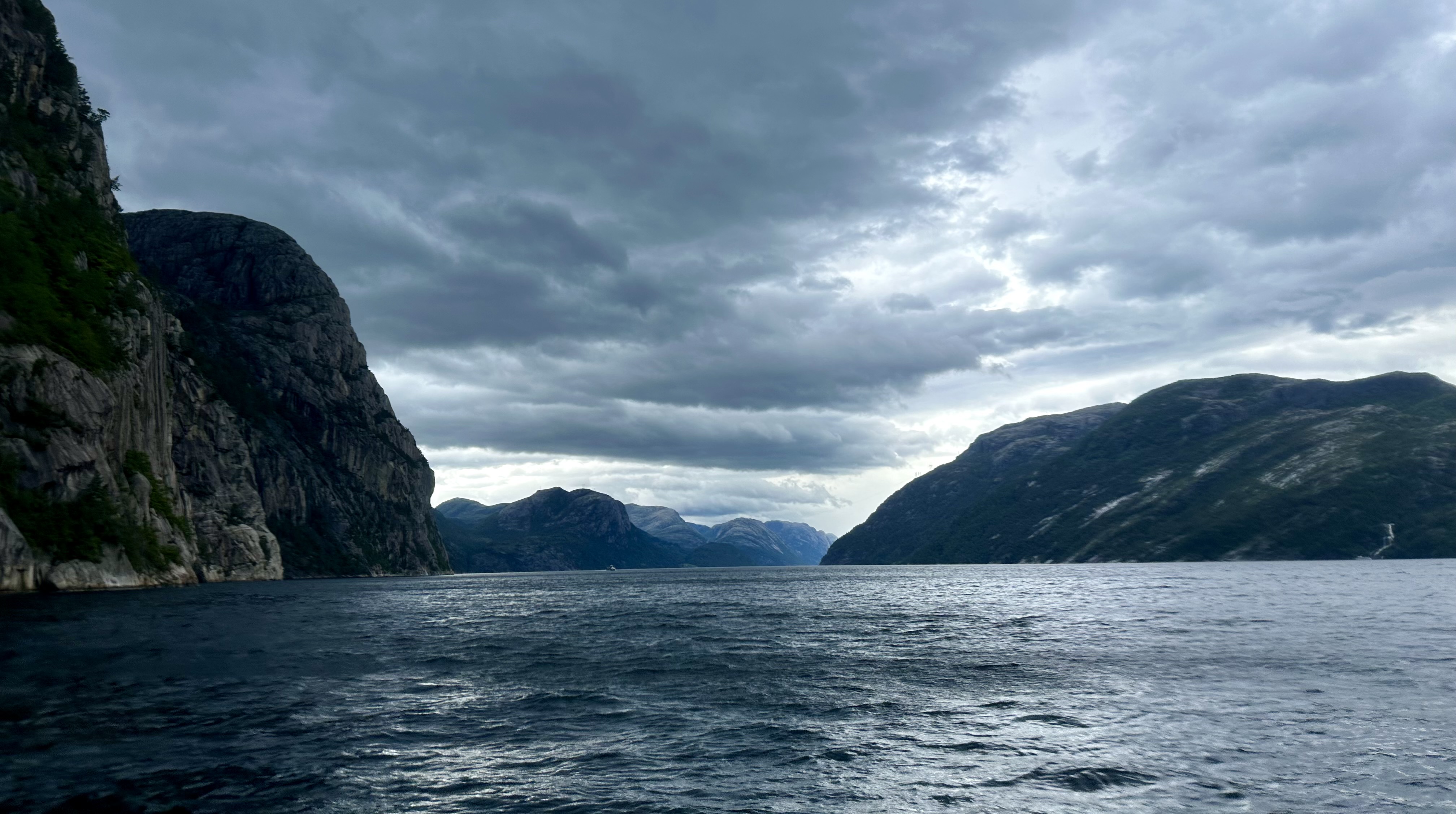
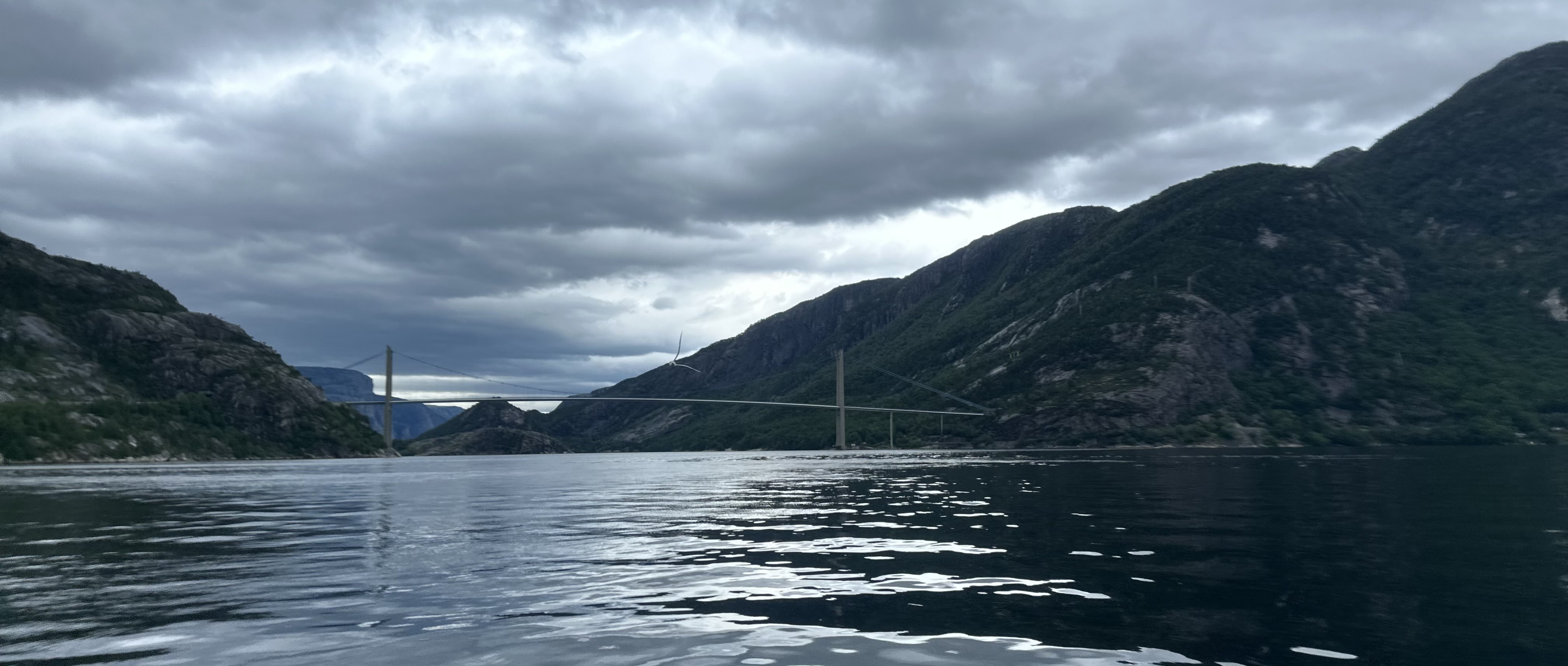
The morning participants had come back soaked from the rain, but despite threatening skies, our tour was rain-free. The ride was exhilarating. After a calm start to get out of the harbor, Skipper Jamie asked, “do you feel good?” and then picked up speed to the James Brown tune of the same name. We rode past beautiful rock formations and waterfalls.
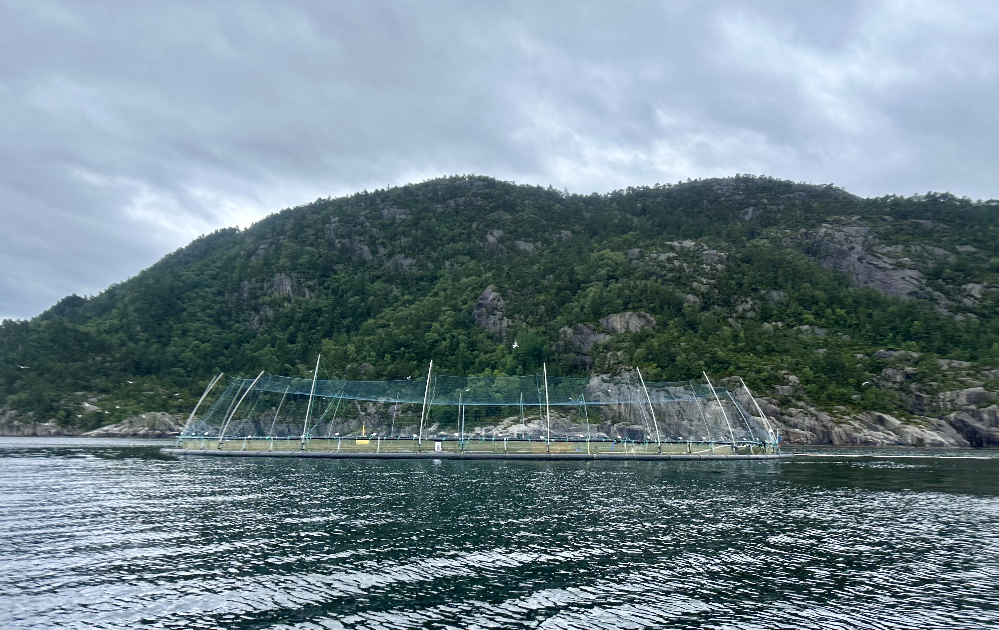
Along the way, we saw fish farms, round floats with nets holding tens of thousands of fish. These are salmon farms and we saw the salmon jumping. They live in captivity about 18 months before they are harvested. The netting goes deep, the fish have a lot of room to move around. Since they are out in the public waters, the farmers pay a tax to the local government for the dedicated water space for their private farms.
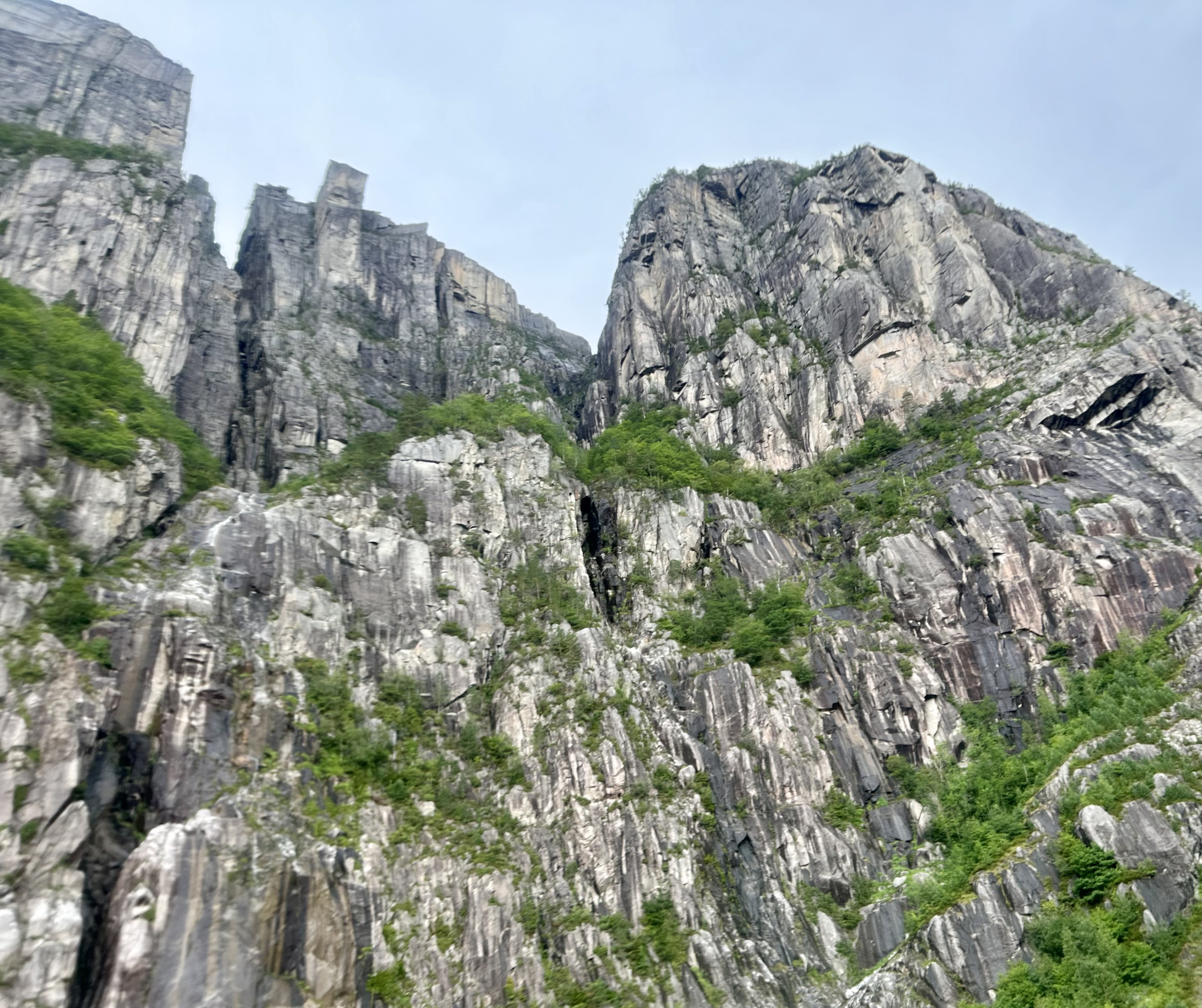
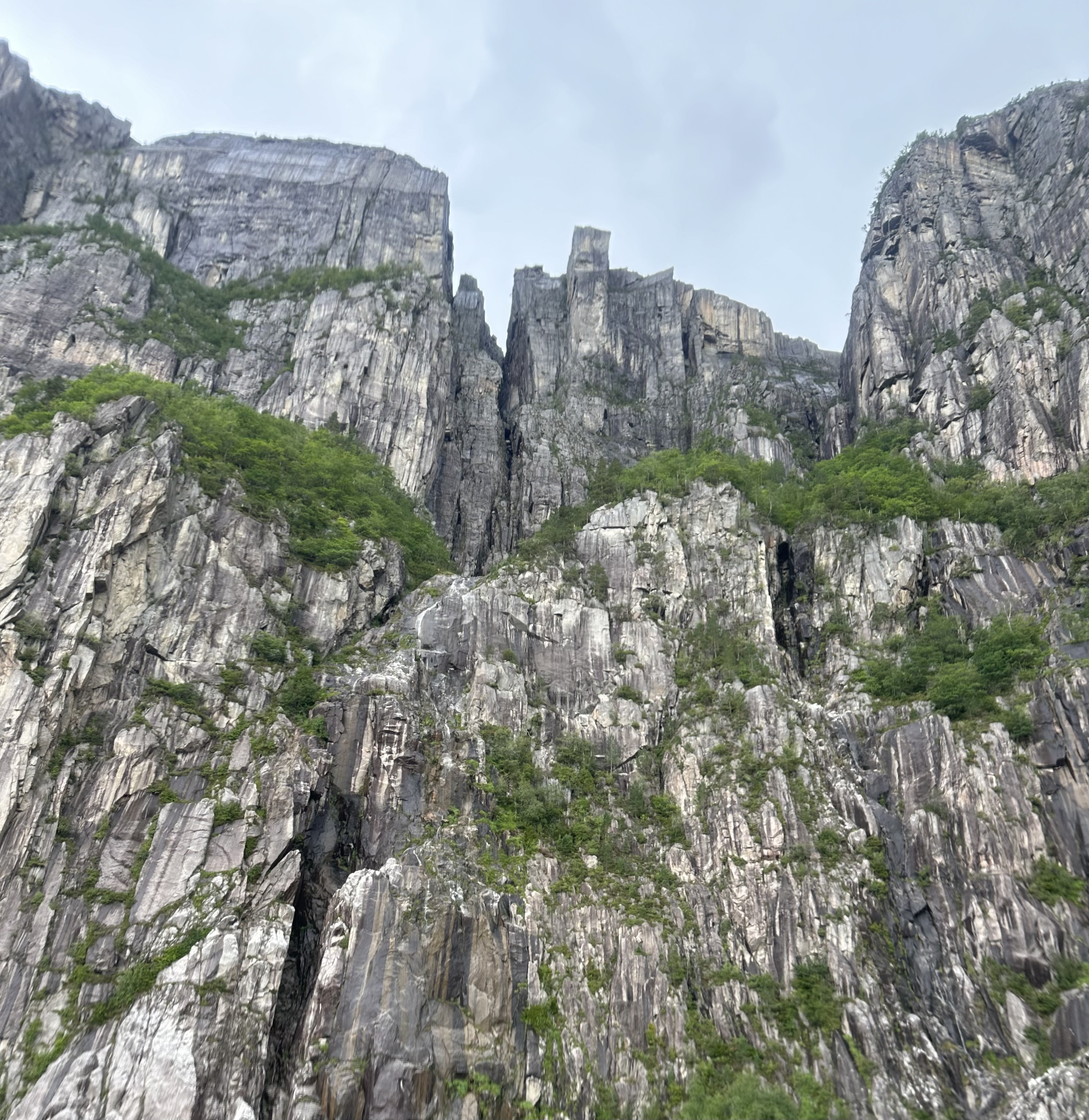
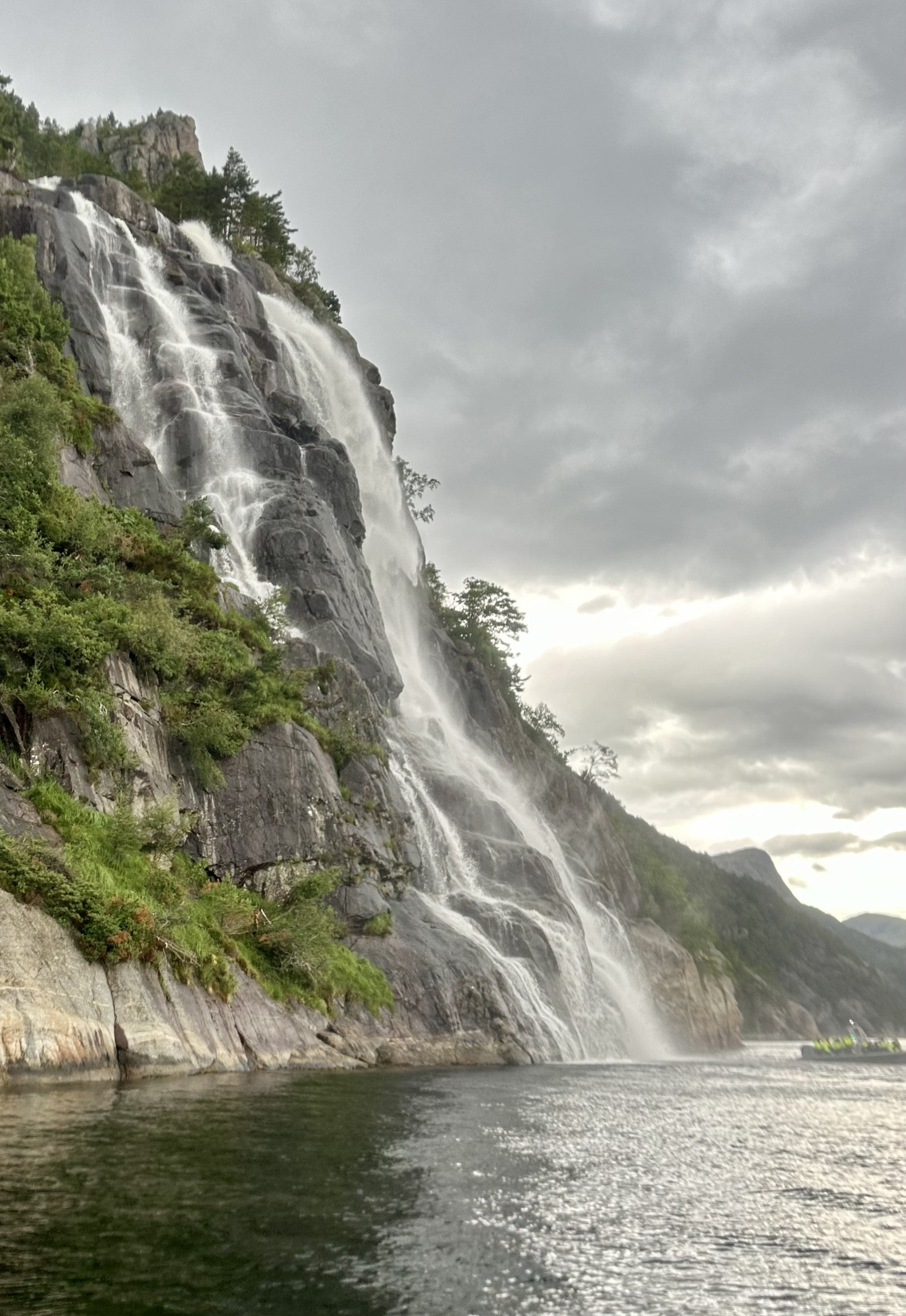
We went about half-way down the popular Lysefjord. We made a stop at the Vagabond’s Cave, a really cool and attractive rock structure. “As legend has it, the cave was named after a group of vagabonds who hid in the shelter for months trying to escape police.” We were on our way to Pulpit Rock, a popular hikers’ destination. Skipper Jamie (not his real name, just how I like to think of him) is afraid of heights, but he said he hiked it once just so he could tell us he had done it. The rock jets out over the water. In addition to the hikers and RIB riders, another way to visit Pulpit Rock is to take a ferry boat. To the music of the Mission Impossible theme, Skipper Jamie told us that Pulpit Rock was featured in one of the Mission Impossible Movies, Fallout, where the fjord is visible in the background.
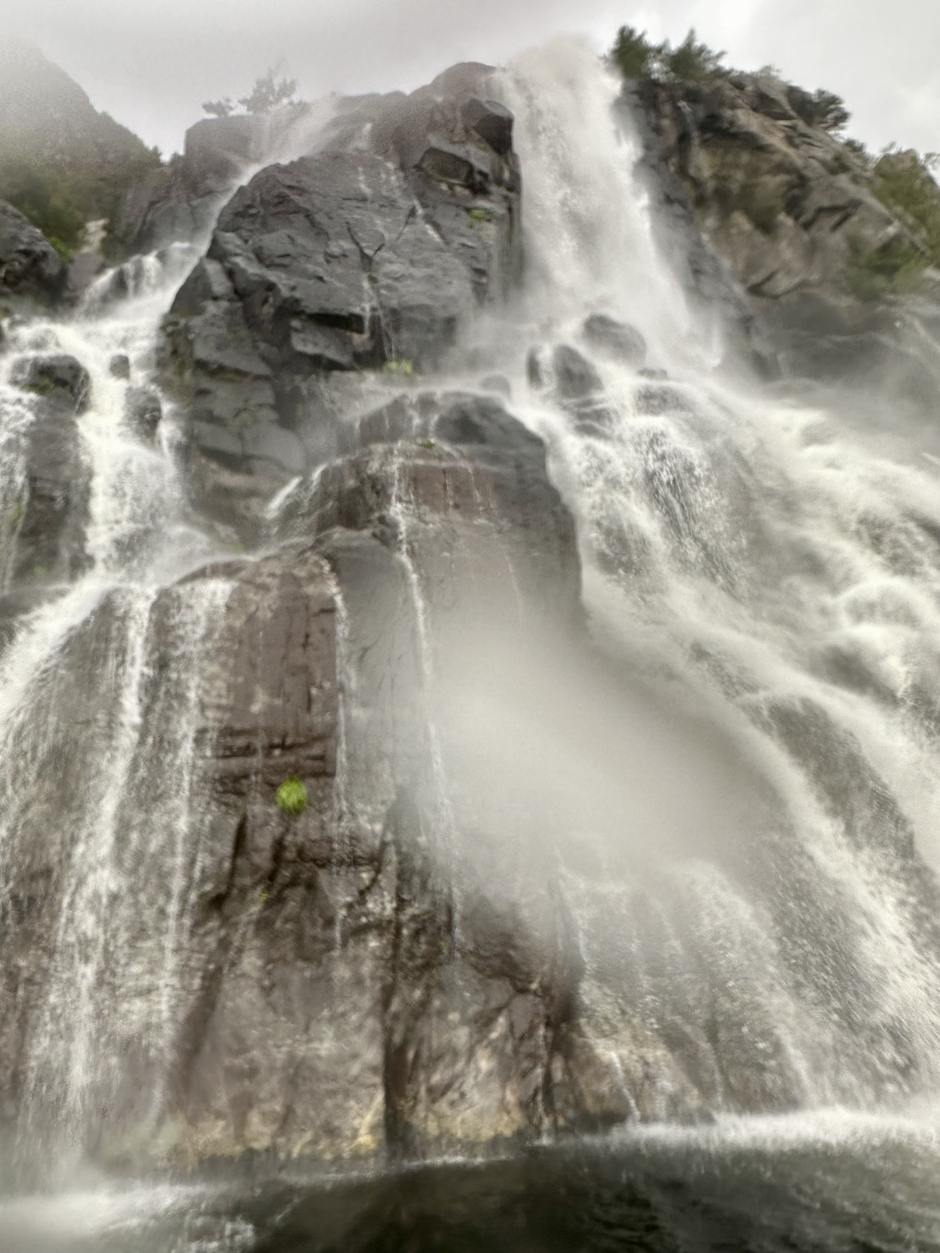
Normally, Pulpit Rock is the turn around point, but Skipper Jamie took us a little farther. Due to the weather conditions, Whiskey Falls was pouring water out full guns. The falls got their name after a German farmer and his Norwegian wife started a distillery on their land in the area. When the farmer got word that the police were coming after them for the illegal activity, he dumped all his equipment and the whiskey over these rocks. Hiding it all under the fast-moving water.
After telling us about the falls from a distance, Skipper Jamie got us really close. Close enough to know that the falls do not taste like whiskey. We played under the water a while, before taking a fast ride back to the pier. Just before passing under the harbor bridge, Skipper Jamie cranked up the tunes once again and did some tricks with the boat.
I felt safe the entire time, although my tail bone was a little tired of sitting on the narrow seat for the 2-hour journey. Skipper also had goggles and heavy rubber gloves on board if you wanted to use those. Because the extra person takes what you can get, it was seated in the second row. The back seats offer a smoother ride, but mine was the perfect seat. I had a better view than anyone behind me, but I didn’t have to deal with the spray of the first row.
After pulling personal items that people had brought along from the large dry bag Skipper provided, we all removed our gear in a process that seemed a little easier than getting it all on. Skipper Jamie helped pull off that last leg of my suit that didn’t seem to want to go over my shoe. Be still my heart.
England is in the World Cup so the entertainment director is streaming the games live into the ship’s main theater. The regular nighttime entertainment in the theater has earlier show times and we missed it tonight because we weren’t finished with dinner in time to make the performance.
Boris and I don’t always visit the specialty restaurants on board because they carry a hefty fee, much more than when this concept was introduced years ago. However, these restaurants are particularly popular on long sailings where people get tired of the dining room food. Other people just prefer the quieter, smaller setting.
After looking over the options, Boris and I decided to try the steak house, Fine Cut. The food and service were excellent, although we paid mightily for the privilege of eating there. It should be noted that specialty restaurants aboard the Apex are not the best choice for those wanting a quiet setting. Fine Cut is open to the main atrium. All the sound from this venue, comes directly into the open restaurant. We had a lovely window seat away from the atrium, but the window seats and a few outdoor tables are next to the 5th deck promenade path. Because of the rain, only one guy walked by during our dinner, but on a different night you could easily be disturbed, have other guests blocking your view of the water, or have the feeling of being watched while you eat. I think this might be a miss on the design.
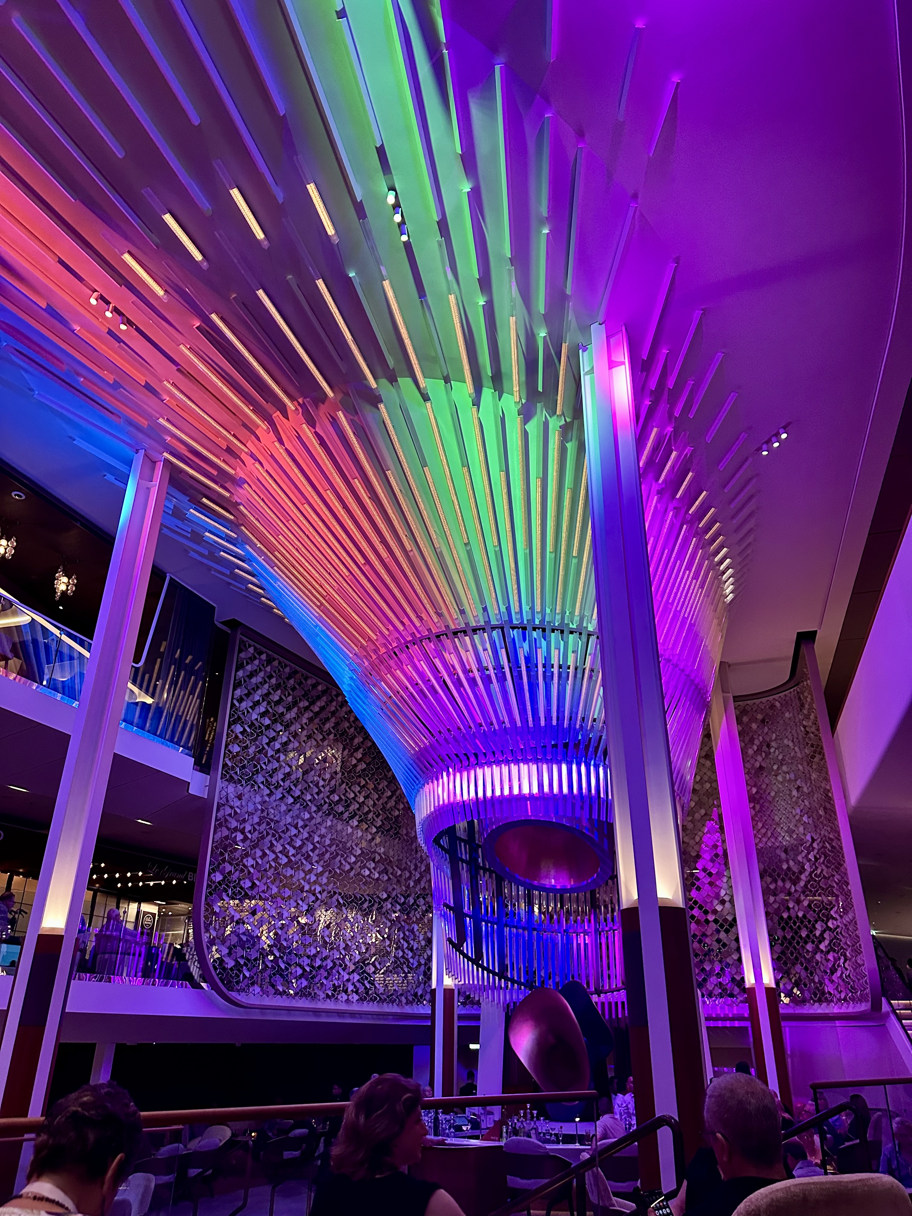
One perk for us was that we got to see the “Chandelier Show”. This is a ten-minute light show featuring the atrium (Grand Plaza) chandelier. Since the two showings, at 6 pm and 10 pm, are usually when we are doing other things I was glad we got to catch it while dining in Fine Cut. The show is loud and bright, but worth planning around to see at least once on your cruise.
Tomorrow we are actually going on an excursion together. The two hours prior to docking at Olden Norway will also be spectacular with the views of the fjord as we sail into Olden. It’s a morning not to be missed. Lots more Norway to come…
–Natasha
*The reference to Jamie Fraser is to the hero of the literary and television series Outlander.
Boris and I are making our second trip to Norway. The first was a one-day stop on a Baltic cruise. We are once again cruising, but this time it is an in depth visit to the fjords of Norway, even crossing into the Arctic Circle. We are traveling on the Celebrity Apex, one of their new ships in the Edge Class which is slightly larger than many of their other ships but still under 3,000 passengers. The ships might be best known for “the magic carpet”, a bar/restaurant that generally rests at the 14th floor but can move to lower levels. The bar is attached to the outside of the ship and sits above the water.
We were trying to beat the hurricane out of Houston and our plane to Heathrow took off only nine hours before Hurricane Beryl made landfall. Our plane was delayed an hour and a half due to the outer bands of the storm that were already hitting the area around the airport. Due to lightening, they “closed the ramp” and none of the workers were allowed outside. Our plane had already pushed back halfway when our pushback was halted, and the driver of the vehicle had to go inside.
Once the plane reached cruising altitude, we relaxed about being able to get out and make the cruise and started worrying about the house. Peabody was originally supposed to be home with a house/pet sitter, but she let us know just the day before departure that she had COVID and was not fit to watch him. We scrambled and got him into the vet which probably was better because they have a generator and someone staying with them in anticipation of the storm.
Our cruise is leaving from Southampton and then we have a full day traveling in the North Sea to reach the western Norwegian coast. The sea day was a great time to catch up on our sleep, deal with jet lag, and explore the ship. The Apex has a lot to recommend it. We (as we typically are) are in a balcony cabin. The balconies on the ship class are unique. They are enclosed but at the sea end have a full wall of windows and can be opened halfway. It is a slow, noisy operation, but easy. There are folding glass doors to close it off if you like. The window itself reminds me of the “Juliet balconies” on the Uniworld River Boats. When the doors to the balcony are left open, it gives the room a much larger feel. The balcony is also completely private with solid side walls.
Another great feature of these balcony cabins is a larger bathroom, featuring a larger shower. Cruise ship bathrooms are always a challenge, so the larger space is a big bonus.
The other unique concept of these ships is that they have eliminated the single large ballroom dining spaces and offer four more intimate main dining rooms. Unless you specifically reserve a space in one of them, you can go to any of the four at any time during their service hours. Unlike the “anytime dining” we have seen on other ships where the standby lines were always long, and people complained about sometimes waiting 30-90 minutes for a table, most people on our sold-out cruise were seated within five minutes of arrival. Most of the menu is the same at all four restaurants each night, but each of the main dining restaurants feature three appetizers, three main courses, and a dessert that are unique to that restaurant. While the common items change daily, the unique options remain the same throughout the cruise.
Cruise lines are always updating their ships and common areas can change drastically, especially with a new design over a refurbishment. The theater onboard the Apex was completely updated. Gone are the side wings and the entire stage is wrapped with a screen. Performers enter from the audience or through doors in the screen that are not visible most of the time. The shows are specifically designed for this new concept.
Boris and I got our first taste of the theater when we went for the morning presentation by the ship’s guest lecturer on the first sea day. She gave us a little information on all the ports. I had hoped for something more in depth about Norway, its people, the Arctic Circle, the possibility of seeing the Northern Lights, etc. Leave the ports to the excursion staff and tell us about Vikings!
Another thing that Boris and I have noticed during our recent trips is that most of the excursions can get booked out early. If you wait to book when you get on board, there will not be much left to choose from. In fact, depending on when you book your cruise, excursions will probably already be unavailable even when you purchase the cruise six months or more before sailing.
Particularly nice, especially when we will be sailing in cooler weather, is that the solarium-enclosed pool area-on this ship is much larger and can accommodate a lot more people. The tall, two-story ceilings add to the spacious feel and over terrific views.
One of the areas I really liked on board was Eden, a three-storied bar, restaurant, and performance area that allowed for more intimate contact with the artists. This isn’t new for regular musical acts, but the acrobatic, singing, and dancing performances in this space allow for a really close up view you won’t get in the main theater.
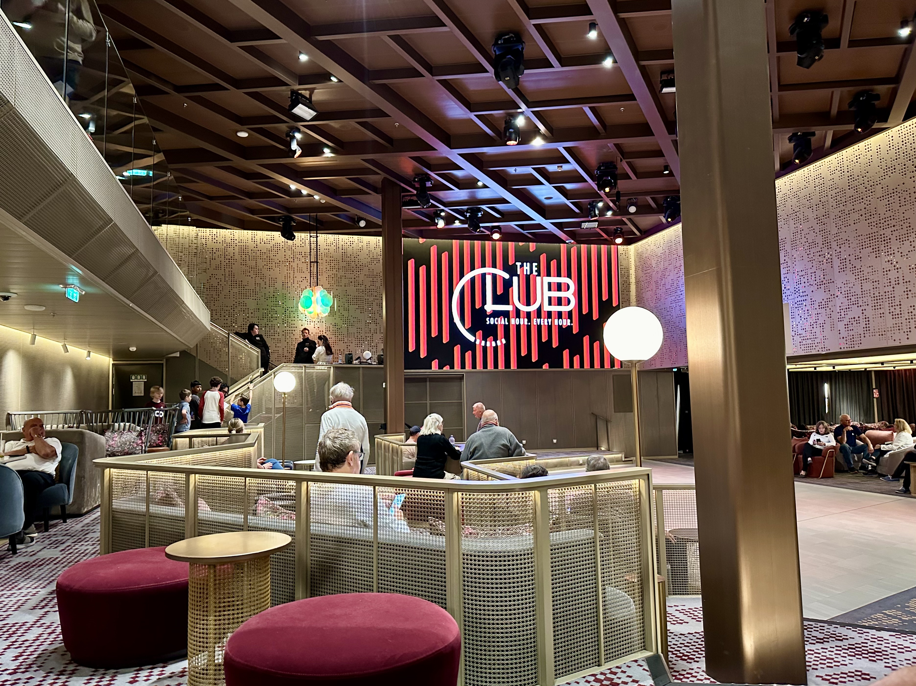
However, the most popular place on the ship is the coffee bar on deck four just off the main atrium (Grand Plaza) that runs from floors three to five. It is hard to get seating here and the dance floor between decks three and four is generally full. It should be noted that our unique sailing that included the Arctic Circle was completely sold out.
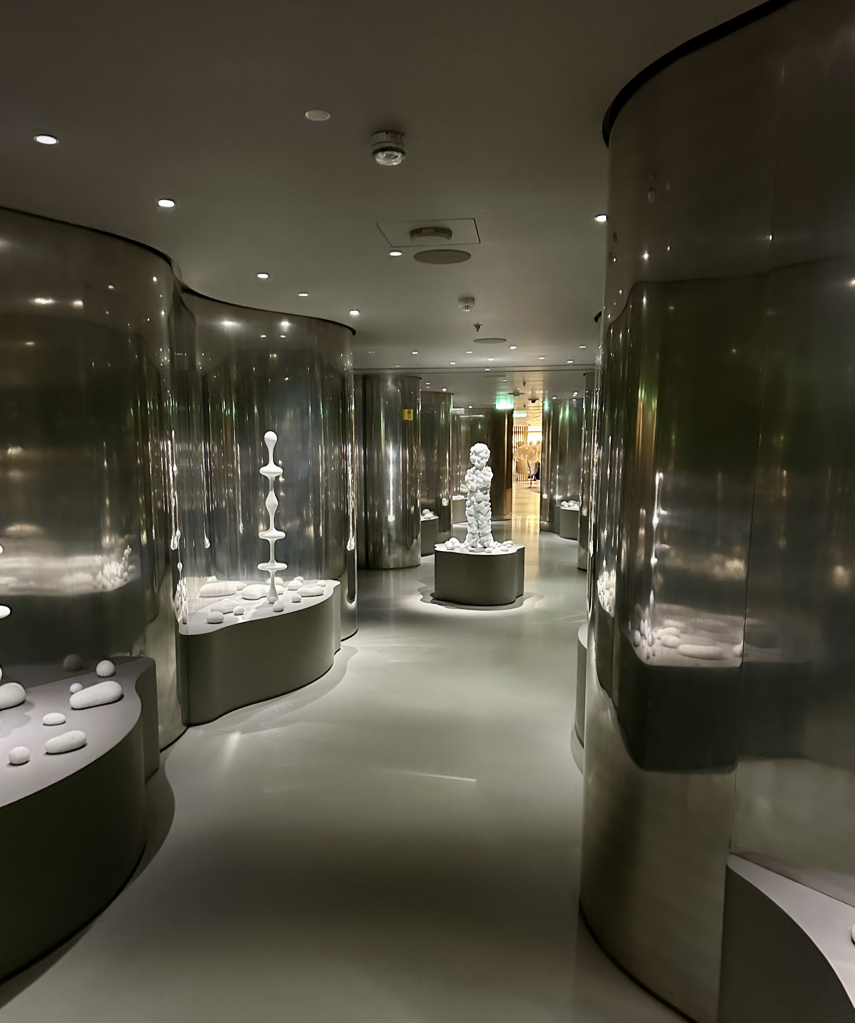
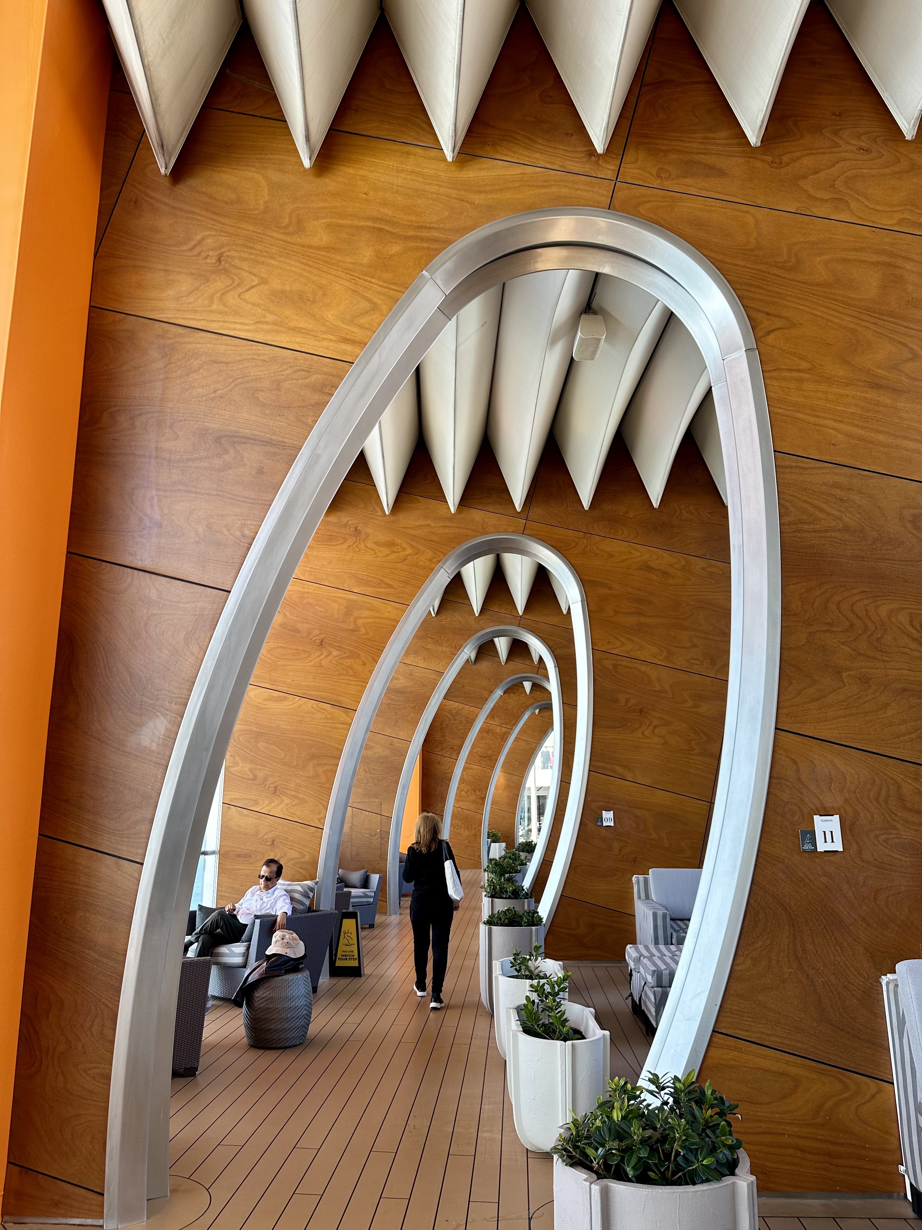
The one thing on the ship that immediately turned me off was the art. In my opinion it is truly awful. It ranges from strange to stupid. There is one passageway that tried to make something out of silver reflective walls and white Styrofoam. It wanted to laugh out loud when I passed through. What a waste. Of course, everyone has different taste, so hopefully they will have passengers who can appreciate the effort and find beauty in the installations. I just wish it wasn’t always so big and glaring like the large hands in a heart sculpture and shark teeth alleyway by the main pool.
One more negative before I move on, it is a point of frustration was that you can not tell if someone is in the stalls in the public bathrooms. The bathrooms are slick, spacious, and always clean, but you must figure out if a stall in available by looking at which direction the bolt is pointed. Ridiculous.
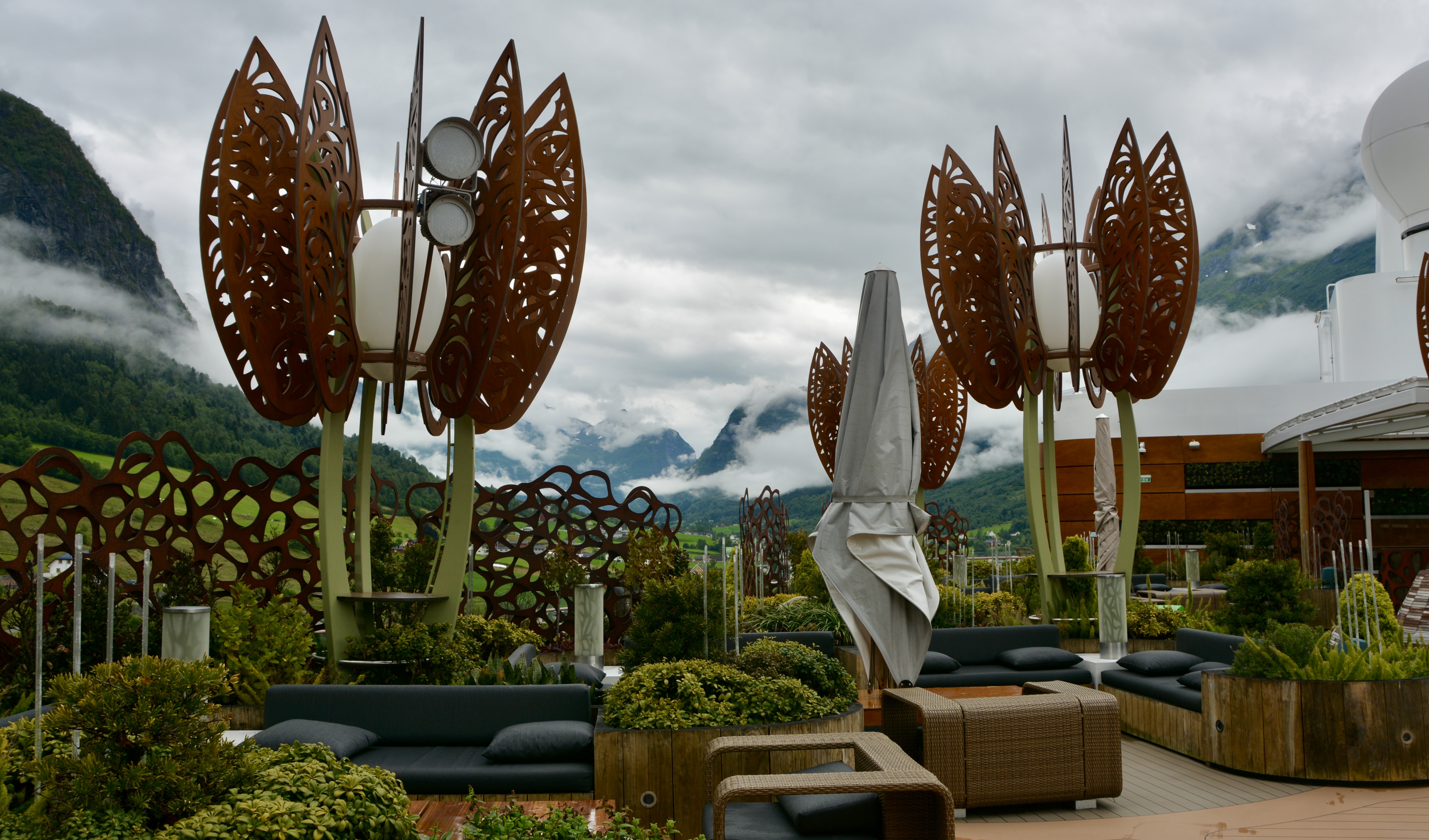
Wanting to end my ship comments on a positive note, I also want to recommend the rooftop garden with the large outdoor screen for movies, a pickleball court, a bar and dining area featuring comfy lounge furniture. On a warmer sailing, I probably would spend more time here. The walking/jogging path wanders through this area and they have certainly done a good job of making that pathway more scenic than most.
This evening’s entertainment was pianist Harrison Treble who led with Ray Charles and closed with Jerry Lee Lewis. It was an upbeat presentation and he blended well with the ship’s onboard orchestra. It was worth checking out both the entertainer and the theater in action.
I am mostly itinerary driven when deciding which cruise sailings to take; however I am so impressed with the Celebrity Apex that I will probably start with looking at available sailings on this class of ship if we book another cruise on board.
The breaking news from Hurricane Central (the name my sister Emma gave her self-appointed posting in Houston) was that while our home was without power, damage was minimal. We lost panes of glass from our front door and there were downed leaves and branches, but it looks like the other doors, windows, and most importantly the roof held. While the next-door neighbor’s tree was uprooted and fell on our yard, it didn’t hit anything. Peabody is safe at the kennel. Now we just have to monitor how long the power is out so we know if everything from the refrigerator needs to be thrown away. A big thank you to Emma for monitoring things and making some repairs.
Today will be our final stop before reaching Boston in a few days. We are docked at Halifax, Nova Scotia. There are lots of different tour opportunities but Peggy’ Cove came up as #1 more times than not on all the reviews I read so that is the plan. If we can do the hop-on/hop-off bus in the afternoon that would complete our day. We were lucky to get in and out of Halifax and Peggy’s Cove before post-tropical cyclone Lee hit the area and knocked out power for two days.
We actually had a sea day in between Newfoundland and Nova Scotia even though they are very close to one another. We were able to do a backstage tour of the Celebrity Theater aboard the Summit as a Elite Status perk. Three of the performers led the tours. We had one of the male dancers. The stage perspective was interesting as was the backstage equipment. The tour ended with a walk through of the dressing rooms, one for the girls, one for the guys. Petty tight quarters.
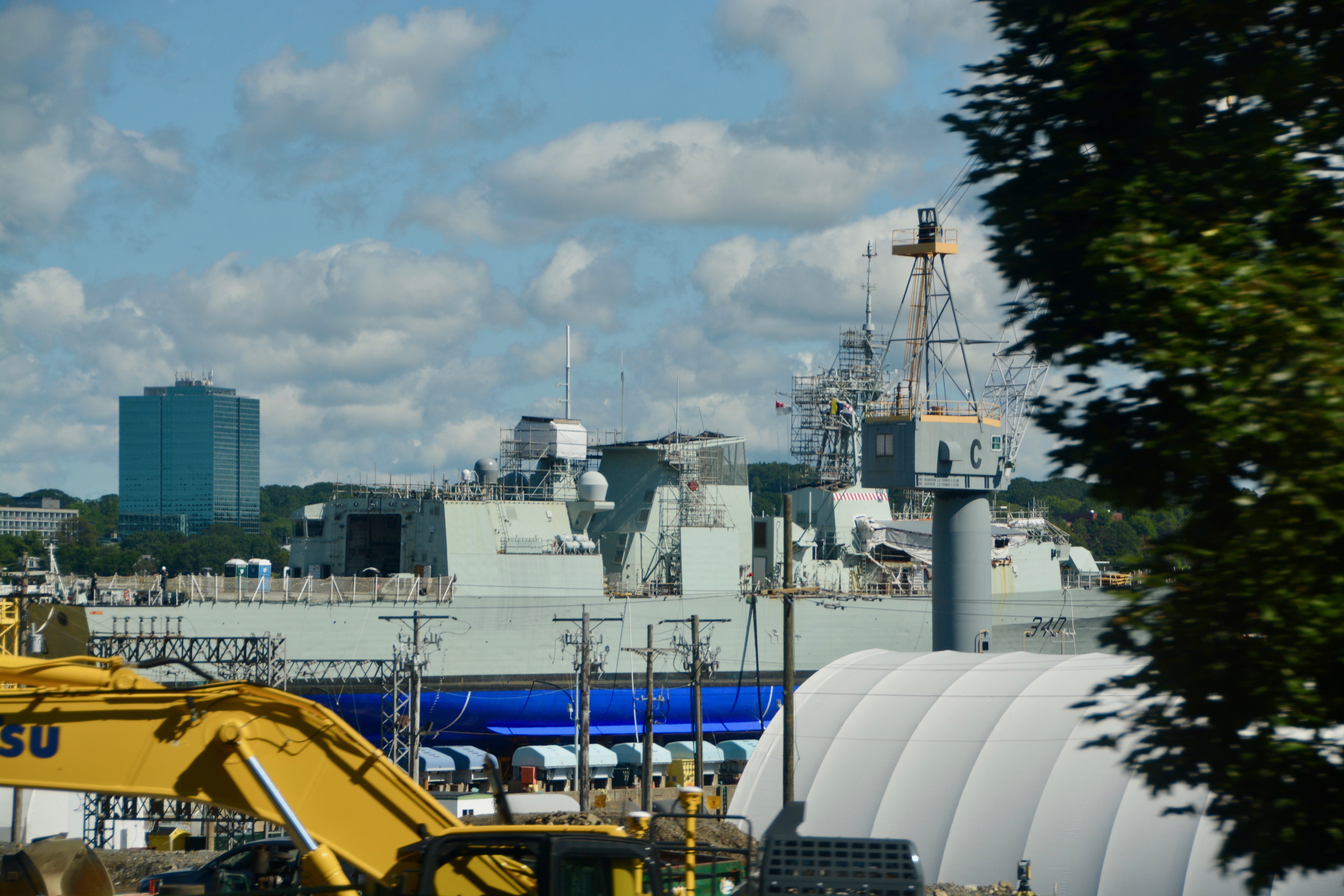
We docked in Halifax early. We had to meet for our tour at 7:30 am so we had an early breakfast. Luckily we got our half hour of time back after leading Newfoundland. On the way out to Peggy’s Cove we saw a little bit of the city of Halifax. Halifax is the largest city in and the capital city of Nova Scotia (New Scotland) and has a rich military and maritime history.
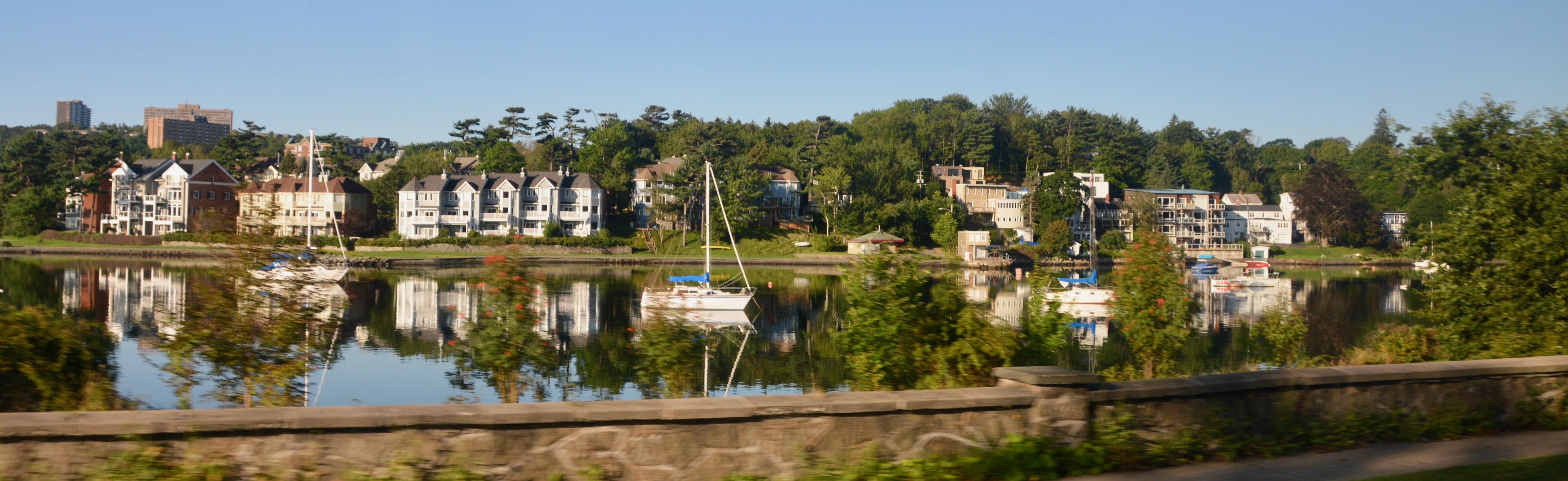
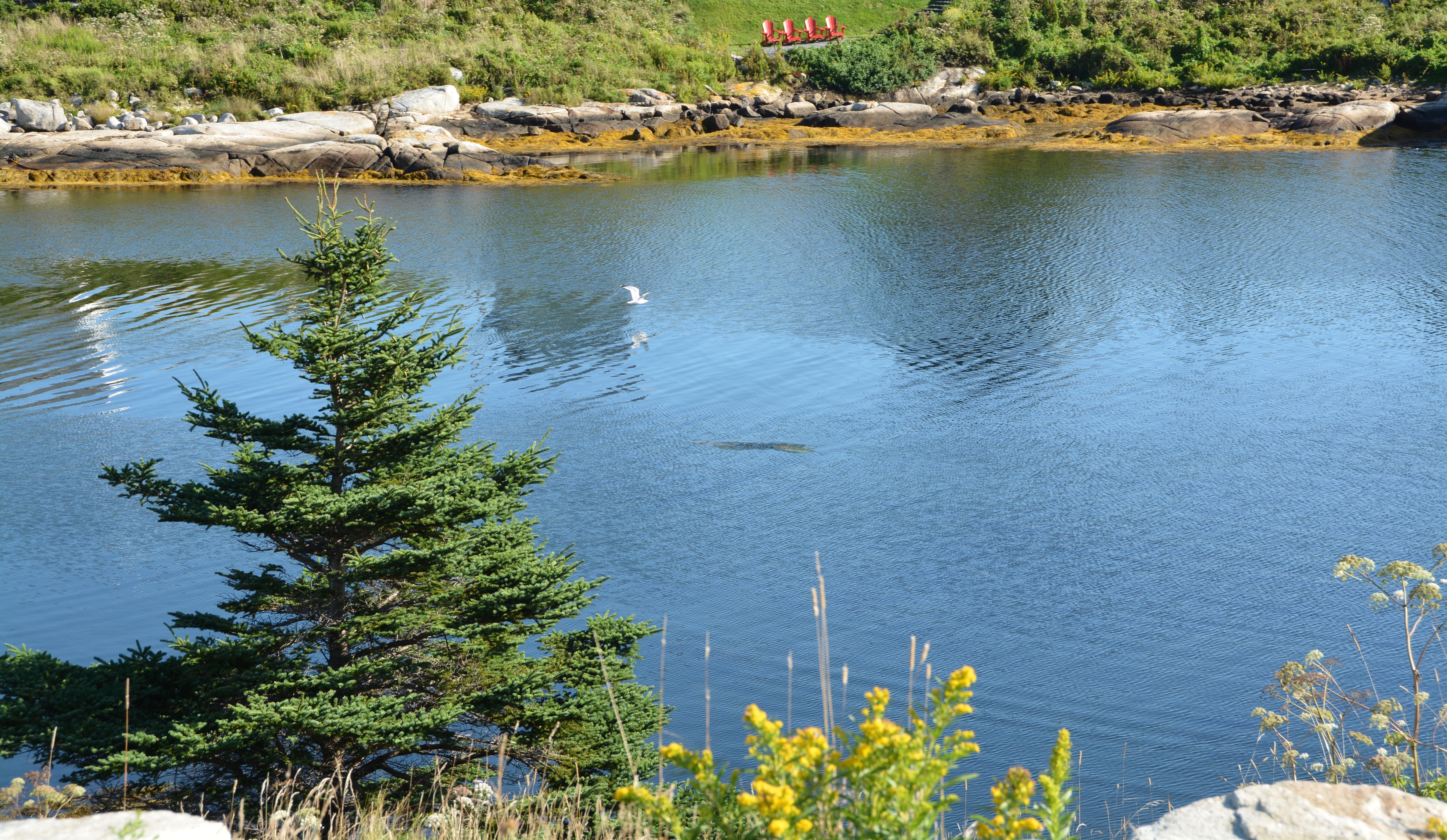
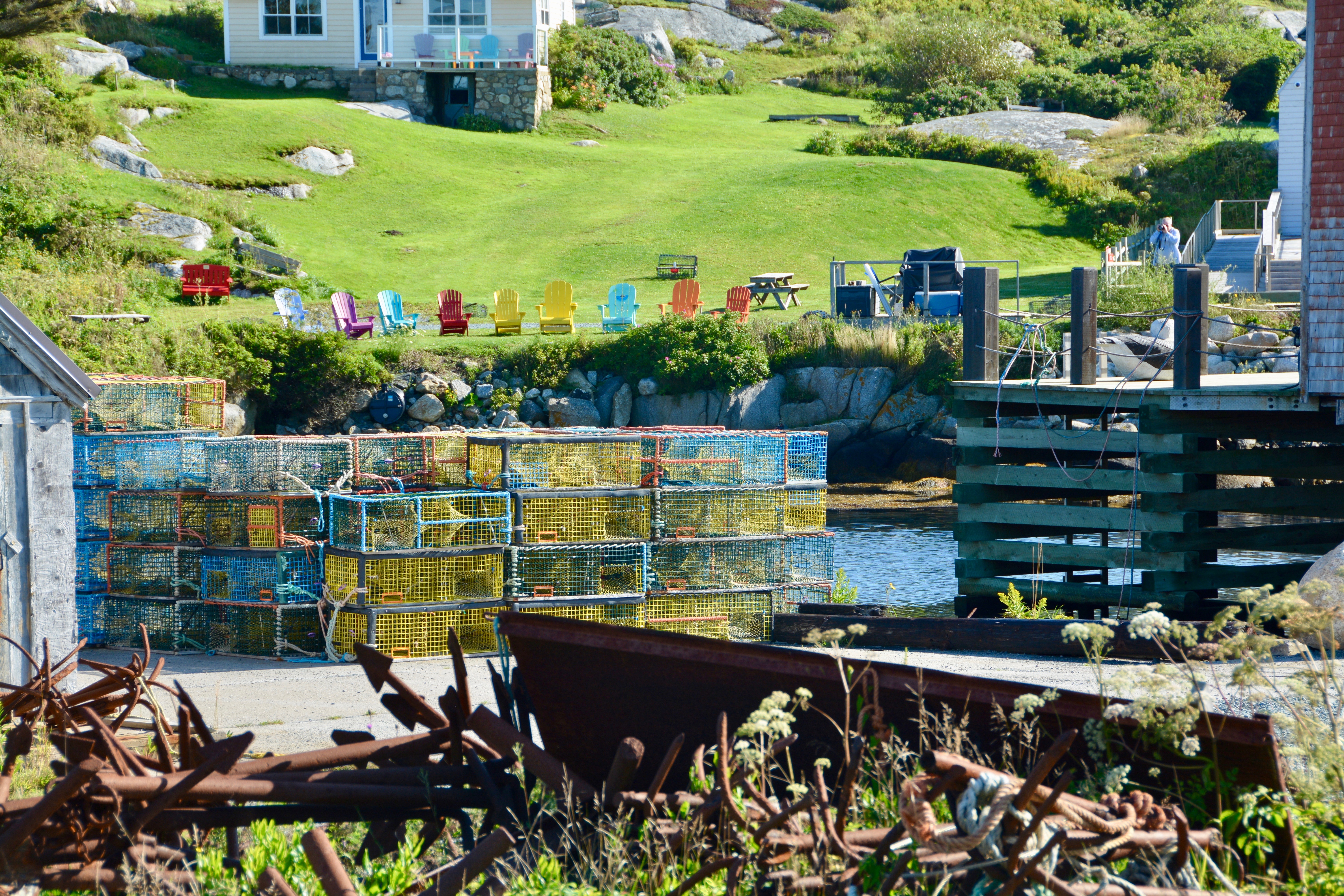
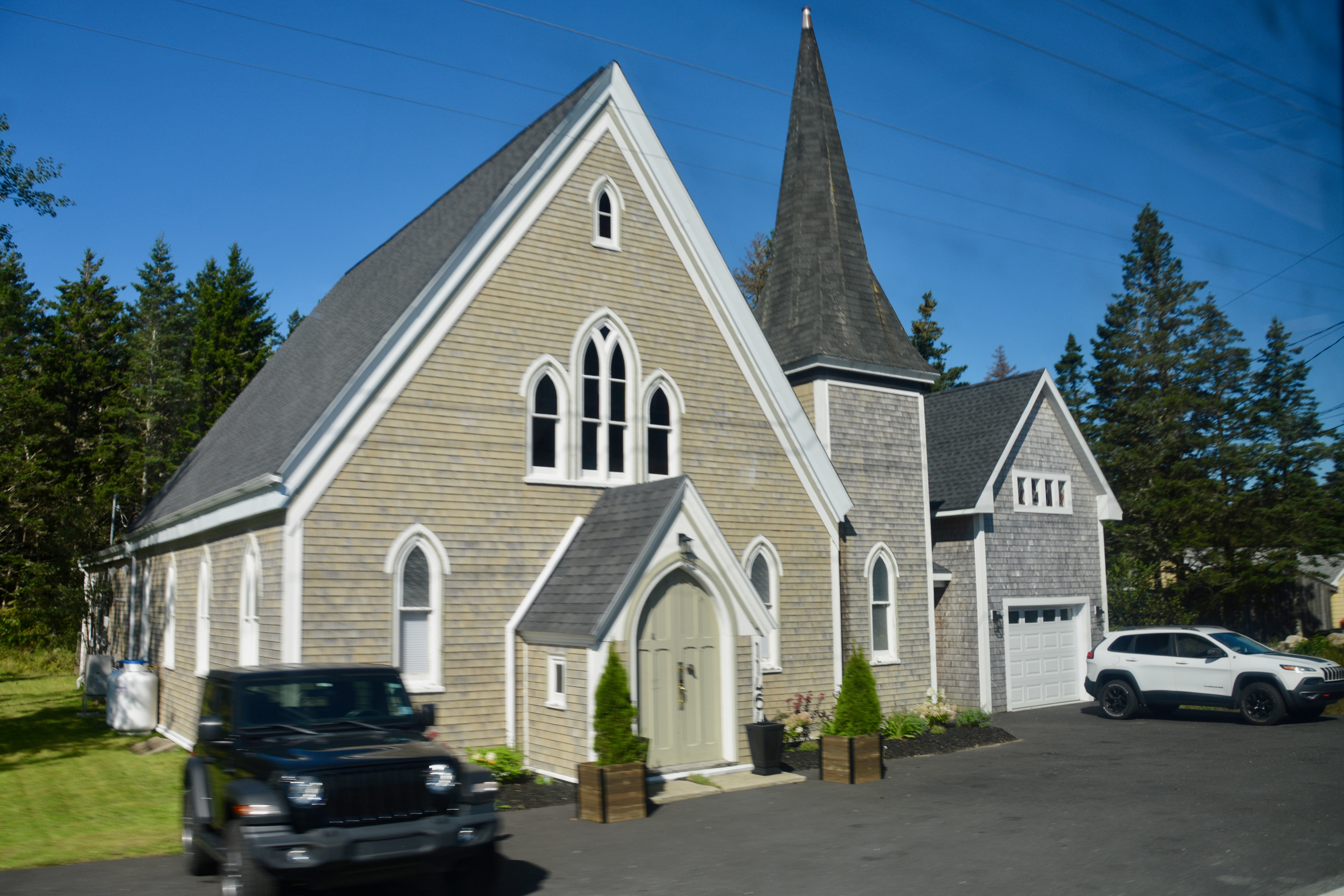
We passed some lovely waterside communities, some with spectacular houses on the way to St. Margaret’s Bay and Peggy’s Cove. The cove sits at the eastern edge of St. Margaret’s Bay. “Peggy’s Cove is famed for its picturesque and typically East-Coast profile, with houses perched along a narrow inlet and on wave-washed boulders facing the Atlantic. Although this unique environment has been designated a preservation area, it is still an active fishing community.” –novascotia.com
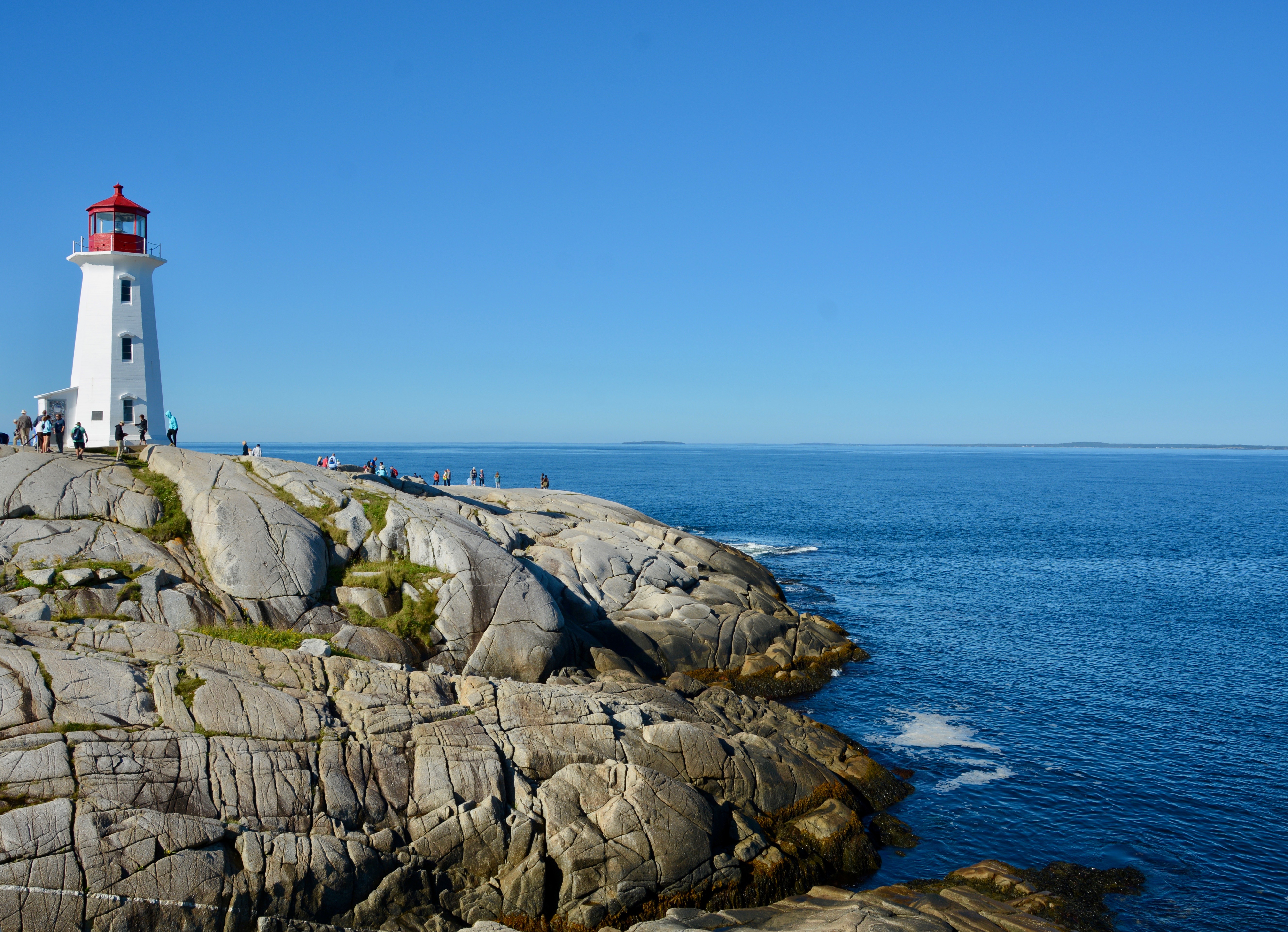
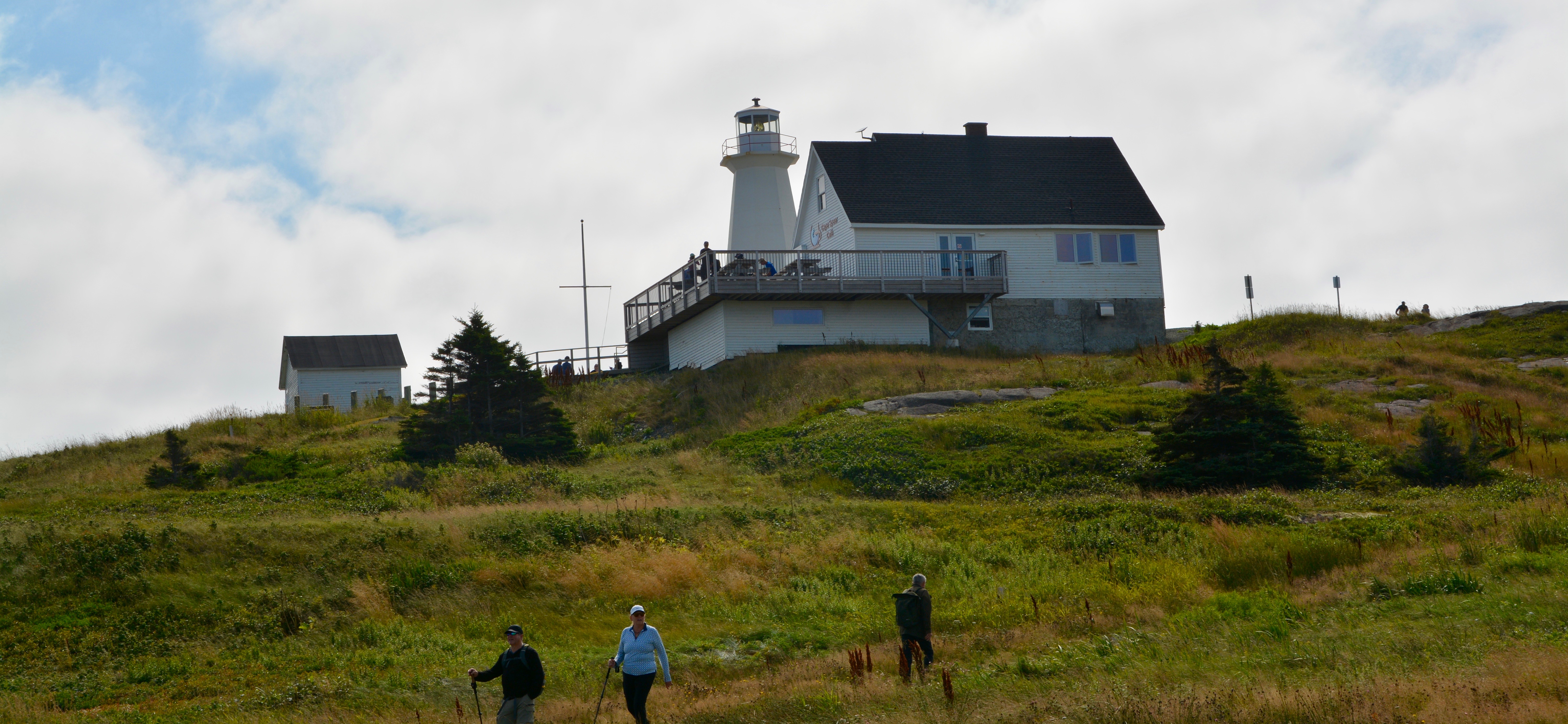
Peggy’s Cove is about an hour from Halifax. But even with our early departure, the cove was already swarming with people. We drove through the village winding our way to the lighthouse and parking areas. It was like a preview of all the things you could do from visiting artisan workshops, stores, churches, cafes and restaurants, and wonderful vantage points for pictures. There are more than 160 historic lighthouses in Canada and the one at Peggy’s Cove is arguably the most famous. It sits at the point among artistic boulders that can become very dangerous when wet. I spotted a bagpiper standing among the rocks. That is pretty appropriate for a province named New Scotland.
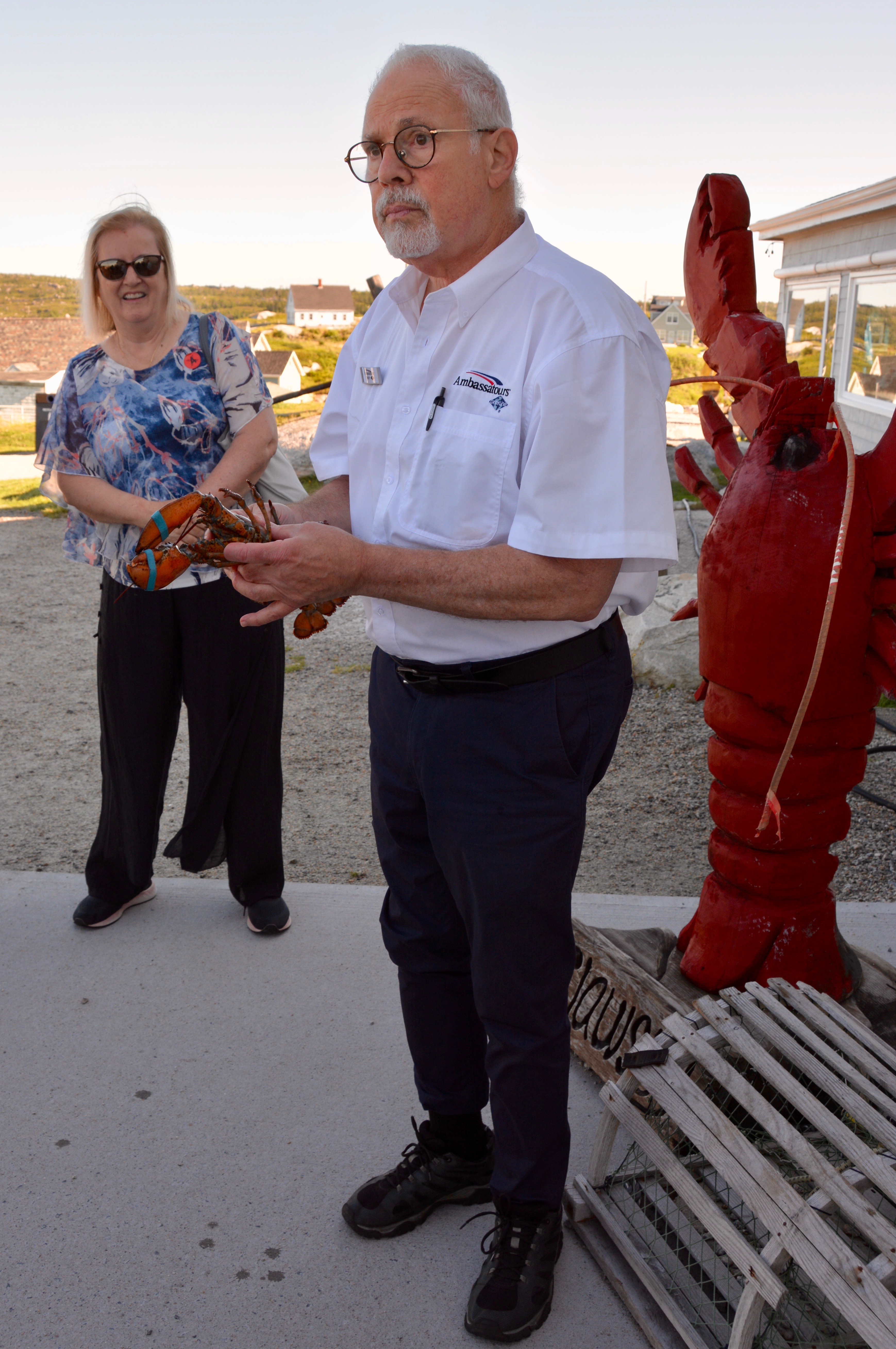
After a bathroom stop, I went to see our guide who was showing us the in and outs of lobsters. They are a mainstay here. They share the waters with those from Maine that our famous among Americans. I even got to hold one of them. Then I took a few more pictures of the lighthouse before wandering off into the village.
Today was all about the scenic beauty of this wonderful place. However I did go into a few shops, my favorite of which was the Crooks family shop that they have had in Peggy’s Cove since 1948. I did wonder about the origin of the family name. 🙂
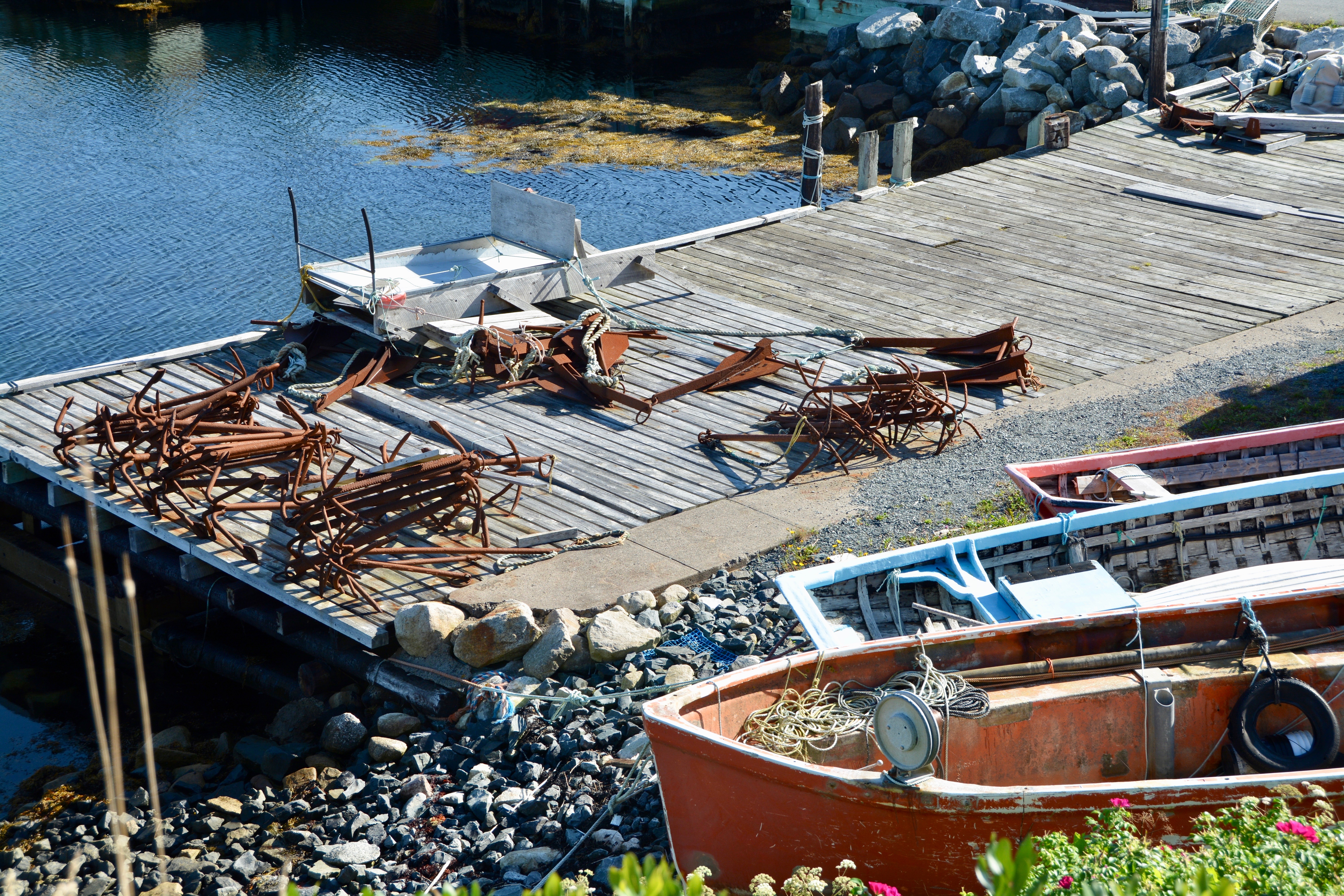
As I walked through town, I came to the granite carving depicting the fisherman and families of Peggy’s Cove. The sculptor who did the carving is William E. deGarthe who lived locally. We saw lots of evidence that fishing continues in the area as a thriving business.
There were lots of lobster traps around, both the older traditional wood ones and the newer coated metal ones. The concept is the same. The lobster goes in through the opening, eats, and then is no longer able to get out.
After I saw the carving, I turned around and went back to the lighthouse area where we were meeting the bus. There had been so much talk about these lobsters that I decided to get a lobster roll. The restaurant right at the parking lot had a togo window, so I picked one up there and ate it on the bus. Fabulous. I loved Peggy’s Cove. If you like beautiful scenery or to take pictures it is a must-see.
As we left Peggy’s Cove, our guide told us about the Swissair Flight that crashed into St. Margaret’s Bay in September of 1998. The crash site was only 5 miles southwest of Peggy’s Cove. All 229 aboard lost their lives. “The cove became one of the staging areas for first responders that were involved in the search-and-rescue response, crash recovery operation, and investigation of the crash. Many of the CCGA volunteers that were first to approach the crash site were privately owned fishing boats that were operating out of Peggy’s Cove and surrounding harbours.” Wikipedia A memorial has been placed along the shoreline of St. Margaret’s Bay.
When we reached Halifax, we drove by two of the cemeteries where victims of the Titanic disaster are buried. We also saw several naval vessels in port and passed the dockyard for Canada’s Atlantic fleet.
We saw some pretty cool historic buildings in the port area. There also have a very nice passenger terminal. I was ready to to walk back to to one of the interesting seafood restaurants we had seen, but Boris was tired. The line for hop-on/hop-off bus was crazy long so we decided to get back on board relax and have a late lunch. I definitely need to return so I can see more of Halifax.
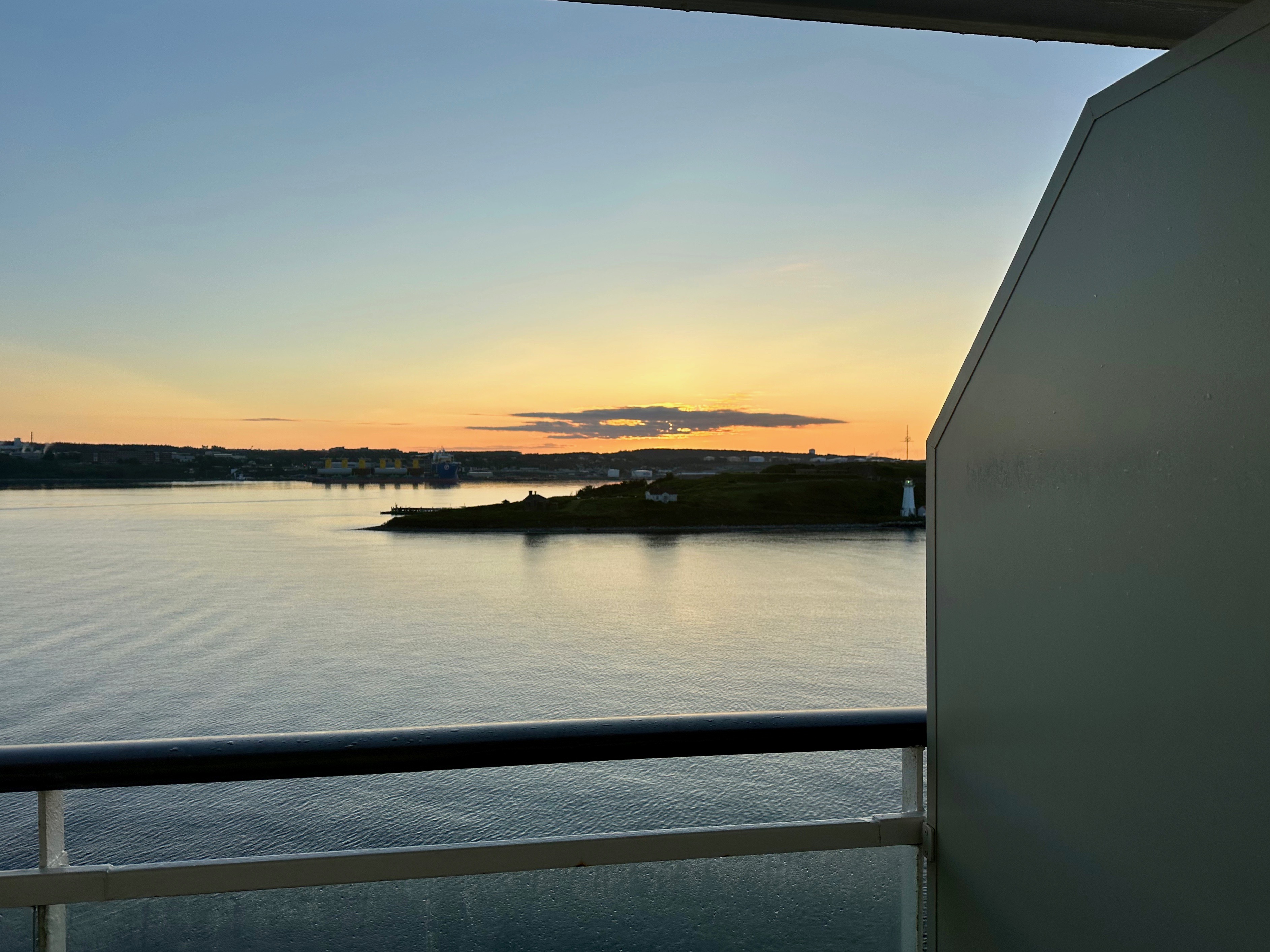
Boris was tired and wanted to nap and I thought about going out in the area near the passenger terminal but he wasn’t too happy with me doing that so I just went out by the pool on this warm, sunny day. I actually had a great time resting, reading, and listening to music. It turned out to be just the right move. The next day, our final sea, was cold and cloudy and it was like that all the way into Boston. We had our best seat of the cruise in the dining room for breakfast, just by the back facing window. My picture of Boris is facing into the ship however. The fog was so thick you couldn’t see anything out that window. Disappointing. Needless to say, it wasn’t pool weather so I am so glad I went out the day before. Good nap and packing weather though.
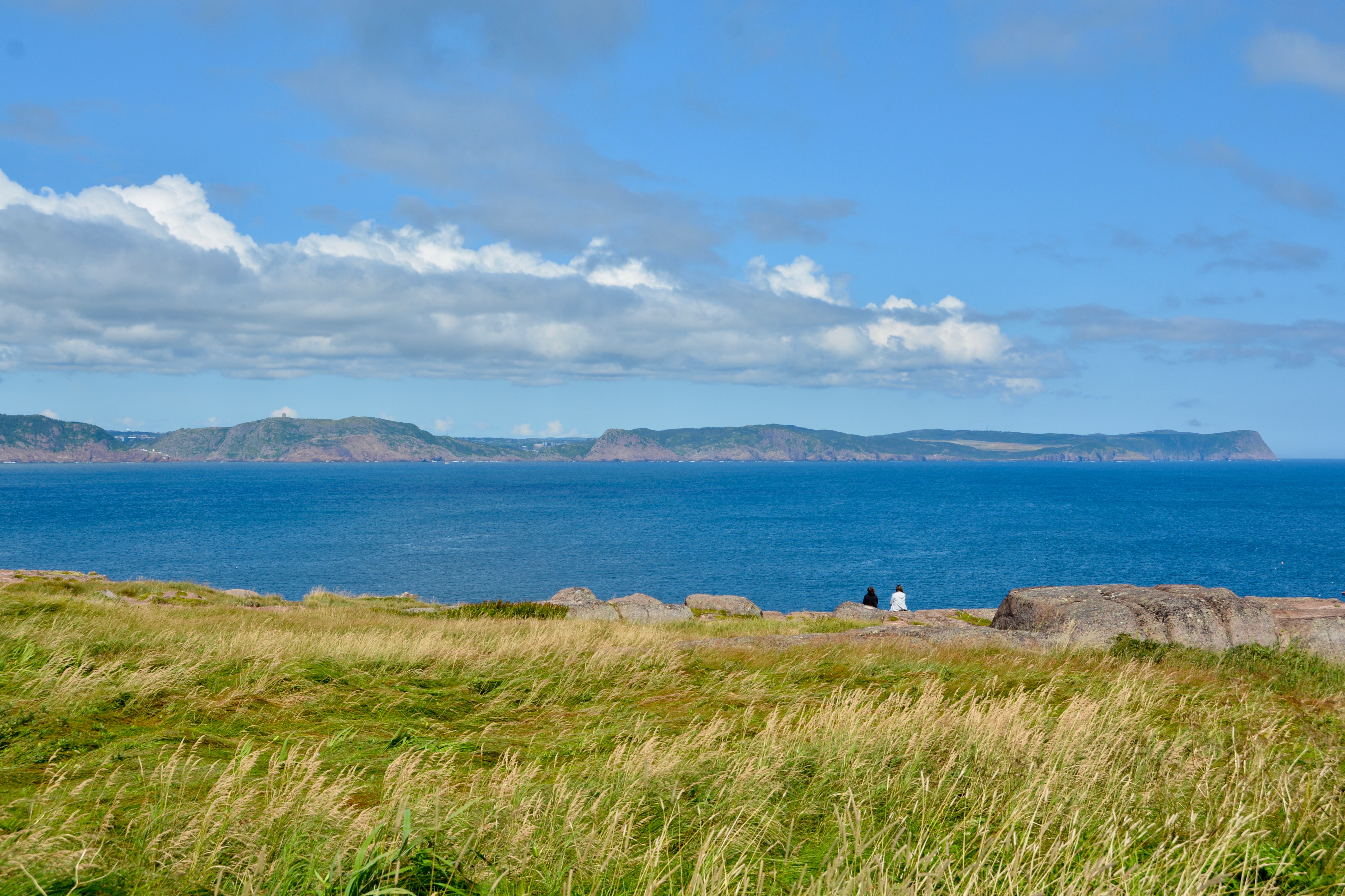
After visiting Iceland and Greenland, our cruise through the North Atlantic continued with two sea days before we reached the coast of Canada and the island of Newfoundland. Our lecturers talked about seals (I have the perfect hat for that), puffins, and jets. What was missing were lectures on the history of the countries we were visiting. What about information on the Inuit, the Vikings, or the Norwegian or Danish explorers? But perhaps the oddest thing we did on our sea days was adjust our clocks a half hour. “When time zones were introduced in the late 19th century, Newfoundlanders chose their 30-minute offset because that was close to the local solar time in St. John’s, the city where most Newfoundlanders lived.” –-Britannica The 30-minute time difference only applies to the island of Newfoundland and not the rest of the province.
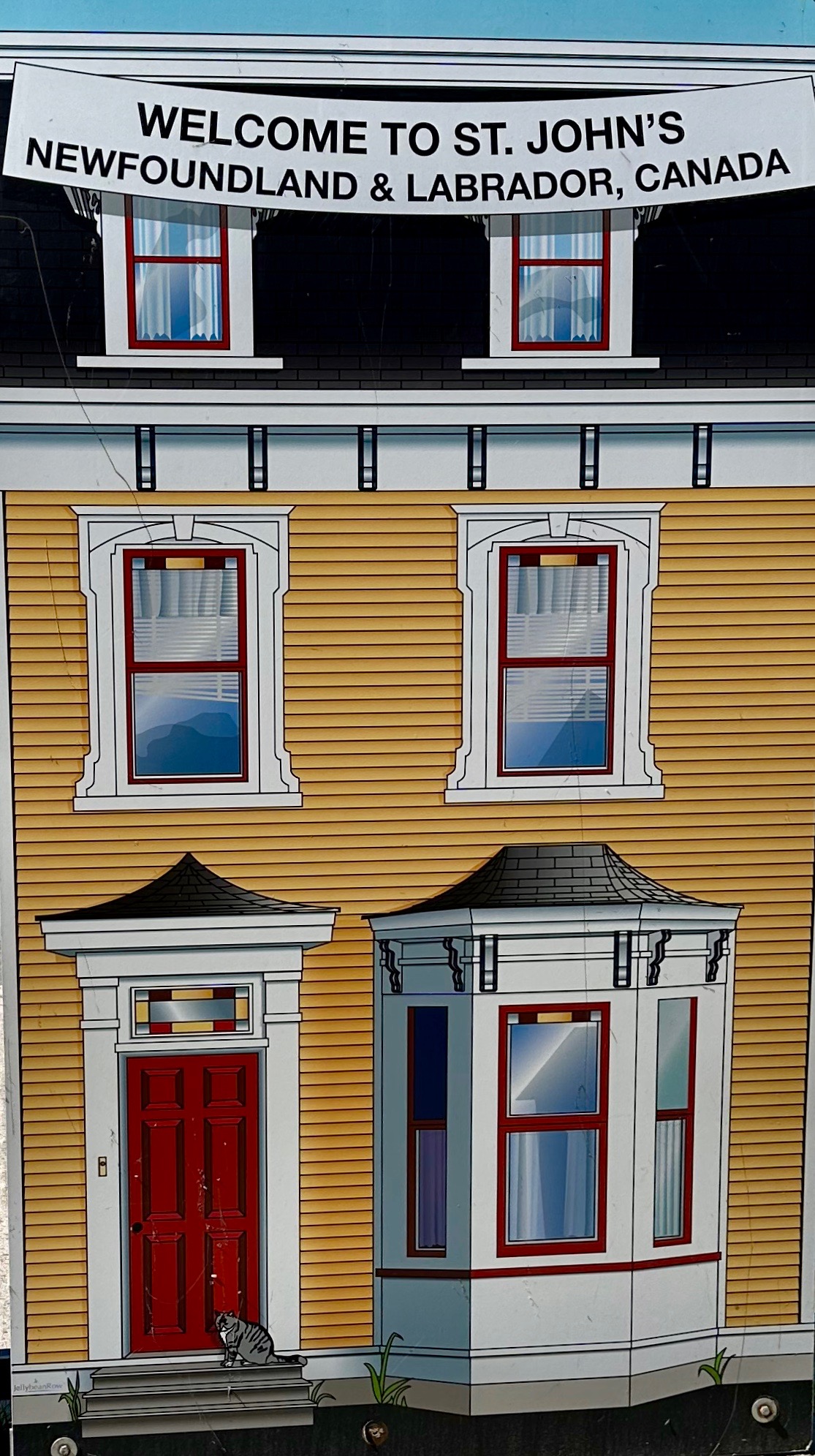
Today we dock in St. John’s in the Canadian Province of Newfoundland and Labrador. This is the capital city and the largest city in the province. It was settled by the British in the 1600s. St. John’s is also the easternmost point of Canada at Cape Spear just under seven and half miles from the city center.
Until 1949, Newfoundland was an independant Dominion within the British Empire. It became the 10th and newest province of Canada that year. In 2021, the name was changed to Newfoundland and Labrador. The province is made up of the island of Newfoundland and the mainland region of Labrador which borders the Province of Quebec.
94% of the entire population of the province lives in Newfoundland and most of those in the capital city of St. John’s. Today the residents are of English and Irish descent. When Europeans first reached Newfoundland in the 16th century, “the Beothuk were the only indigenous group living permanently on the island.” –Ingeborg Marshall, The History and Ethnography of the Beothuk. Today, 3.2% of the population consider themselves “First Nation”.
The country’s economy was quite depressed after the collapse of the cod industry in the 1990’s but the emergence of oil exploration and production, continued mining in Labrador, diversified fishing, and even some agriculture in southern Newfoundland have contributed to a stronger economy in the province today.
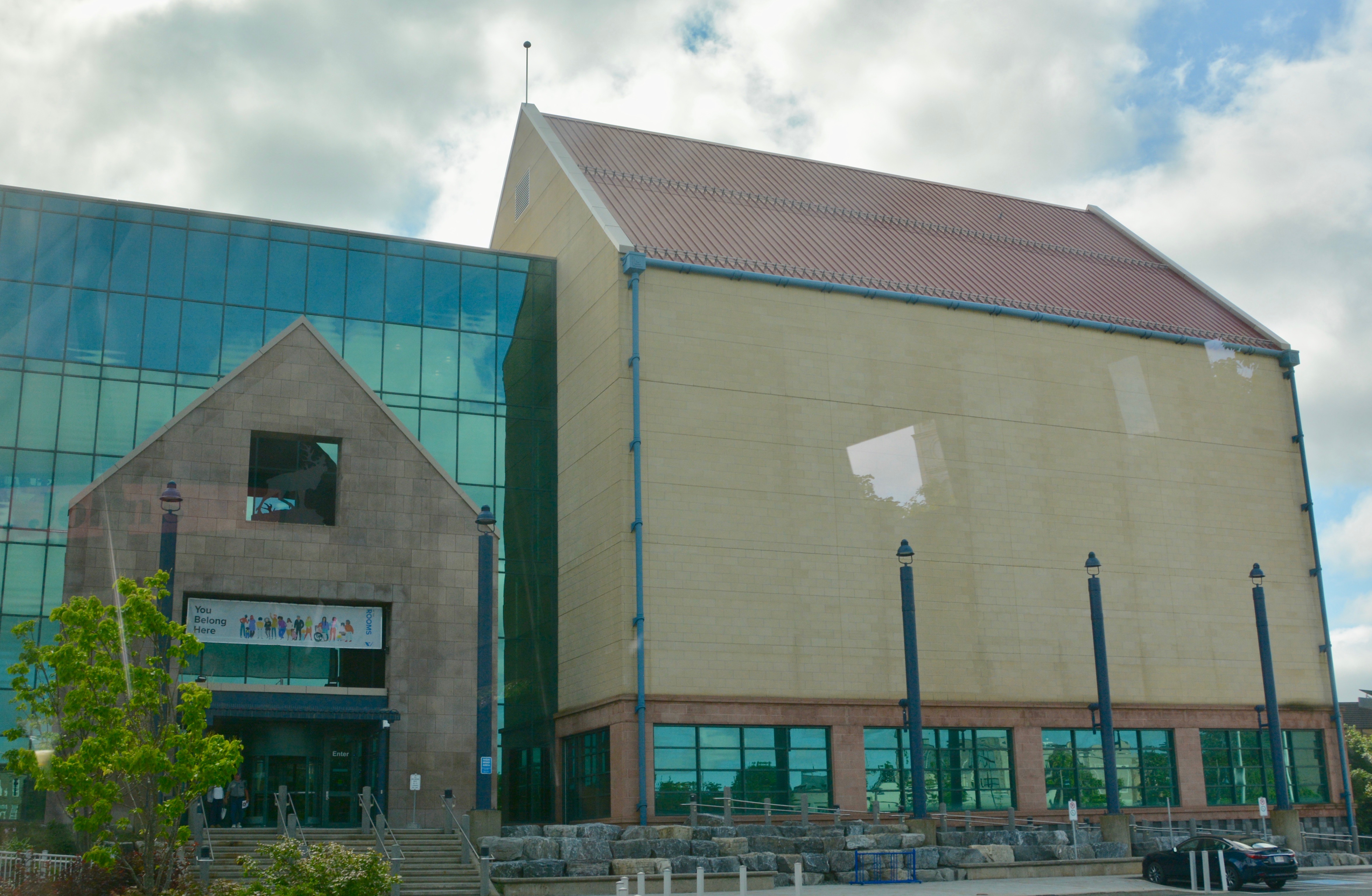
Folk music with a strong Irish influence is quite popular in the province. The culture of the region is best explored in the local museum known as The Rooms. Soccer (football) and rugby are the most popular sports, although there is a minor league hockey team The Growlers. However, if you asked our guide, he would tell you that softball is the most popular sport for men and women in St. John’s.
Today’s excursions were pretty limited and mostly sold out, so we decided to take the local hop-on/hop-off bus as we do in many cities. It was a short walk from the pier to the hotel on Water street where the first bus stop was. They were running four buses, but I think they might have underestimated the crowds. When we got there the wait for the next available bus was 50 minutes (the line was much longer when we got back). The bus got there 30 minutes early, but we had to wait for the actual departure time to leave although the bus-actually more like an extended minivan-was full. This worked in our favor since Boris decided to walk around a bit when we found there would be a wait. I grabbed a seat and he luckily made it back in time.
The cost was C $50 or $45 for those 55 and over $35 for those under 12. (We paid about $70 US for tickets for both of us.) The route took about an hour and a half if you just stayed on the bus. We learned pretty quickly that we needed to do that. People were very angry when our bus would reach a stop and there was no room for anyone to get on because no one wanted to get off the bus. This often happens early in the day. It is not unusual for Boris and I to do an orientation loop and then get off on the second go around.
Our first stop was Signal Hill and Cabot’s Tower. The tower was built in 1898 to commemorate the 400th anniversary of John Cabot’s landing in Newfoundland, and Queen Victoria’s Diamond Jubilee. The real significance of the tower is that this is the point where Guglielmo Marconi received the first transatlantic wireless message, the letter “S” in morse code, sent from Cornwall, England in 1901. Signal Hill was originally used for flag signaling by the British military.
Our second stop was at the Johnson Geo Center which we passed on the way up to the tower. The facility is a science center affiliated with the local Memorial University. Just FYI, the center’s Titanic exhibit is no longer there (since the COVID closure). Some guests were disappointed to get off, pay an entrance fee, and then find out the exhibit was no longer there. The center’s director actually came running out to tell our bus.
The next stop was Quidi Vidi Village, a neighborhood in St. John’s next to Quidi Vidi Lake where the Royal St. John’s Regatta is held annually. It was quite charming. If we weren’t worried about getting a seat on another bus and if it would have been late enough to grab lunch, I would have gotten off the bus. The driver/guide had been telling us all morning about the fabulous fish and chips in St. John’s. Cod is currently in season. I thought about coming back on a second loop and then taking a cab back to the ship if necessary.
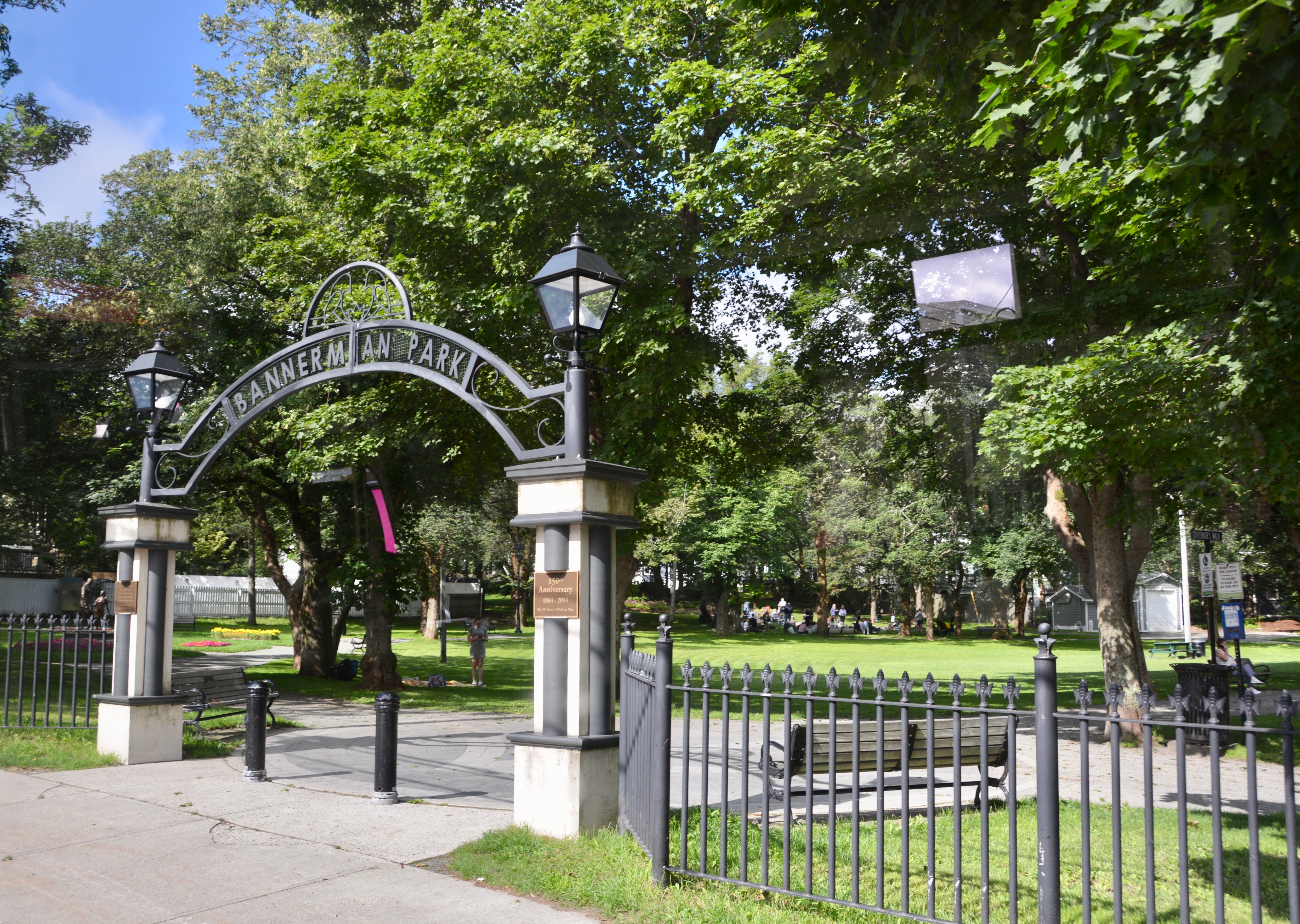
The fishing village is at the far end of the lake so we made the loop around Quidi Vidi Lake before heading back into the heart of St. John’s. Our next stop was Bannerman Park. The park includes open spaces, a children’s playground, walking trails, an ice skating trail for the winter and a pool and splash pad for the summer.
After leaving the park, we made two more stops in town at The Rooms, a recommended cultural museum, and at the Newman Wine Vaults. Then we made the drive out to Cape Spear.
It was a nice drive along the coast out to Cape Spear, the easternmost point in Canada and North America. The Cape is not far from the heart of St. John’s, only 12 km (less than 7.5 miles) to the southeast. Just go out route 11 until it ends at the Cape.
They do a good job of marketing the Cape: “Watch the First Sunrise of North America…It’s our geographic position, jutting out into the North Atlantic that gives us the honour of receiving the sun first before anyone else on the continent. And with it comes a half-hour off-kilter time zone and, some would say, an extra half hour in the morning. It’s safe to say, though, that firsts are nothing unusual around here. Suffice it to say, as one of the oldest cities in North America, we’ve seen more than our fair share in the last 500 years. To name a few:
We were the first to respond to the RMS Titanic’s distress signal that fateful night in 1912. The first non-stop transatlantic flight took off from St. John’s in 1919. And wireless communication was received here first when the letter S was transmitted from Cornwall, England to Signal Hill, St. John’s. As monumental as these historical moments may be, if you find yourself standing here at the edge of the continent at first morning light, you’ll likely be a little preoccupied.” —NewfoundlandandLabrador.com.
On the way back into town, we made an unscheduled photo stop and had a nice view of the city from our elevated position. Then we drove right by the next stop, The Railroad Museum At the final stop, our driver had to recommend to those waiting that they go to the first stop because the bus was full.
Even though we could have stayed on the bus, there were so many people in line that Boris and I decided to get off and give someone else a chance to see the sights. We decided to walk around town, maybe find one of the pubs the guide recommended, and check out the local fish and chips during cod season.
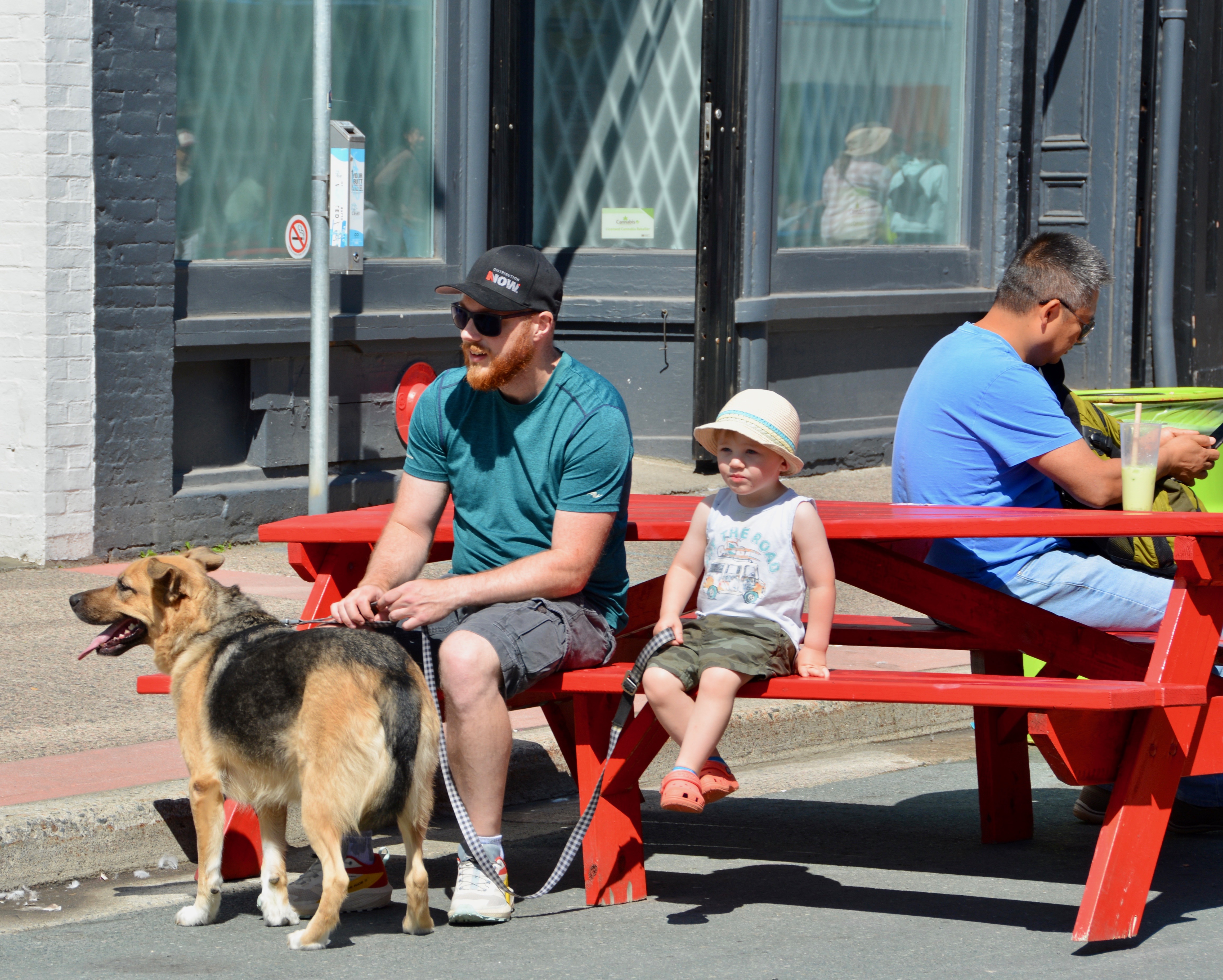
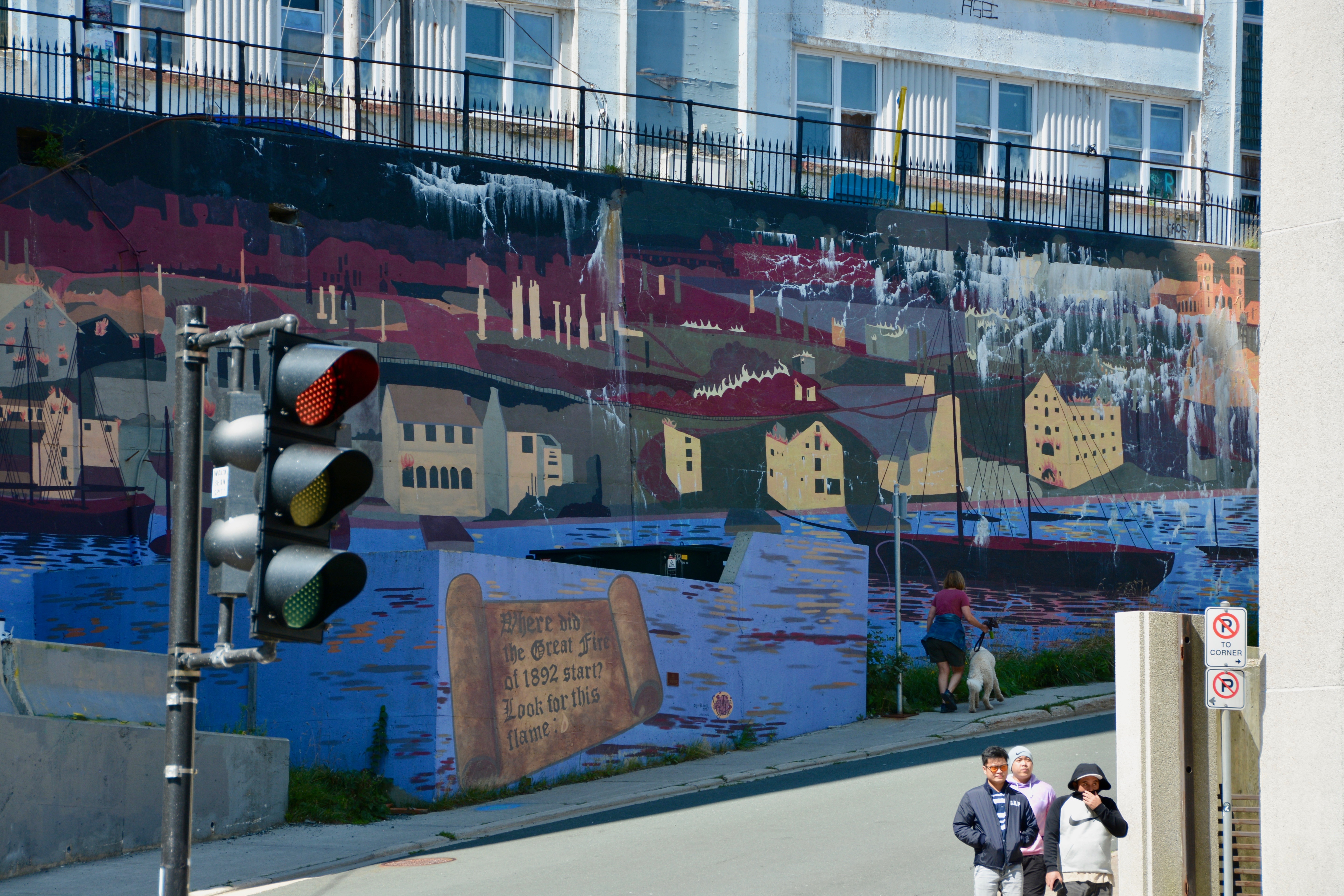
The pedestrian street was only one block up and we loved the charming building facades and the tables that had been placed in the middle of street so you could take a break or enjoy food or drink from a shop/cafe or food truck.
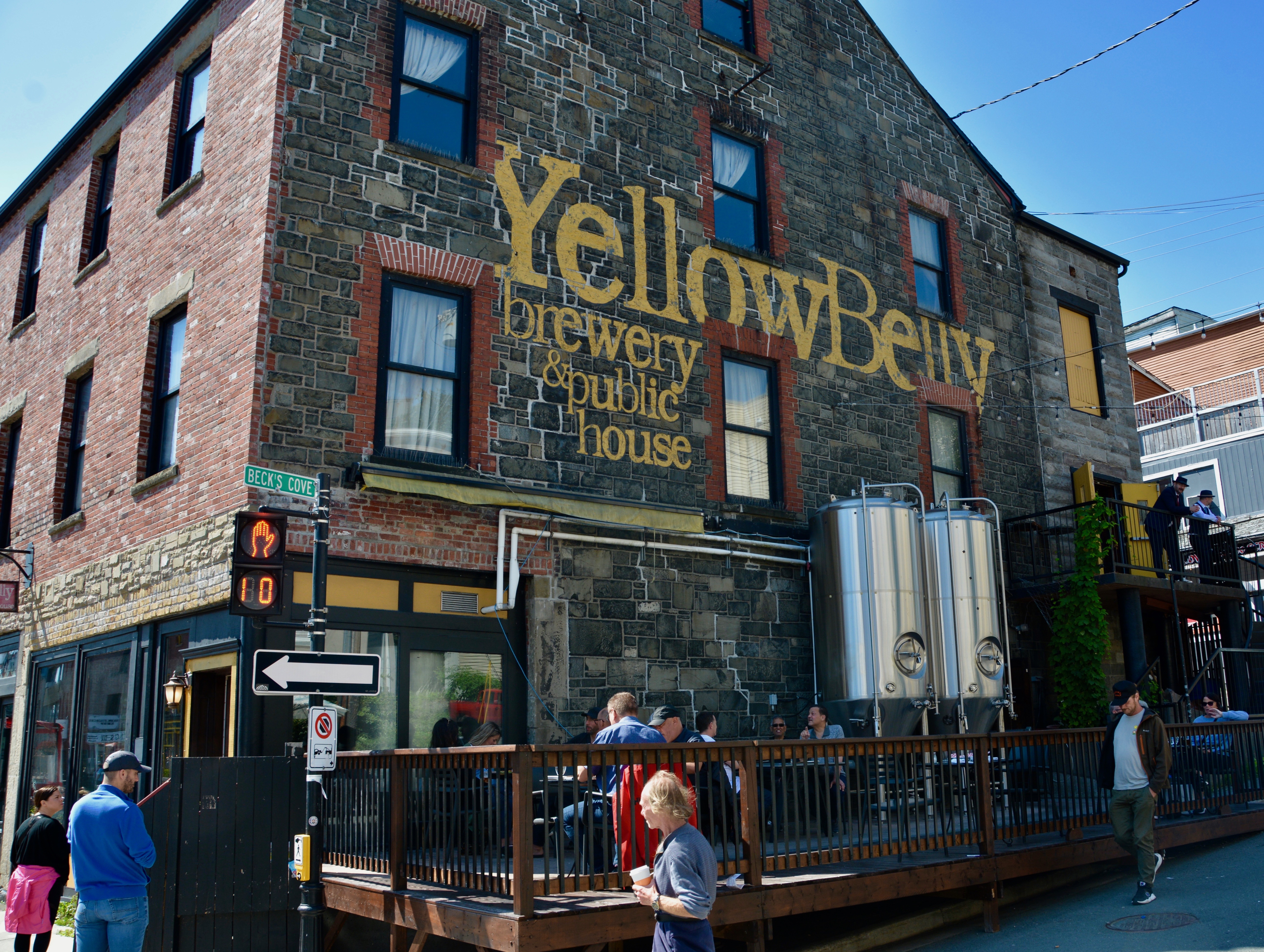
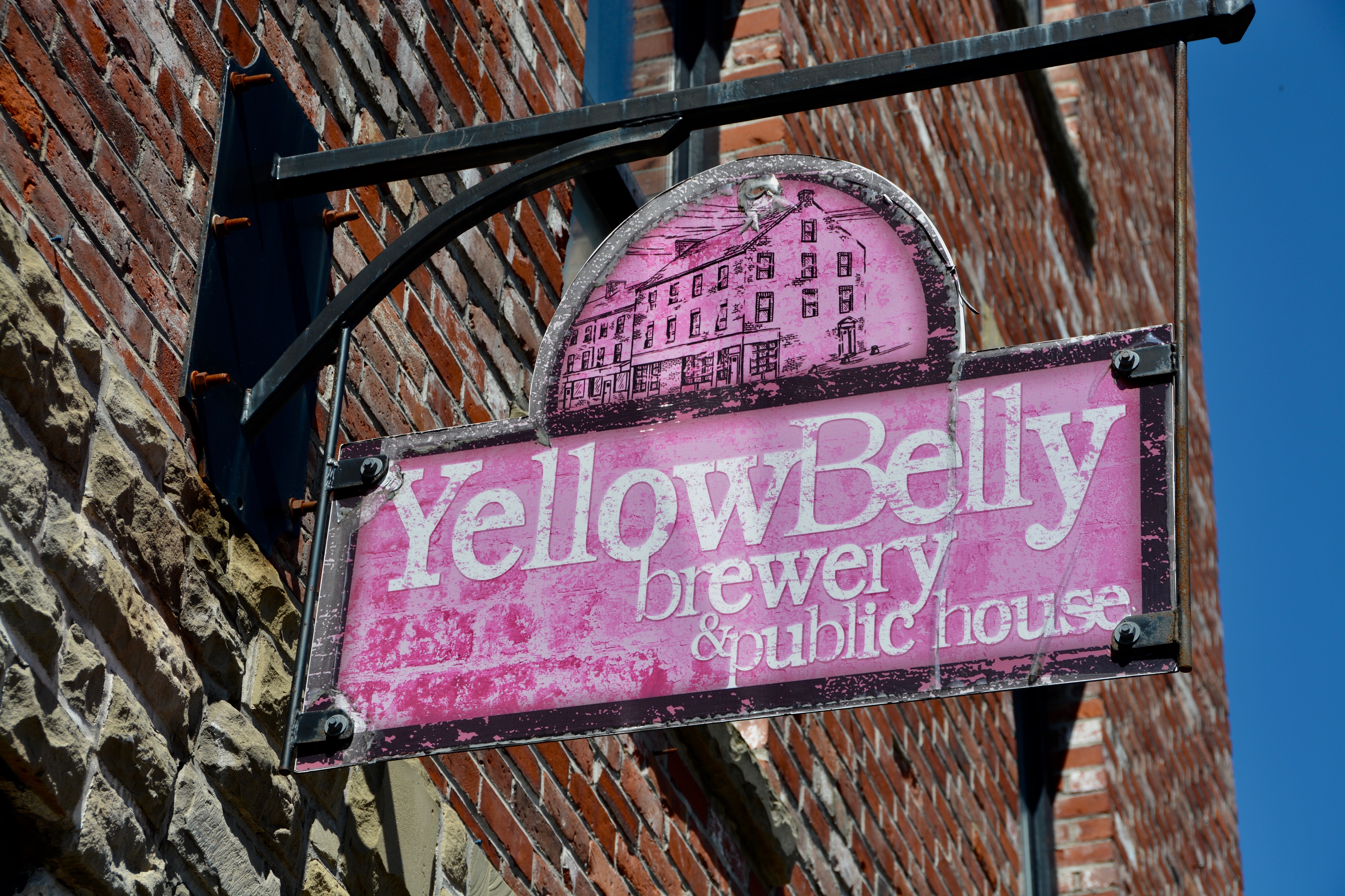
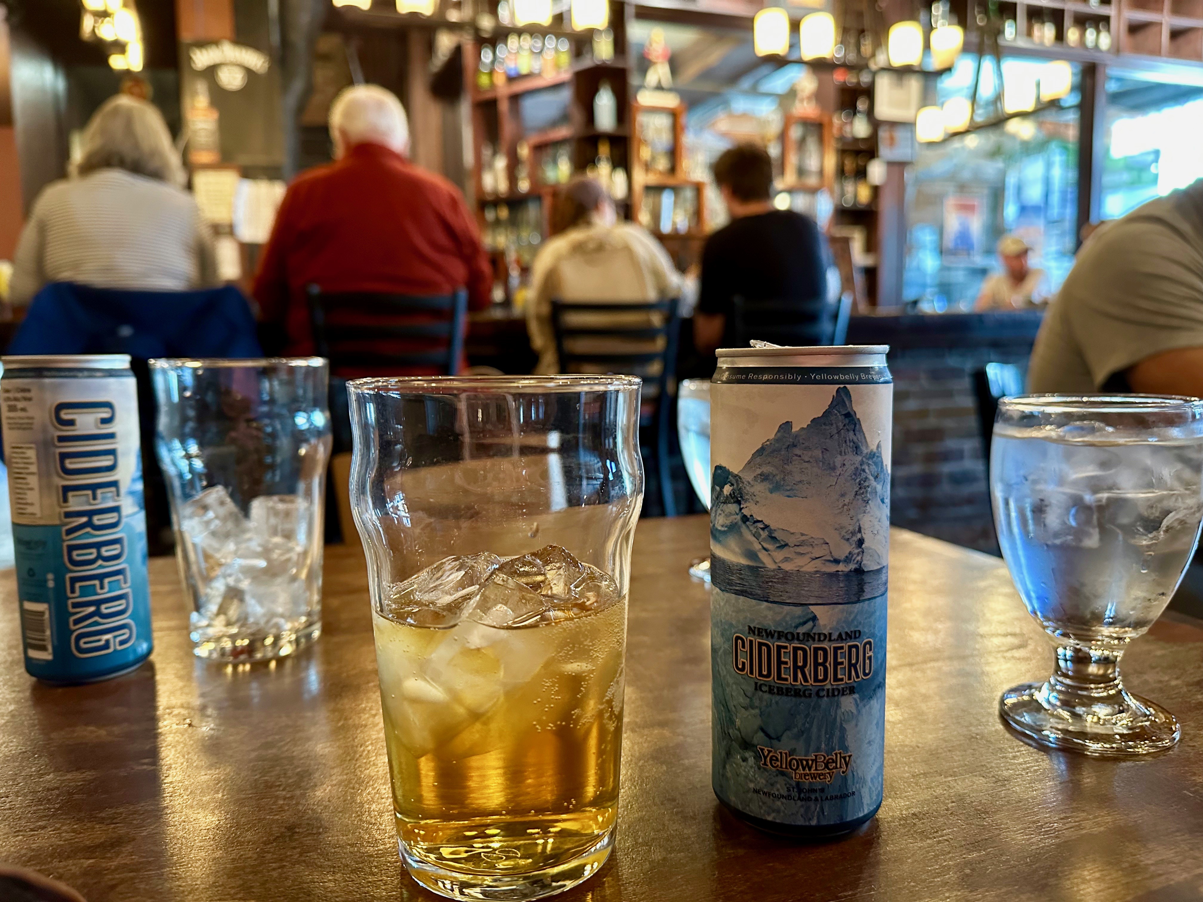
Our guide had recommended several cafes and pubs for excellent fish and chips. The first one we came to was out of business and second one was the Yellowbelly Brewery and and Public House. It had that traditional pub look and a line that said it had been recommended. I had talked to a girl on the bus (one of few that got a seat when some people got off at Cape Spear) who had been in St. John’s a week and this was the place she ate at several times. We felt pretty safe giving it a try.
We put our names on the list and went and did a little shopping. I found some cute puffin stuff and Boris got a hat, although I am not sure when he is going to wear this one. When we got back to Yellowbelly, we didn’t have long to wait for our table. We both ordered the cider. Unfortunately they didn’t have any on draft but we got one in a can made from glacier iceberg water. We ordered onion rings as an appetizer and fish and chips for lunch. Unfortunately, it was all awful. Sorry can’t recommend anything we got here, not even the cider. Cool building though.
After lunch, we wandered around town, into a few more shops, and then back to the ship. It had become a warm, sunny day and I was definitely overdressed at this point. When we reached the pier, I could hear a bagpipe. I looked around until I spotted a guy just standing in a parking lot playing the instrument. At least he was dressed for the weather.
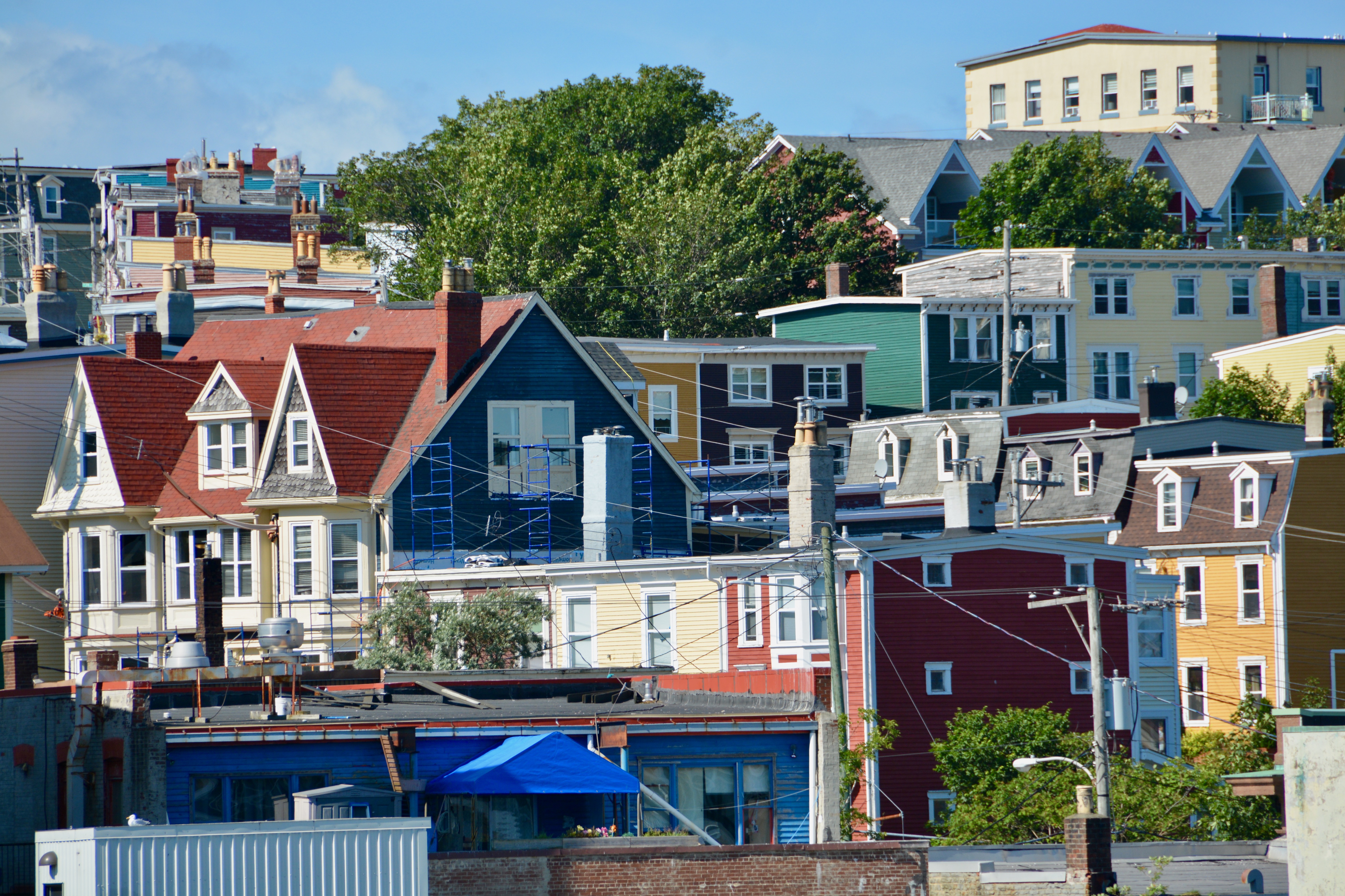
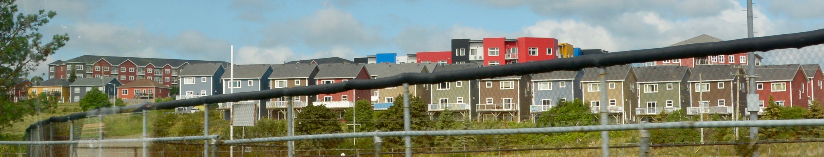
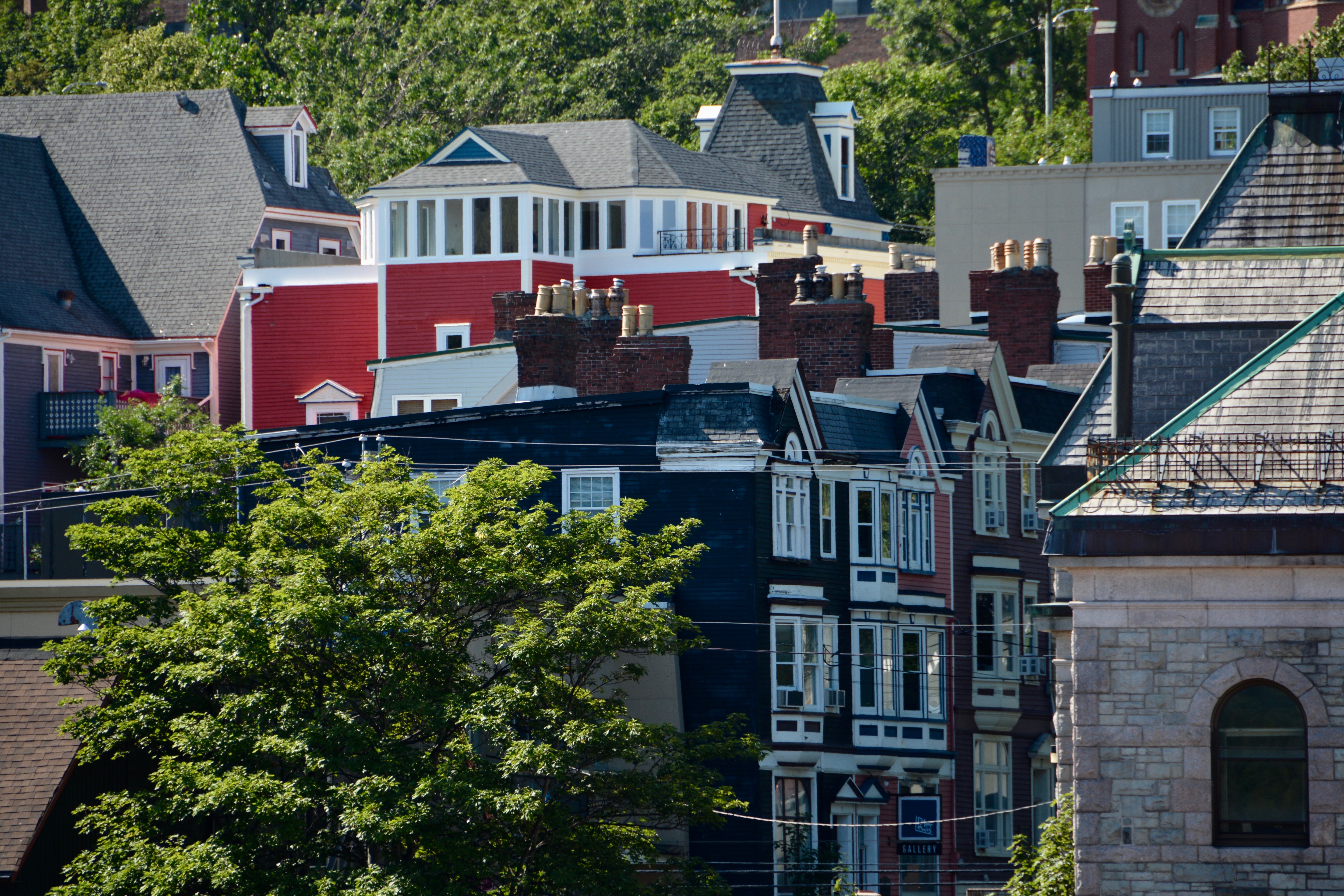
Once I got back on the ship, I changed into something cooler. From our cabin balcony, I had a great view of the city, the goings on, and the colored row houses all over the town. We had a fun day in St. John’s, Newfoundland and Labrador, Canada.
During dinner we had a great view of Signal Hill and the coastline of Newfoundland as the ship departed. On to another Canadian province as we head to Halifax, Nova Scotia.
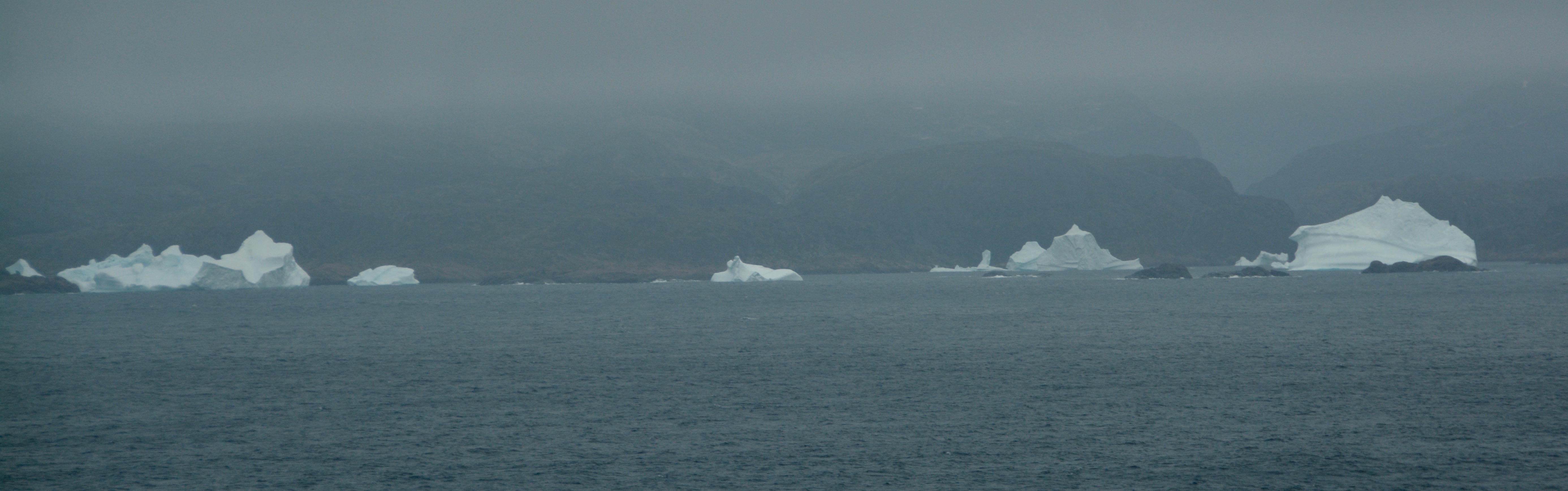
I would like to say I am checking off a new country today when I step foot in Greenland, but its classification is a bit tricky. Technically it is an autonomous territory that is part of the Kingdom of Denmark. I guess it is a country within a kingdom. Greenland’s citizens do enjoy the benefits of residents in the European Union since they are part of the Kingdom. Regardless, it is still pretty exciting to say I have been there. Yesterday, we took a breathtaking cruise through the Prins Christian Sund, named for the Prince who would later become the King Christian VIII of Denmark.
The territory is vast, more than 3 times the size of the US State of Texas, a comparison that works for this Houstonian. In spite of the fact that Greenland is the world’s largest island, it is the least densely populated country in the world with 0.026 people per square kilometer. Why? 80% of the country is covered by an ice sheet that is second to only Antarctica’s in size. Yes, it would be far more appropriate if Greenland was named Iceland and Iceland was Greenland. There is a reason that Iceland is a popular tourist mega and Greenland has very few visitors. Cruises ships running aground in the northern fjords of Greenland and taking more than three days to get unstuck doesn’t help the tourism cause. Today, Natasha is one of the lucky few. First, our ship didn’t get stuck and second I get to step off and into a country most people will never visit.
Two thirds of the island lies within the Arctic Circle. At one point, Greenland is only 500 miles from the North Pole. “Seals and whales are found in the surrounding waters and were formerly the chief source of nourishment for the Greenlanders.” -Britannia Activism and world views have changed this habit and livelihood. The 56,609 people that live in Greenland (2023 numbers) have settled along the coast and are mostly fisherman and hunters. Some sheep farming is found on the southern coast.
“The first humans to set foot on Greenland arrived some 4,000-5,000 years ago…No less than six different Inuit cultures have migrated in distinct waves. Greenland’s current population is descended from the last migration, the Thule culture, who began arriving in the 1200s AD. At the same time, Norsemen led by the Norwegian Viking Erik the Red settled in Southern Greenland. The Norse population disappeared around 1500AD.” —Denmark.dk
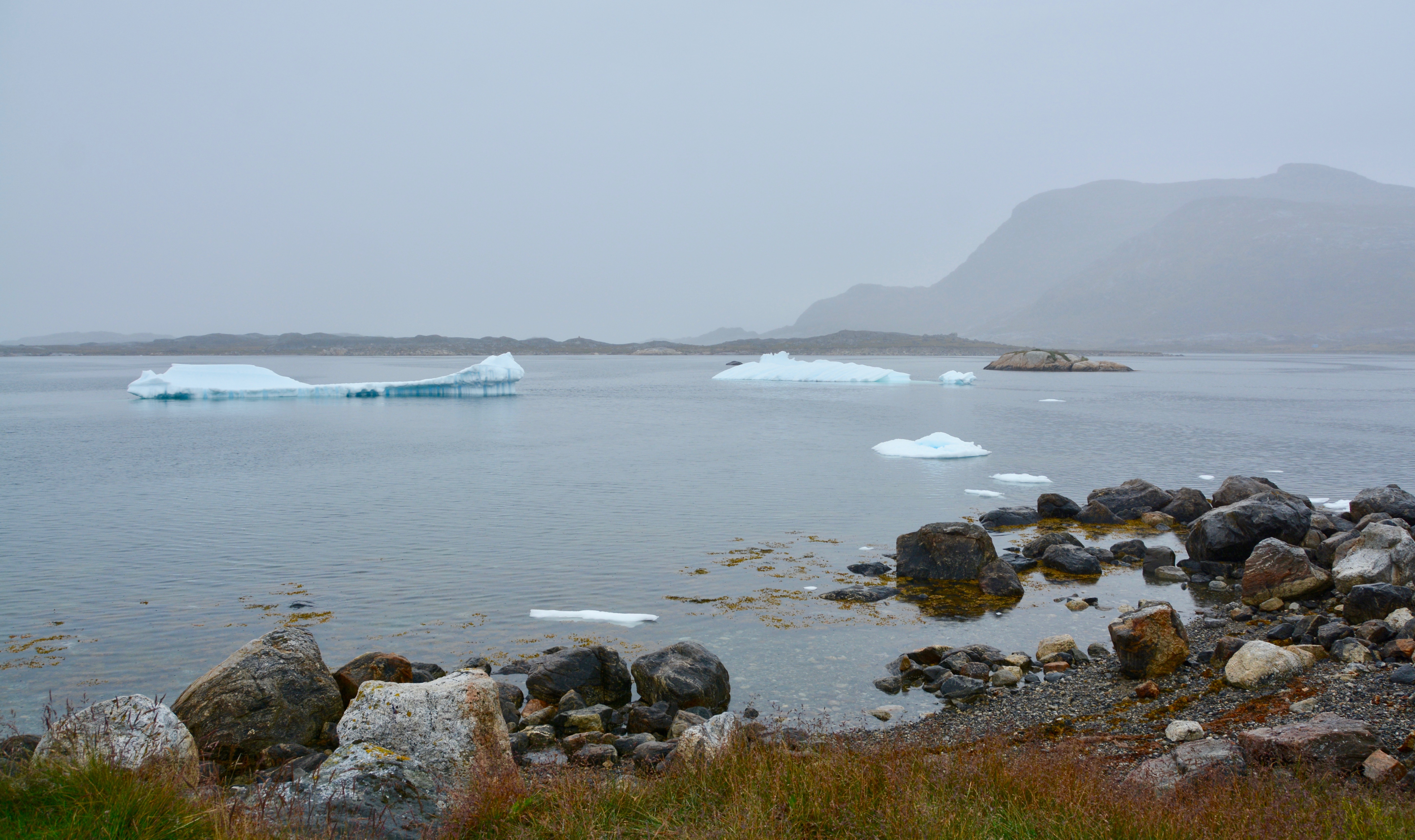
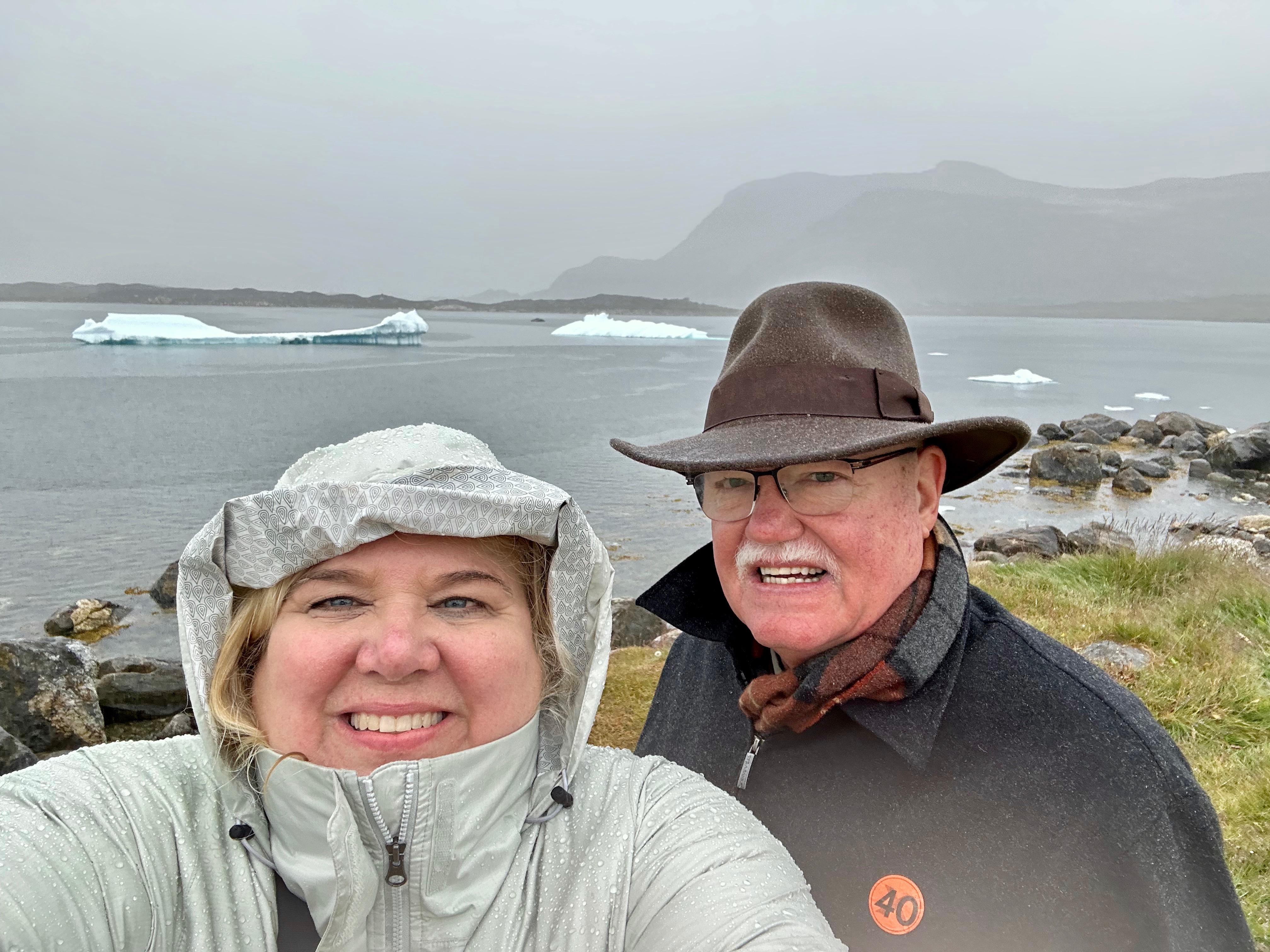
Today we are anchored in the harbor off Nanortalik, Greenland, the southernmost city on the island. Most of today’s excursions are iceberg tours and they were all sold out months before we got on board the ship. We saw so many icebergs yesterday, I don’t feel like I missing out not going on an iceberg tour today. Nanortalik is a great place from which to visit the Qinngua Valley, the only natural forest in Greenland. We are taking the tender in to visit the city’s open-air museum in the colonial area of Nanortalik.
Nanortalik is “place of the polar bears”, although today polar bears are rarely seen in the area. The primary industry is based at the local fish factory. This was one of the first places settled by the Norse and more recently the Inuit. The Inuit people are found in Greenland, Quebec and Labrador, Canada, and Alaska. The Greenlandic Inuit are descendants of the Thule.
While yesterday was foggy and cold, today rain was predicted. We got up and had breakfast and then went to grab a priority tender. These priority tenders were offered on the other tender day as well, but we were on an excursion and didn’t need it. This service is for those who frequently take cruises on Celebrity. We were walked directly down to the loading ramp by Celebrity personell as soon as the next boat came in. To be on the safe side, I grabbed my rain jacket and Boris took the umbrella the ship had provided (one per cabin).
We needed it. By the time we reached the shore, the rain was coming down hard. As we got off the ship, we were given a “day pass”, essentially a ticket for the open air museum. Boris had done his research and really wanted to see this museum. Local regulations require everyone leaving the pier to have a day pass. There are not a lot of roads in Greenland. Access to most communities in Greenland is via the water. The town buildings all appeared to be constructed with function in mind. There was very little beauty until we got to the old colonial area of the town. We didn’t see any signs in English to indicate what was a store, a school, etc. (Of course everyone that lives here knows what is what.) The only marked building was the tourism office. The area is not large, but you need to be prepared to walk. Nothing is very far away; it was just uncomfortable due to the rain. We did not see any buses, bus stops, taxis, or car rental agencies, so be sure to arrange your transportation before you go.
When Boris and I reached the church we went right in, as much to get a break from the rain as to tour the inside. It was actually quite lovely. Of course everyone had the same idea and it was a small space so things were crowded.
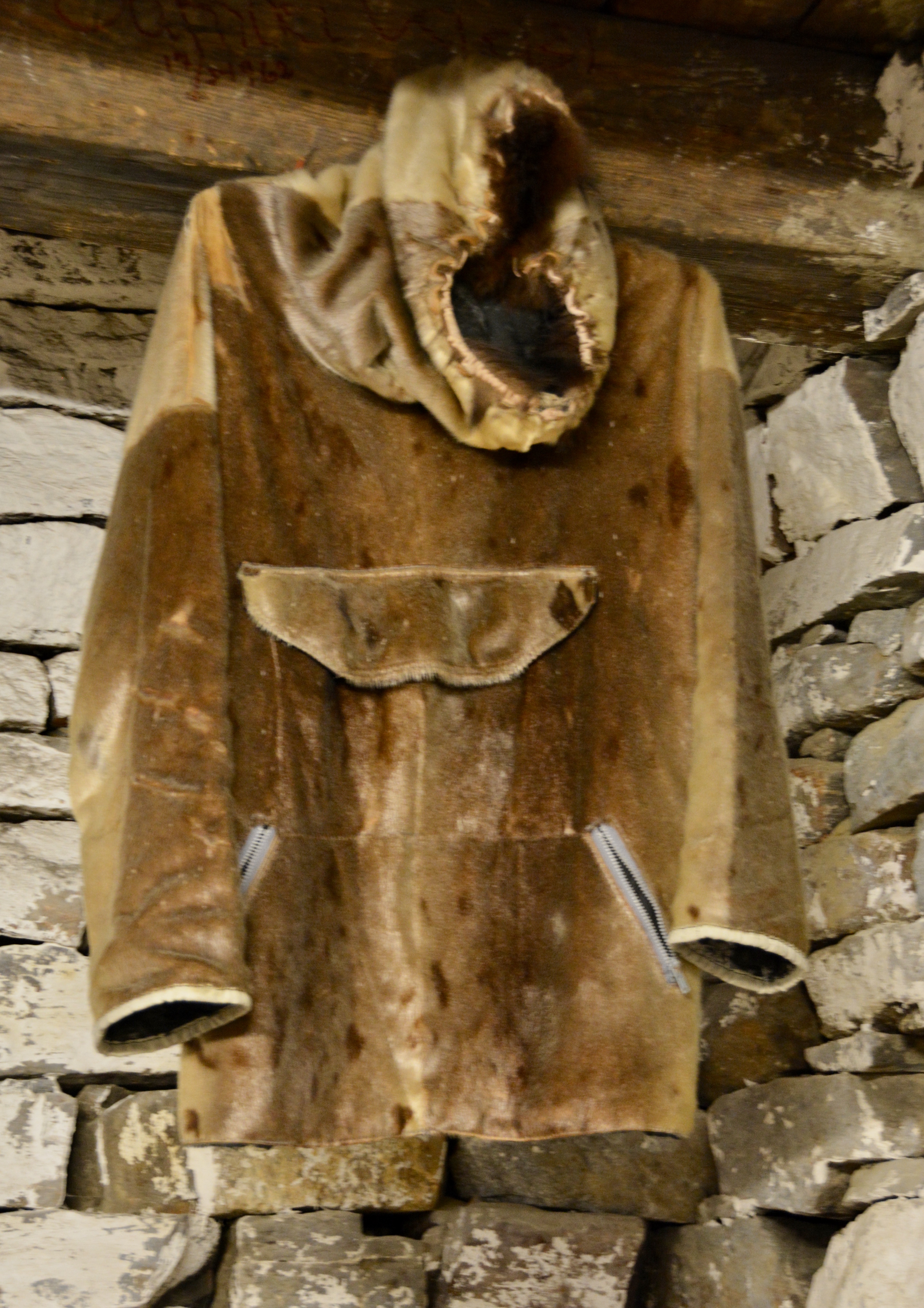
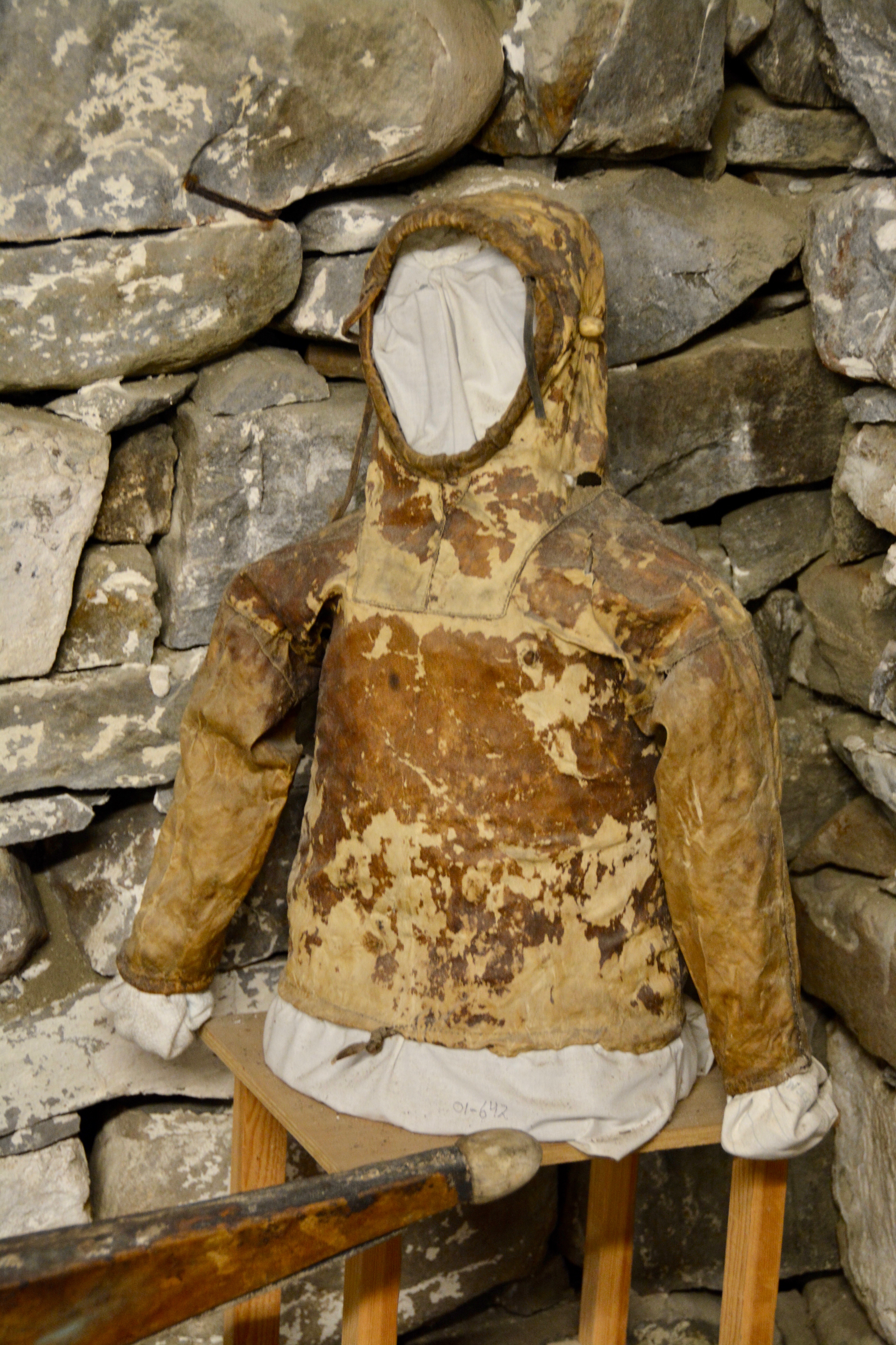
We reached the open-air museum and handed over our day pass and were give a sticker as access for the museum. This was paid for by the cruise line. The museum is actually a series of buildings each with a different focus. One was on the whaling history; another was on the medical issues faced by the people who live here: a third was set up as traditional home; etc.
The museum was very well done and each stop provided us a chance to get out of the rain. I had not thought about it ahead of time, but my tennis shoes have holes to provide air circulation and keep my feet cooler. Unfortunately that meant my feet and socks got wet, actually soaked. The rain was pretty bad and people who were wearing hiking boots said their feet got soaked too. I could have used some rain boots. I would also have liked to have rain pants. I had ordered some before the trip, but even the women’s variety were not good for a curvy woman. They were either too big or too small so I sent them back. If you can find them in your size, I suggest taking them along when touring Iceland and Greenland, even in the summer.
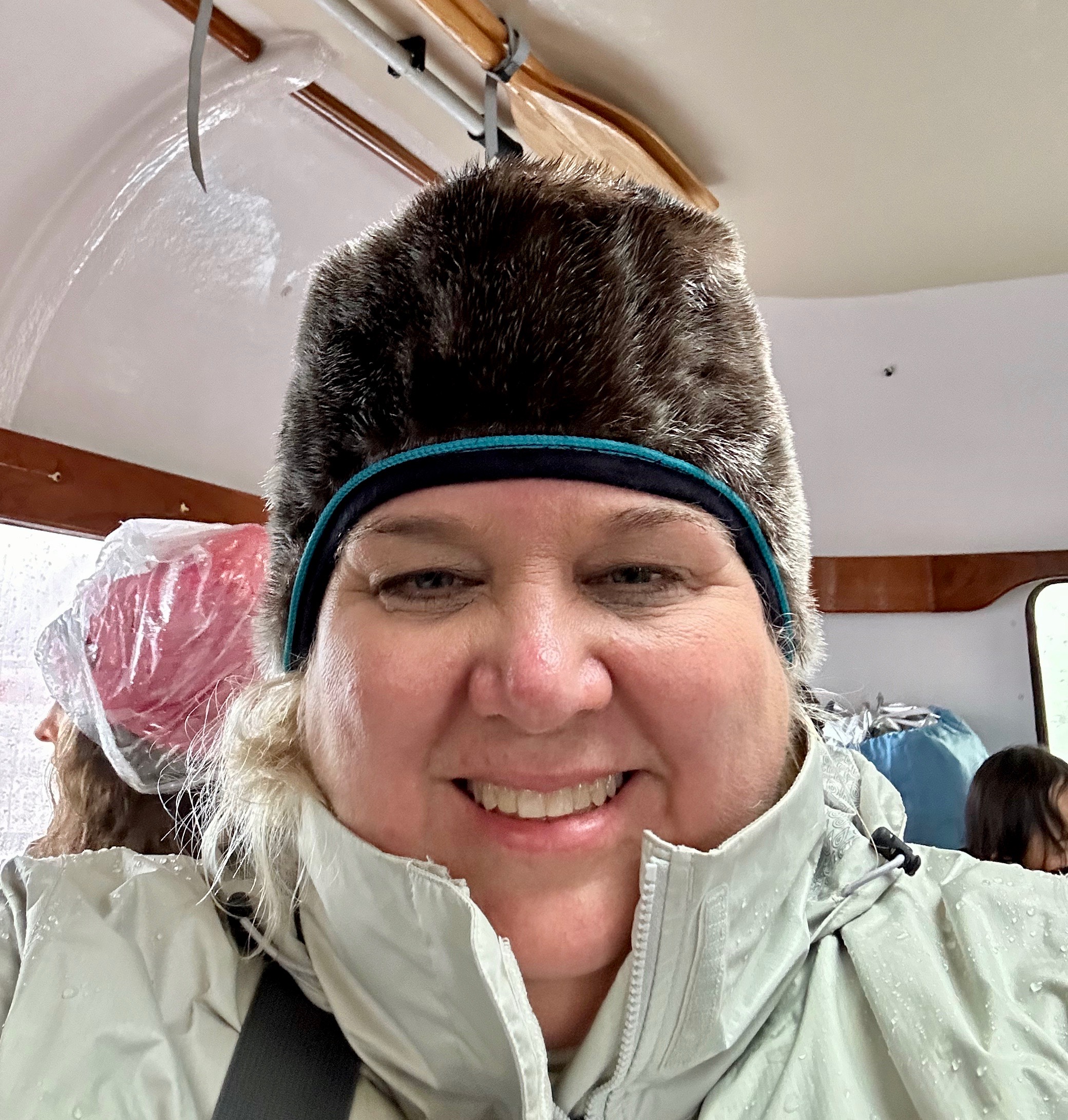
After we completed our tour of the open-air museum, we doubled back toward the pier again. This time we made a stop in the tourist office which had a shop. It was so crowded with people that you couldn’t even move inside. There are also toilets inside the building which was part of the reason for the crowd. Boris decided to do his shopping outside. Some of the citizens had set up tables along the road, although not all the vendors we saw on the way down to the museum had stayed outside due to the heavy rain. Of course Boris found something unique. He got a hat made of seal skin and fur. He came walking back to me wearing it, but it was kind of just sitting on the top of his head. It was actually designed to be pulled down over the ears. The hat was too small for Boris. I told him to see if they had a larger one so he could exchange it, but that hat was actually the only one the vendor had for sale. It was really made for a woman or older child. I modeled the fit for Boris on the tender back to the ship. I think I just got a seal hat.
After our outdoor touring, we were drenched so we went back to the pier and waited for a tender to take us back to the ship. I was hoping we didn’t make a mistake going out in the morning. It would have been the wrong choice if it cleared in the afternoon. Another ship was anchoring at 2 pm and Nanortalik only has a single pier for the tender boats so we knew it was going to be very crowded later in the day and we had wanted to do our touring early. We had taken the first tender we could that morning.
We got back to the ship and immediately went for dry clothes before a late lunch. It ended up raining all day. I took a nap wrapped in my extra plaid blanket I took from the upper deck. The cruise director joked about all the clothes the guests and staff had hung out to dry all over their staterooms.
My photography was limited by the rain and needing to protect my equipment, but I was still able to get some pictures and attempt to capture the feel of this southernmost city in Greenland. In spite of the rain, I had no regrets about heading out and setting foot in Greenland. It was still a great day.
We are headed to Greenland and have a sea day between the islands, one of several on this itinerary. Boris and I love sea days. It gives us a chance to rest after several days of touring, explore the ship, and take advantage of the on-board entertainment. I will admit to reading a fair share of books and napping on these days as well. This trip will be a little different because I often spend sea days by the pool reading or listening to music. It currently is a little chilly for that, although some guests just snuggled up with the plaid blankets the cruise line provides up on deck. I snagged one of the blankets to use while sitting on my balcony.
On these extended voyages, some cruise lines, like Celebrity, have guest speakers who give lectures that put what you are seeing in context or speak on topics of general interest. They are usually featured on itineraries with multiple sea days. Our guest speakers were Dale Erhart, a former Canadian jet fighter pilot and instructor (think Top Gun) and Brent Nixon, a marine biologist. We went to both lectures on the first day they spoke.
Although it appears Mr. Erhart does a lot of speaking on cruise ships, I was underwhelmed with his presentation and it appeared he was having to stretch to come up with enough material to lecture over six sea days. Mr. Nixon was the opposite. He was obviously a seasoned performer with a multimedia presentation. He knew exactly where to stand so he didn’t block the screen. He spoke mostly on the wildlife in Iceland and Greenland, from whales to bears, but his first presentation was on the northern lights.
He told us that we are currently in a cycle that will peak next year so it is a great time to try to see the lights. You need a clear night and darkness. He told us to step outside on our balcony around 10 pm (when it gets dark here at this time of year) and if you could see stars the conditions were right. He told us to turn off all the lights inside the cabin and on the balcony porch. Best viewing is between 11 pm and 4 am. I toughed it out until 12:45 am, but couldn’t stay awake any longer. The northern light were visible that night at 1:30 am. A man sitting one table over from us in the dining room got pictures. Mr. Nixon recommended the following website for information on the northern lights: www.gi.alaska.edu.
The other thing happening onboard was that we were going to begin slowly gaining back the time we lost due to the time difference. It will usually be in 1-hour increments, but there will be two, half-hour changes to accommodate the way the province of Newfoundland, Canada interprets the time zones. I love getting an extra hour of sleep!
For our first sighting in Greenland, we won’t actually be stepping off the boat. We will be touring through Prins Christian Sund. (Yes, that is how you spell it.) Gaining that extra hour, I easily had time to get to the dining room when it opened for a sit-down, served breakfast and afterwards went up to the Sky Lounge to enjoy the view while reading and staying out of the room so our cabin steward could clean. We had thick fog this morning. I got a spot right at the front windows and quickly realized this would be a great vantage point for our cruising through the Sound if the fog cleared. We were not scheduled to reach the mouth of the Sound until 4 pm. Visions of our view of the Panama Canal crossing aboard the Azamara Onward swam in my head.
I texted Boris and told him he had to help me save these seats. When he finally came up, I took a short break and went down to the cabin and got my computer, chargers, camera, an extra camera battery, airpods, and a carrying tote. I already had my ipad and phone with me. I was ready to camp out and camp out I did. The captain was going to open the heliport in the front of the ship if the conditions were good, but I wasn’t sure how cold it would be. Boris came and went. I only took breaks for the the bathroom and to go get myself some lunch. By 2 pm, Boris realized he better stay put. I told him to be prepared; depending on the timing, I might not be go down to dinner that night.
About 3:00 pm the rescheduled entertainment show in the main theater got out and people started to realize the value of my spot. The room was filling up. People asked if I got there at 2:30 pm to get this seat. I wanted to laugh. “I have been here since 8:30 am.” I think people thought I was crazy until I was able to sit down for the entire viewing and take pictures with my zoom lens. I hadn’t missed anything I really wanted to do during the day anyway. The temperature inside was perfect and the Sound was the highlight of the cruise. What a hidden gem. Words cannot describe how glorious it was. Boris had insisted that Greenland be included in the itinerary and boy was he right!
“Named for King Christian VIII of Denmark, this dramatic fjord separates the southernmost islands from the rest of South Greenland, a land of jagged mountains and green pastures where sheep farms border icy fjords and Norse history intersects with modern communities. Prins Christian Sund presents beautiful scenery for cruising, with mountains reaching 4,000 feet, glaciers inching toward the sea, and tidal currents the limit the formation of ice.” Celebrity Today from Celebrity Cruises.
Other than the small weather station we saw when we entered the Sound, we never saw another building throughout our journey. Prince Christian Sound (English spelling) is 60 miles long and connects the Labrador Sea with the Irminger Sea.. It is actually rather narrow at some points, onl 1,500 feet wide. At some points, the steep, jagged-topped mountains can reach over 3,900 feet.
Perhaps the only thing more beautiful than the jagged-peaked mountains were the many glaciers we saw throughout the Sound. Some of them run straight into the water and break off forming the icebergs we saw floating around. It is important to note that icebergs are larger under the water than on top of it; in fact only about 10% of the iceberg is above sea level.
We went into a small offshoot fjord and came right up to a large glacier wall. When it is warmer, it is common to see small broken pieces of ice in the water. Today is a foggy, cold day so the water was clear of “debris” and we were able to get closer. Towards the bottom you could see the very blue ice. Later the captain pulled back to where the fjord was wider and did two 360 degree turns of the ship in the fjord so regardless of where you were watching from on the boat you got a fabulous view of the glacier wall and the surrounding fjord.
Boris was ready for dinner after the glacier wall and most of the guests left the Sky Lounge. I stayed for a while just to enjoy the rugged beauty of the landscape. Knowing our assigned table was next to the window, I went down to dinner abandoning the seats that had served me well all day. I usually change clothes and do my hair and makeup for dinner, but i just went straight down, tote bag with equipment in hand.
We continued to travel down the Sound all evening. After dinner, I went out on the balcony of our cabin and got lots of wonderful pictures. It was definitely worth the cabin upgrade to a balcony room just for this spectacular day touring the Sound. The skies were still cloudy, but the fog was almost gone by the time I was watching from the balcony. I just loved the jagged peaks of the mountain tops and the “baby bergs” floating in the water.
Since we were in the Sound, the evening entertainment had been rescheduled to 2 pm in the afternoon and 10 pm that night. The shows are normally at 7 and 9 pm each evening. We left the Sound and were back in the ocean just before dark. I spotted an “ice stage” (my name), a flat sheet of ice on the water, just before we left the Sound.
The light was almost gone when we exited the Sound. Tomorrow I will actually get to set foot on Greenland during our visit to the fishing community of Nanortalik.
Today we are at our final Icelandic port, Akureyri. We have moved from the Northwest region and the Westfjords to the Northeast section of Iceland. With 20,000 residents, Akureyri is the second largest city in Iceland (but keep in mind that 80% of the country’s population lives in Reykjavik and the surrounding region). Akureyri, which sits at the base of the Eyjafjorour Fjord, is often referred to as the Capital of the North. It is one of the country’s most important ports and fishing centers.
Visiting the city itself, be sure to see the government-maintained Lufas Turf Houses, that show how Icelandic citizens used to live. Other city highlights include the Akureyrarkirkja, a Lutheran church with stained glass windows depicting scenes from Icelandic history; the Akureyri Art Museum with its collection of contemporary art from Iceland; and the Arctic Botanical Gardens with specimens from across Iceland.
Going just a little farther afield, you can trek through the Kjarnaskognr Forest; go horseback riding; hike Mount Sulur; visit the Dettifoss Waterfall (the largest waterfall in Iceland and the most powerful in Europe); go whale watching; or visit the Asbyrgi Canyon. I would have loved to go to Grimsey Island, the only part of Iceland that is actually above the Arctic Circle (the rest of the country sits just below it), and home to very few people, but lots of seabirds. Grimsey is a nesting place for puffins.
There are lots of nature-based excursions being offered, but honestly I didn’t seriously consider all of them because this was my opportunity to visit a Icelandic mineral bath, a cultural favorite. Having missed my chance at the Blue Lagoon by not flying into Reykjavik early, I was set on going to the Myvatn Nature Baths today. I got more than I hoped for with today’s excursion, also visiting several of the other major attractions near the capital of the north.
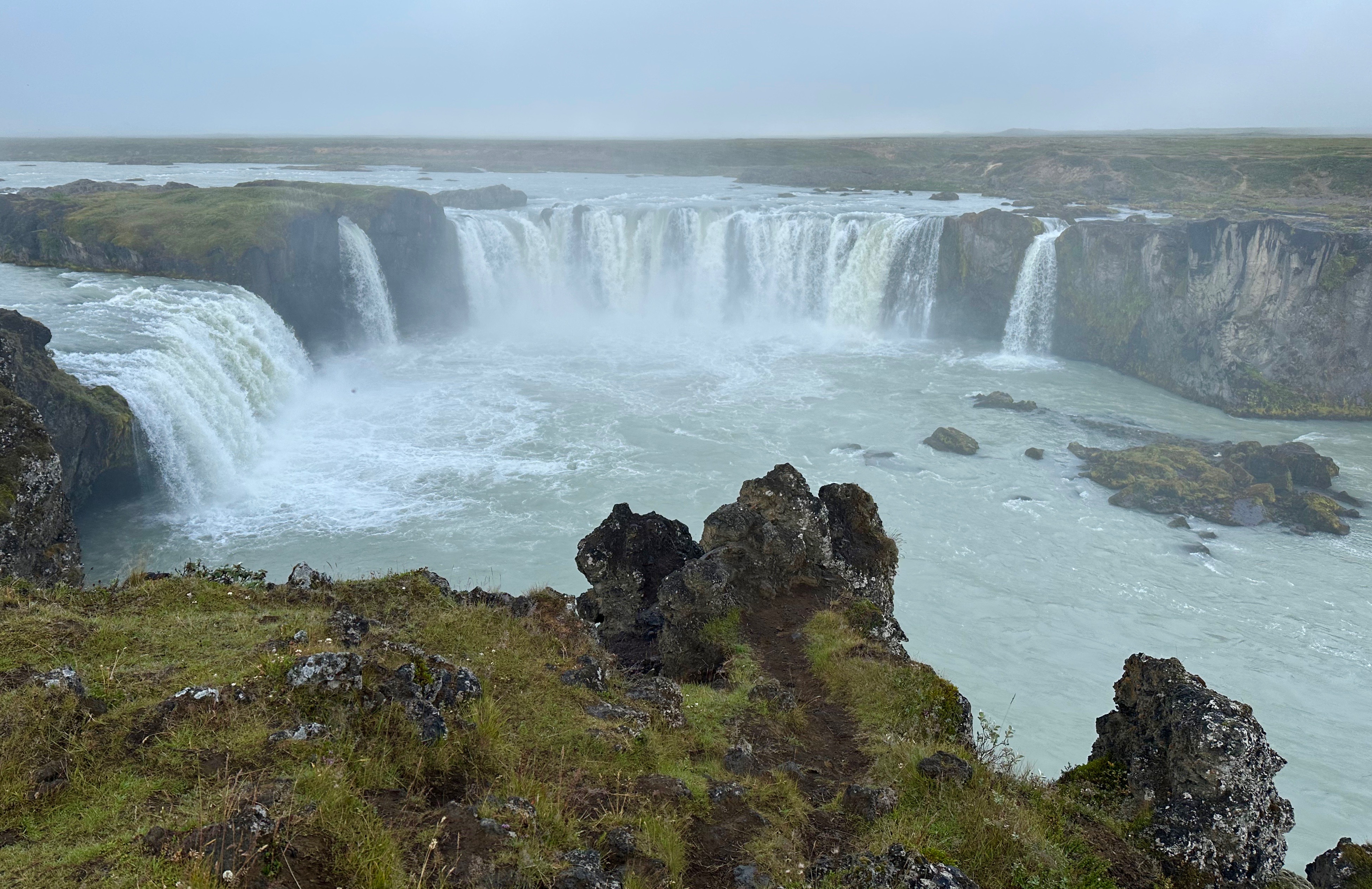
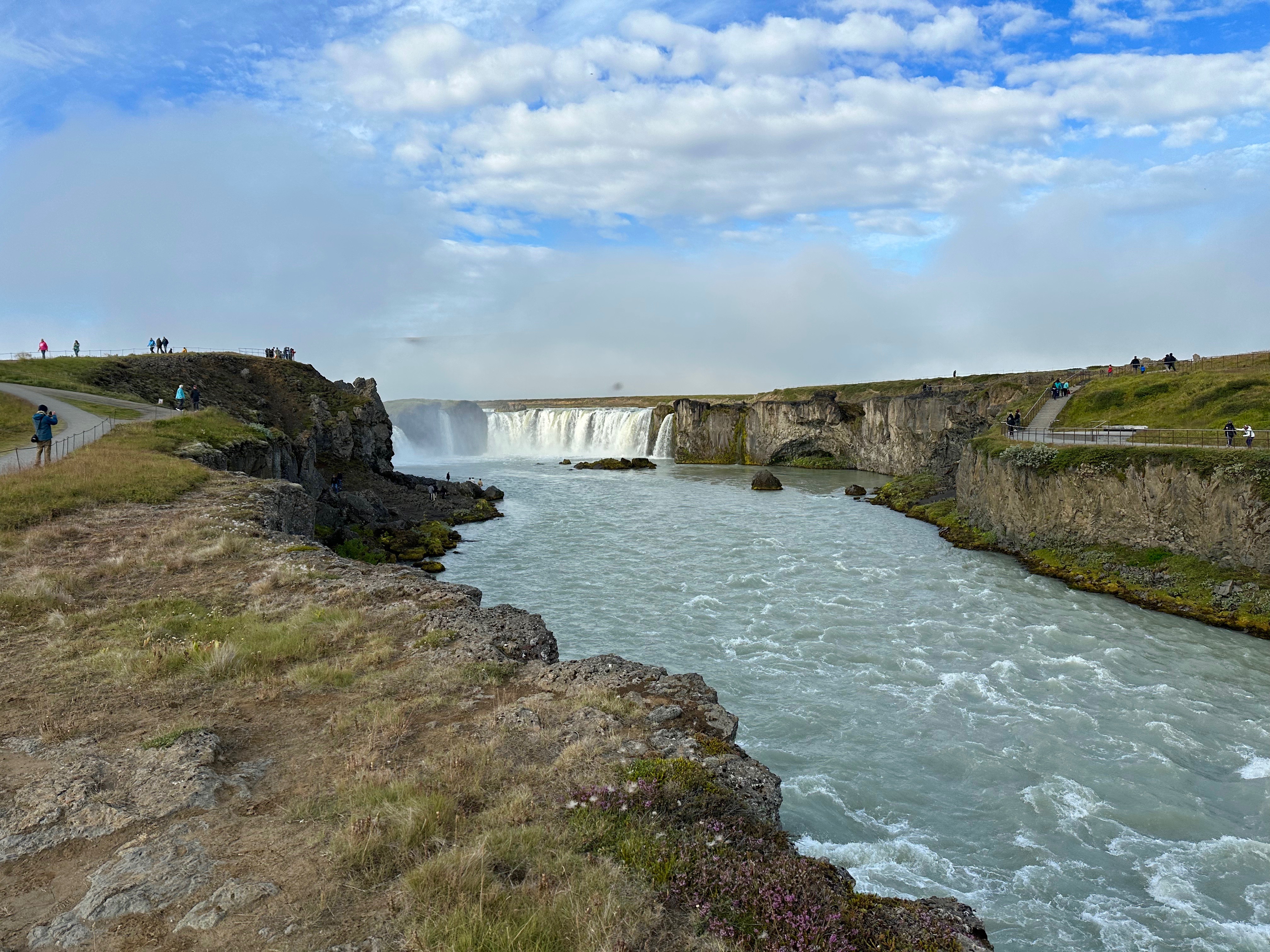
We had an early start to our day and had to meet for our tour at 7:30 am. We got off a little early under sunny skies and as we drove, we could see the fog rolling in as we were heading to our first stop. Regardless of the weather, this stop was a treasure. It wasn’t just a waterfall, it was the famous Godafoss Waterfall. Legend has it that around 1000 AD a local chieftain threw his statutes of pagan gods into these falls when he decided Icelanders should adopt Christianity. Hence the name, Waterfall of the Gods.
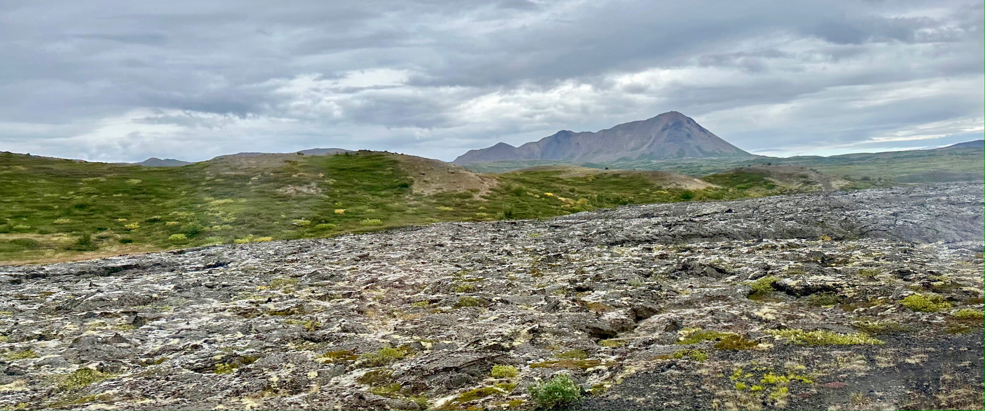
The falls are fed by a glacial river and the surrounding riverbank is formed by 8,000 year-old lava. The soil here is very thin, mostly dwarf shrubs, lichen, and moss. The falls are spectacular and the surrounding lava landscape is amazing. There are viewing platforms (and car parks) on both sides of the falls. There were even steps down to explore the river. We received countless warnings to avoid the lava rock, but that didn’t stop everyone.
There is a very popular cafe and souvenir shop near the parking lots for the falls. I admit I did pick up a few Icelandic souvenirs here. They obviously have visitors from all over the world, some with different cultural habits. A sign in the toilets, complete with explanatory drawings, reminded visitors to put tissue paper waste in the toilet and also that it is not appropriate to stand on the toilet seat. Apparently some visitors used to squatties prompted the need for the signs.
On our way to the next stop at the mineral baths, we drove around the Skutustadahreppur region and Lake Myvatn. Mývatn is a volcanic lake, and the area surrounding it is spectacular. There are wonderful hiking opportunities with the mud baths, geothermal pools, bird-watching (particularly for ducks), mountains, craters, and an active volcano. “Mývatn is, in fact, so beautiful that it was used as a site in the Game of Thrones franchise. Filmed in mid-winter, it was used to represent the lands North of the Wall, namely Mance Raider’s Wildling camp.” —Guide to Iceland.is
The Lava fields were incredible. We saw one that ended abruptly just before reaching a church. The Krafla Viti volcano has erupted 29 times since the 9th century. The name translates to “hell”. The most recent violent eruptions were between 1975 and 1984 when there were nine magna eruptions. Although there were no casualties, farmland was rendered useless for years.
In addition to the volcano there are these amazing craters that cause you to wonder if an asteroid hit this region at some point. There are also multiple pseudocraters. “These rootless craters form when piping hot thin-flowing molten lava flows over a wetland or boggy areas. The hot lava boils the water of the wetlands and the steam pressure causes explosions, creating clusters of pseudocraters.” —Guide to Iceland.is. The only places on the earth where pseudocraters are found are Iceland, Hawaii, and the Azore Islands. There is also one on the planet of Mars.
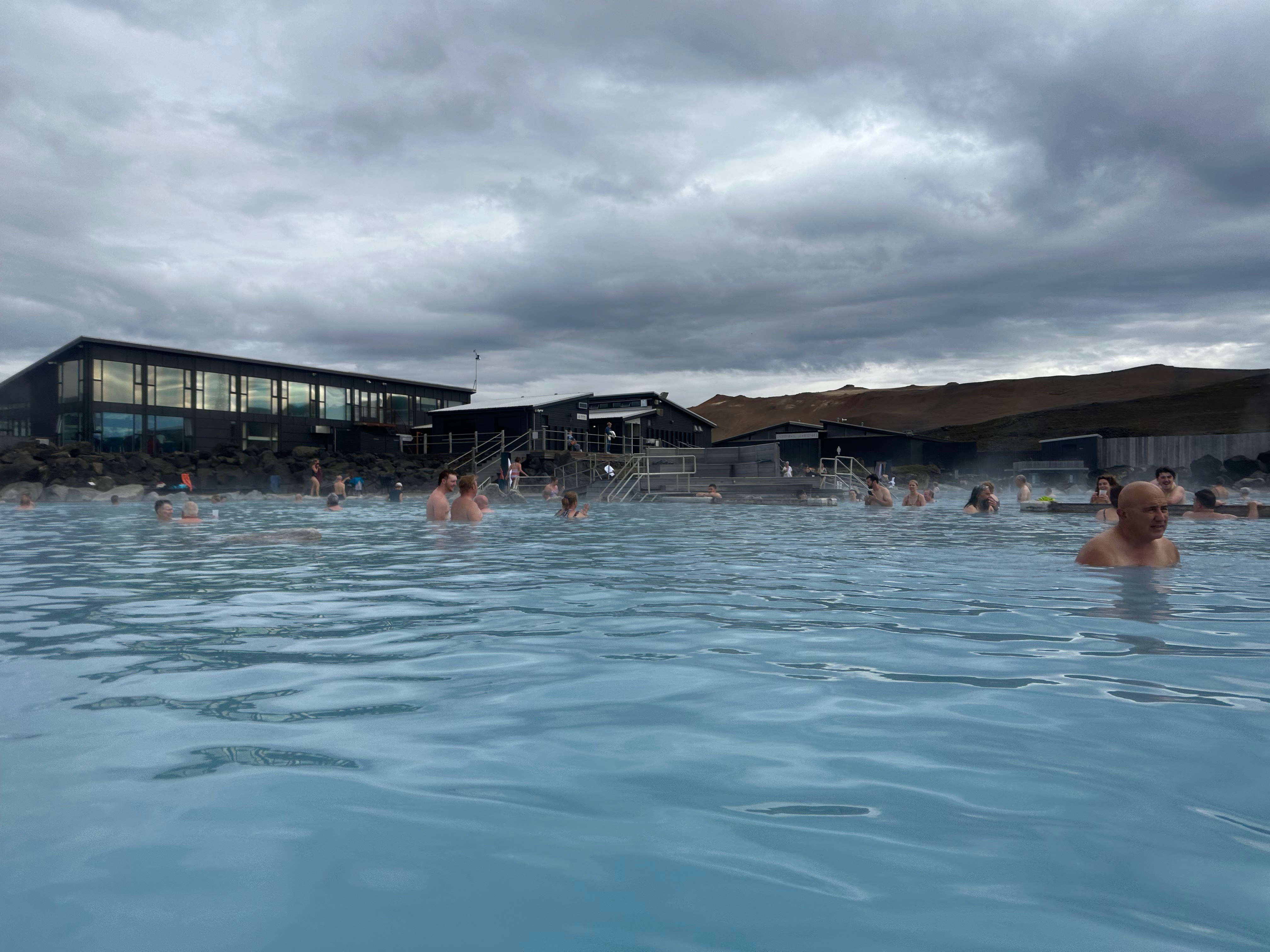
Next it was time for the mineral baths. We arrived at the popular Myvatn Nature Bath and got our orientation. First we had to “fight our way” through the gnats. These pesky bugs are actually the origin of the lake’s name. They do bite but they really don’t hurt; they are more annoying. I saw people with netted face masks and a special spray was recommended. You really do not need it. I got a few bites that lasted a few days but nothing painful. There were no gnats once we got inside the building and the mineral baths.
We were taken to a locker room (women and men are seperated) and given a coin that allowed us to get in and out of our locker as many times as we wanted. You are required to shower (with nice warm water I would add) without clothing-including swimsuits-under Iceland’s health regulations. We were told there would be a monitor, but I didn’t see one. Some of the younger women ignored that rule. It is a large community shower, but after the fact I noticed that there were two private ones. I put extra conditioner in my hair because the minerals will dry out your hair, but I never actually submerged my head. My swimsuit sustained no damage due to the minerals, but you do need to take off any metal jewelry.
There were easy ramps in and out of the water. The warm water felt fantastic. The minerals are said to be good for your skin and my skin sure felt wonderful when I got out. Be sure to move around the pool and determine your level of desired heat. The water is different temperatures in different parts of the pool. There are a few places to sit outside the water and relax and there is also an indoor cafe. We didn’t have that much time there so I stayed in until it was time to shower off again and get dressed.
Boris wasn’t sure about going to the baths, but he ended up really enjoying it. We met a nice Italian couple who were surprised Boris spoke the language and we visited with them for a while while enjoying the mineral baths. They were not on a cruise. I had gotten Boris and I clear underwater holders for our phones so our cell phones could be taken in the water. They were less than US$10 each on Amazon. You can see from the photo, Boris forgot to bring his from the locker room, but I used mine and it worked great; my phone worked perfectly both during and after we were in the milky mineral water. I recommend these inexpensive cases so you are able to take a few pictures while in the baths.
If we had been on our own I might have made a day of it, getting in and out of the baths and enjoying lunch there. All too soon it was time to head back. We passed a power plant where they use the steam from underground to generate energy. The Krafla Power Station was built in 1977. Clean energy from these geothermal power plants powers most of the homes and towns in northern Iceland. That is one way to benefit from an active volcano.
From the waterfalls, to the lava fields, to the craters and pseudocraters, to the mineral baths, to the volcano, to the clean energy lesson, it was quite a day spent in the land of fires and ice.
With temperatures in Texas over 100 degrees Fahrenheit (38 Celsius) most days since May, we were thrilled that our next trip was a cruise leaving out of Reykjavik, Iceland where highs were in the 50s (12 Celsius) most days. Air travel to Reykjavik, the area where 80% of the country’s population lives, was half price on the day of the cruise departure so we did forgo going in early to spend some time in the capital city. Most of the country can be explored on tours based out of Reykjavik, so if you are doing land-based travel to Iceland that is your best starting point. Reykjavik is in the southwest part of Iceland. With three ports in Iceland, we will be able to reach quite a bit of the country Losing extra time in Reykjavik means I now have an excuse to go back to Iceland (especially to see the puffins). My big disappointment was that I did not get to go to Blue Lagoon, the famous mineral bath outside of Reykjavik; I will make up for that with a visit to the Myvatn Nature Baths in a few days.
Iceland is a country of rustic, wild, untamed (choose your adjective) beauty. In contrast to its name, in the summer it is green and lush. It is the location shoot for many modern movies, often set in earlier, futuristic, or mythical times. It was a treat to see the Icelandic coastline from our balcony and the interior peaks on our land tours.
While we usually prefer smaller boats, this itinerary included Greenland (which is icy and white as opposed to what its name suggests), so we are aboard the Celebrity Summit. The Summit is one of Celebrity’s older Millennium class ships. It launched in 2001 and was renovated in 2019. It has a passenger capacity of 2,218 and is completely full for this unique sailing. We will have to tender in for a few of the smaller ports.
This first morning after embarkation, our port of call is Isafjordur on the northwest coast of Iceland. The town’s name translates literally as fjord of ices. The port has a dramatic landscape. I noticed a big dip in the rock formation as we sailed in and took a picture from our balcony. I later learned this is referred to as The Troll’s Seat. Although Isafjordur is the largest town in the Westfjords peninsula, those going ashore without a excursion didn’t find much to do. The settlement started as a trading post in the 16th century. The community grew in the 19th century as a result of salt fish production which is still a major industry for the town.
We had to tender in at Isafjordur. This port is all about nature and breathtaking landscapes. It is a great jumping off point for a wide variety of outdoor activities, particularly hiking. The whale watching and horseback excursions were sold out and we ended up choosing a visit to the nearby community of Sudavik to get a better feel for this region. To reach Sudavik we traveled by a coach along the road bordering the fjord and then back inland along side the next fjord. In route, we passed through Iceland’s oldest and shortest tunnel cut through the rock.
Sudavik was the site of a major avalanche in 1995. 14 people were killed and many buildings were destroyed. Although we saw examples of manmade avalanche walls in the area, the decision was made to move the town rather than risk a future drop off overwhelming a new avalanche wall. Only a few houses survived the disaster: these homes are currently only open in the summer months as guesthouses. Fifty-one new homes were constructed in the new town (which is just next to the old town) and eight homes were moved to the new settlement. A formal avalanche memorial as well as informal one created from whale bones sits next to a very popular children’s park in the original Sudavik. The old town in maintained for tourists.
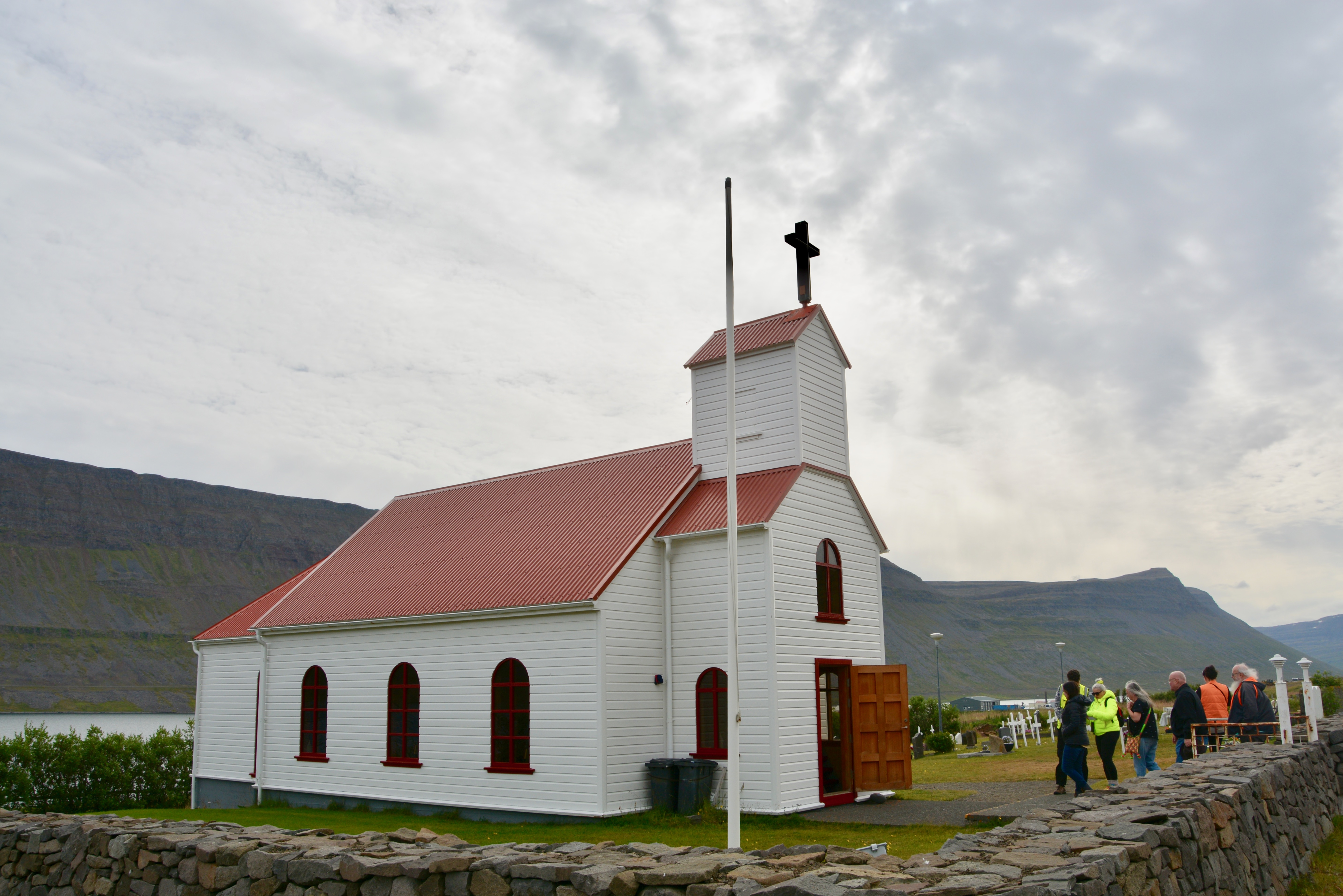
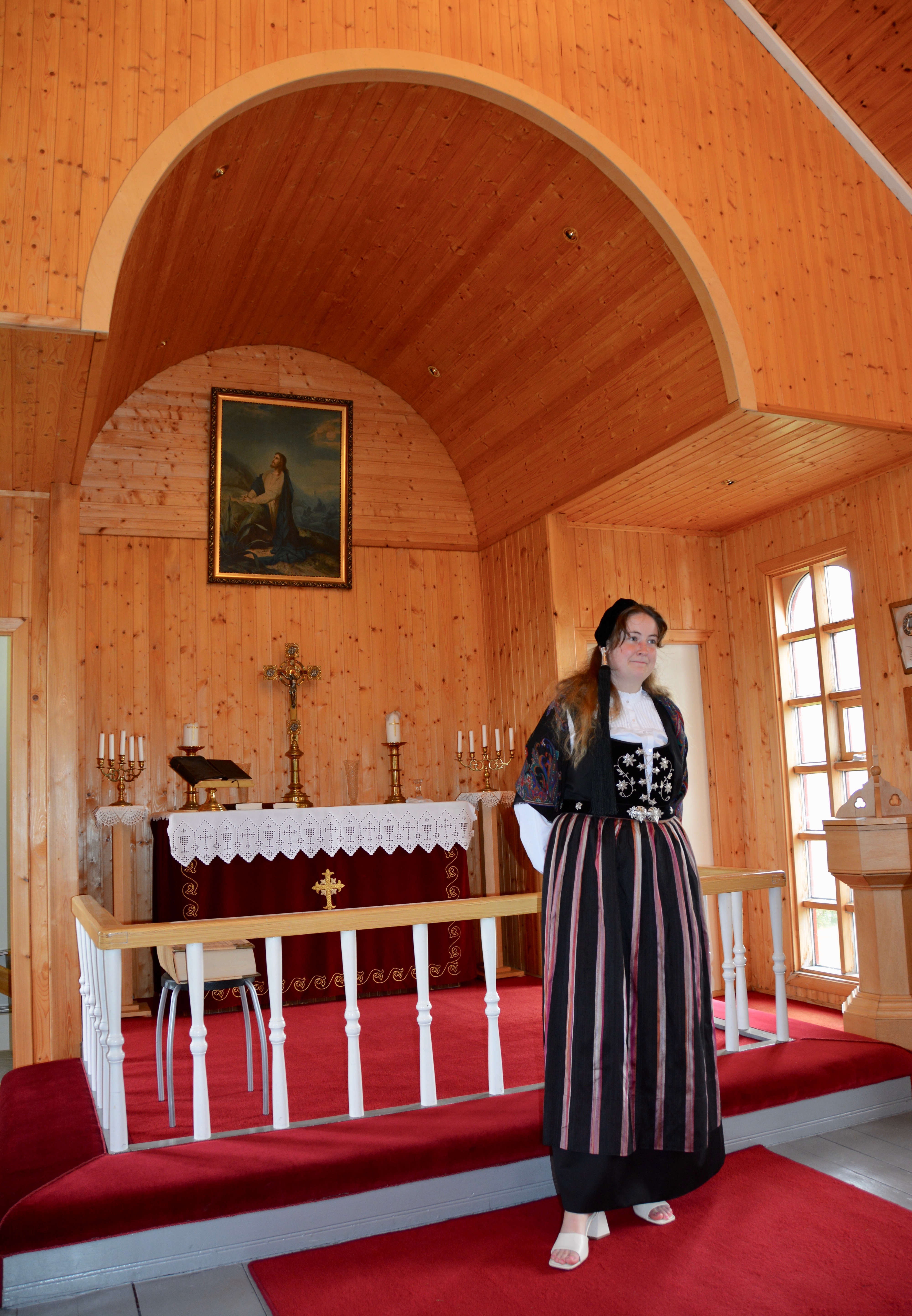
We also had the opportunity to visit the Stolen Church which is often locked to visitors. The “Súðavíkurkirkja church…was moved to Súðavík from Hesteyri in Hornstrandir. The church was originally built in 1899, a present from the Norwegian Brödrene Bull to the inhabitants of Hesteyri…When that area became deserted the church was moved across Djúpið to Súðavík and was consecrated here in 1963.” Regina Hronn for FunIceland.
The church was simple, but beautiful inside and featured the lovely wood imported from Norway. One of the local residents was inside in original costume. The beautiful silver filigree clasps were fashioned by her grandmother. She sang three of the most popular local songs in the native tongue. The singer had a lovely voice. She said that moving the church to Sudavik is still considered controversial. Locally, it is known as the stolen church.
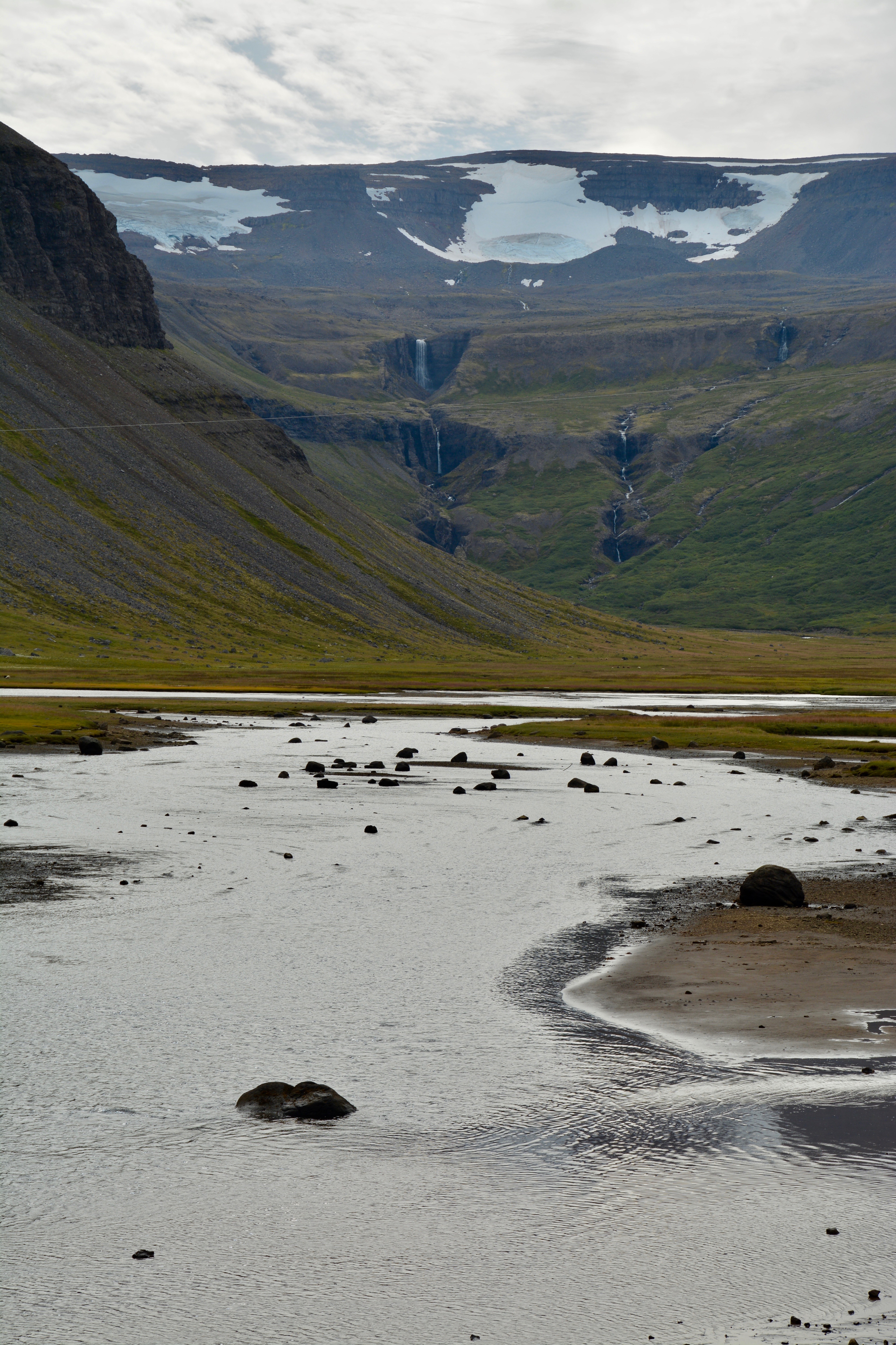
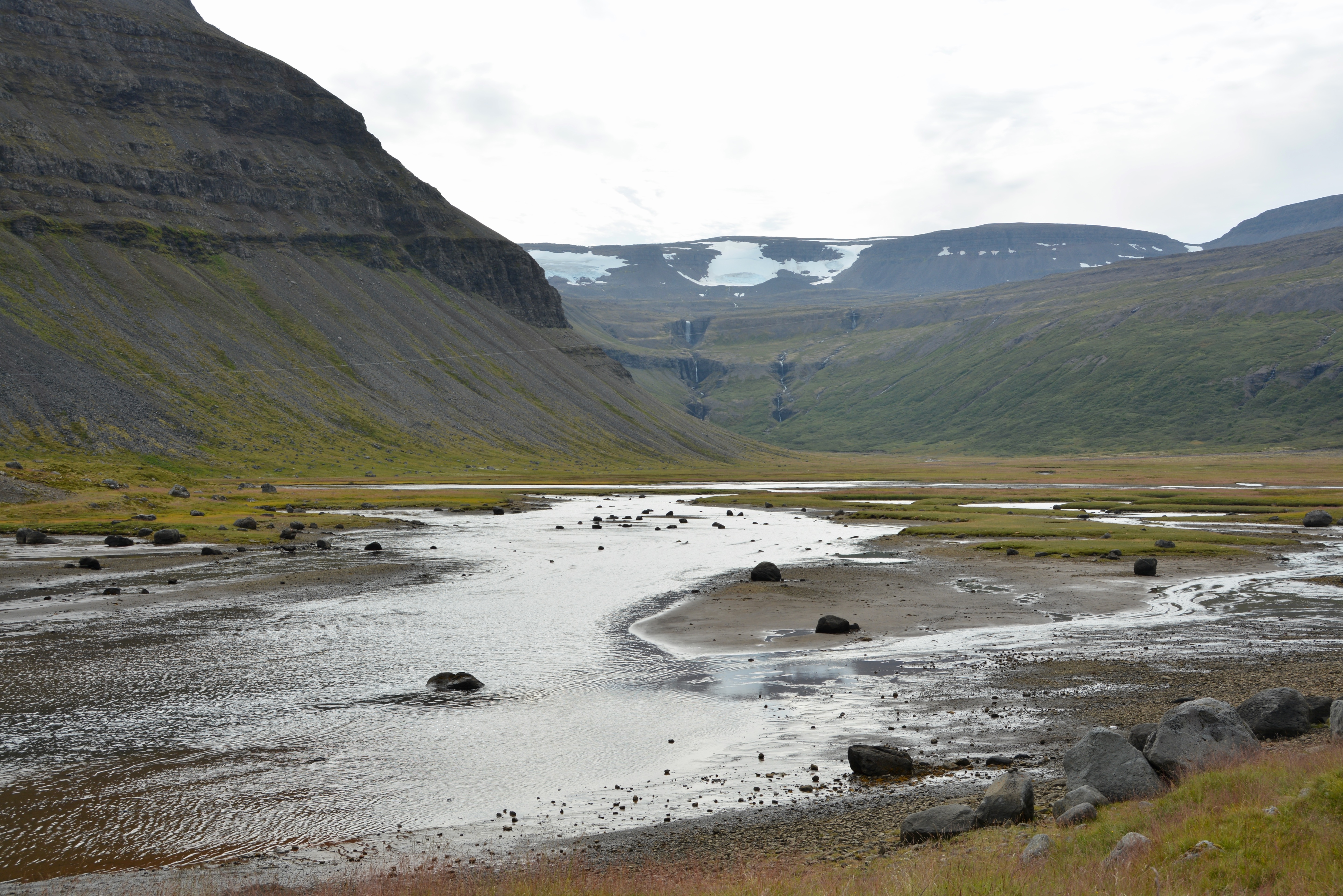
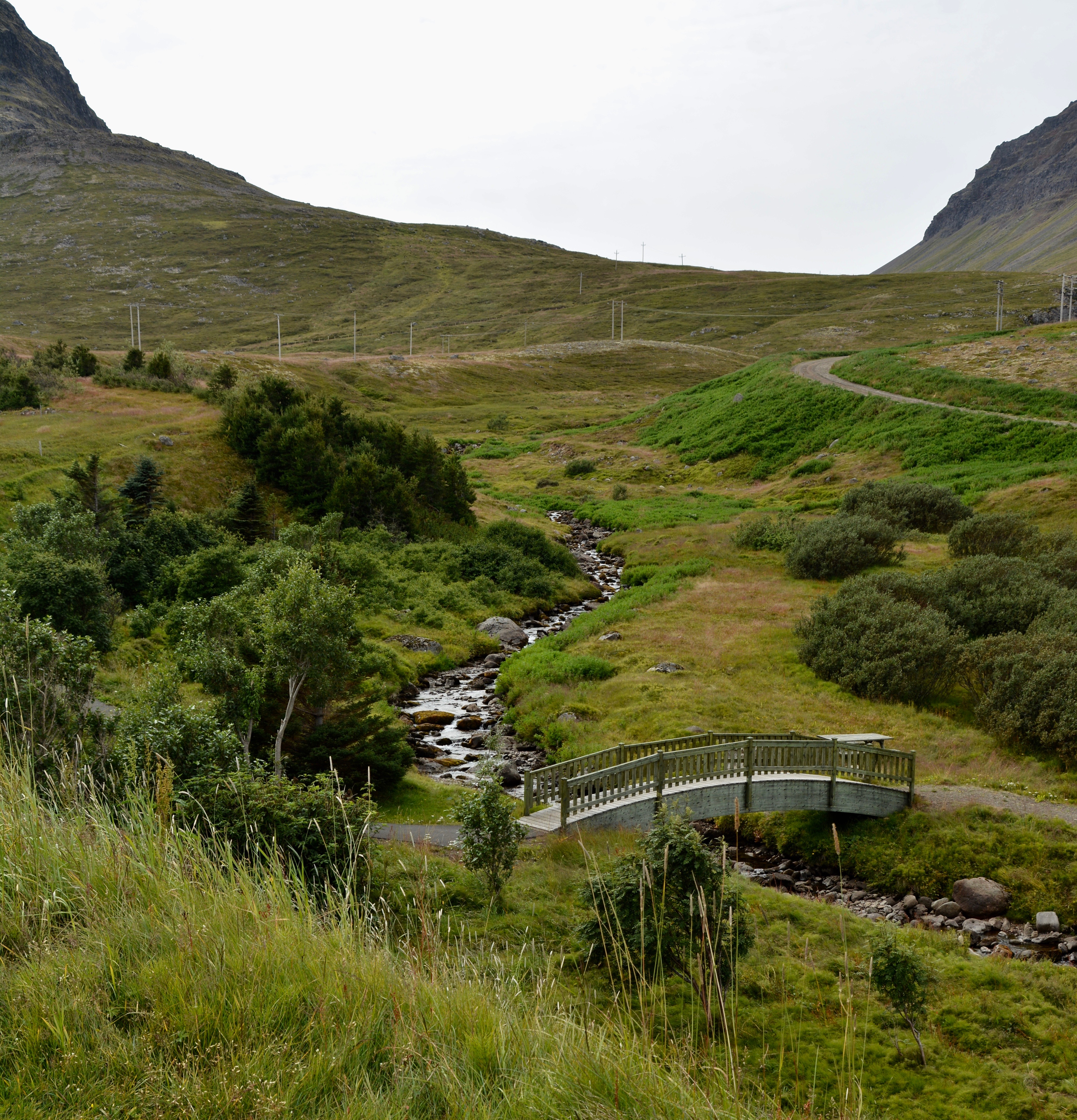
From the church we drove 9 km (5.6 miles) south to the end of the fjord to see the beautiful water flow to a trickle only to have the fjord fed again by the distant waterfall. It was a dramatic site with the high peak, the shallow water on the rock and the distant ice peak and waterfalls. In fact, from the viewing point near the carpark, you could see waterfalls in two directions.
Boris and Natasha at the gorge leading to the Valagil Waterfall just south of Sudavik, Iceland
From the parking lot you can take a 2 km (1 and quarter mile) hike in to the reach the Valagil Waterfall. Unfortunately, we didn’t have enough time at this stop to make the trek. From our vantage point we could look south and west and see waterfalls. To the north, the landscape was snow-capped jagged peaks. For something requiring more of a hike, the most dramatic waterfall in the Westfjords is the Dynjandi Waterfall, also known as Fjallfoss.
Leaving Valagil behind, we drove back to Sudavik to visit the Arctic Fox Centre. The facility features an indoor museum, gift shop, and a cafe with outdoor seating in good weather. It is a nonprofit research facility. The Centre is housed in a charming blue house that was built in the 1890s and sits in New Sudavik on what was formerly farm land. When we first arrived we enjoyed coffee, tea, and rhubarb cake on the outdoor patio. Afterwards we could tour the inside exhibits and visit the outdoor enclosure.
The Arctic Fox is the only territorial mammal native to Iceland. They are found across the country, often terrorizing the sheep population. For the most part they are frightened of humans. We saw two in the research center’s enclosure. One is two years old and the other less than a year old. The fur on the lighter colored fox will be white during the winter months when he has a ticker coat. The dark furred one will not be white and this variety of arctic fox is most often seen near the water.
There were not any blockbuster attractions in Sudavik or Isafjordur, Iceland but these charming fishing villages offer some unique delights and breathtaking scenery. I enjoyed the Westfjords of Iceland.
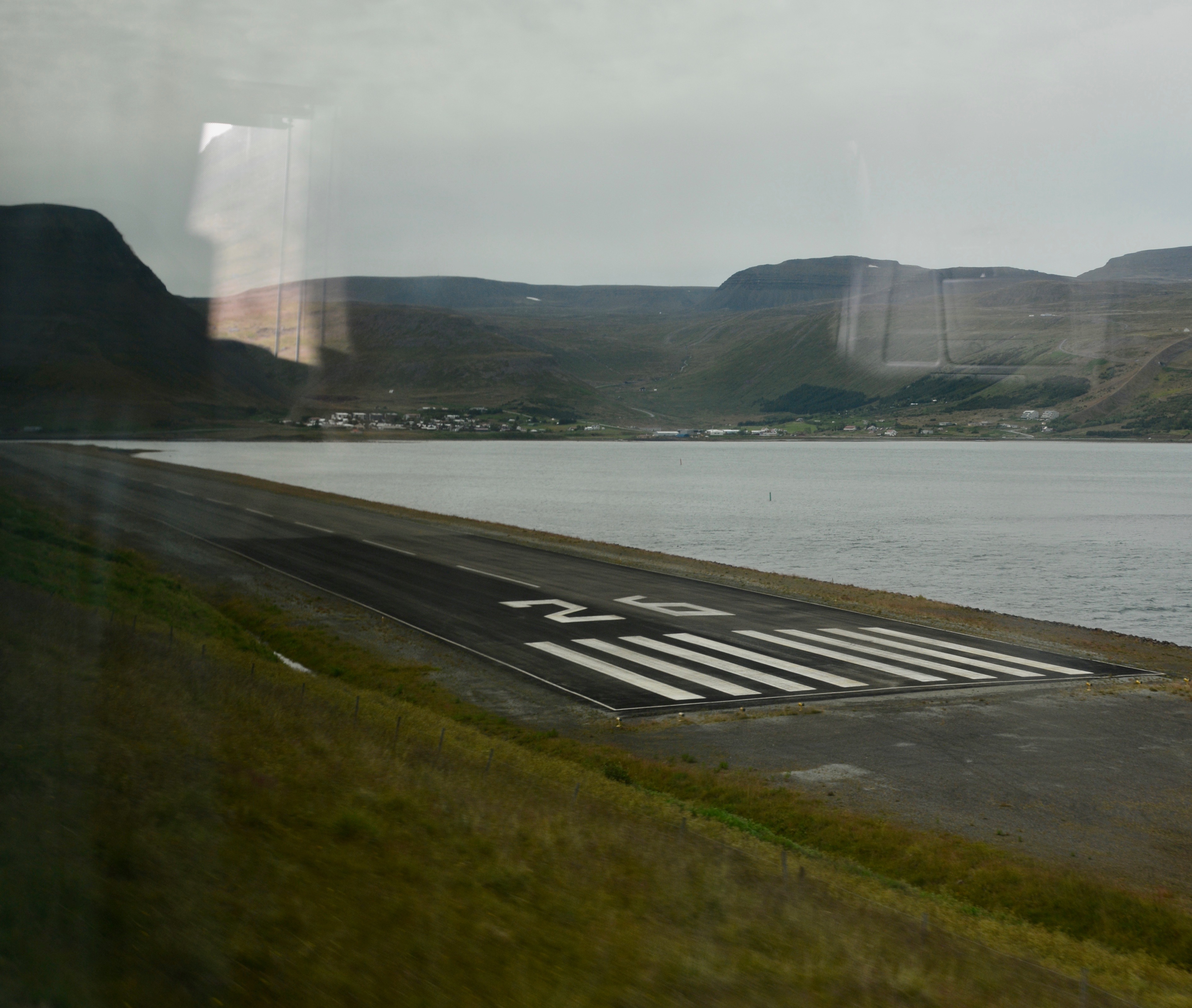
Returning back to the harbor at Isafjordur, from the bus window I got a picture of an airport runway that has to be one of the shortest I have ever seen. Our guide told us that about half the flights scheduled to land or take off here are cancelled due to high winds or other weather conditions. We also had a nice look at our ship at anchor with the birds in flight crossing the harbor.
Today we are visiting the Chacchoben Mayan Ruins accessable from the Costa Maya Cruise port. Boris likes to call this a “made up cruise port” set up as the water access point for cruise ships to reach several Mayan ruins sites in Mexico. I wrote more extensively about this port in a previous post a few months ago.
Once again, there are a lot of passengers headed out on excursions today. We are going to the Mayan ruins at Chacchoben. Not a mini van today, we are in a full-size bus. The ruins are just under an hour away from the cruise port.
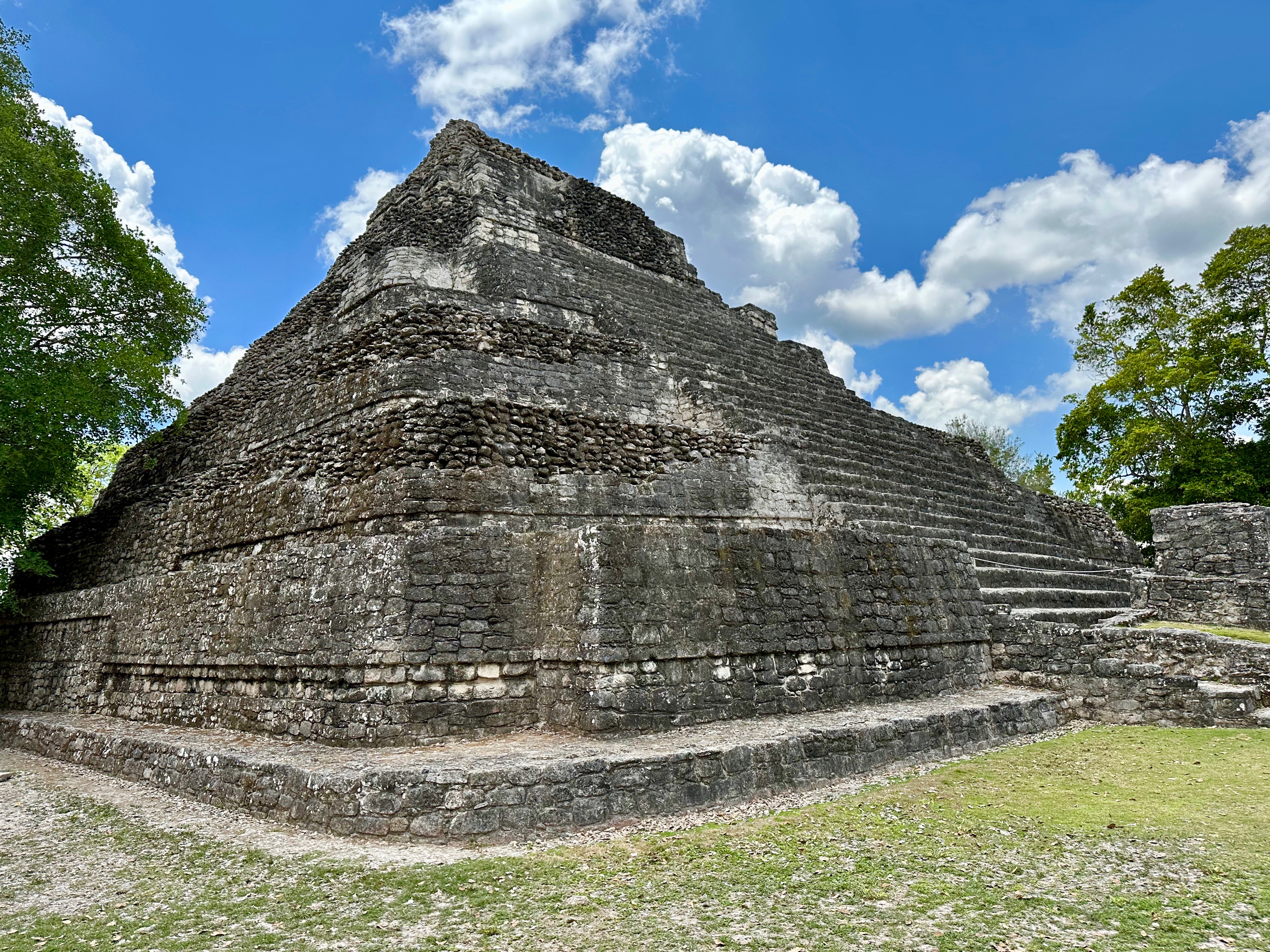
Locals still used the site in the 1960s when archeologists first visited the area. It was officially reported to the Mexican government in 1972. The ruins at Chacchoben were not opened to the public until 2002. Three pyramids and several site walls and steps have been uncovered and are open for visitors following a circular path. The number of uncovered ruins at this site was the biggest surprise for me. We first stopped at Plaza B and temple #24, what I had assumed would be the highlight of the tour, I wondered why we were there first and why a two-hour visit was needed. Leaving temple 24 behind, I realized there was so much more to see.
Chacchoben means place of the red corn in Yucatec Maya. There is a village of the same name nearby. When you enter the archeological site, there is a gift shop, restrooms, and a cafe. The tour groups leave from this location at staggered times. It was exceptionally hot. I recommend wearing cool, comfortable clothing; good walking shoes; a hat; and sunscreen during your visit. The accessisbility is good; there was only one stop where I found the climb a bit difficult. Most of the ruins are yet uncovered, but excavations continue in areas closed to the public.
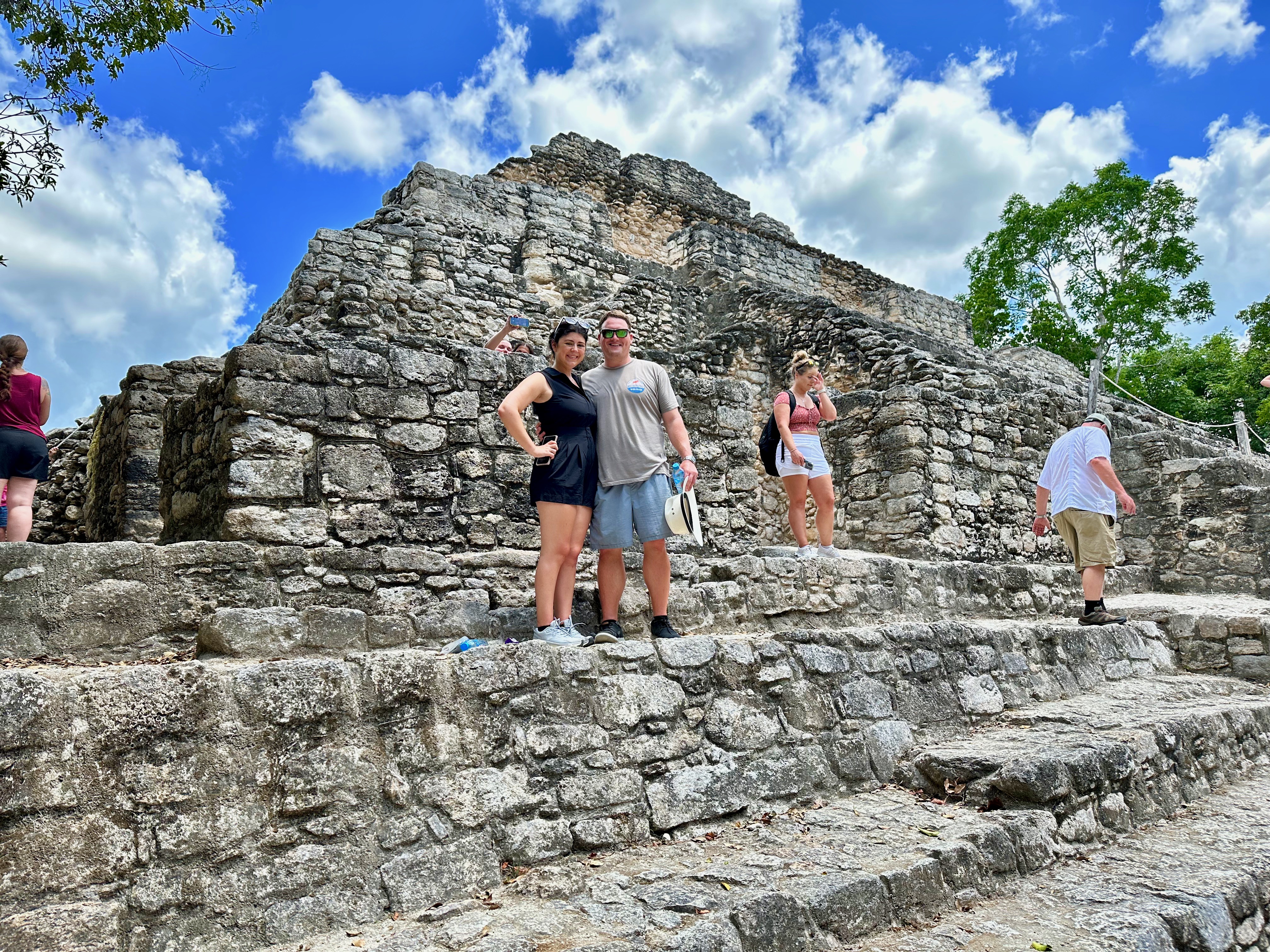
At the base of Temple 24 at the Chacchoben Mayan Archaeological Site, the Yucatan, Mexico
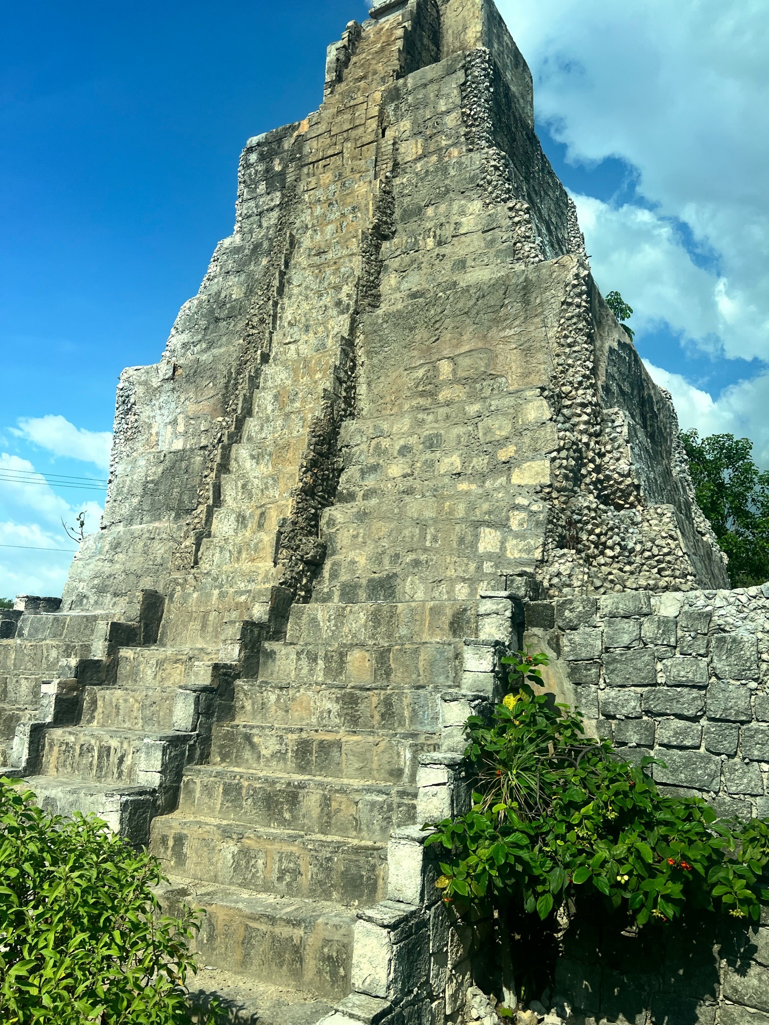
Our first stop was Plaza B and temple 24, a step pyramid with interior chambers closed to the public. You can only climb a few of the steps at the base of the pyramid, but there are staircases on all four sides. The area was flooded with tourists, but we waited our turn to capture photos on the steps with just the four of us. The pyramids were built with steps of stone and concrete made from limestone, clay, stones and water.
Following the circular path, our guide took us by other ruins that you could climb on and see where the inner rooms would have been. We came next to the Grand Plaza and the area where dwellings and palace would originally been located. I hope someday they have a model that shows what the area would have looked like at the civilization’s peak.
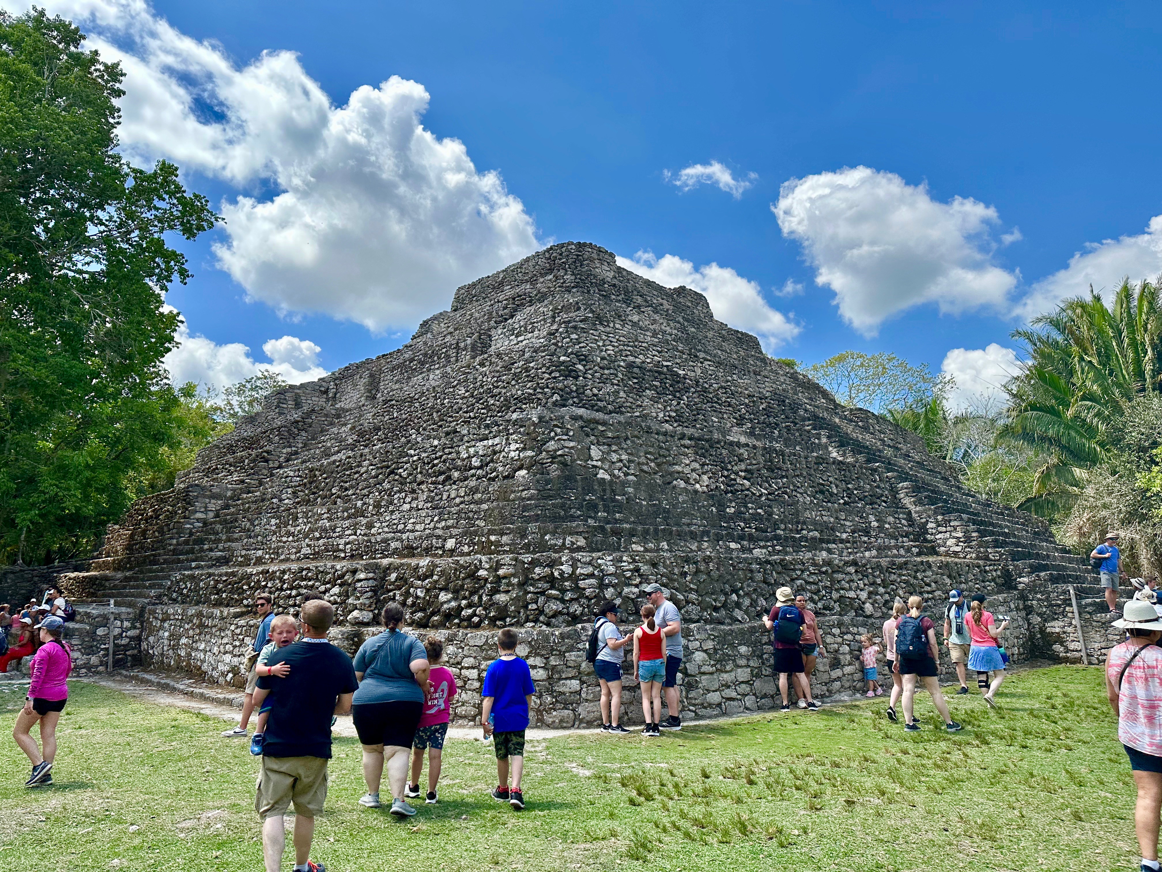
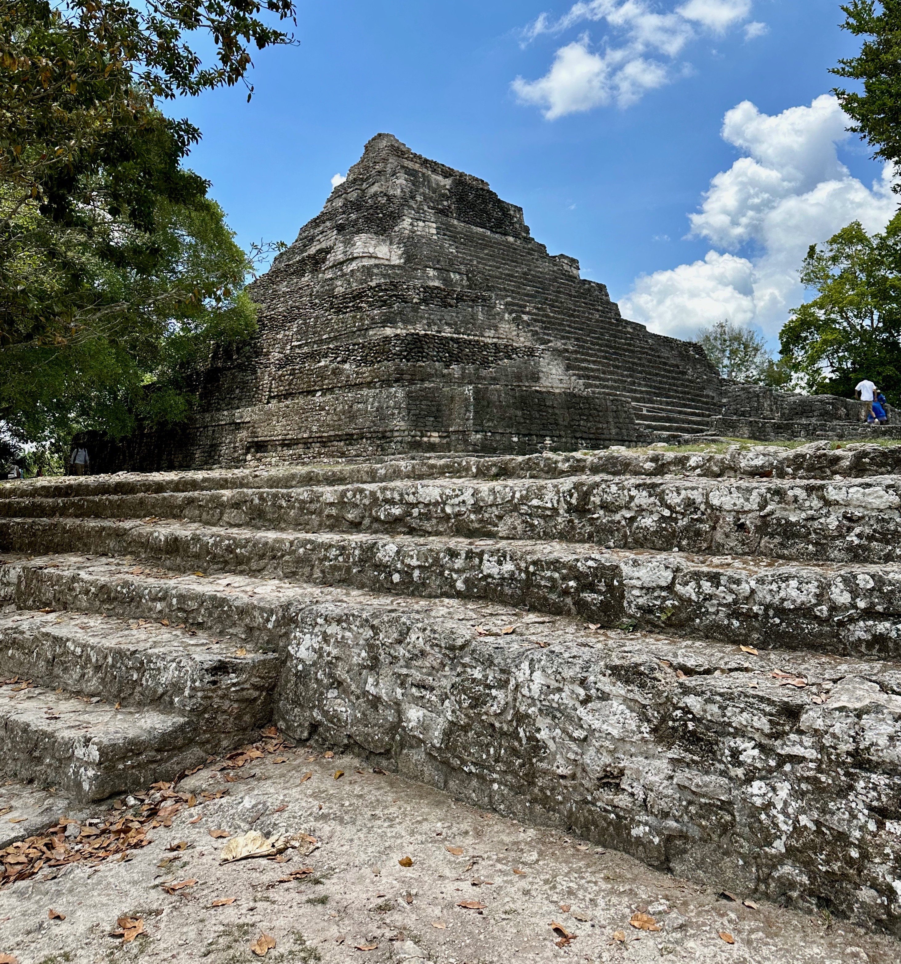
Continuing our journey, we came to the grand staircase, the primary way up to the grande dame of the archeological site, the Gran Basamento plaza and Temple 1. This primary temple is 42 feet tall. The grand staircase is the best way to get the knockout view when the temple comes into focus and rises (as one blogger put it) “high over the jungle canopy.” Justin + Lauren Adventure & Kind Travel. Most of the participants went this way; a few of us choose the alternative pathway with fewer steps with a side wall to hold on to. Given the heat, my two foot surgeries, and a fall down the stairs in the not so distance past, I chose option two. It was still a little difficult and there was not really much to hold on to, but the climb was worth it. The site is spectacular.
Following my route, the first thing that comes into view is the Temple of the Vessels, just to the side of the Gran Basamento and Temple One. While the smallest of the three temples at the archeological site, for some reason I found it the most attractive. Maybe because it felt more approachable. The items used in the ceremonies held on the Gran Basamento would have been stored here. The thatched roof in the back is not original. It was added to preserve some surviving painting.
There were so many people there the day of our visit that it was impossible to get a clear picture of the Gran Basamento and Temple 1. However, the people served to show the grand scale of the pyramid and how visitors can actually experience the Gran Basamento. We were given free time in the area and some people used it to photograph the monkeys that live near the pyramid.
Retuning to the ship, we did a little shopping at the mall at the port and then got back on board. Once again rather than eat in the heat and with the crowds in port, we tried one of the onboard speciality restaurants at a time when they were not crowded. Today we went to Johnny Rockets. It looks like they moved it to the opposite side of the Boardwalk (although I could be wrong about this) and I did notice the Build-a-Bear is no longer there. I went to Johnny Rockets on our last time on the Allure and as before, the food and shakes were good. We may have gone a bit overboard with the ordering, but it was all included in the specialty restaurant fee. The shakes are extra, but are discounted for us as Diamond members.
Our last port of call is a longtime favorite of mine, Cozumel, Mexico. However I like Cozumel as a dive location which is how it first got discovered by frequent travelers. We didn’t do an excursion. Besides the fabulous drift diving, there aren’t a lot of unique excursion opportunities. Cozumel is an island so options are limited. It is a short 45-minute ferry ride from Cancun. I have written about Cozumel many times, including just two months ago.
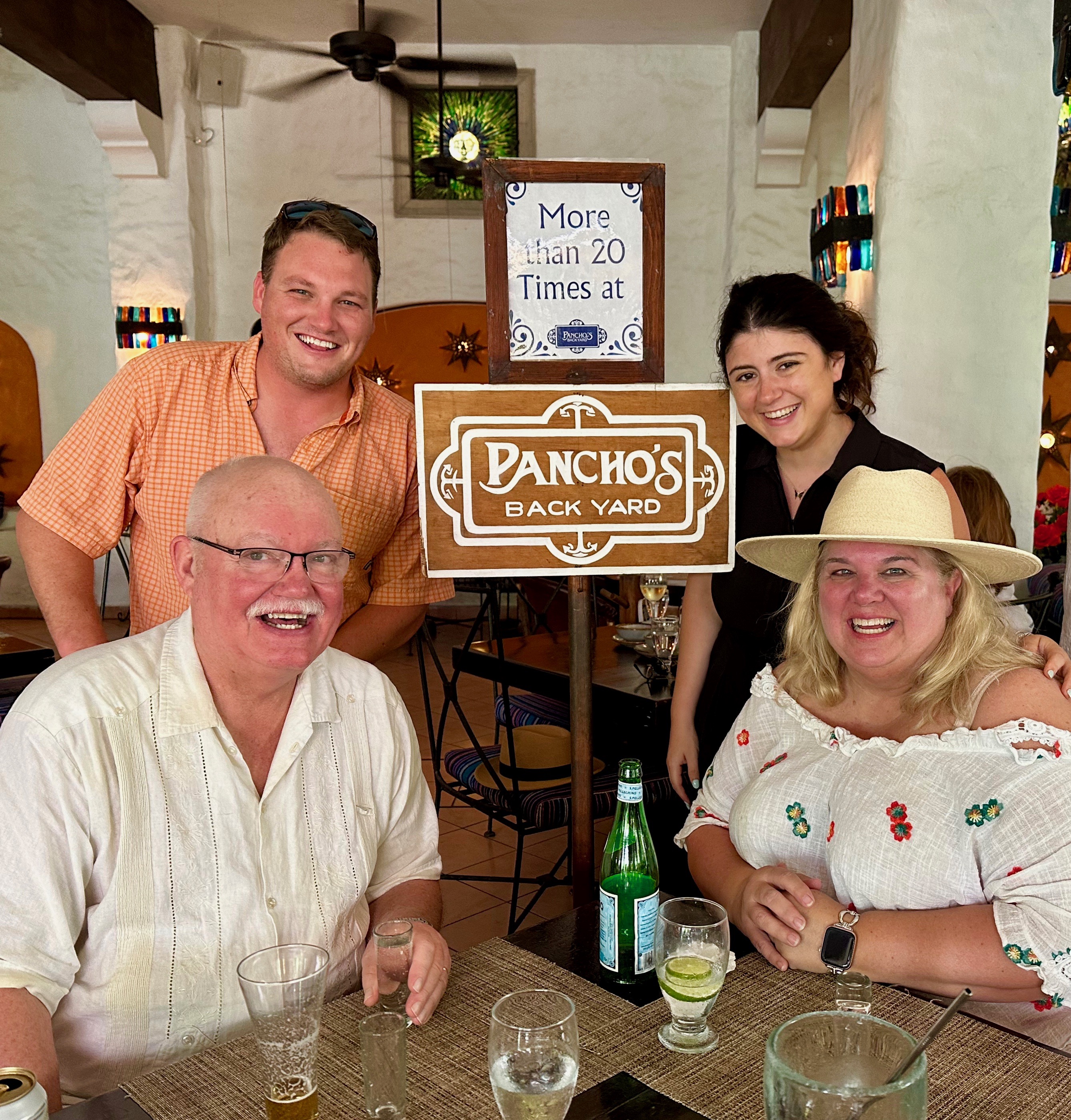
We walked around and did some shopping. We returned again to Pancho’s Backyard and this time they asked how often I have been there. (It is probably at least 30 times). They brought out the frequent visitor sign-which I hadn’t see before-so I could grab a photo with my people. We had excellent food (order the superb guacamole), drinks (a fishbowl margarita), and xylophone music in a covered outdoor setting that stays relatively cool even at the height of summer.
We were docked at the far cruise terminal so we taxied to the other far end of town to begin our day. Our plan was to walk all the way back, but we only got about half way when the heat got to me. I was ready for the air conditioning on board the ship. Clyde and Bonnie stayed out to do a little more shopping and got a few things.
We got lucky and were able to get seats in the Comedy Show this evening, but it came at the price of a long wait in the standby line and missing our other production show. We later learned the production show got cancelled due to technical problems. It was also canceled the next night so we never saw it. We enjoyed the comedy show, although one of the two comics was very sexist.
The last full day of the cruise was a sea day which meant I was out at the pool early and eventually everyone joined me. Boris wanted Clyde to help model Mexican wrestler masks at the pool; Clyde wisely declined. It was hot in the afternoon, so we opted to go inside to pack, nap, see a parade, and make one more stop at the Diamond Club. In the evening we tried out our last specialty restaurant, Giovanni’s Table. It was just ok and we would have been just as happy in the dining room which is included.
Overall we had a great time and loved traveling with Bonnie and Clyde. We hope they will be up for a repeat adventure with Boris and Natasha. Until then….