
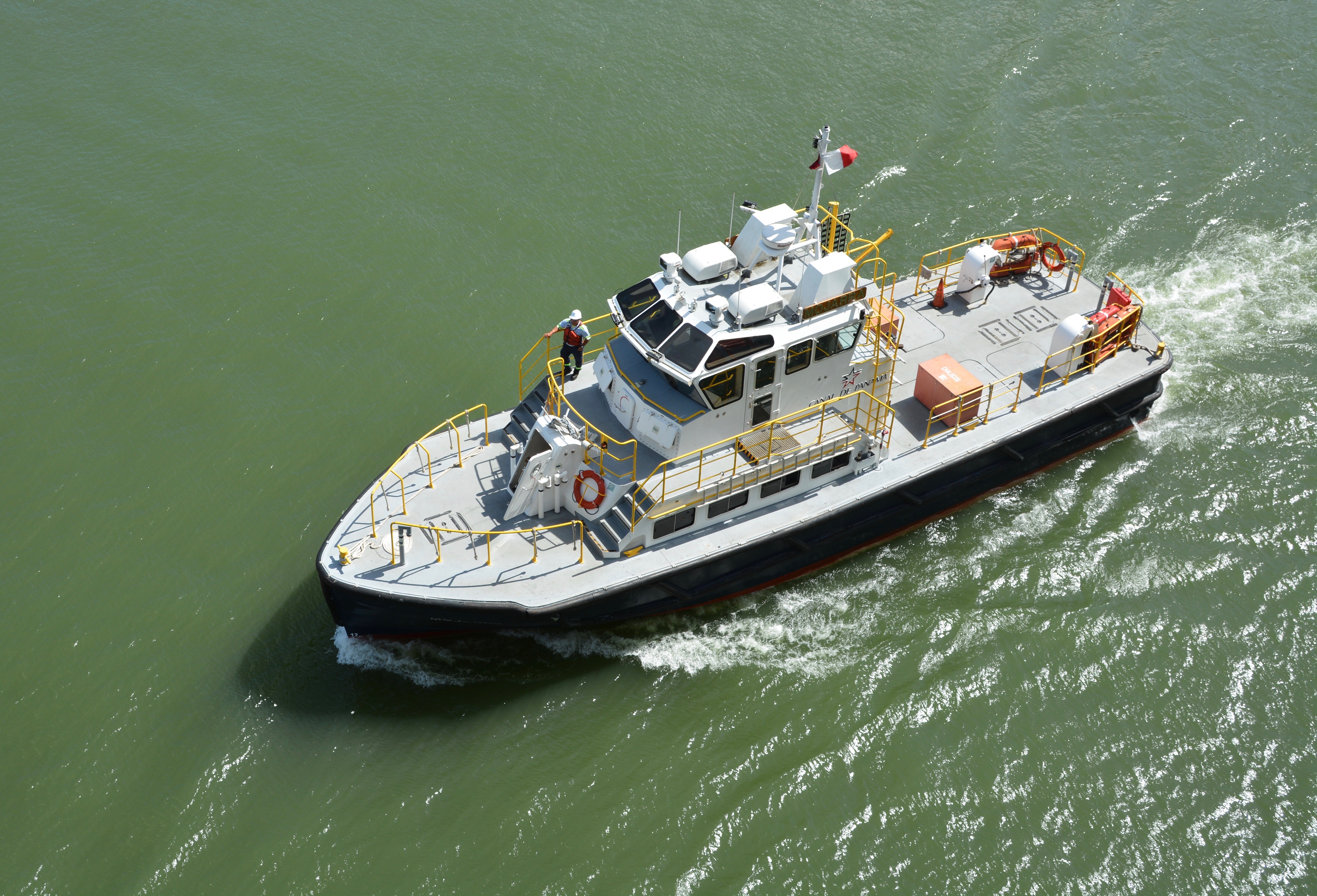
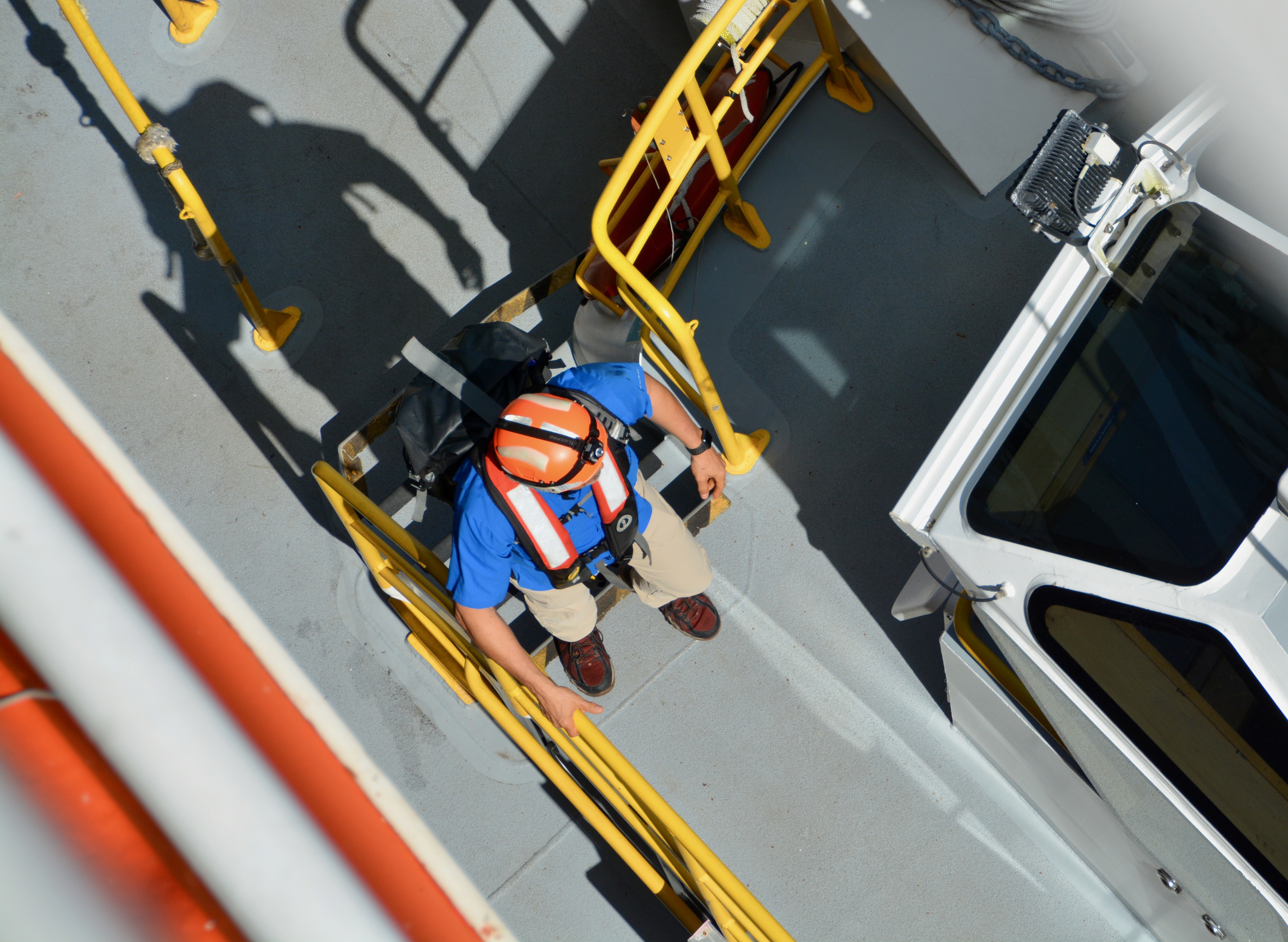
Today is the big day. Natasha is making a full transit through the Panama Canal going from the Pacific Ocean to the Caribbean Sea in the Atlantic Ocean. I was so excited this morning, that I woke up when the engines on our ship started. I even caught a picture of the pilot boarding our ship before first light. The pilot and the line handers are all Panamanian and you are required to allow them entry to go through the Panama Canal. The Panamanian line handers will board our ship and pass our crew the lines to secure the ship.

Our destination lecturer will be offering commentary throughout our passage from the Bridge starting about 9 am. It will be broadcast through the public areas of the ship or you can tune in from your stateroom TV. At 7 am, he began offering the “play by play” from the ship’s Living Room. There are floor to ceiling glass windows on three sides of this space and you can look out the front or each side of the ship from this high perch. I didn’t want to miss a thing. We got to the Living Room about 7:20 am and got seats in roughly the third row. The people who wanted to be right by the window got there before 6 am. The couple in the cabin next to ours set an alarm for 5:30 am to get these premium seats; I told “The Professor”-as Boris likes to refer to him-that he should have just knocked on the wall and I would have joined him.

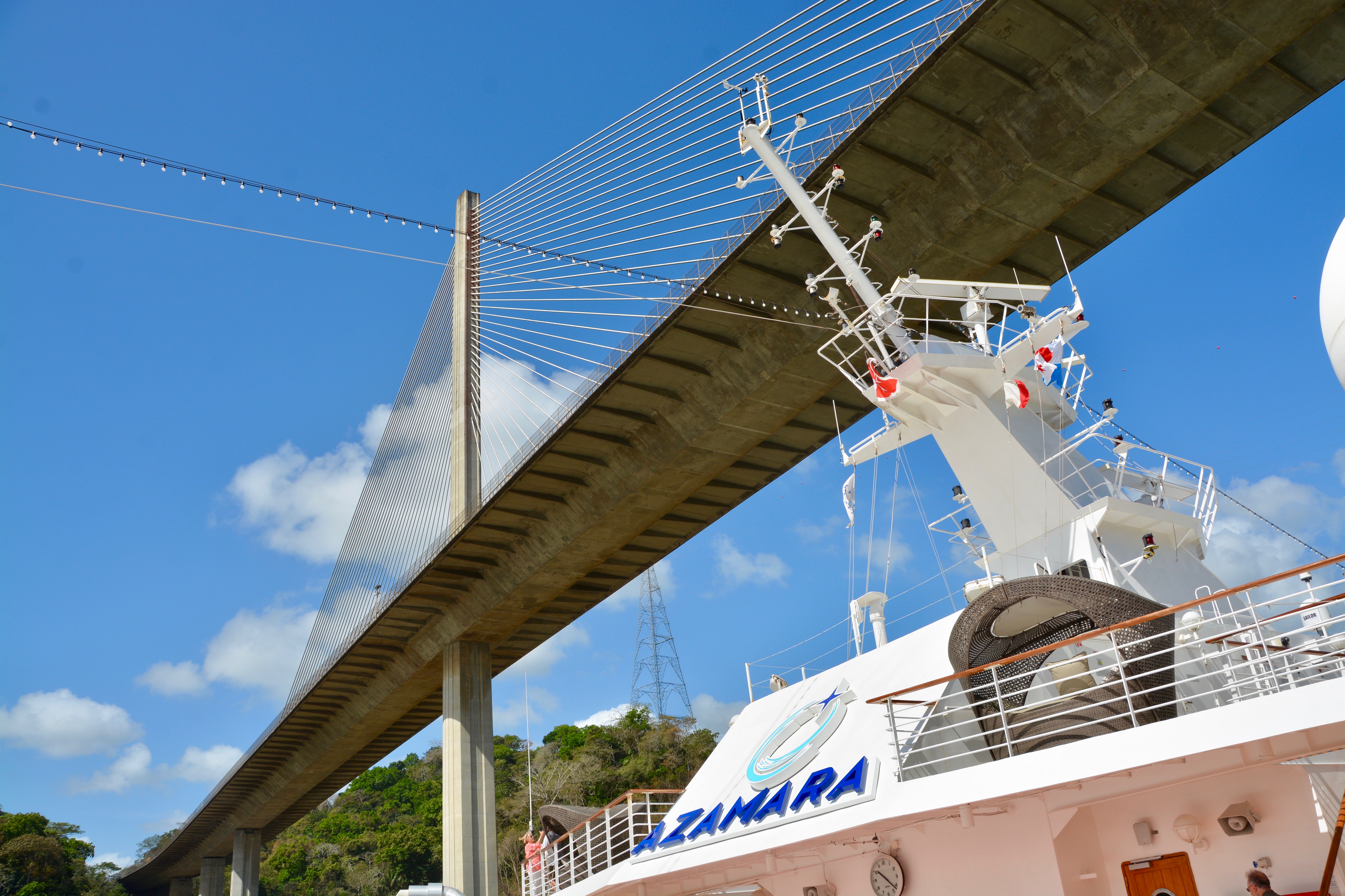
Of course, you could walk up between the chairs and take pictures. Boris set his sights on moving closer to the front windows as seats became available. Our first point of passage was under the Bridge of the Americans. For many ships, their height keeps them from being able to pass under this bridge. It is a problem for many of the larger cruise ships. Just FYI, this post is about our passage through the canal. For more on the background for a canal being built in Panama, check out yesterday’s post on Panama City including limited history on the canal.

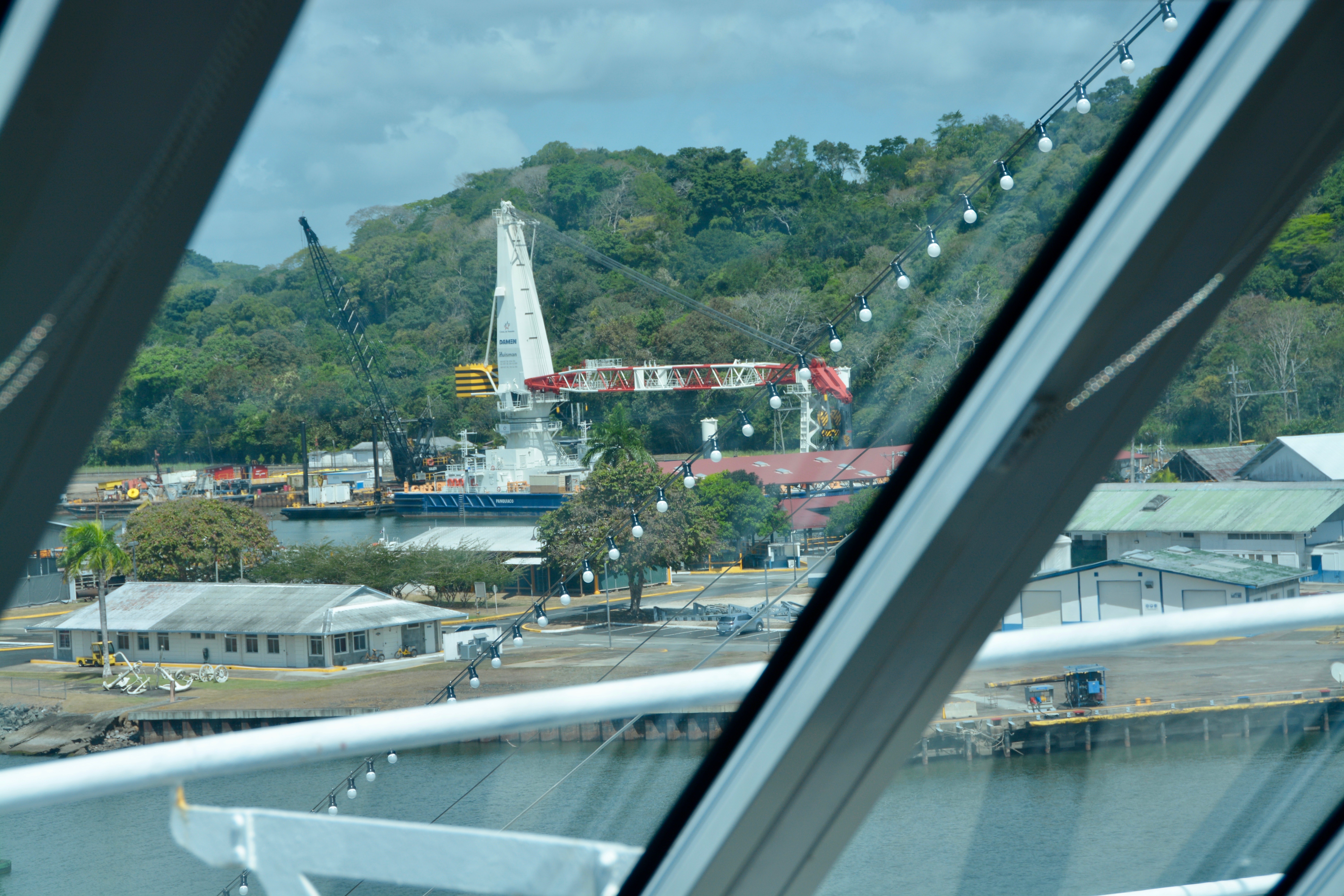
To our left we could see the large green cranes that were purchased with the investment from the Chinese. Each cost between 25 and 45 million dollars. Any ship passing through the canal must be under the weight limit. If you are overdraft, these cranes will lift and remove the excess. The containers are then moved to the other end of the canal via a rail line and the containers will be there when you arrive. If you can’t afford or don’t need the rail transit, the black cranes on the right side unload excess cargo into trucks that will meet at the other end. Those cranes cost about $2 million each.

We could see the entrance and tower for the third lane. This newest lane is for the megaships and was completed at a cost of $6.2 billion. Construction was two years behind schedule, but the lane finally opened in 2016 under Panamanian control. As I discussed in yesterday’s post, the Panamanians took over the canal in 2000. Under the original agreement, the Americans had the right to control the canal in perpetuity. The new lane features multinational products (i.e., Chinese cranes, Italian gates, etc.). In our destination speaker’s opinion, the new lane is very efficient but boring to go through. It features a single lane with three chambers. The megaships that pass through the third lane by-pass the Miraflores Lake we will be going through.
There is an easy way to tell the difference between the American construction of the original lanes and the Panamanian construction of the third lane. The roofs of the structures that make up the Panamanian construction are in blue tiles; the American construction used red tile roofs. The Panamanians wanted to distinguish their construction.


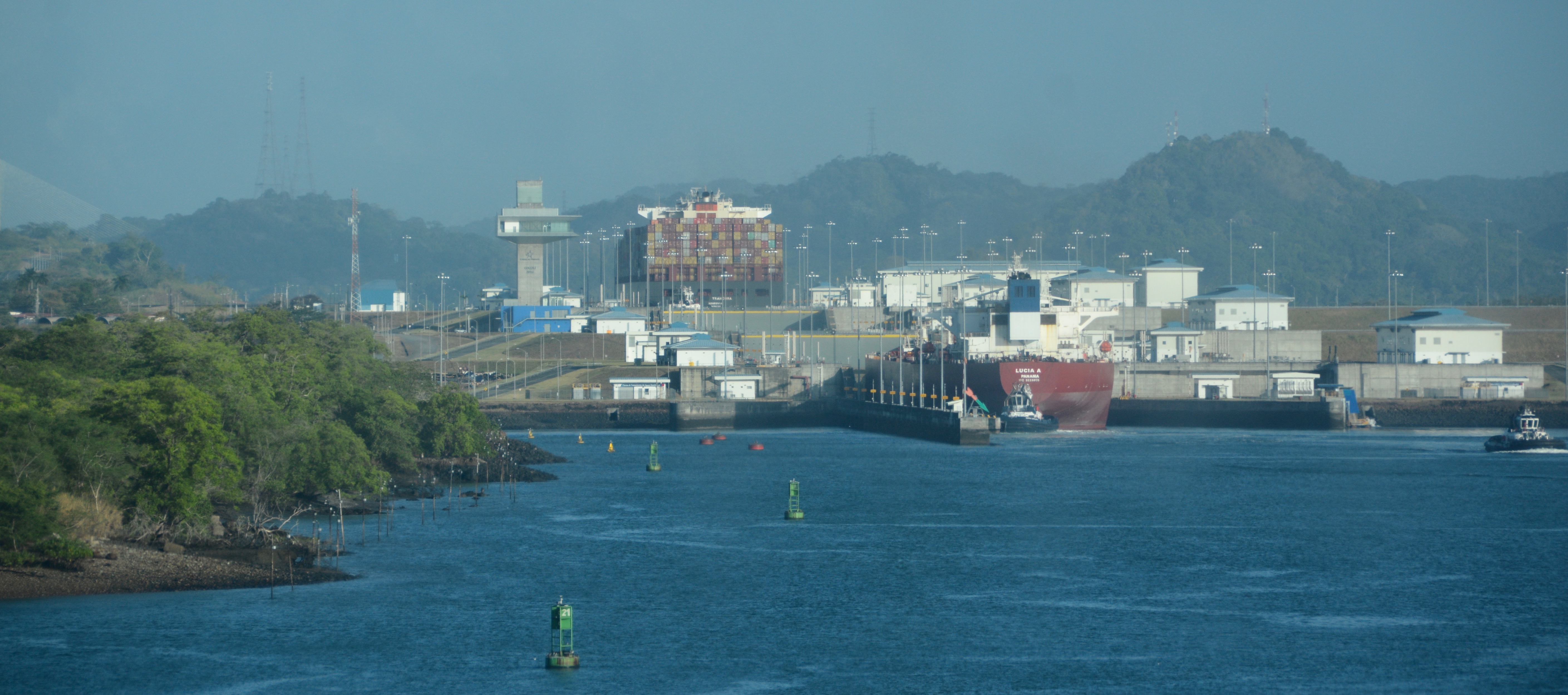
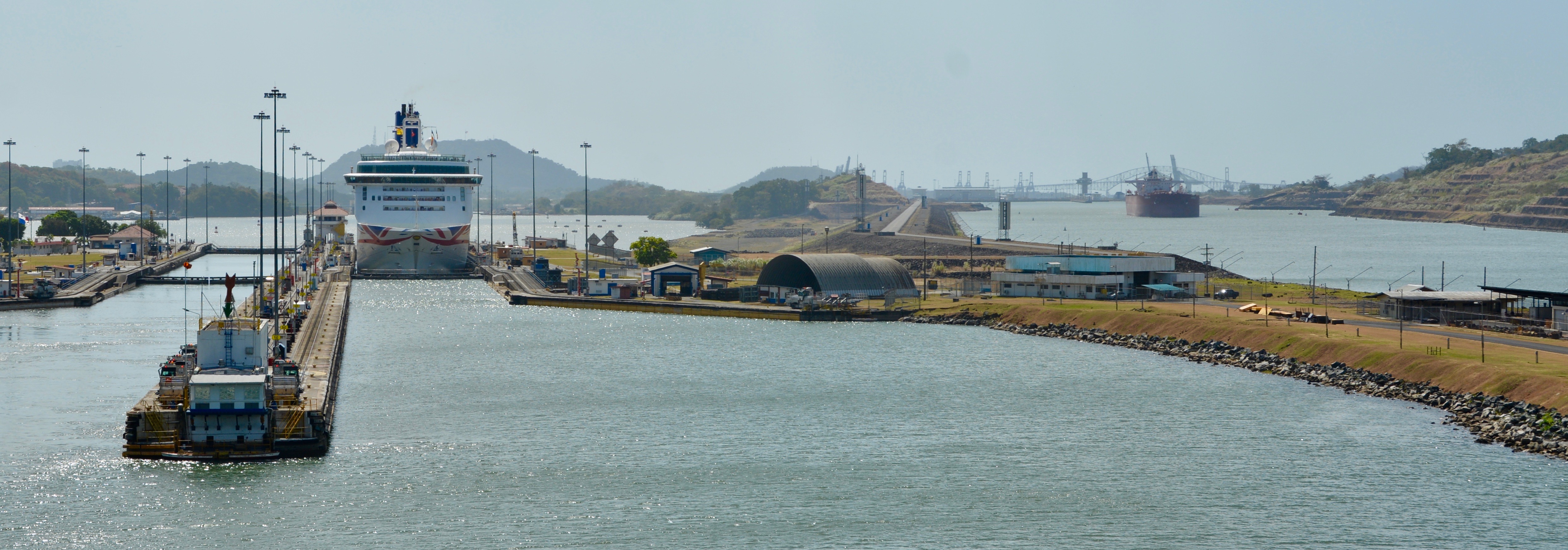
According to our speaker, “we are a big deal going through”. Cruise ships going through the canal draw lots of locals. The schedule is published in the paper and people come out for the cruise ships. There is a visitors’ center, viewing platform, museum, and an excellent IMAX theater. Several people from the ship went on an excursion there yesterday and really enjoyed the experience. They were particularly impressed with the IMAX. We are going through today with another cruise ship. About 44 ships a day go through, usually in convoys of 4. They mix the big ships with the smaller ships. The cruise ship in front of us has two tugs on the lead sides. Their appointment was one hour before ours. We will not be using tugs. If you don’t have a reservation, you may have to wait and go through with a night convoy.

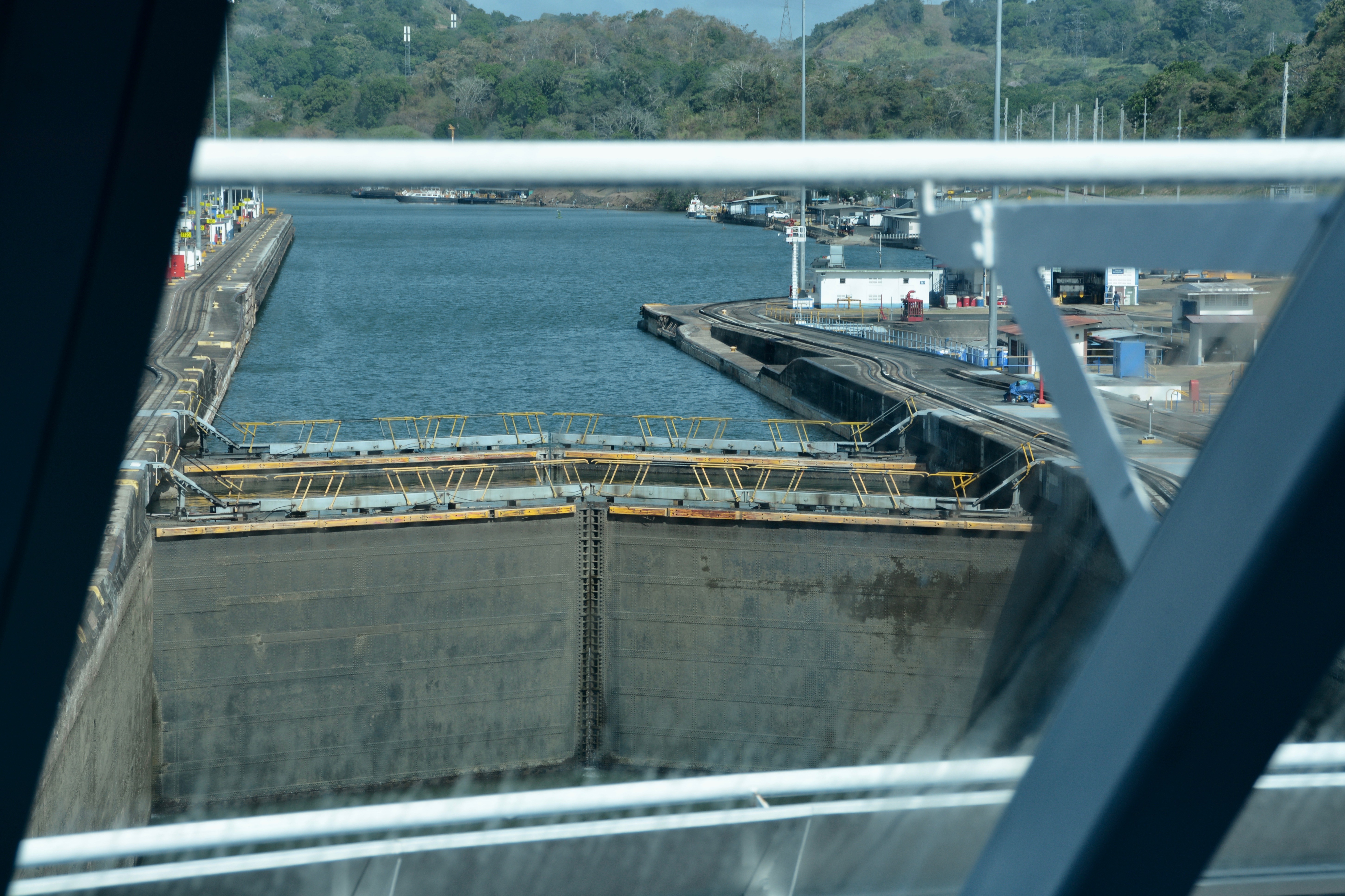
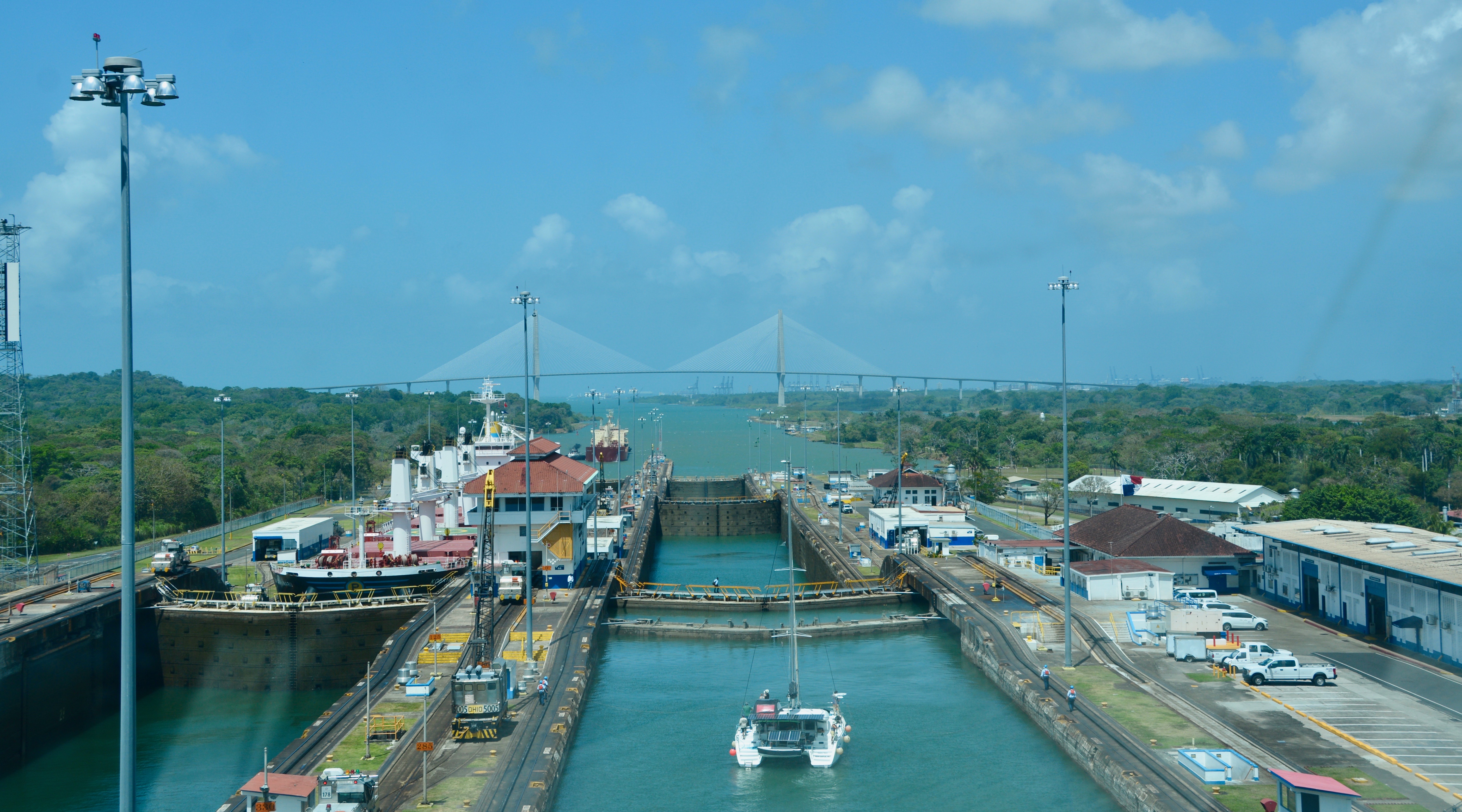
What I really hadn’t realized before preparing for this trip is that passage through the Panama Canal, at least passage through the original lanes, is actually transit through a series of locks and two lakes. Our passage from the Pacific begins at Miraflores where there are two lanes and a two-lock passage. The oceans are at different levels, but the lakes are actually the high-water point of the transit. The major flaw in the French attempt to put a canal in Panama was assuming they could do it at sea level as opposed to using the lock system.

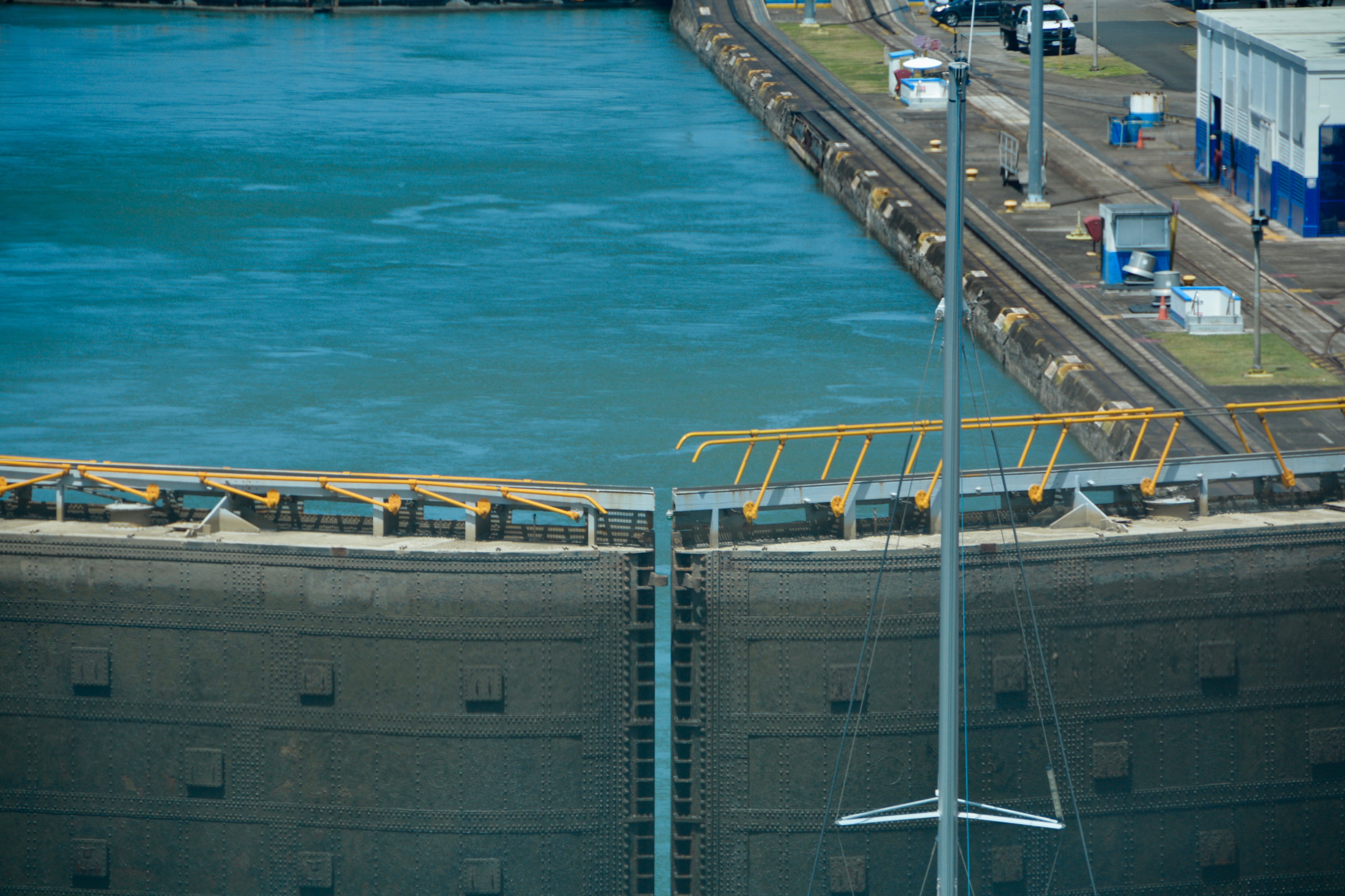
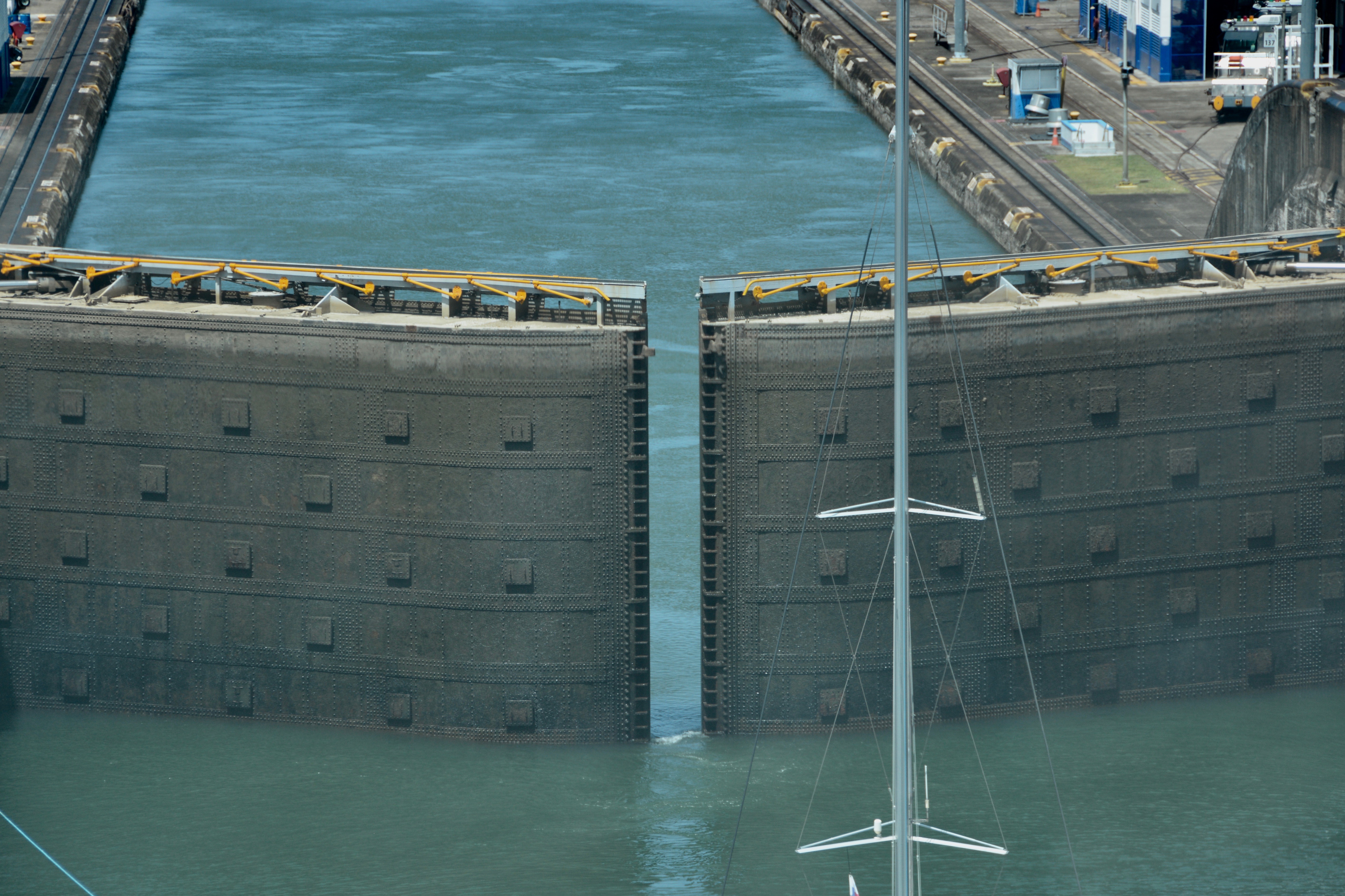
Our passage from the Pacific Ocean begins at Miraflores where there are two lanes and a two-lock passage. The Panamanian line handlers tied us on as we approached the lock. They practice using the “monkey fist”; their throwing is very accurate.

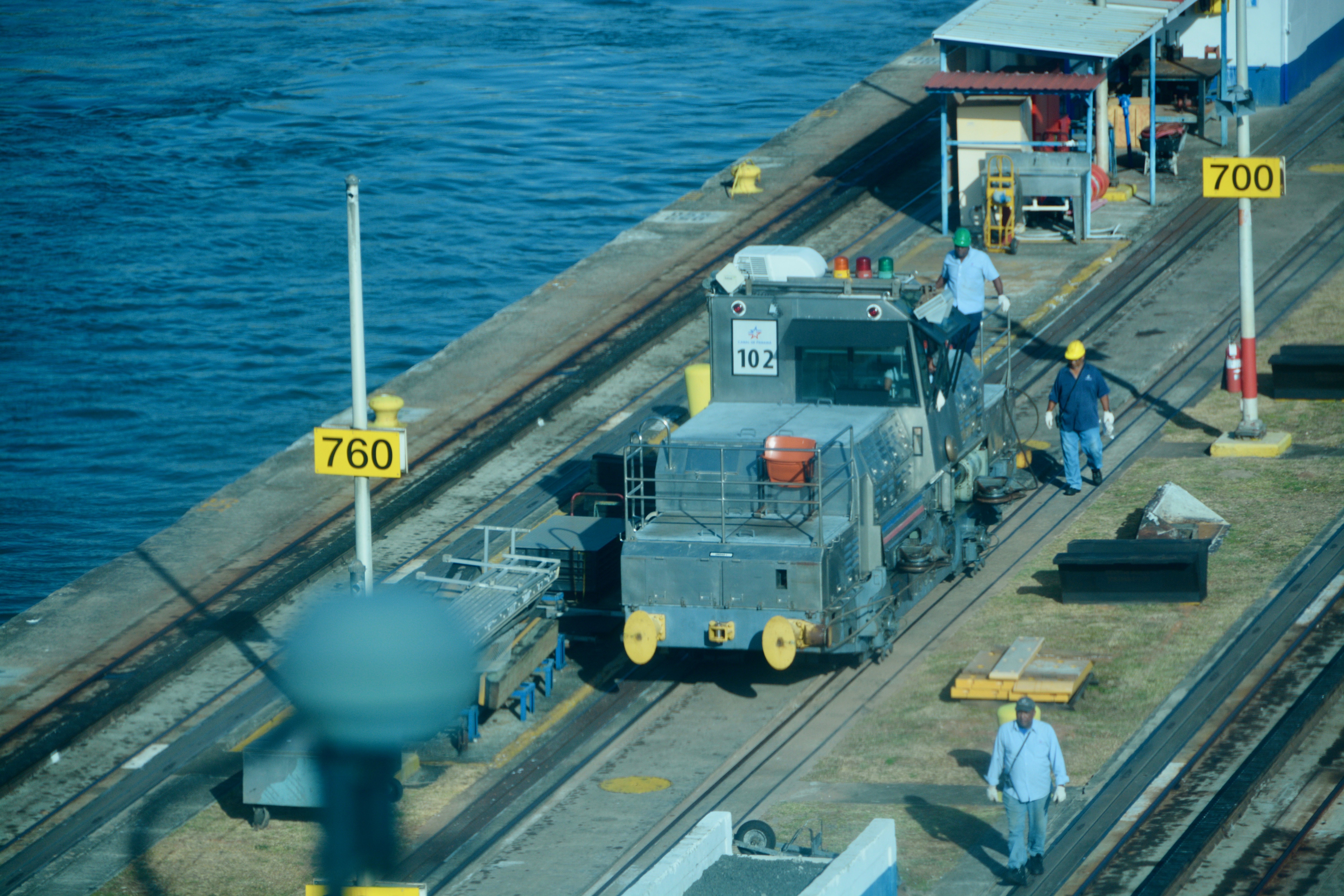
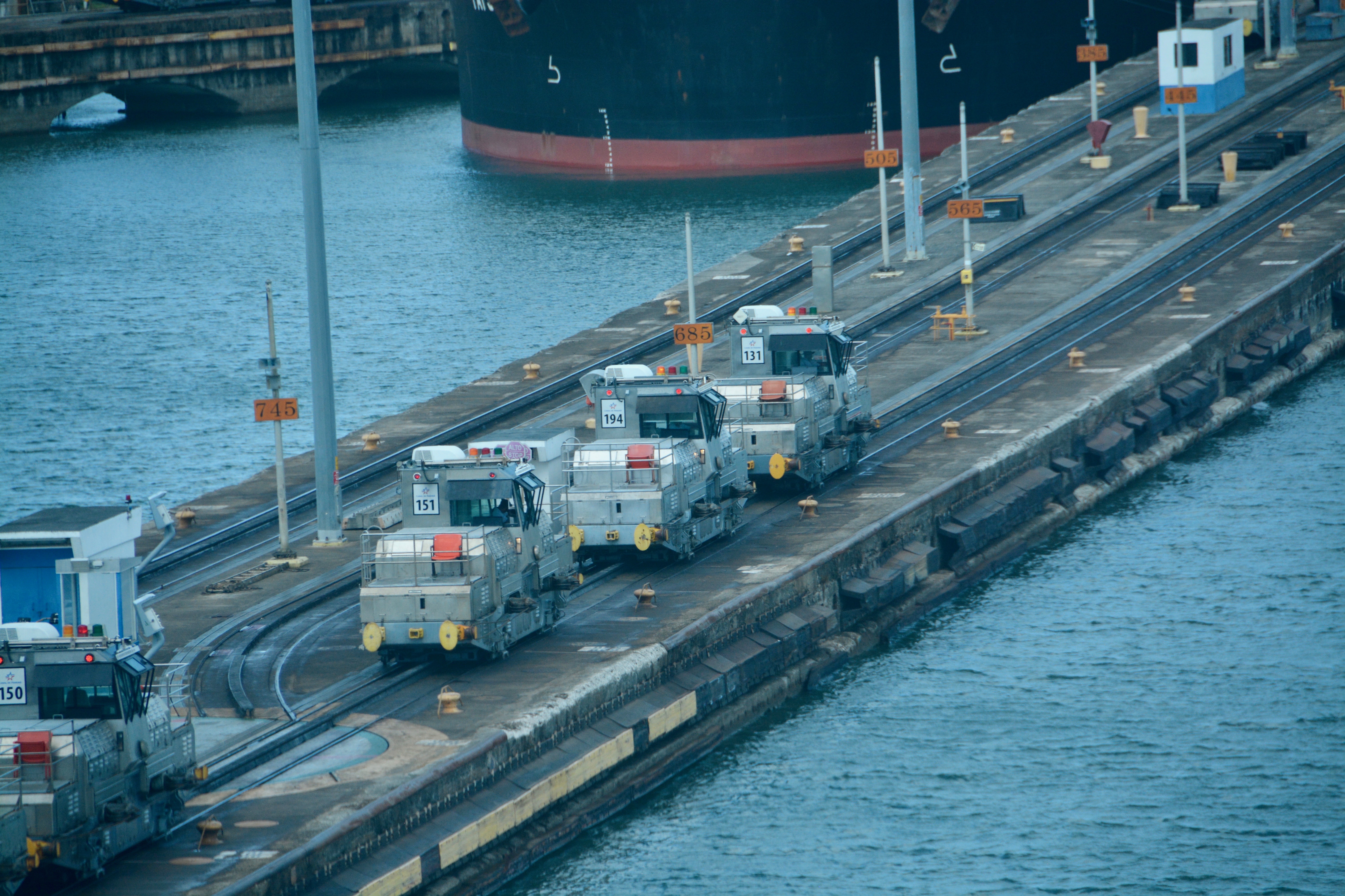
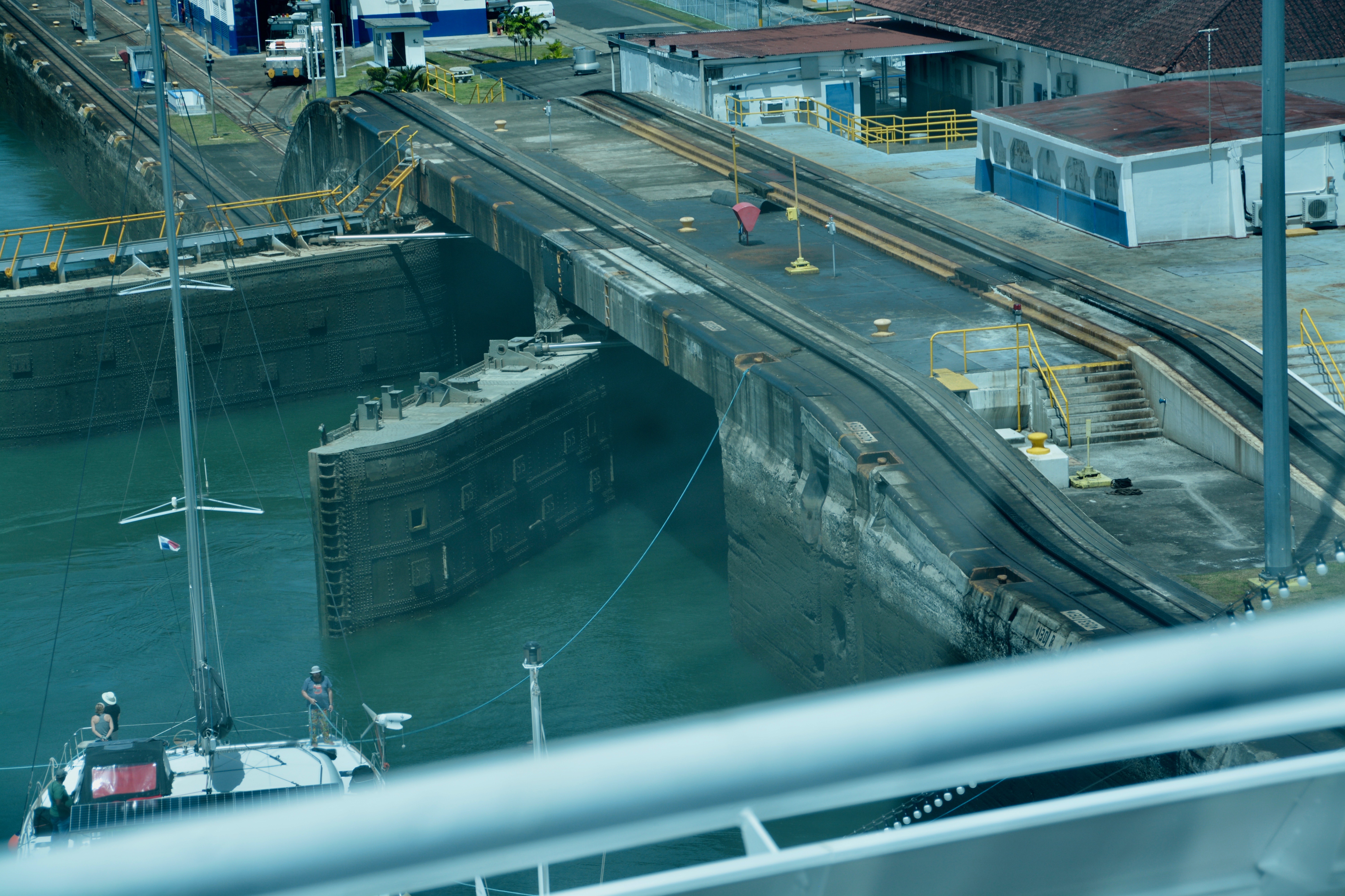
We are attached to “a mule” on each side, although we reached the inner (left in our case) mule sooner because the wall between the two locks jets out farther than the outer wall. Americans call the machinery mules, a reference to the animals that pulled boats through the Erie Canal. The Panamanians call the mules electric locomotives, a more accurate term. The Mules just help with alignment and hopefully keep you from hitting the front wall/gates. The ship is really doing the work, supplying 99% of the power to move forward.

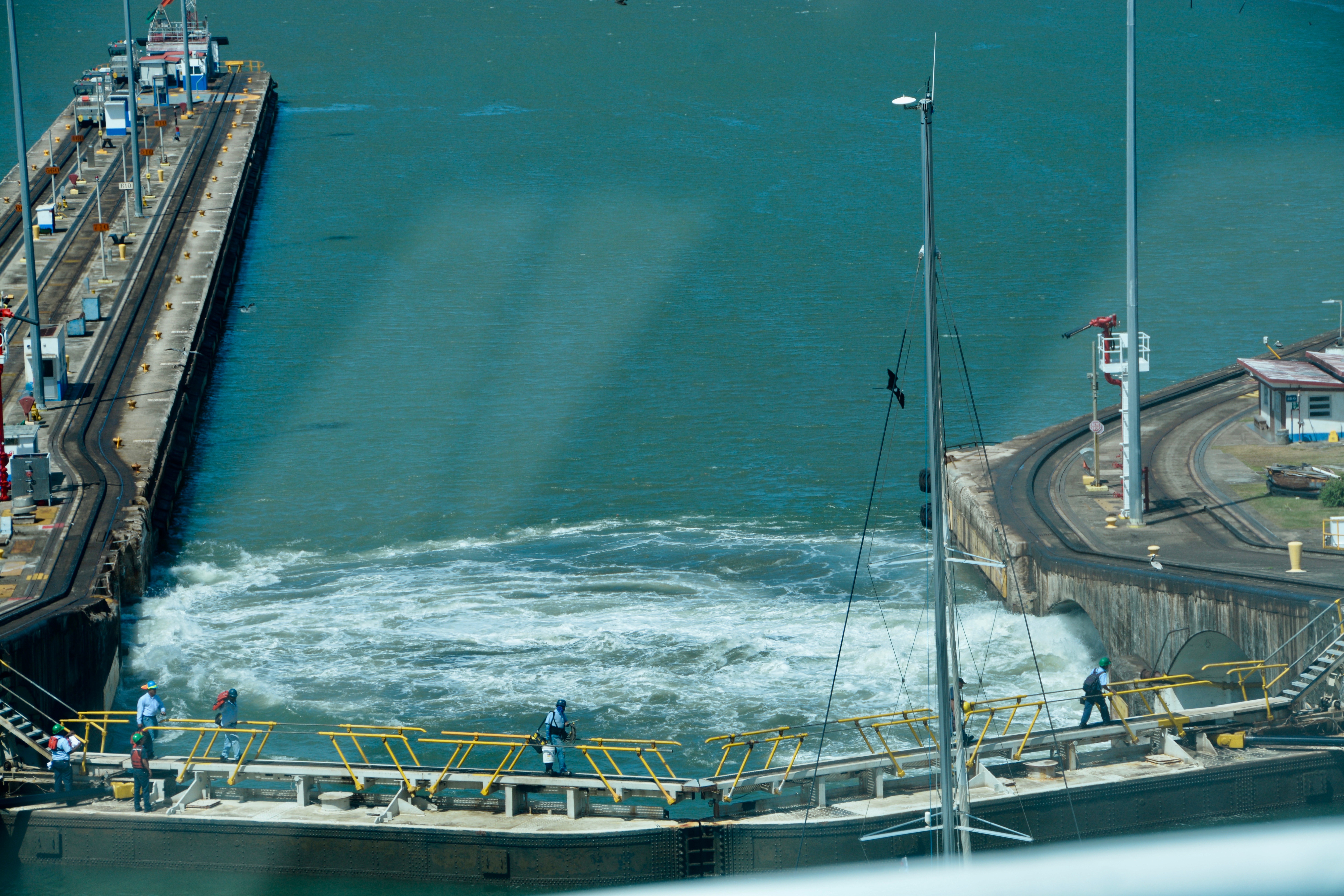
There are NO pumps to move the water; it is simply water flowing down. They just open the chamber. The water in the chamber goes up at a rate of three feet per minute. They use water from the upper chamber to fill this one. There is little to no water lost. The locks have water saving basins. The Panamanian operators don’t always use them because it takes an hour longer. It is not currently a busy time of year for the canal, but water is precious during the dry season. We are currently at the end of the dry season, so they will probably use the basins today.

The water flow is controlled by the gates. The ones at Miraflores are hollow, 80-foot-tall gates. Most canal gates are 65 feet tall. The original gates were operated by motors. These motors constantly had to be greased; it was a hard, dirty, and difficult job. The opening and closing of the gates are now powered by hydraulics. The first thing the Panamanians did when they got control of the locks was to replace the motors with hydraulics.

After we passed through both of the Miraflores locks, we moved into Miraflores Lake. The lake is about a mile across and it will take us about 20 minutes to cross it. For me, this was bathroom/food break time. I never had breakfast; I just snacked on things that were offered in the Living Room. I should mention that by this time, Boris has worked his way up to the front row right by the windows. We were able to add a chair for me and we were set for prime viewing for the rest of the passage.

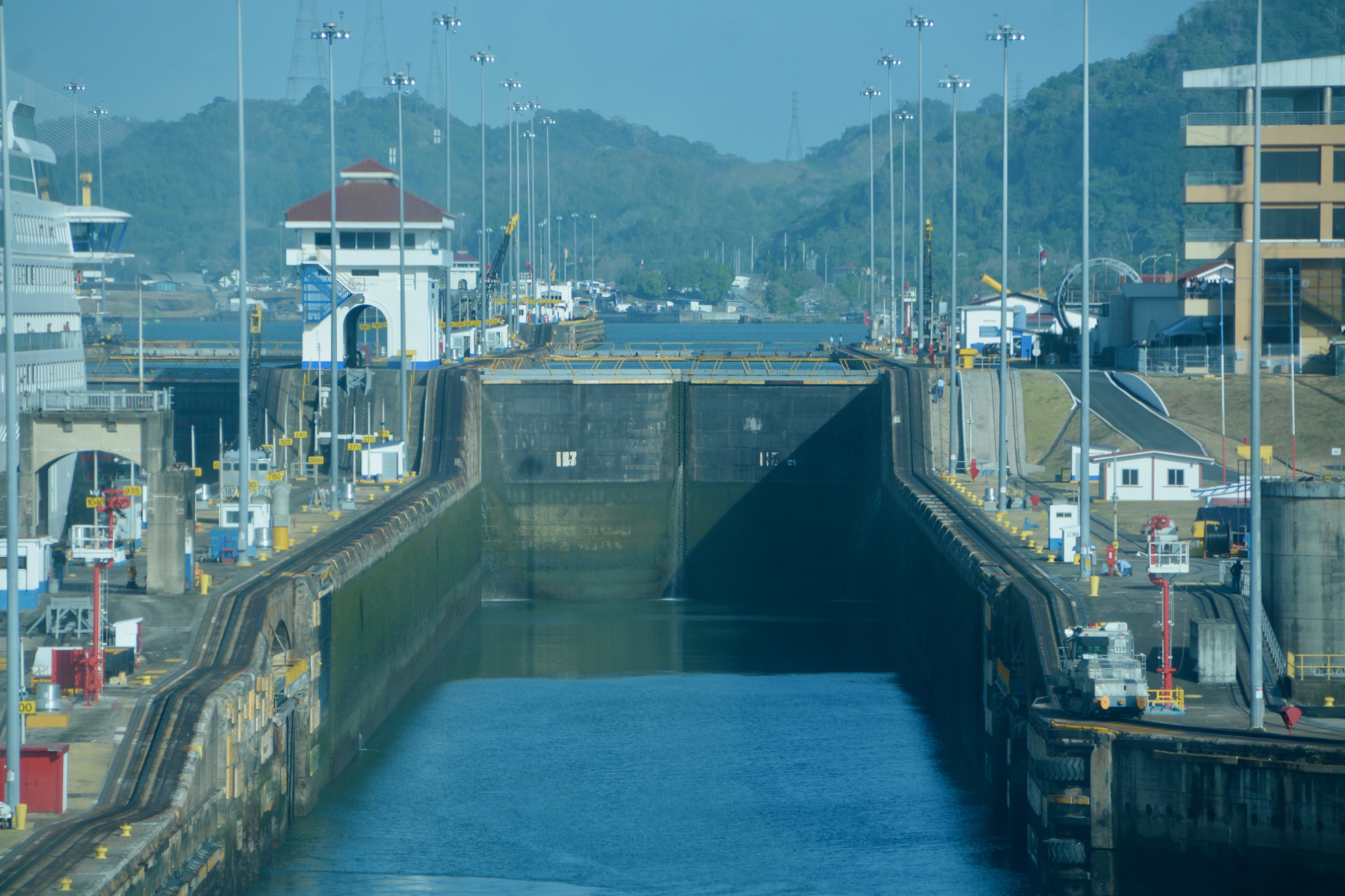
It didn’t take long to reach the Pedro Miguel lock. Like Miraflores, it has two sides. However, this time there is a single lock on each side. Also, there is not one, but two gates at the end of the chamber. This is for added protection just in case the first one is breached or damaged. They don’t want the water to drain. There are spare gates, but the ones in place now are the originals.


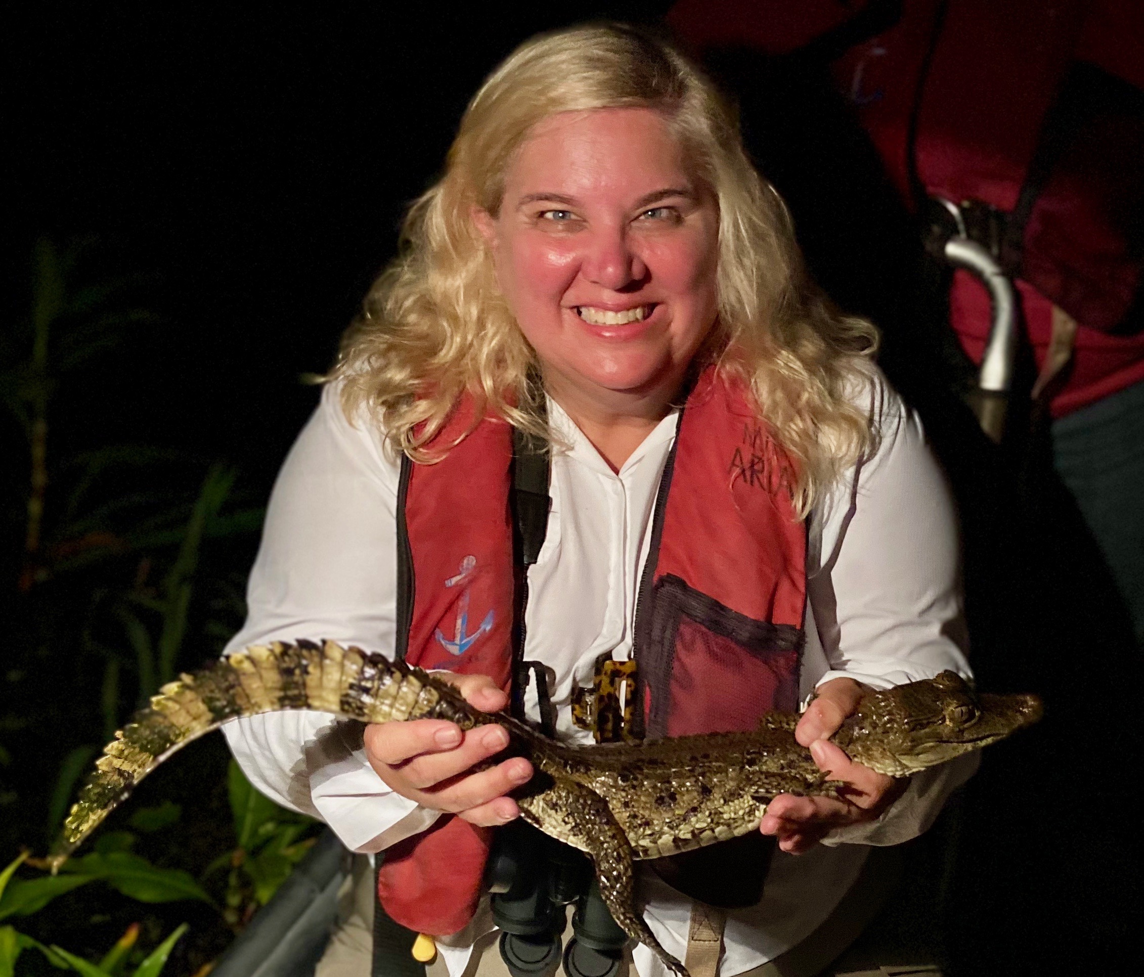
Our speaker enhanced the experience immensely. I would not necessarily have known what I was seeing otherwise or known the background. At each set of locks, he referred to the “free fish buffet”. The crocodiles were hanging out on the shore waiting for the water (and the fish in it) to be discharged. There are lots of signs warning against fishing, but it is not unusual for a fisherman to ignore the signs and be taken by the crocs. The speaker called them crocodiles, but he also said that in this part of the world they are probably caiman. I held a caiman last May when we were traveling on the Amazon River in Peru.
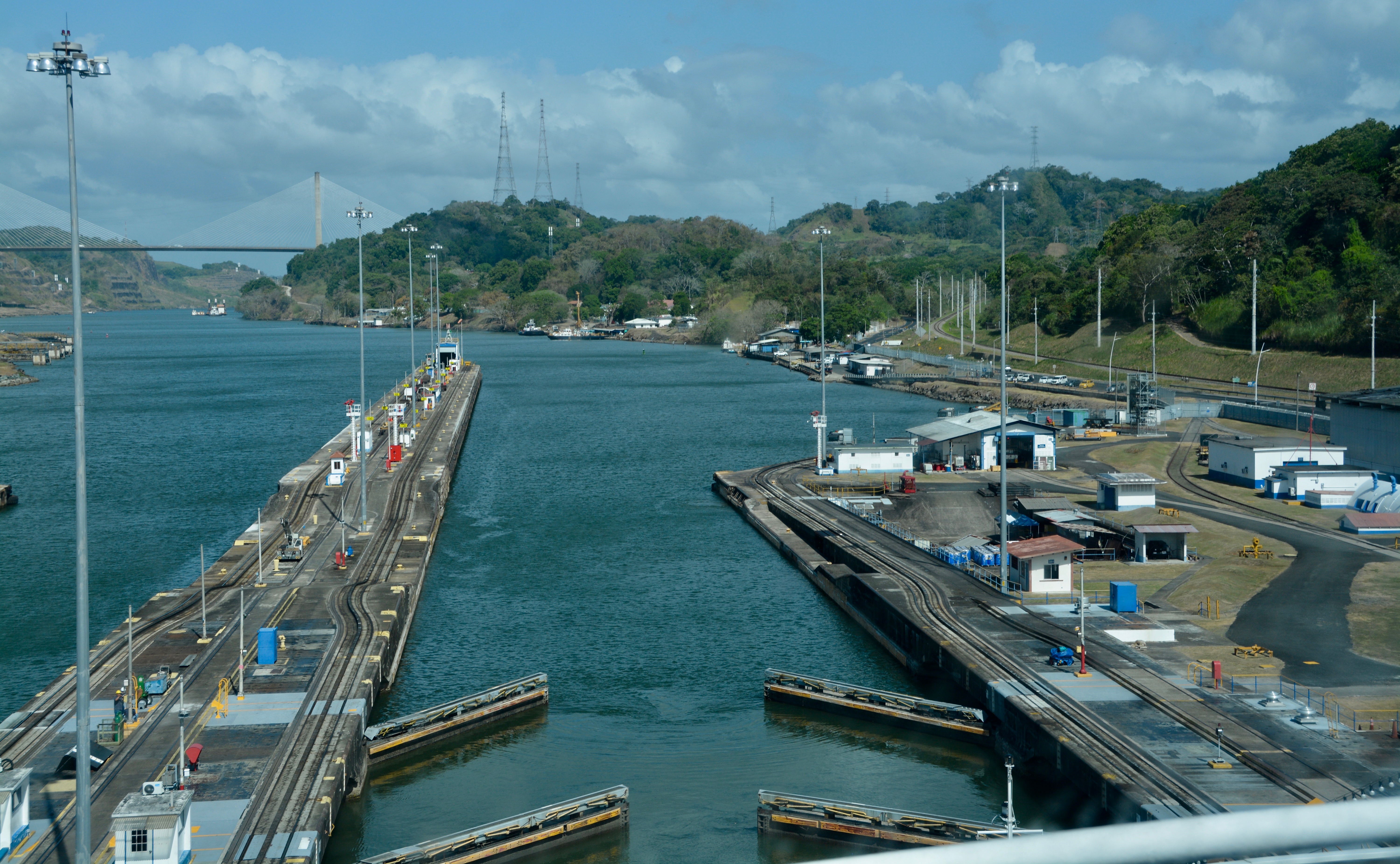

From the Pedro Miguel Lock, we can see the Centennial Bridge built in 2014 in celebration of the centennial of the opening of the canal. It will take a while to reach the third, and final, set of locks. I decided to go outside and see things from a different angle and maybe get some pictures as we passed under the bridge. Our speaker is broadcasting to all the public spaces from the bridge now so I will be able to hear him from the outside deck.

I took a look back and could see the other cruise ship still in the Pedro Miguel Lock. We are making much better time than them. In fact, our speaker said this was the fastest he has ever gone through the canal. Looking back, you could also very clearly see the third lane and the large megaships. They do not go through Miraflores Lake.

We will have a different pilot and different line workers take us through the third set of locks. The ones on board now leave us here and return to Miraflores. I saw the pilot boat first. Later, a second boat came to pick up the line workers who helped with attaching the mule lines to the ship. There were 20 line workers. Yes, Natasha counted.
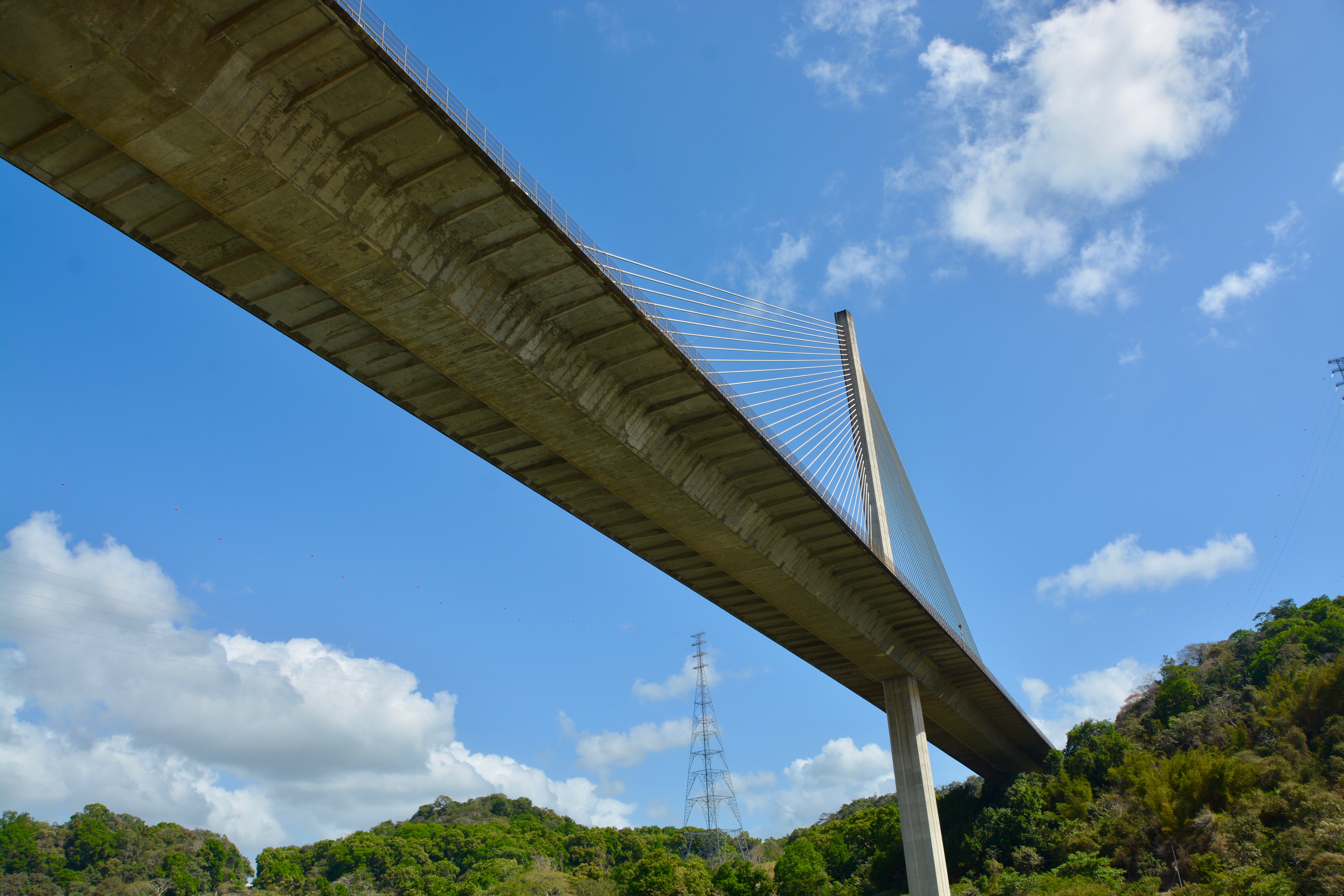
Afterwards we went under the Centennial Bridge and I enjoyed getting some pictures under the bridge. We were now in the Culebra Gap. It is narrow here, so traffic is only one way. We are traveling north. There is one northbound convoy and one southbound convoy during the day and one of each at night. Both start out at the time. Because of the direction we are traveling, we have made our three steps up (two at Miraflores and one at Pedro Miguel). When we reach the final set of locks, we take three steps down before passing into the Caribbean Sea.

Our speaker referred to the Culebra Cut as the Culebra Gap. “Culebra is the name for the mountain ridge [the canal] cuts through, and was also originally applied to the cut itself. From 1915 to 2000 the cut was named Gaillard Cut after US Major David du Bose Gaillard, who had led the excavation. After the canal handover to Panama in 2000, the name was changed back to Culebra. In Spanish the cut is known as the Corte Culebraand and is also called the Snake Cut.”—Panama Canal Authority via Wikipedia.
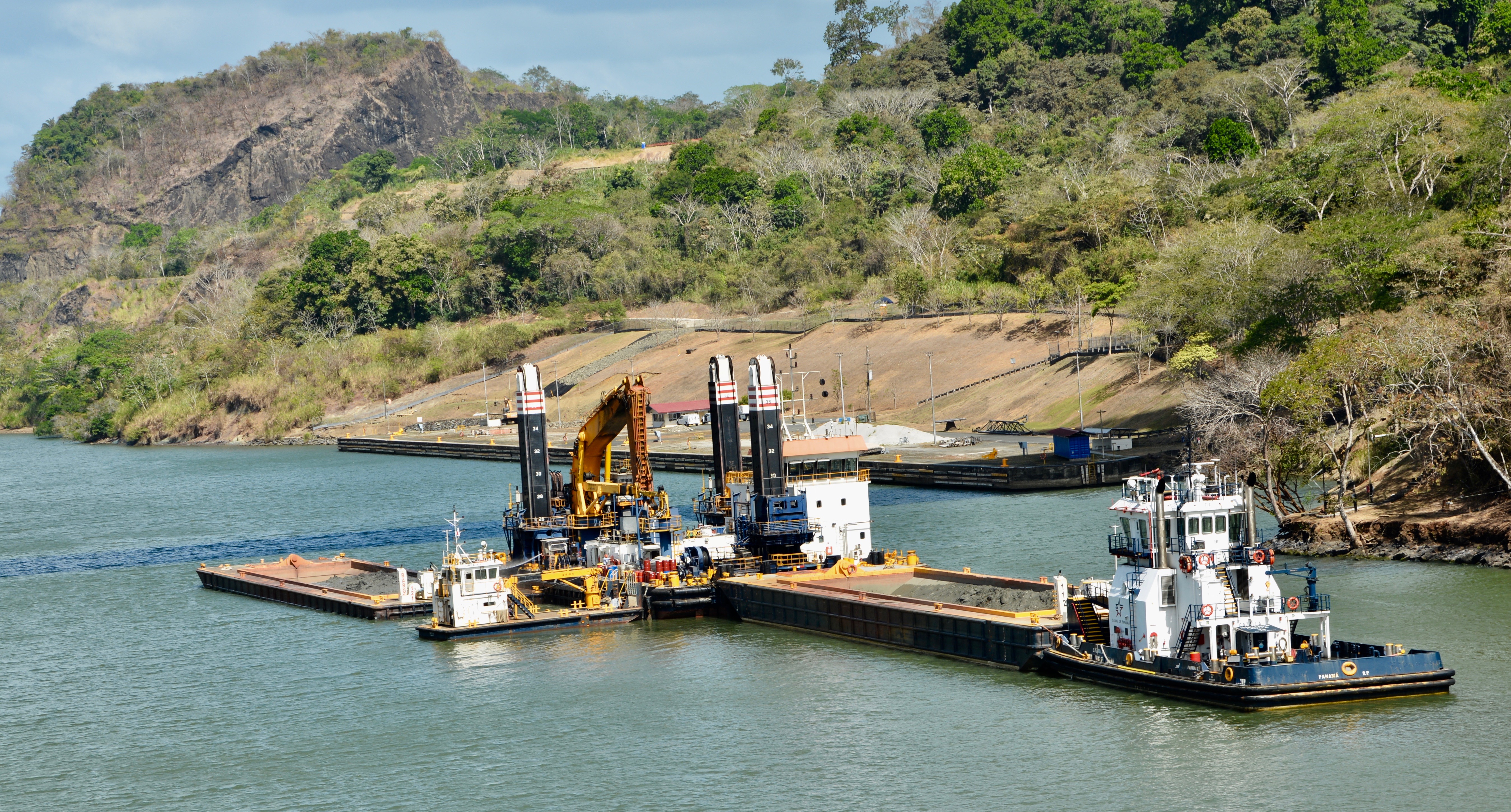
In the water, we saw a land dredge attached to a barge. When the barge is full, they simply move it and redeposit the fill somewhere else. It is a suction dredge using a pipe to put the material directly out of the water and into the barge; there is no need to scoop up and drop the material into the barge. The dredge is removing silt that flows here from the Chagres River or silt that accumulates here after heavy rains.


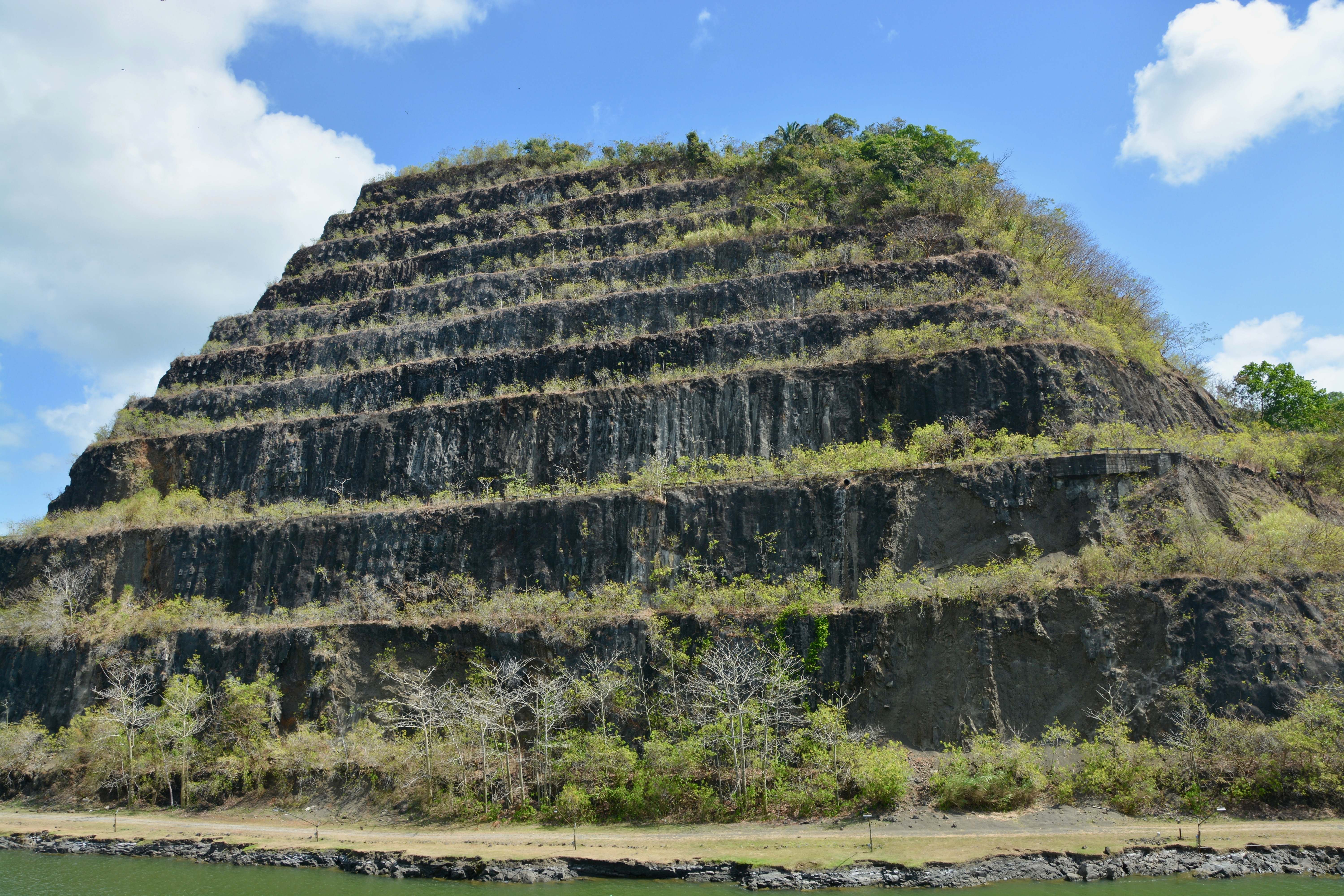
It was a moving moment for me as we passed through the narrowest part of the Culebra Cut and the continental divide. I was still outside and enjoyed getting some selfies from the deck 10 above the pool. After the narrow point in the continental divide, we saw a drill in the water. This is new and Panamanian built. They are very proud of their design and construction. The old drill, Thor, is still used occasionally.

On the starboard side of the ship we could see the final prison where South American dictator Manuel Noriega was held. He served prison time first in United States in Florida (on drug trafficking charges), then in France (on money laundering charges), and finally in Panama (for embezzlement, corruption and murdering his opponents). “Manuel Antonio Noriega was born poor in Panama City on Feb. 11, 1934, and was raised by foster parents. He joined Panama’s Defense Forces in 1962 and steadily advanced through the ranks, mainly through loyalty to his mentor, Gen. Omar Torrijos, who became Panama’s de facto leader after a 1968 coup.” –The El Paso Times. Our speaker told us the Panamanians do not like people to die in prison. He was released shortly before his death in May of 2017.
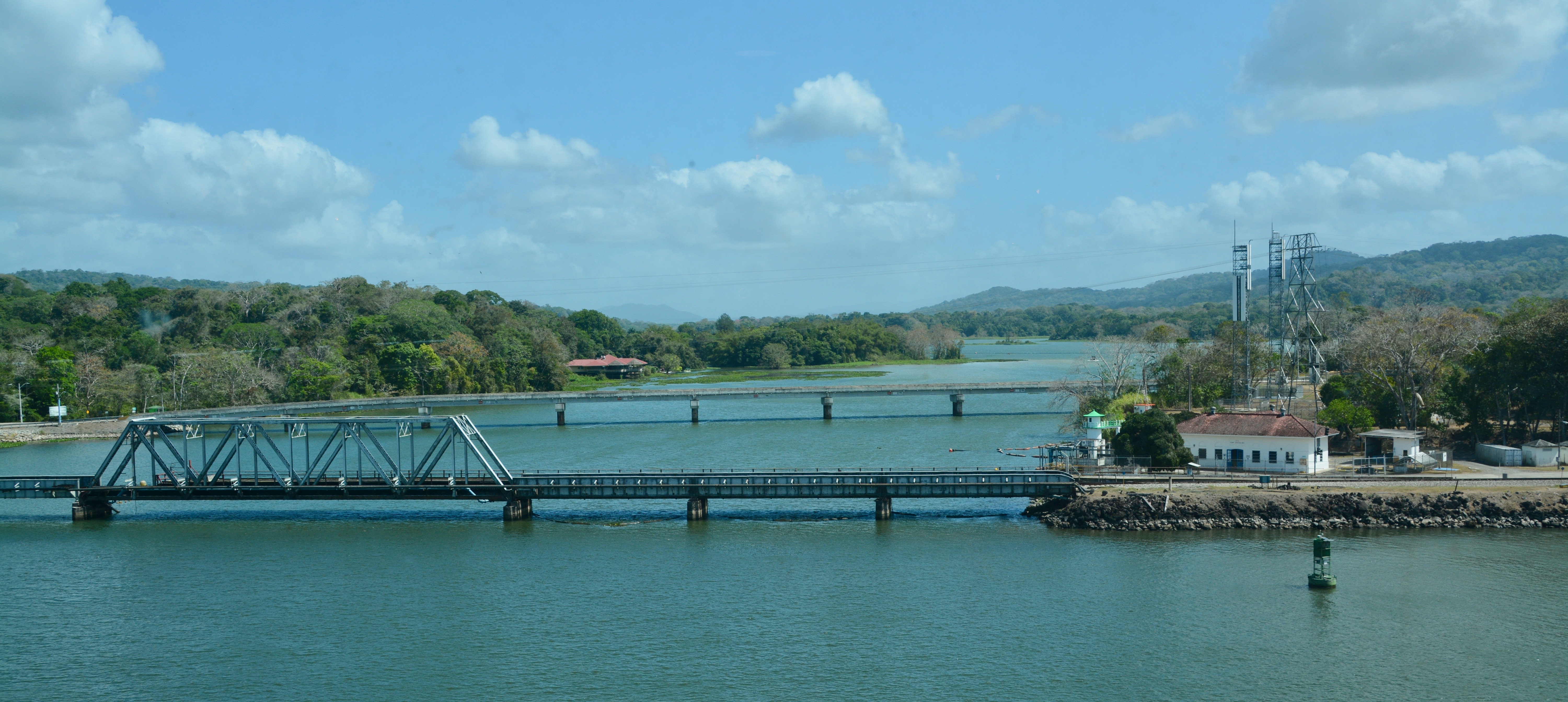
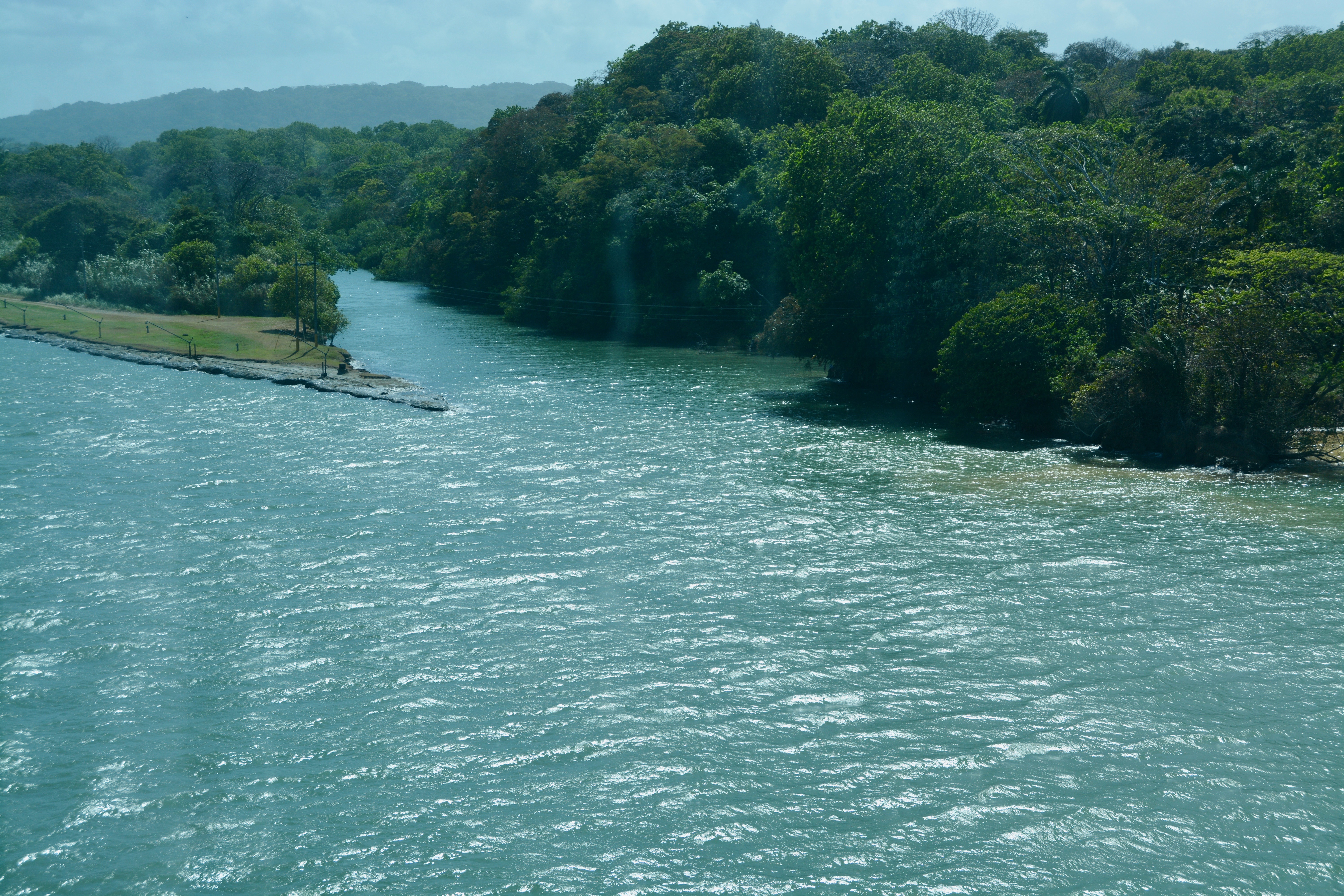
We came out of the Culebra Cut and into the Gamboa Reach. On the starboard side were two bridges over the Chagres River. There used to be a single shared bridge with a traffic signal; the bridge was used by trains and vehicular traffic. The train always got precedence. Now there is a separate vehicular bridge, farther from the canal, but still visible.
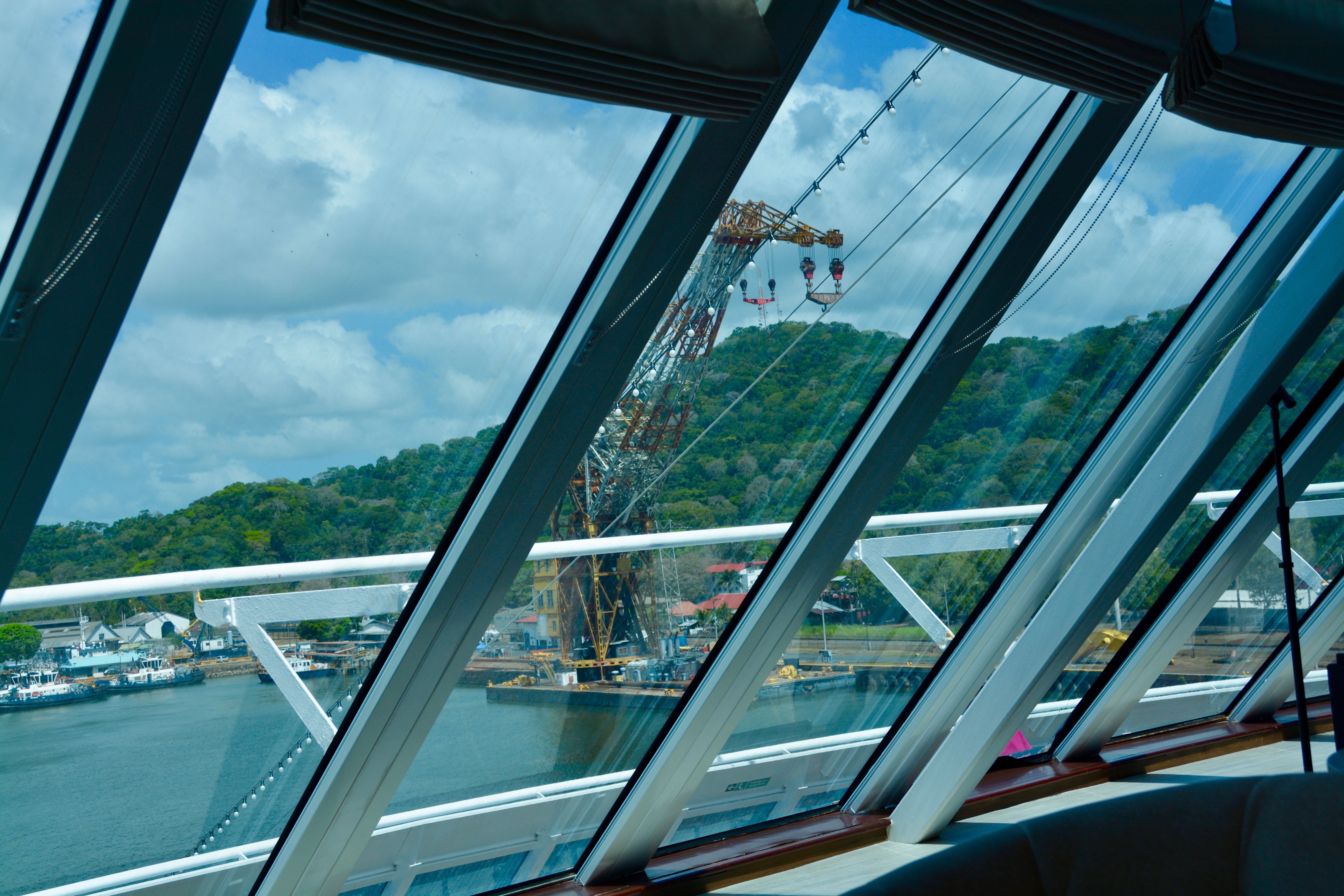
Just past the Chagres River we spotted Titan, so named by the Panamanians. Titan is a large floating crane “given” to Panama just before the turnover for $1. The crane was formerly in operation at the Long Beach Naval Shipyard until 1995 and before that Germany during WWII. It is perhaps better known by its nickname, Herman the German. The crane is of German construction and is used for canal maintenance. The Panamanians have also added an additional crane; this one is white and is already in use.
The canal is definitely wider in the Gamboa Reach. We are beginning to see/cross southbound traffic. The town of Gamboa, just past the Chagres River, is home for many of the canal workers.

Also on the starboard side just past the cranes is the dock for the Smithsonian Institute Journey (orange buoys). A little farther up north (less than an hour later) and on the opposite side of the canal, we saw the buildings that make up the institute itself. Our speaker used to work there and highly recommends the experience. Many people come out to explore the rainforest near Gamboa.
We also sailed by Monkey Island which is used as a rehabilitation center. Monkeys that are found in public areas and have become a nuisance are sent to the island. It is popular with tourists who approach in small boats hoping to see the monkeys in the trees.
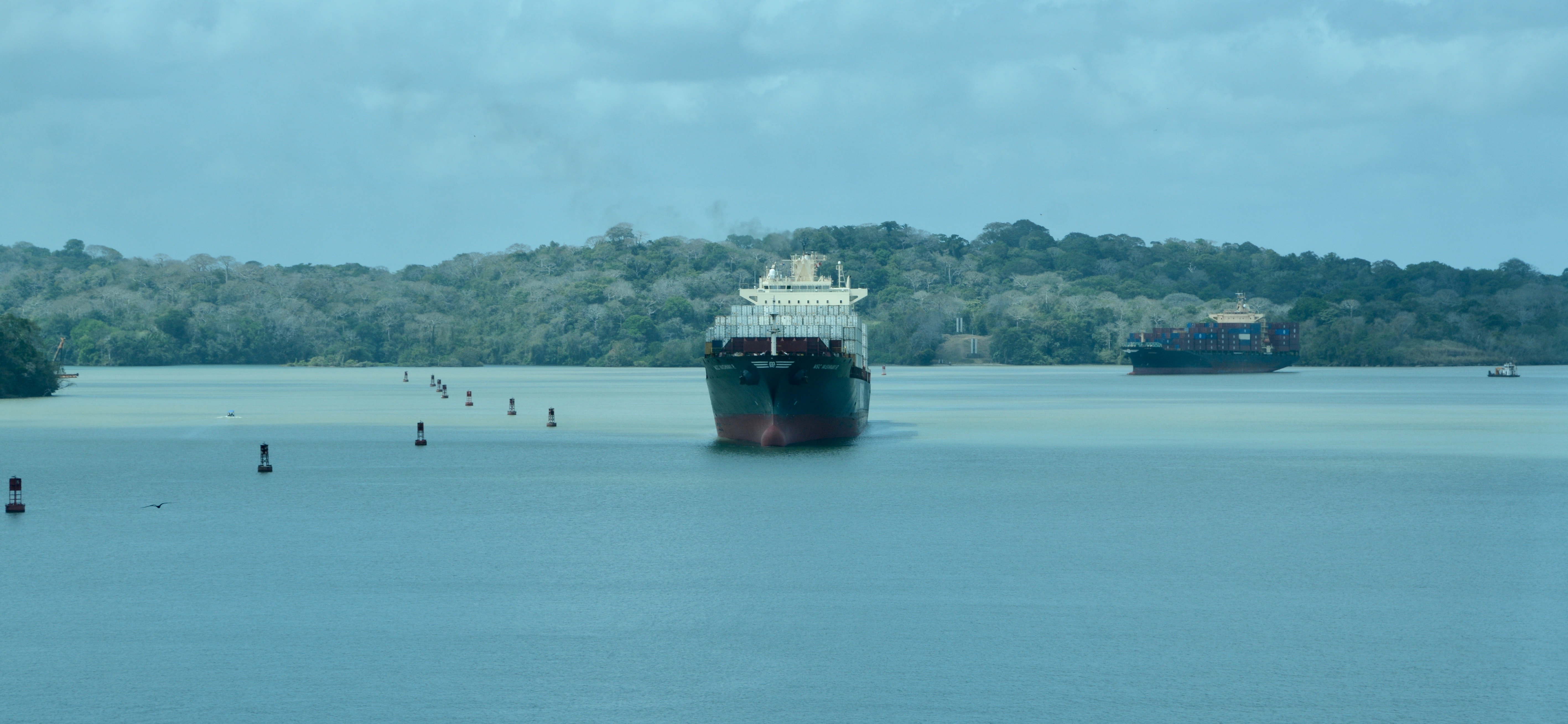
We reached the second lake, Gatun Lake. It is rather large, especially in comparison to Miraflores Lake. Our guide once again commented on how swiftly we were moving through the isthmus. We saw another cruise ship, the huge Celebrity Edge in the lake. The Edge and ships like it have to go through the new third lane; it is too large for the older locks. Additionally, like the Queen Mary, it has to turn around and go back to the Caribbean Ocean. This is what our guide called an “inee, outee”, or partial transit. The primary reason these huge, tall ships have to turn around is because they cannot fit under the Bridge of the Americas at the opposite (Pacific) end of the canal. A partial transit costs the same as making the full transit.

Up until this point, the third lane has been on our port (left when facing forward) side. All the traffic can pass in the large Gatun Lake. On the Pacific end, most traffic goes through the original Miraflores Locks, Miraflores Lake, and the Pedro Miguel Lock. Traffic in the newer third lane goes through the Cocoli Locks and bypasses Miraflores Lake. All convoys go through the Culebra Cut, Gamboa Reach, and Lake Gatun. On the Atlantic end, the third lane will be on our starboard (right when facing forward) side. The third lane traffic goes through the Agua Clara Locks and primary traffic goes through the Gatun Locks.
Our time in Gatun Lake was my only chance to grab lunch before we hit the final set of locks. We are running almost two hours ahead of schedule. Boris grabbed breakfast and lunch at the buffet and brought it to the Living Room, but I wanted to sit down and be served. I went to The Patio, the outdoor grill with table service. The only time in my life that I get served is at a restaurant or on a cruise ship. No one is serving me at home. I am going to take advantage of this every day of the cruise. I was looking a little worse for the wear by this point due to my interrupted, excited sleep the night before and our early wakeup. I think I will need a nap after this.
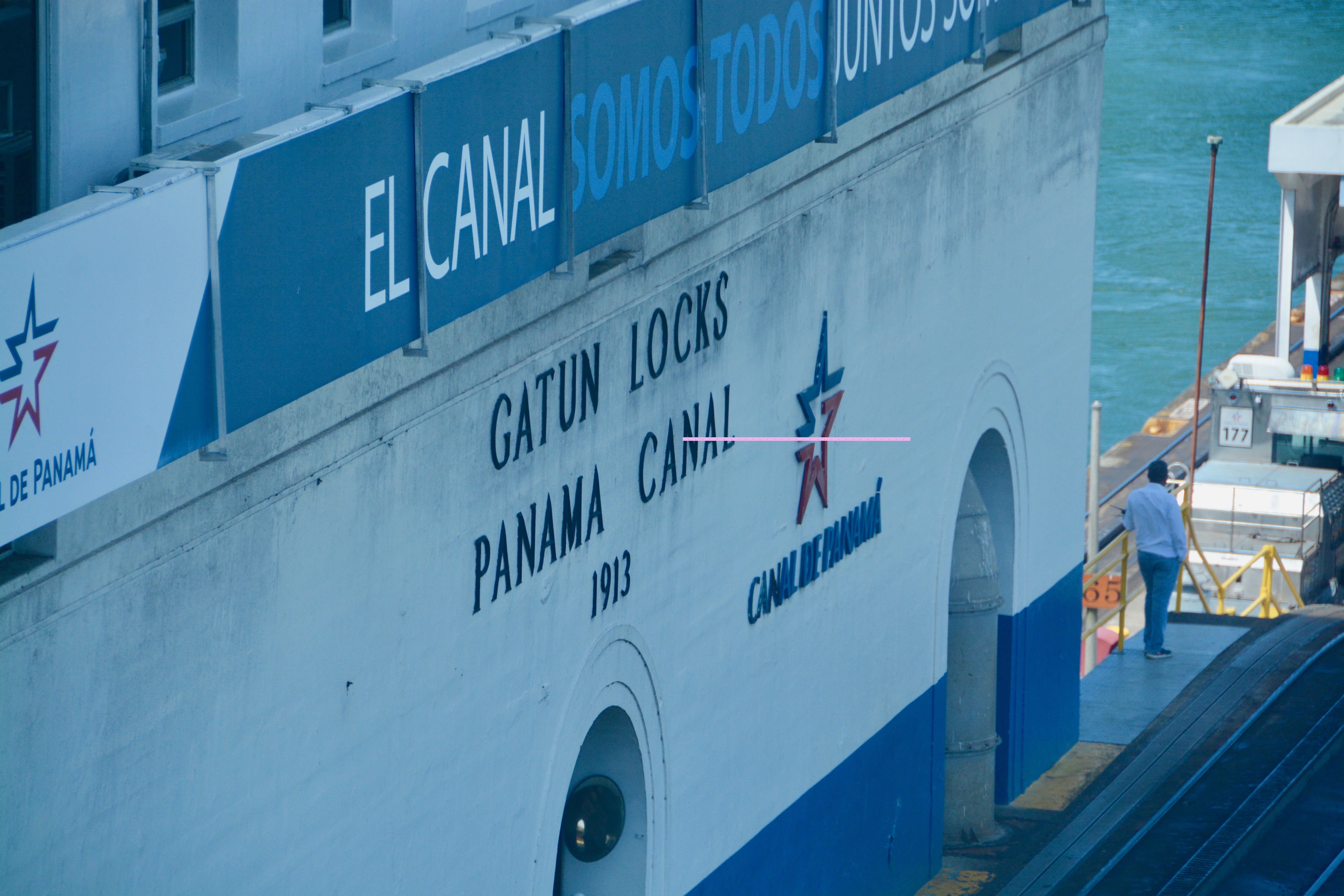
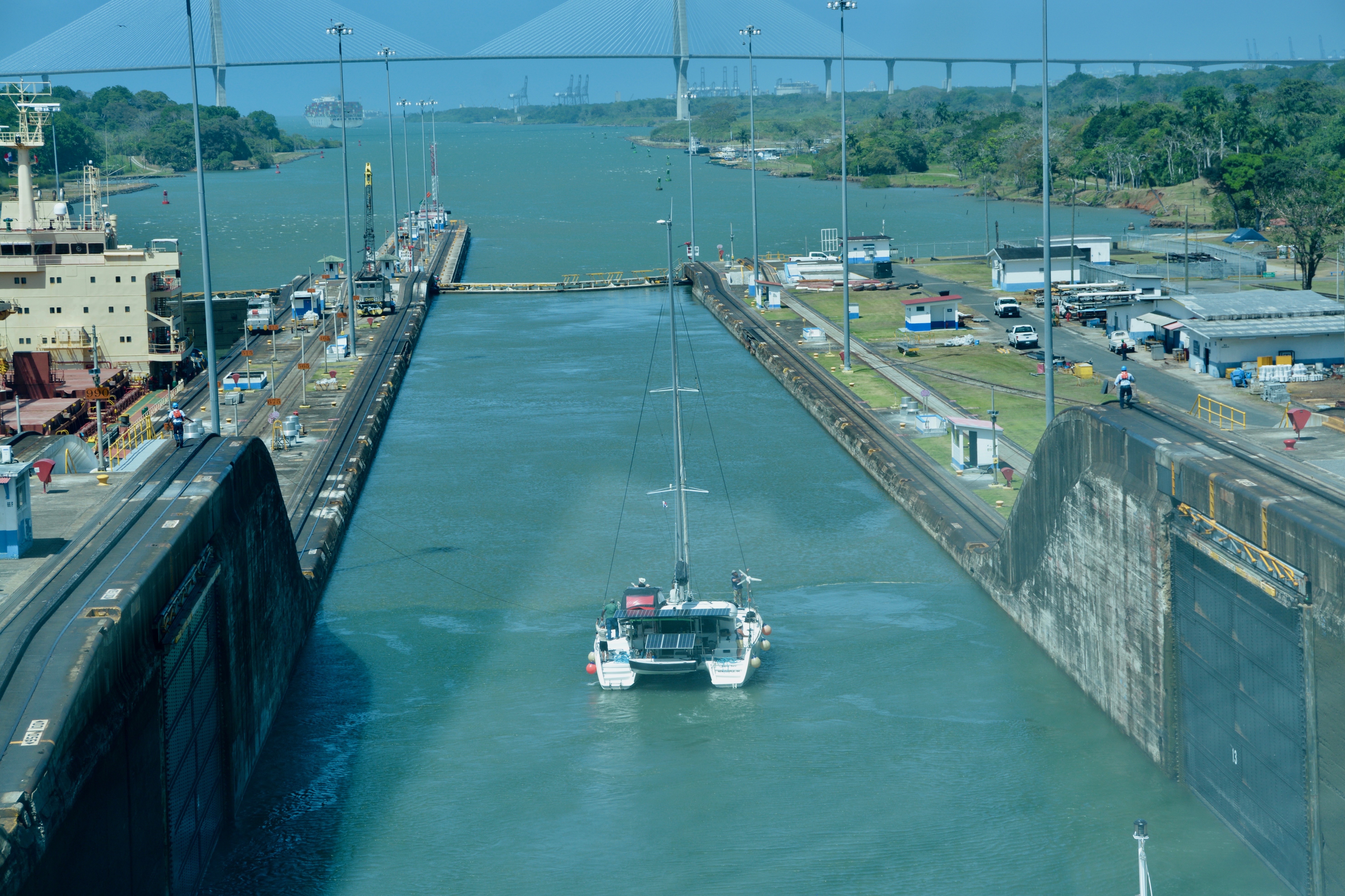
The Gatun Locks at the Atlantic end of the canal once again have two lanes. This time each lane has three locks, each with double gates. We made three steps up as we traveled northbound leaving the Pacific, two steps up at the Miraflores Locks and one step up at the Pedro Miguel Lock. We will take three steps down in the Gatun Locks. For this series of locks we have a catamaran in the chambers with us. I don’t think I would want a cruise ship looming over me in the same lock chamber. Our speaker estimated that it was costing the catamaran sailors $1,000-$2,000 to go through the canal
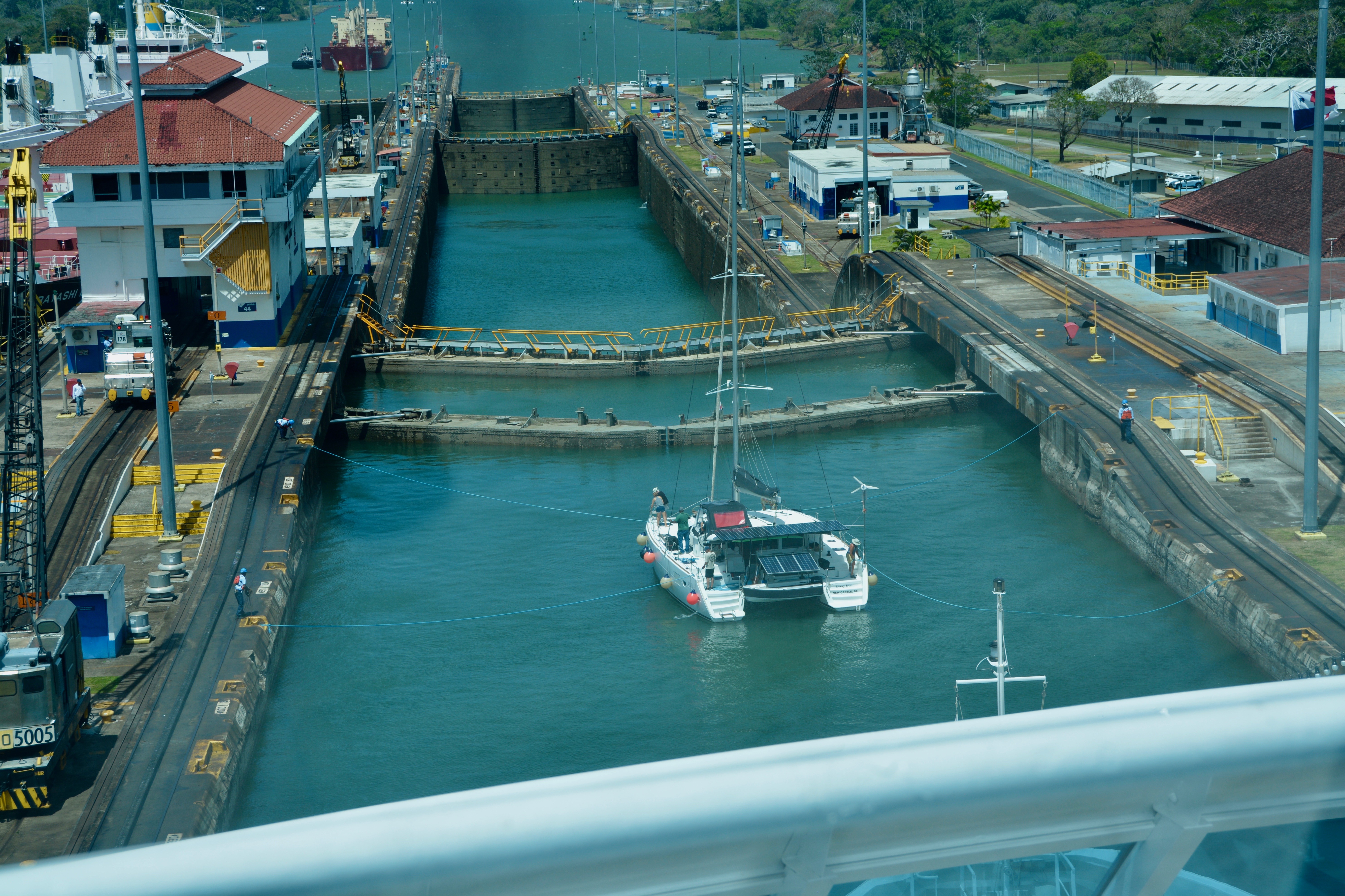
The catamaran did not have lines attached to mules but was attached at ground level by ropes. The catamaran also had Panamanian line handlers on board. When the chamber gates were open, the lines were detached and the catamaran moved forward. We waited patiently.

This time I got a good look at the handrails on the gate walkways being detached from the ground and going down before the gates were opened. We could also see where the gates (with lowered handrails) could recess into the wall of the lock chamber.


The southbound ships we saw were all very large. They were using the other lane at the Gatun Locks. We saw some grain carriers with their own cranes and shovels built right onto the deck of the ship. The grain carriers we saw also had a helicopter landing pad on the deck. We got a good look at their flooded chamber and our shallow one as a comparison.

Size matters in the canal. While in the Gatun Locks, I could see the large container ship in the third lane. These ships can carry as many as 15,000 containers (the panamax design). This was the agreed upon size when constructing the third lane. There are larger ships, but they carry less expensive material like concrete and their owners are unlikely to justify the expensive of the fees to pass through the canal.
“Panamax and New Panamax (or Neopanamax) are terms for the size limits for ships travelling through the Panama Canal. The limits and requirements are published by the Panama Canal Authority (ACP)… The allowable size is limited by the width and length of the available lock chambers, by the depth of water in the canal, and by the height of the Bridge of the Americas… Panamax specifications have been in effect since the opening of the canal in 1914. In 2009, the ACP published the New Panamax specification which came into effect when the canal’s third set of locks, larger than the original two, opened on 26 June 2016.” —Panama Canal Authority via Wikipedia.


When we were in the third lock, I saw the same large container ship exiting the new lane in the distance. I felt a little sad when we completed our final lock. It was a magnificent transit.
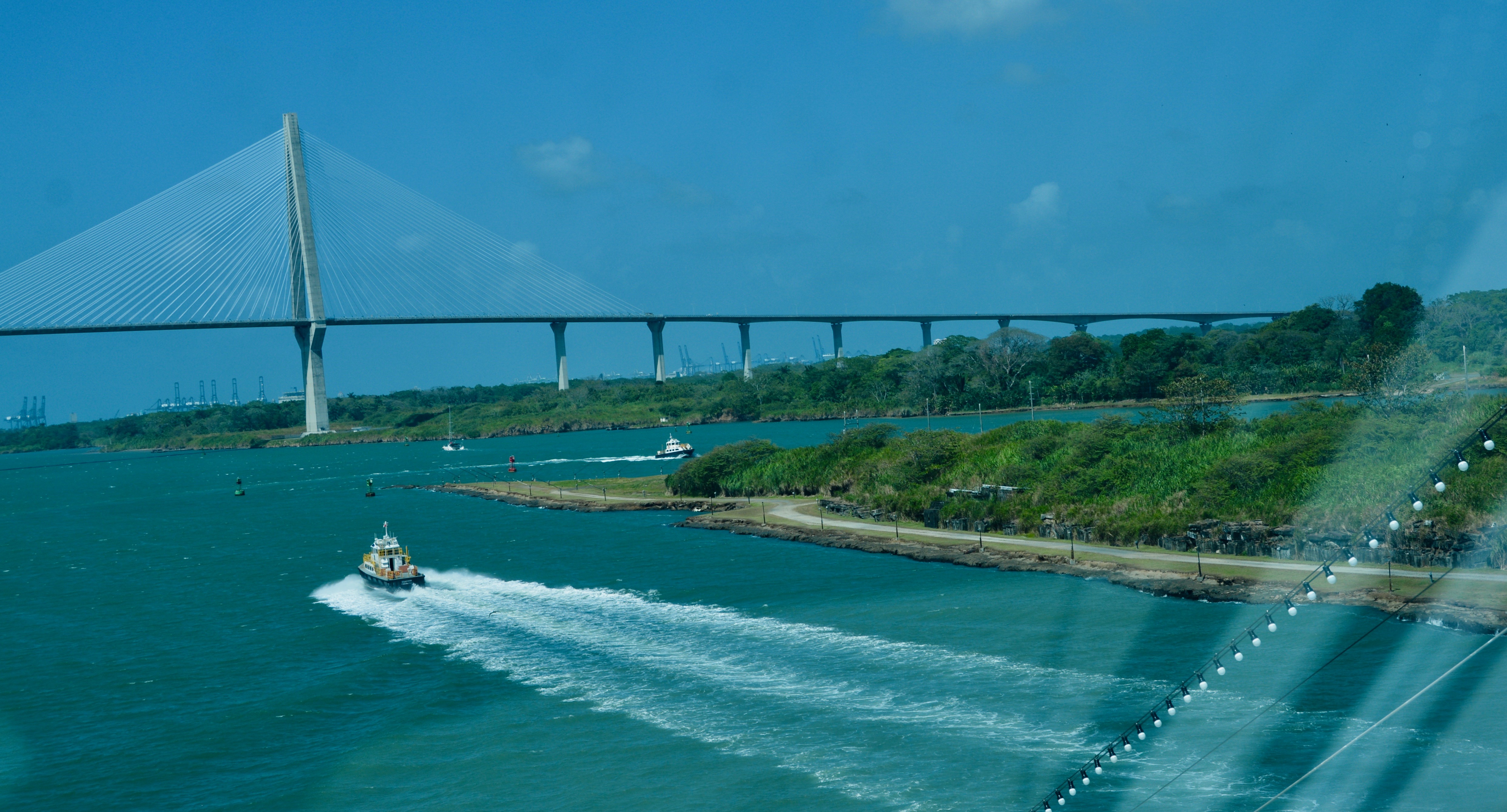
As we moved toward the open sea to our left side (port), we could see the remains of the French canal. For more about its history, check out yesterday’s post. On the right side (starboard), we passed the exit to the third lane. Then just ahead is the Atlantic Bridge, one of the largest cable-stay bridges in the world. In the distance were loading/unloading cranes of the Montecristi seaport.

The basic requirements to go through the Panama Canal are:
- You must pay your fee at least 48 hours in advance;
- You must be within the weight and size limits (panamax) for the canal;
- You must pass an inspection (i.e., condition of the vessel; no explosives aboard; etc.); and
- You must allow the Panamanians to board your ship for inspection, piloting of your vessel, and handling the lines.

It was never a moneymaker when the Americans controlled the canal. We didn’t even break even until 1987. The cost to those making transit through the Panama Canal has been much higher since the Panamanians told control. Traveling on the third lane can cost up to 1.2 million dollars. It cost approximately $160,000 for the Azamara Onward to make our transit. It was part of the ticket price of my cruise and in my opinion well worth the money.

This bucket list experience was even more amazing that I had hoped for. I highly recommend a full transit of the Panama Canal by cruise ship. –Natasha
