

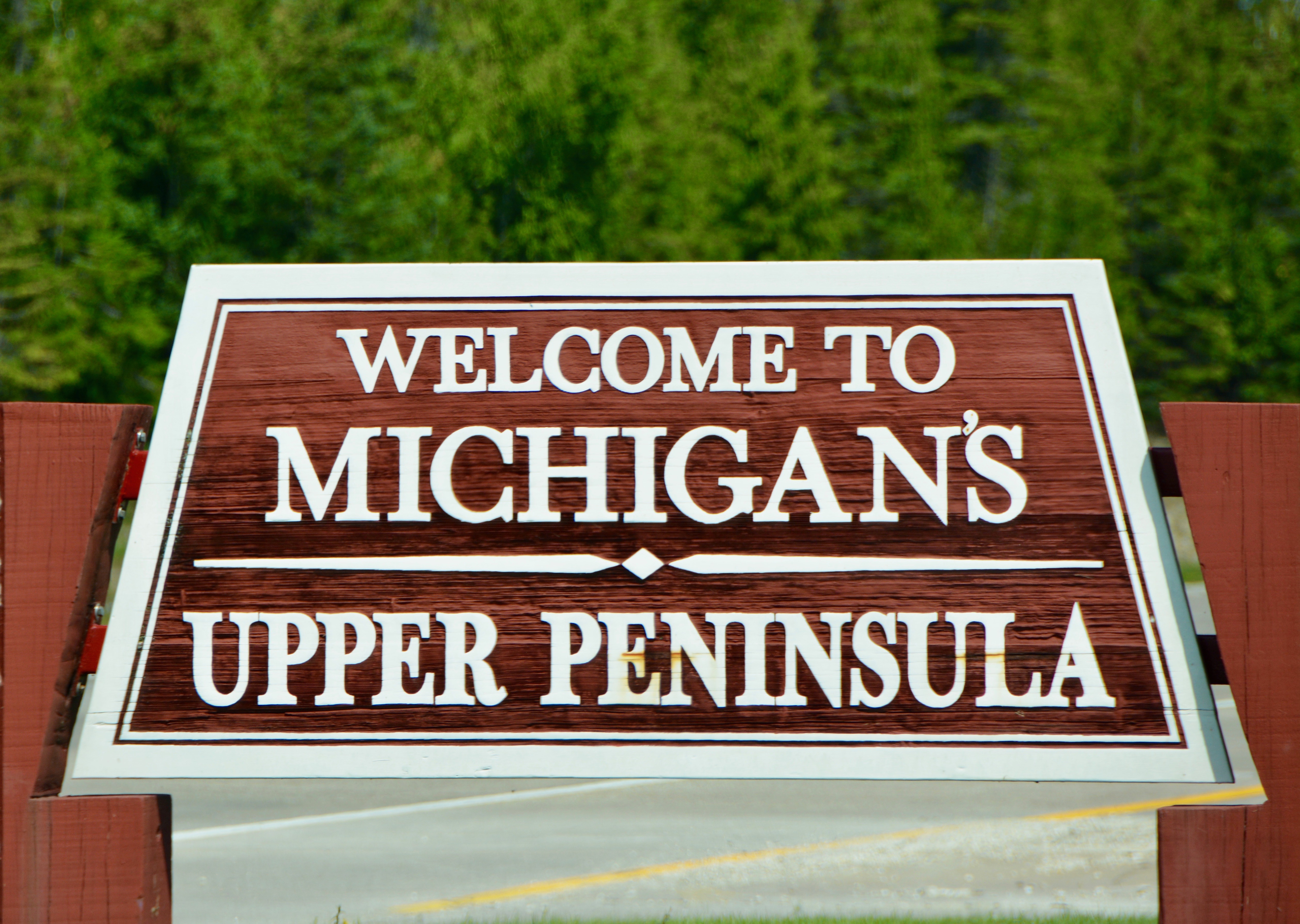
This summer with us all fully vaccinated, my mom suggested that we recreate a trip that we took as children. My brother, sister, and I all met in Grand Rapids, Michigan for a four-day road trip “up north” with Mom. Early Monday morning we set out for the Soo Locks in Michigan’s Upper Peninsula.
Emma did an early stop at Van’s bakery. My brother Jack had already done the oil change and filled up the car with gas the day before. After loading mom’s three pillows-neck, seat belt cushion, and footrest, the bakery goodies, and the rest of our luggage, we set off. We are going to take a bit of a scenic route, hoping to arrive in Sault Ste. Marie in time for the 3:30 pm tour. On this tour, you actually pass through the locks. After living in Texas, the driving distances just didn’t seem that far to me.
Mom had four things on her travel bucket list: A ride on Route 66, another trip to Hawaii, the Panama Canal, and Morocco. Given COVID concerns and her age, we have modified things a bit. She wanted to travel in the continental United State, but thought route 66 might be too tiring. That is when we hit on retracing a trip we took as children in 1978. We’ll drive through her home state instead. It is not the Panama Canal, but today’s visit to the Soo Locks does attempt to stay with the theme.

When we were children, my mom would take a large scrapbook and draw lines to create 4 squares on a page for each day of our trip. We then each drew a picture of something we did that day. We hated it at the time and often had to go back and fill in a couple of days in one sitting. However, now those drawings are treasured memories. We won’t be employing our sketching talents on this trip-extremely limited in my case. Rather, with Emma as our scribe, we are writing down our favorite part of each day, the biggest surprise of each day, and one thing we didn’t like.

Emma’s surprise came early in the day. While passing through farm land, we spotted a training facility. We didn’t know it was a training facility at first. We just saw lots of guys going up and down on poles. I told Emma I would be happy to record pole dancing as her favorite activity of the day.
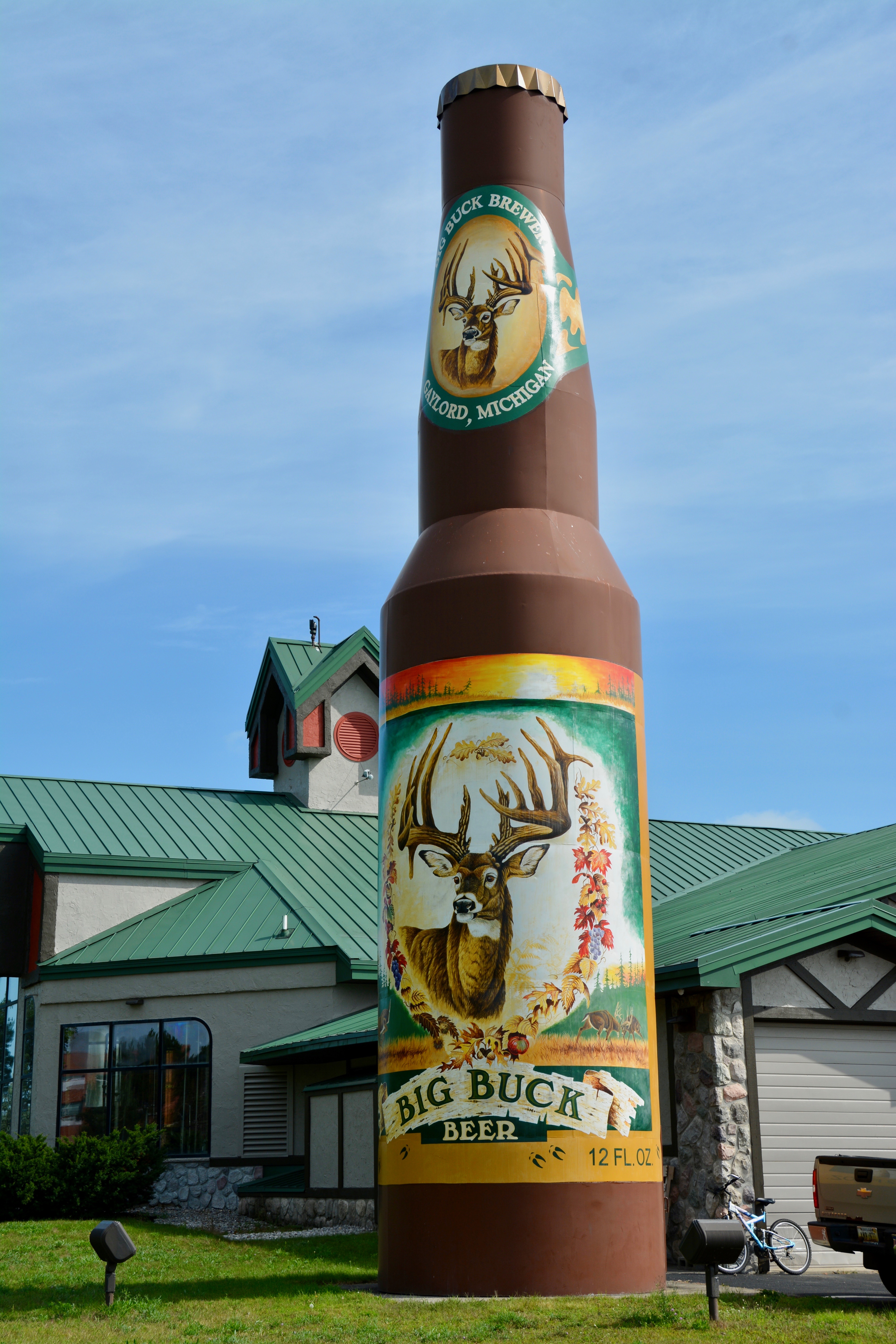

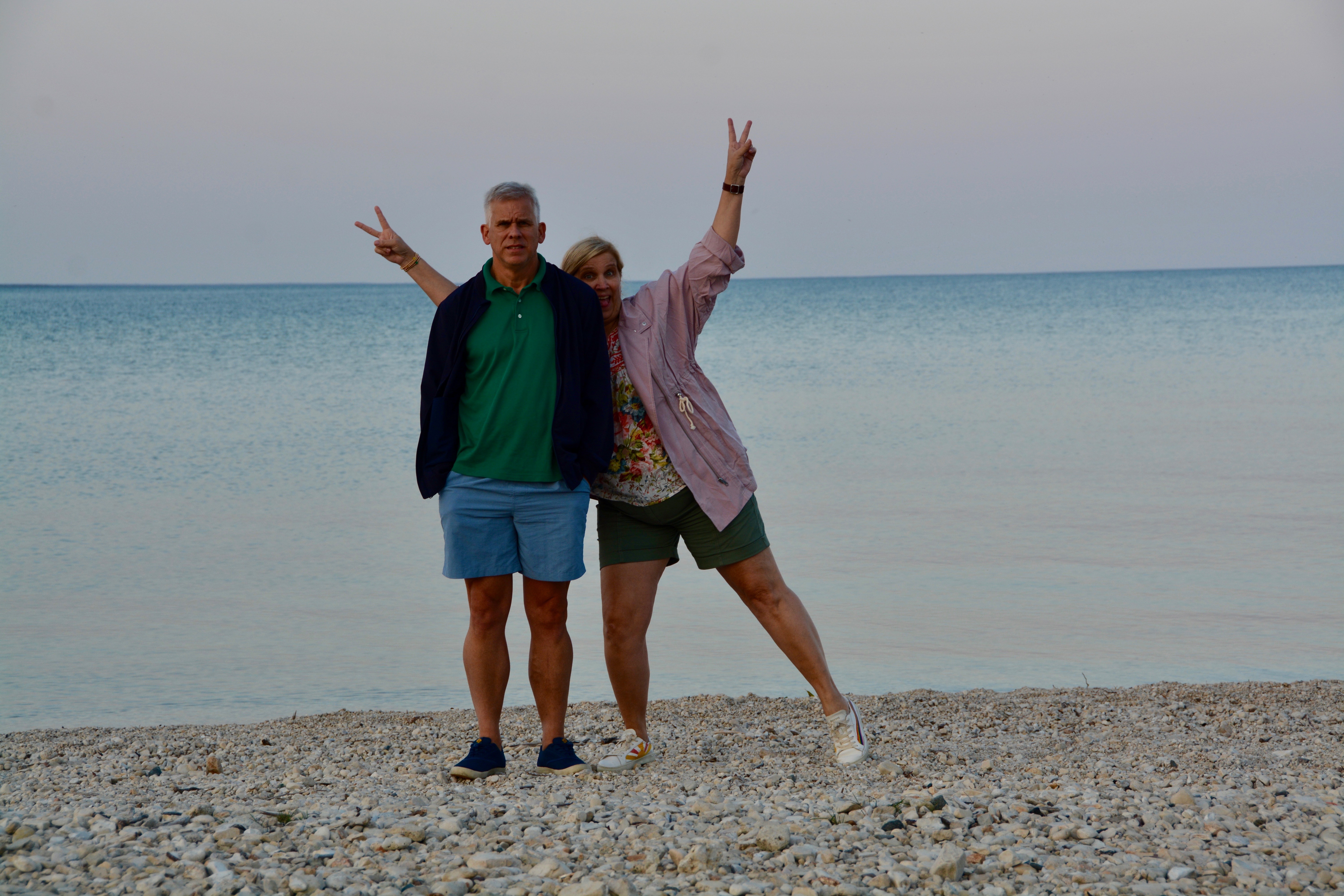
We stopped in Gaylord, Michigan for a drink and what the tour guides always refer to as a “necessary stop”. A local brewery offered a highway icon so you can’t miss it while heading north. We all noted the ski lodge look to the town and mom said she had come her once with a friend from school. The friend’s father was the manager of the local resort at the time when the wealthy would fly in for golf and skiing in the area. The locals think of their town as an “Alpine Village”. More recently, the area has acquired a reputation for its many cycling trails. It was a charming city and I asked Jack to drive down a few streets so I could get pictures. I don’t always bring my better camera when I come to visit Mom, but I had on this trip.


At one point we drove down a street and passed a beautiful traditional church and my mom announced that that had been her friend’s church and that they had gone there decades ago on her visit. We weren’t looking for it, but somehow for me that was a wonderful start to this trip knowing the connection the city and this church had with my mother’s past.

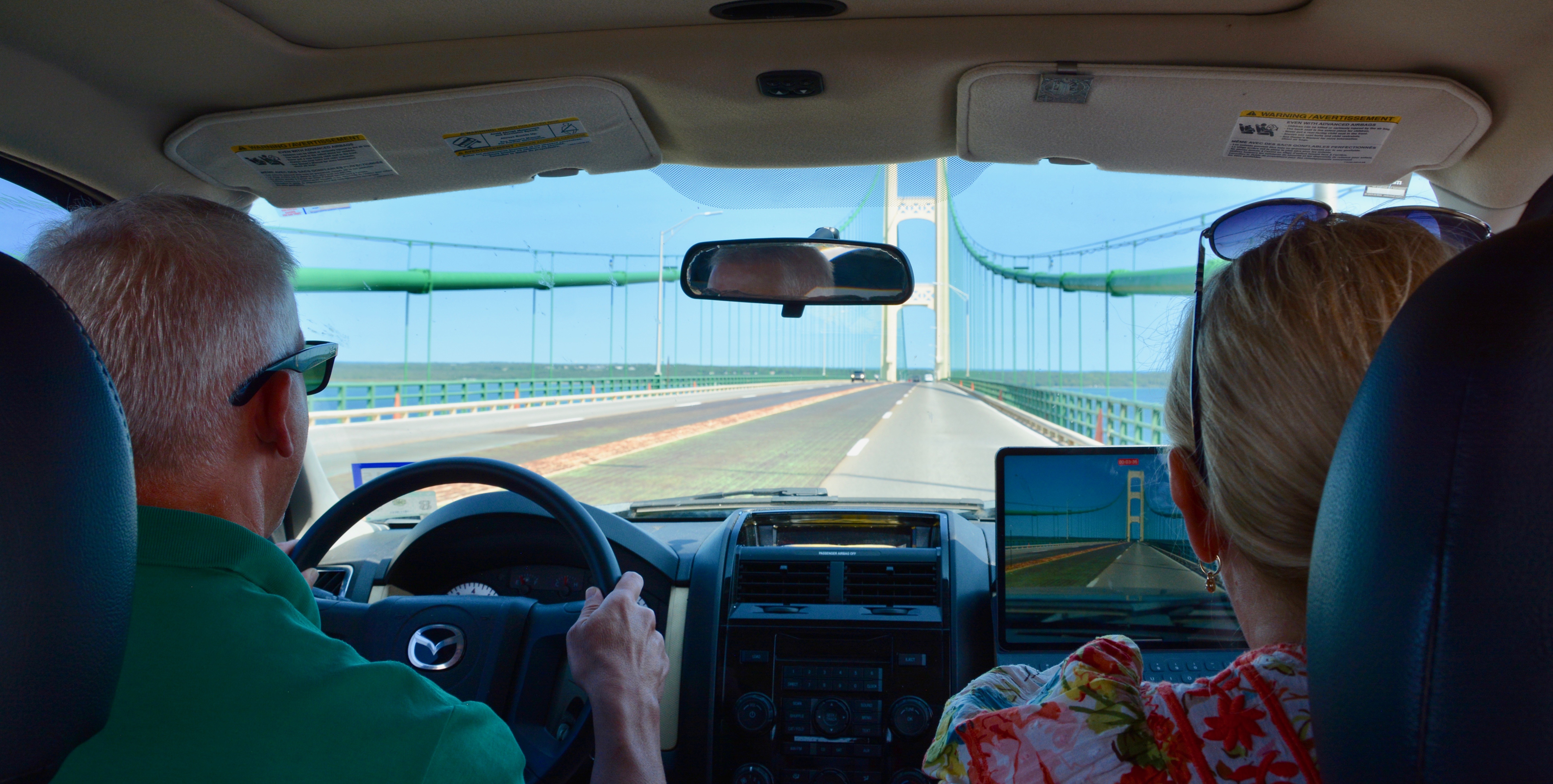
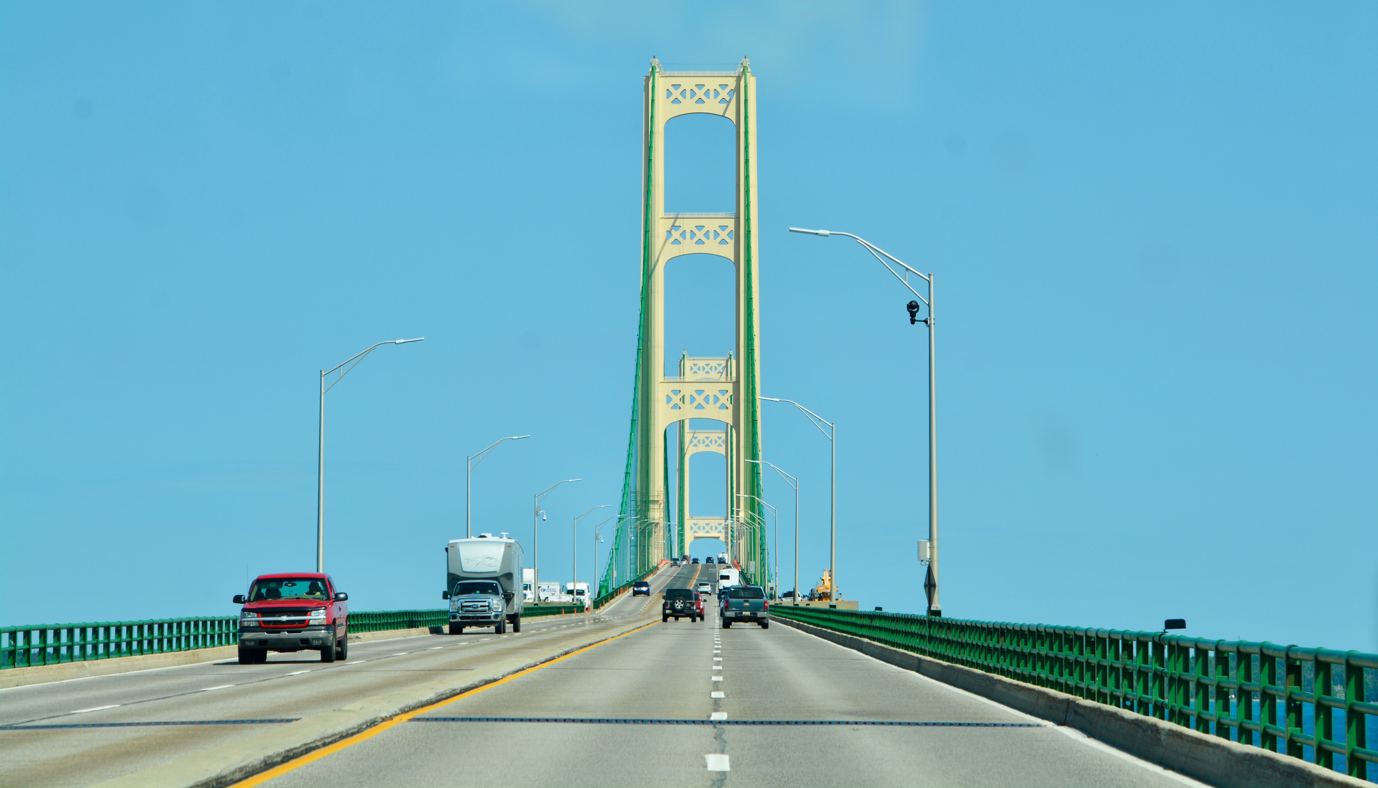
The upper and lower peninsulas of Michigan are joining by the Mackinac Bridge, a long beautiful structure that is sometimes shown as the symbol for the state. My sister Emma hates crossing bridges, especially when driving or sitting on the side facing the open area outside the bridge. Since my mother had decided to “nest” in the seat behind the driver, my brother Jack, Emma was in the outside position sitting next to the driver. She decided to film the bridge crossing as a distraction. There are multiple lanes crossing in each direction but the inner lanes have annoying ridges that can cause you to slide a little. (This is rather ironic given the purpose of the grooves is to assist in poor weather.) We were traveling in the outside lane, with Emma and I closest to the water.
My brother kept up a running commentary the entire way across the bridge, pointing out how far we had gotten, the continued possibility of plunging to our death, and the icy temperature of the water. The result is a hilarious video with Jack and Emma’s voices, his as a monotone narrator, and hers fluctuating between fear and laughter. I did not share with Emma that one car, a 1987 Yugo, had been blown off the bridge. “The Life and Death of Ugly: No, You Go”, Los Angeles Magazine.
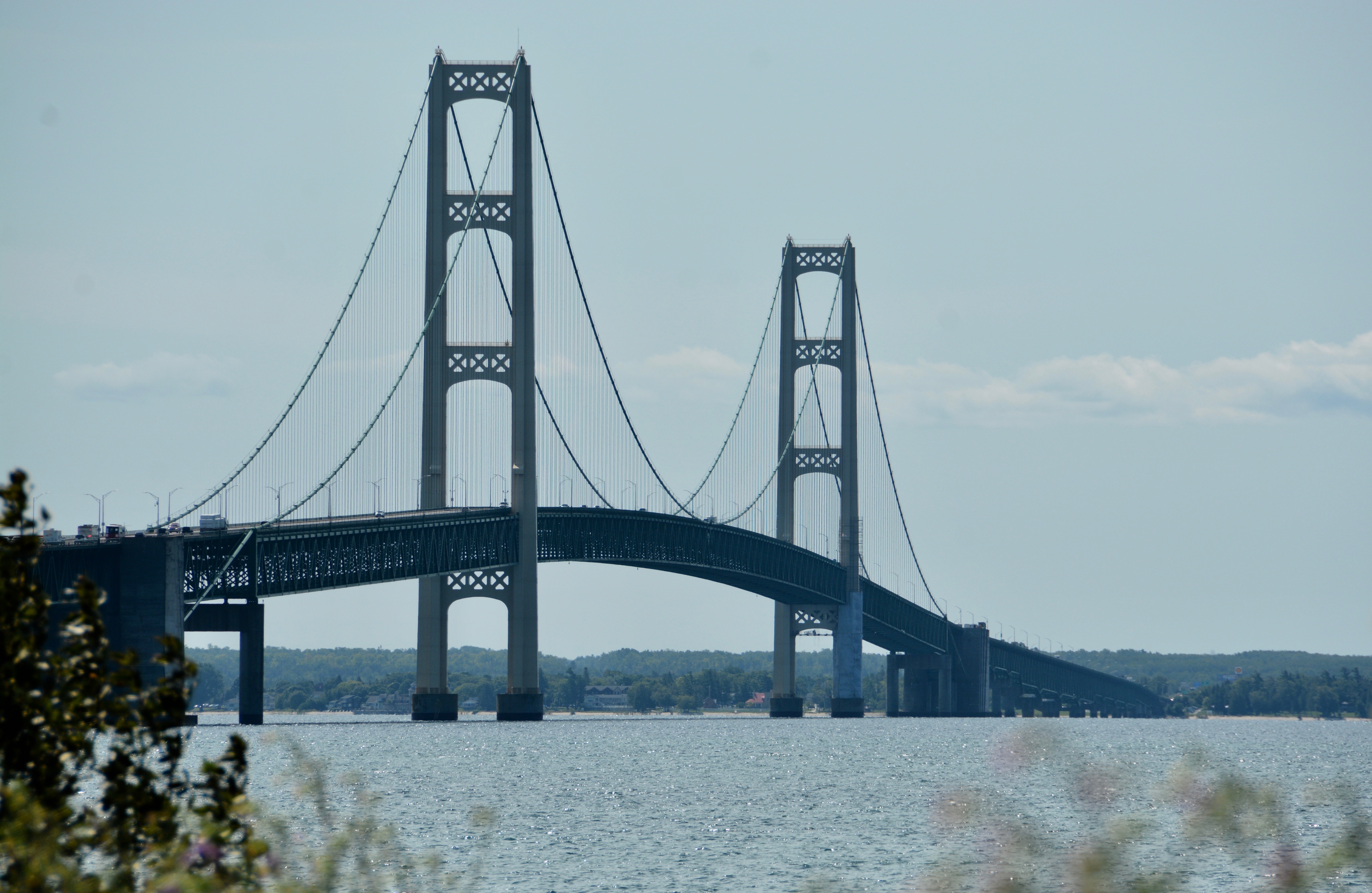
The Mackinac Bridge is the 5th longest suspension bridge in the world and the longest in the western hemisphere. Like all suspension bridges, “it is designed to move to accommodate wind, change in temperature, and weight…the deck at center span could move as much as 35 feet (east or west) due to high winds. This would only happen under severe wind conditions. The deck would not swing or ‘sway’ but rather move slowly in one direction based on the force and direction of the wind. After the wind subsides, the weight of the vehicles crossing would slowly move it back into center position.” Mackinac Bridge Authority

The Straits of Mackinac (between the upper and lower peninsulas) in Lake Huron historically had been crossed by boat, but that was only a seasonal option. Ideas for a bridge or tunnel were floated for over 75 years. In 1923, the highway department began operating a ferry service, but within 5 years that service was overwhelmed. The bridge opened to traffic on November 1, 1957.
There is a toll charge (currently $4.00) each way. The bridge is open 24 hours a day and only closes occasionally for falling ice or on Labor Day from 6:30 am to noon for the annual Bridge Walk. The Bridge had been closed just 5 weeks before our visit because of a bomb threat. MLive. For current conditions including weather and traffic, you can log into the Mackinac Bridge Authority’s website or tune into their radio channels. There is also a bridge cam for a visual view.
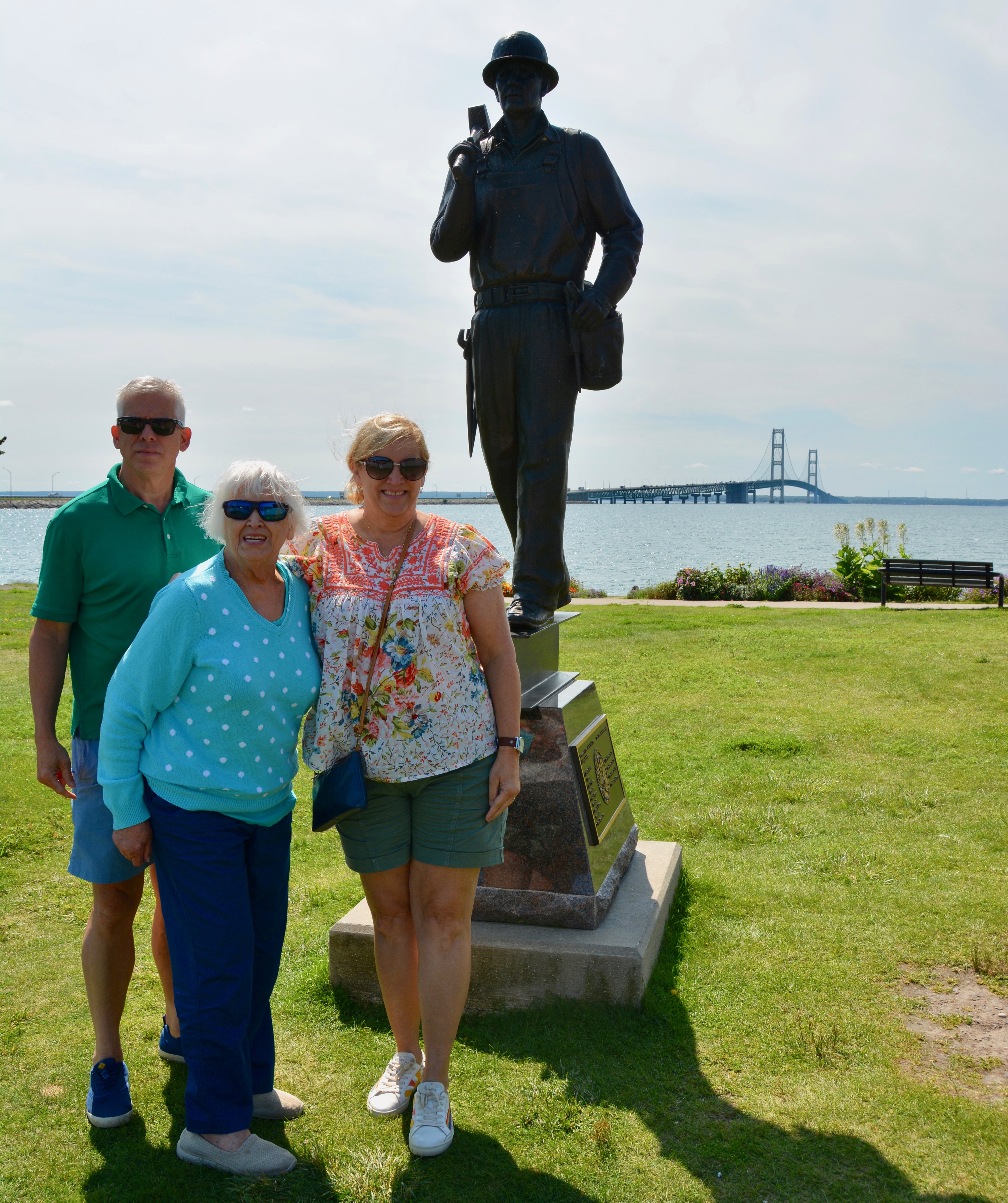
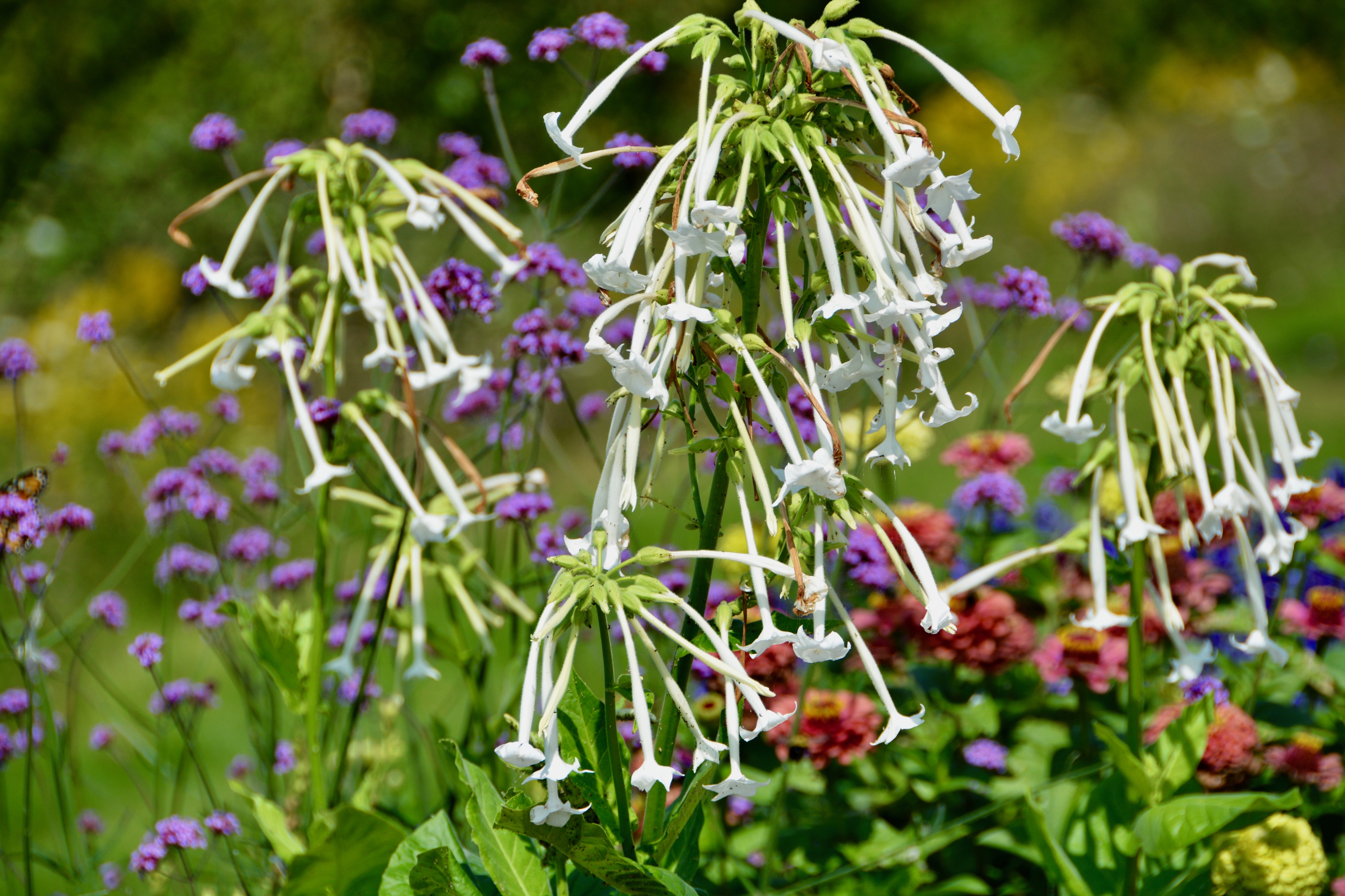
After we crossed, we went to a lookout point featuring a statue dedicated to the five men who lost their lives while building the bridge. Mom had known a girl who was engaged to one of them. The views from the park were spectacular. We also loved the wonderful flowers that were showcased at the park. It is far too hot at home for this sort of floral display. One of things I love about Michigan in the summer is the beautiful gardens.
Back on the road, we realized that we may not have enough gas to make it the additional 50 miles it will take us to get to Sault Ste. Marie where the Soo Locks are located. The three of us distracted Mom so she wouldn’t get nervous while we looked for a gas station on this stretch of the upper peninsula highway that is rather barren. Of course we had just crossed the straits, but I guess I had anticipated a wild and beautiful landscape. Perhaps that lies a little farther north.

We found the gas and made it to Sault Ste. Marie-sometimes called Michigan’s First City-without having to ride in on fumes. The Ojibway people that first lived in this area called it Bahweting, the gathering place. When a French colony was established in 1668, it was called Le Sault de Sainte Marie, the rapids of St. Mary. Today is sometimes referred to as the Twin Saults for the American city of Sault Ste. Marie, Michigan and the Canadian city of Sault Ste. Marie, Ontario, just across the St. Mary’s River. Growing up we just called it “The Soo” as the locals do today. Sault and Soo are pronounced like the girl’s name “Sue” and not like the table spice “salt”.

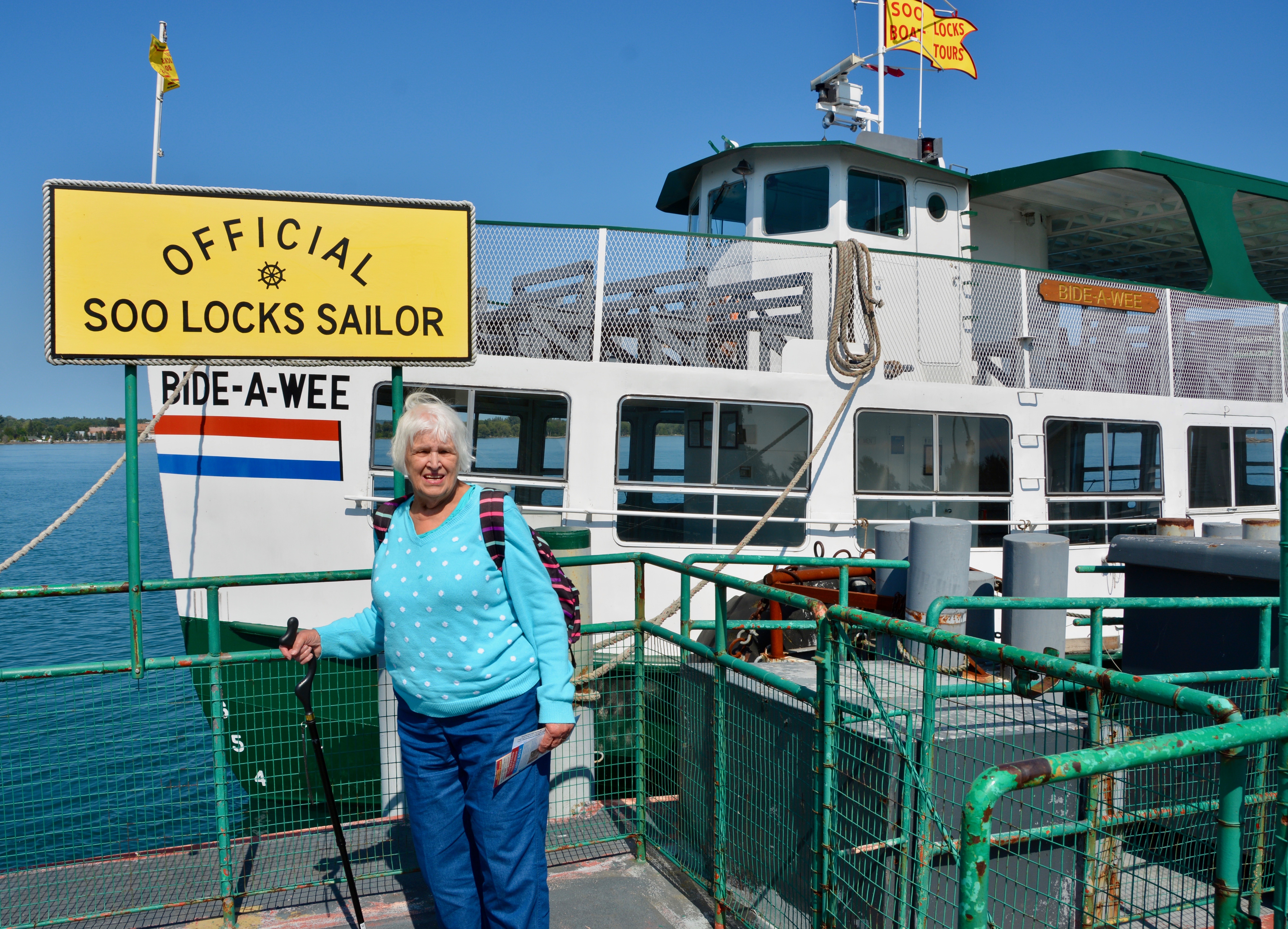
When we arrived in Sault Ste. Marie, Michigan, we went to find the boat launch. We did make a few stops so I could get pictures. Afterwards, we went back into town for lunch at the Lock View Restaurant. The Lock View opened in 1945 with only about a quarter of the space it occupies now. We got a table near the window with a narrow view of the locks. A viewing platform had been built since our last visit over 40 years ago and it was right in our line of sight. That said, the viewing platform does offer an nice alternative for anyone wanting to see the locks in action.


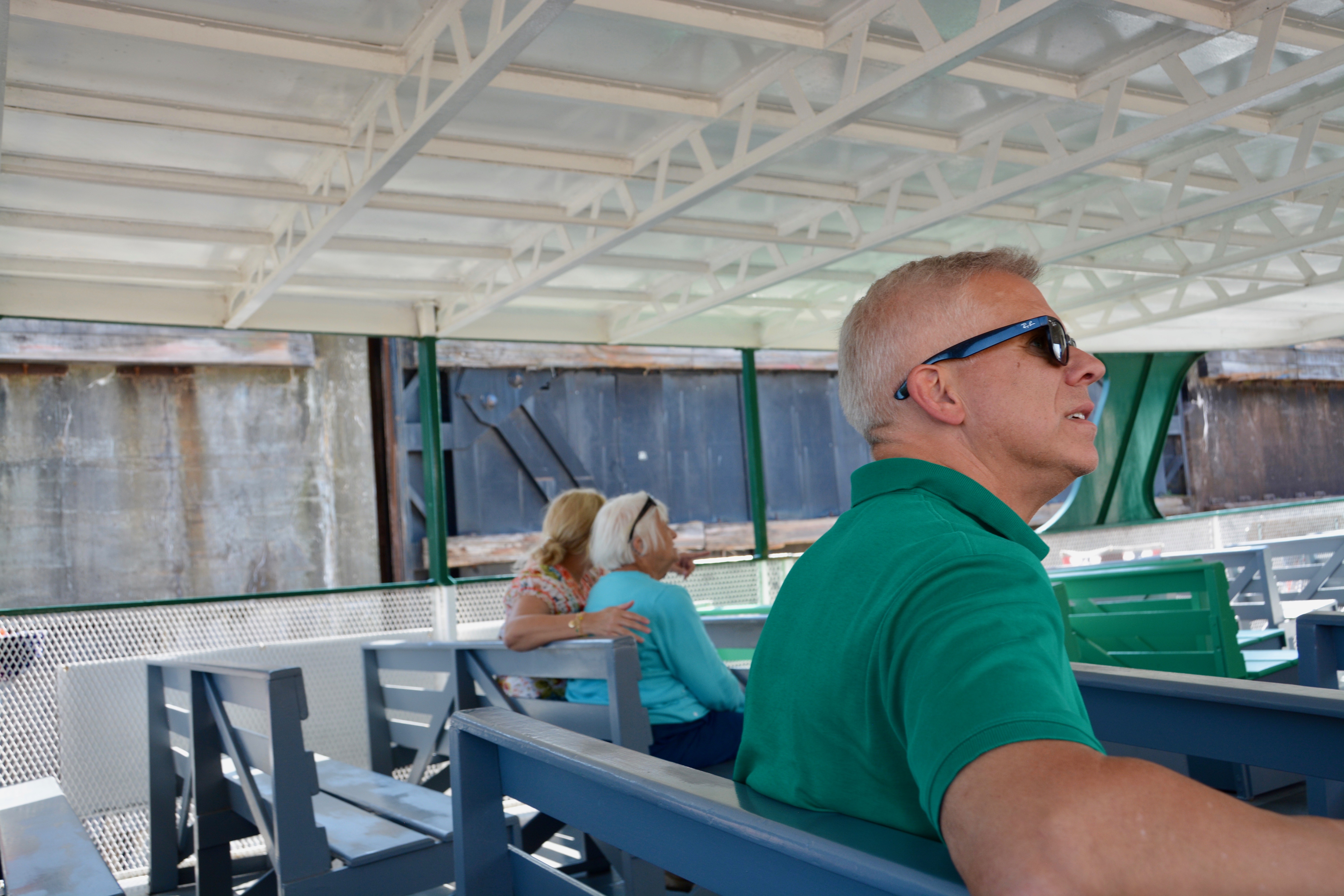
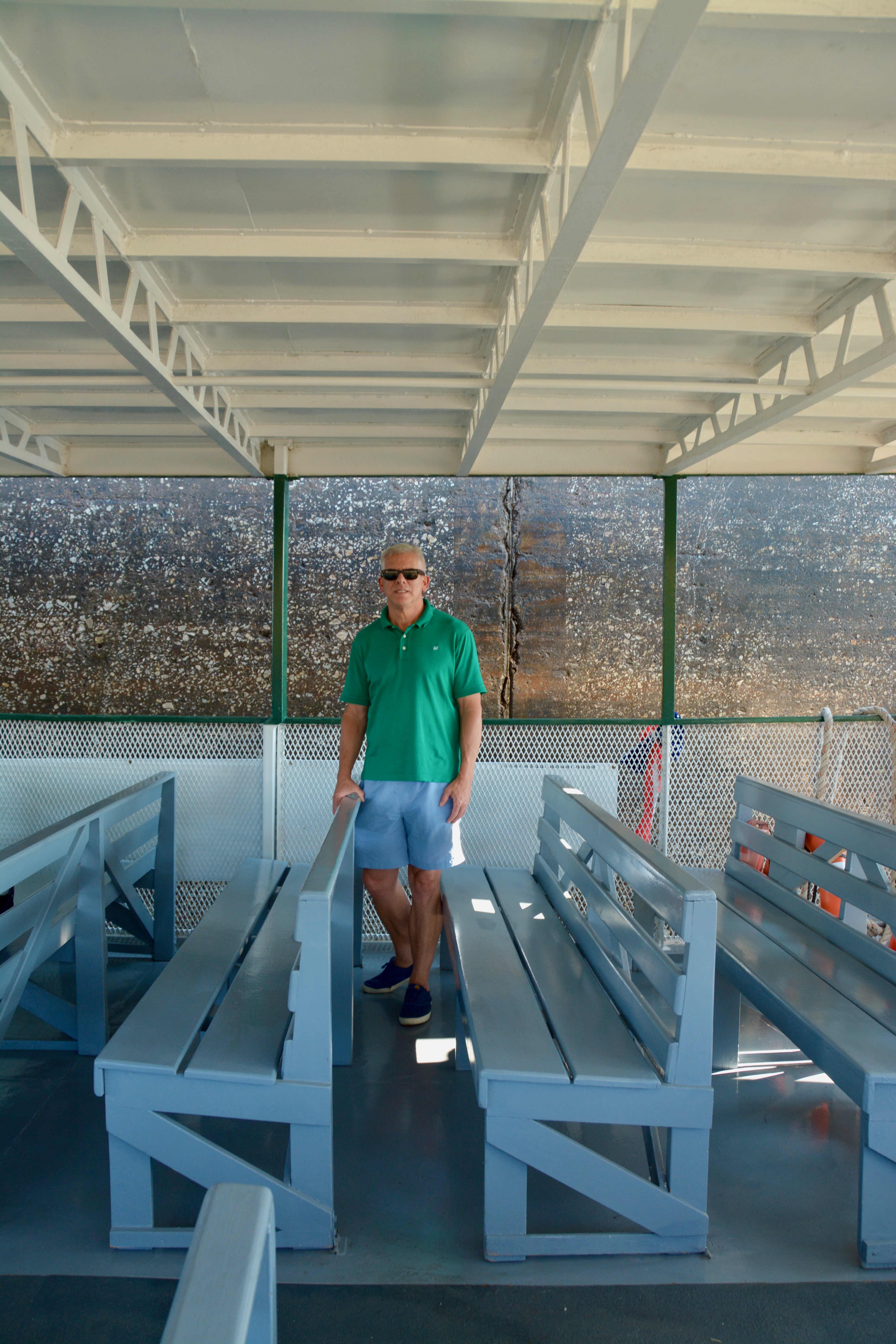
Mom and I got fried lake perch. This is one of her favorites and not something I can get back home in Texas. Emma and Jack got hot turkey sandwiches. After lunch we had just enough time to go back to the docks and board our boat for the 3:30 pm tour. It was a steep climb for mom, but we went to the boat’s upper deck for a better view. Many of the Michigan schools are back in session, so the crowd was lighter. Of course it was a weekday too. Our server at the cafe said that Sunday is the busiest day and Friday is the lightest. For the cafe, on Friday the locals clear out for the weekend before the tourists come in and the tourists have not yet arrived.

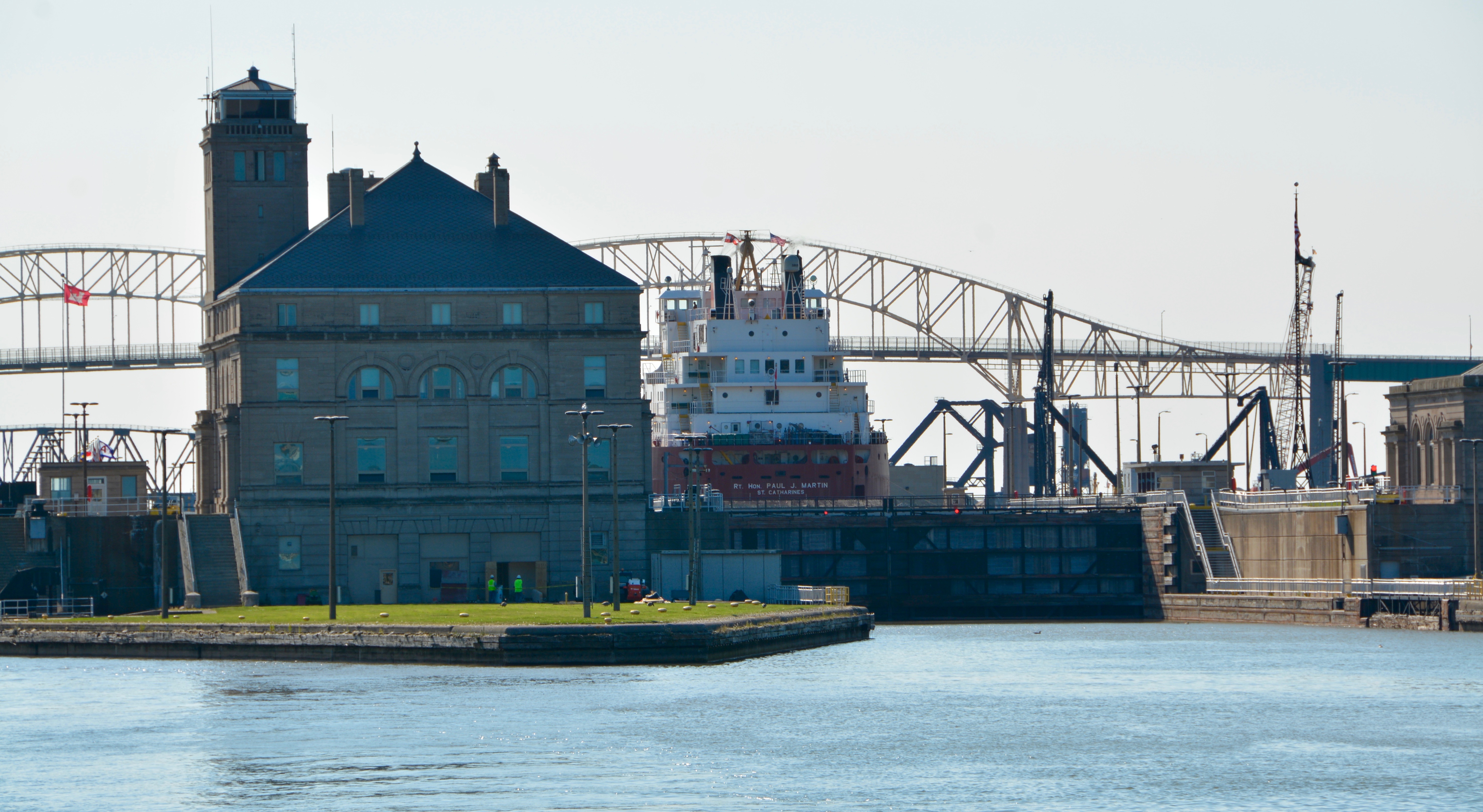
We are on the St. Mary’s River between the United States and Canada and the middle of this channel is the international border. The Ojibway Indians used canoes to travel the rapids on the river to reach Lake Superior. The name of city comes from the French word sault meaning rapids. You can still still some evidence of the original rapids which spread the length of the River. Later, it was the Northwest Fur Company that constructed a navigation lock on the Canadian side of the river. This lock, built in 1797, was destroyed during the war of 1812. In 1852, the State of Michigan was granted compensation to built a lock to allow for commerce to flow through the Great Lakes. Construction on this first chamber State Lock was completed in 1855.


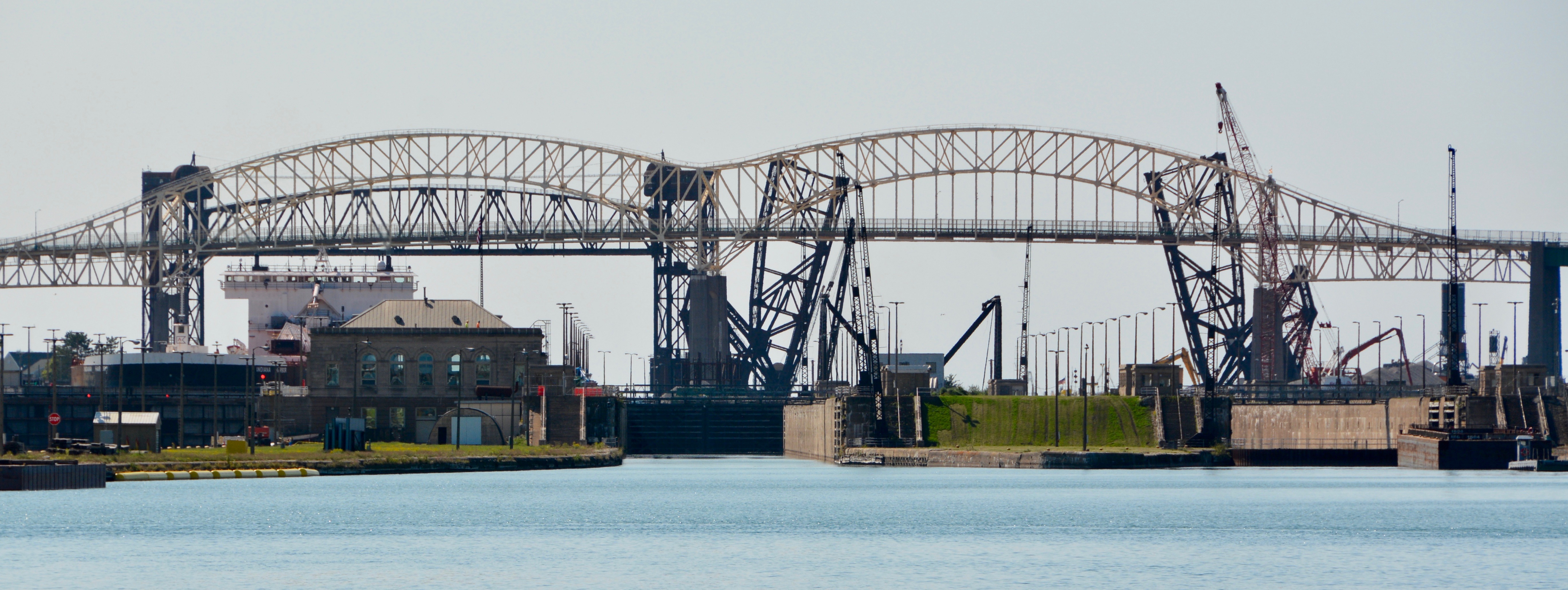
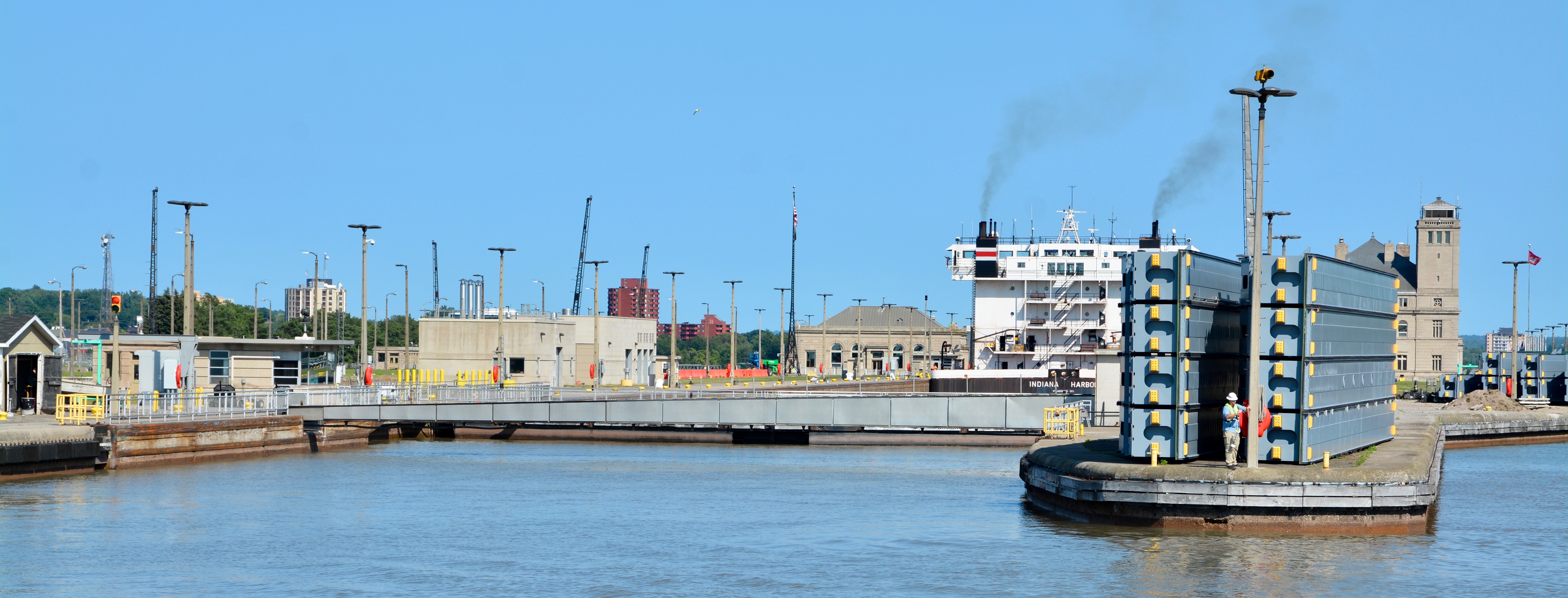
There was originally a toll to pass through the locks. In 1881, control was passed to the Federal Government and assigned to the Army Corps of Engineers. Since that time, no toll has been charged. Sault Ste. Marie, Pure Michigan Today, there are four locks on the American side and one Canadian lock. The Canadian lock is for smaller, recreational boats and is currently closed due to COVID. The mostly commonly used American Lock is #3, the Poe Lock, which was originally built in 1896 and rebuilt in 1968 to accommodate larger and more modern boats. It is 1200 feet long. It uses 22 million gallons of water to lift or lower a boat. Most ships that pass through it have only about 2.5 ft clearance on each side.

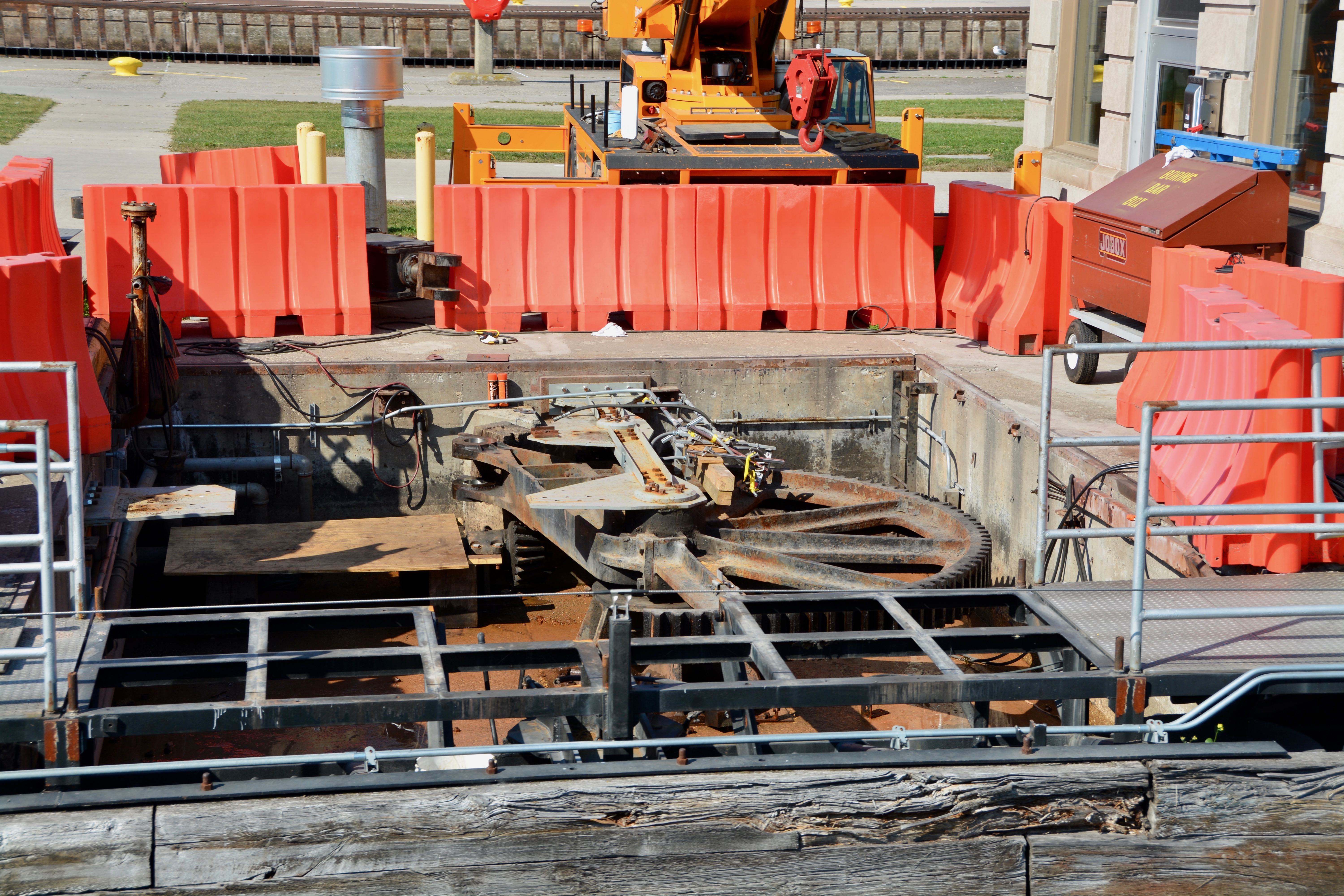
The smaller MacArthur Lock, lock #4, is 800 feet long and was built in 1943; we will pass through it twice today. The Soo Locks do not use pumps. They are 100% gravity fed. When on the viewing platform of the Visitors Center we saw from the restaurant, you look down into the MacArthur lock. The large ships in the Poe Lock are also visible. Locks #1 and #2, the Davis Lock built in 1914 and the Sabin Lock, built in 1918 were the first locks to utilize concrete walls and electricity to open and close the gate. Both gates are currently out of service. The Sabin Lock has been inactive since 1989 and was officially decommissioned in 2020. The Davis Lock was used by the Soo Area Offical Vessels.

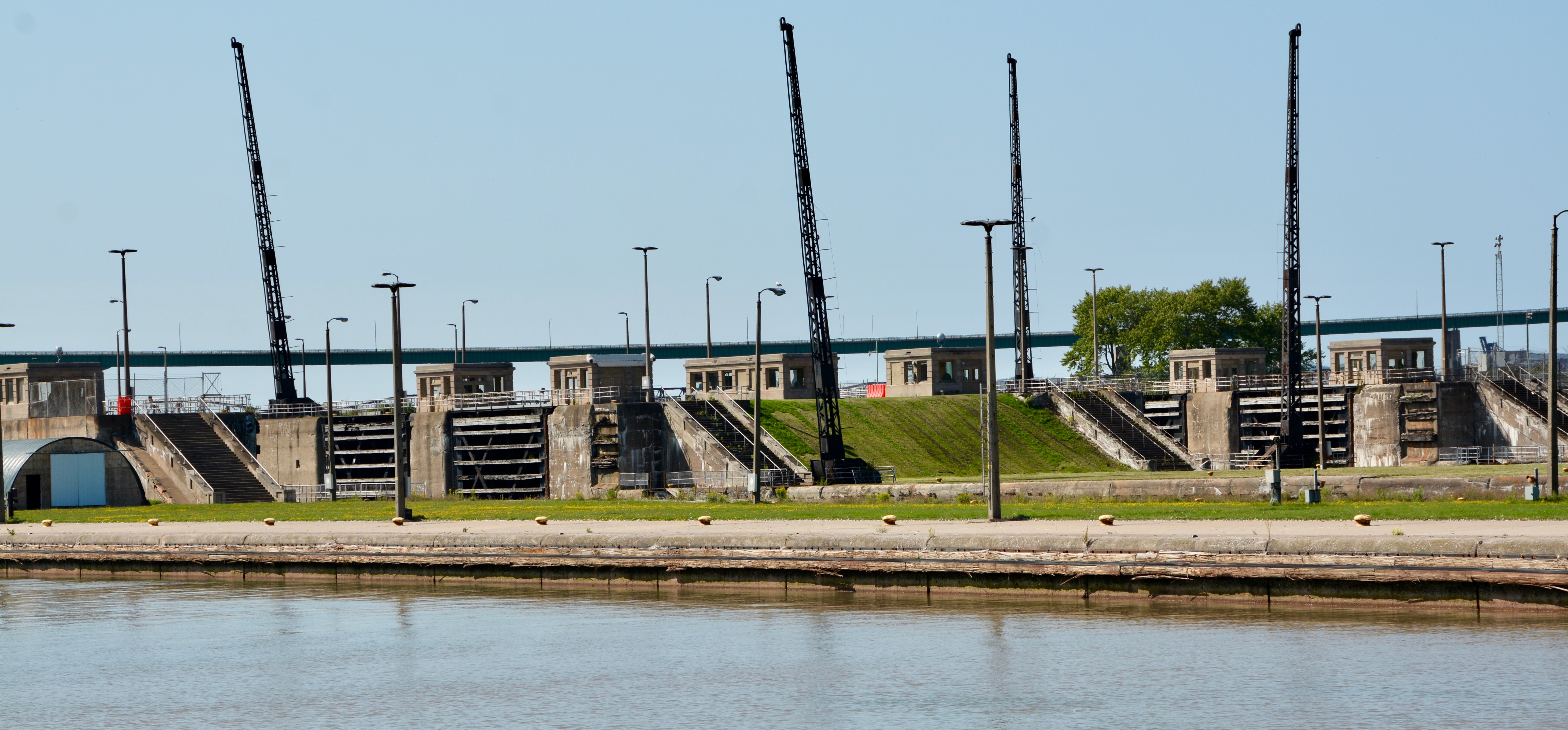
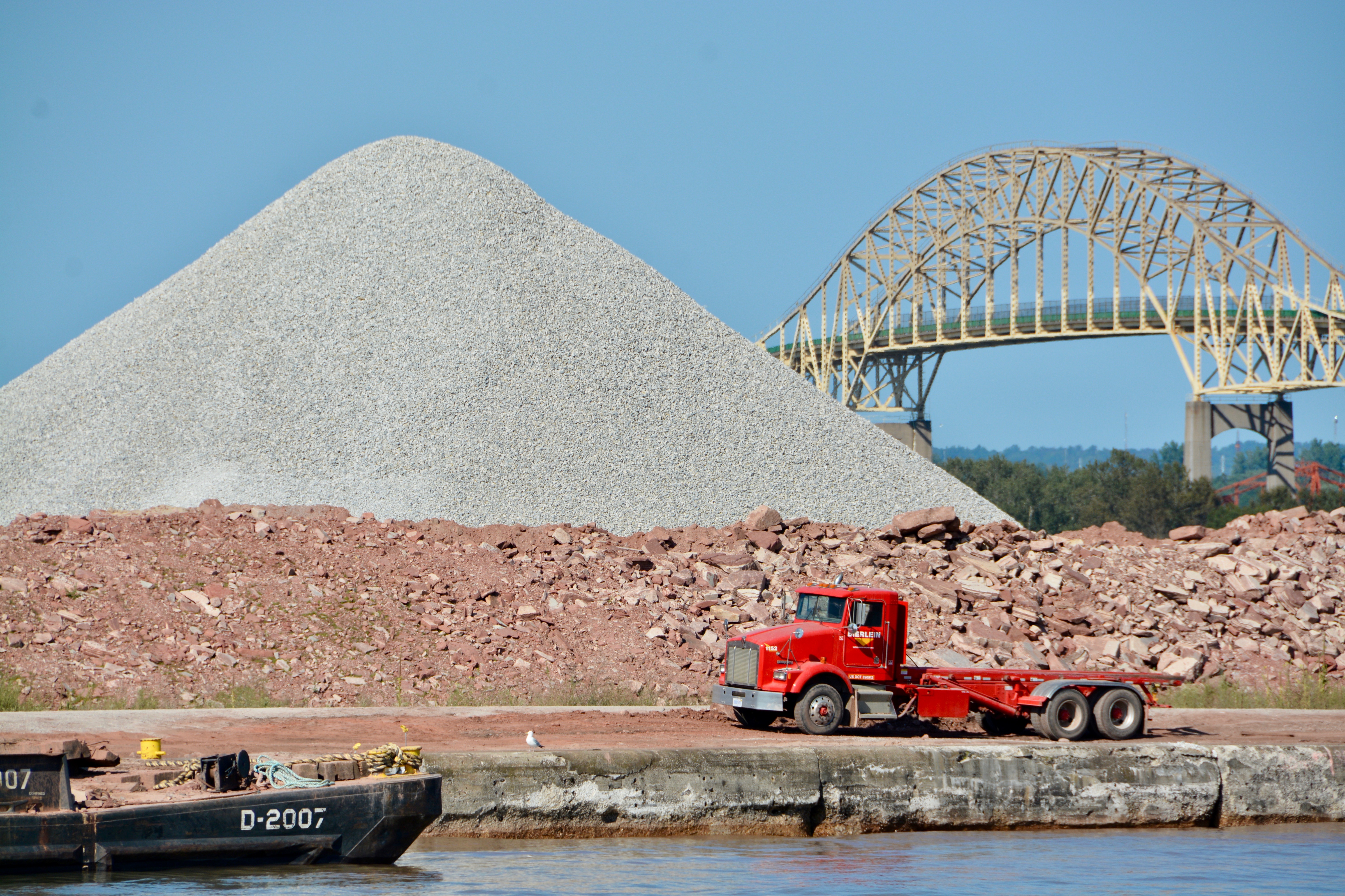
Both of the Davis and Sabin locks are currently being dismantled to make way for a new, larger, single lock that will be able to accommodate ships of a larger size. We saw the dredging for the new lock. Completion is expected in 2023. A rendering of the new look for the Soo Locks is on the webpage for the Army Corps of Engineers. The importance of the locks cannot be overstated. 90% of the country’s iron ore passes through the Soo Locks. The existence of the locks means transport ships can travel from Duluth, Minnesota to the Atlantic Ocean. The trip takes 7 days.
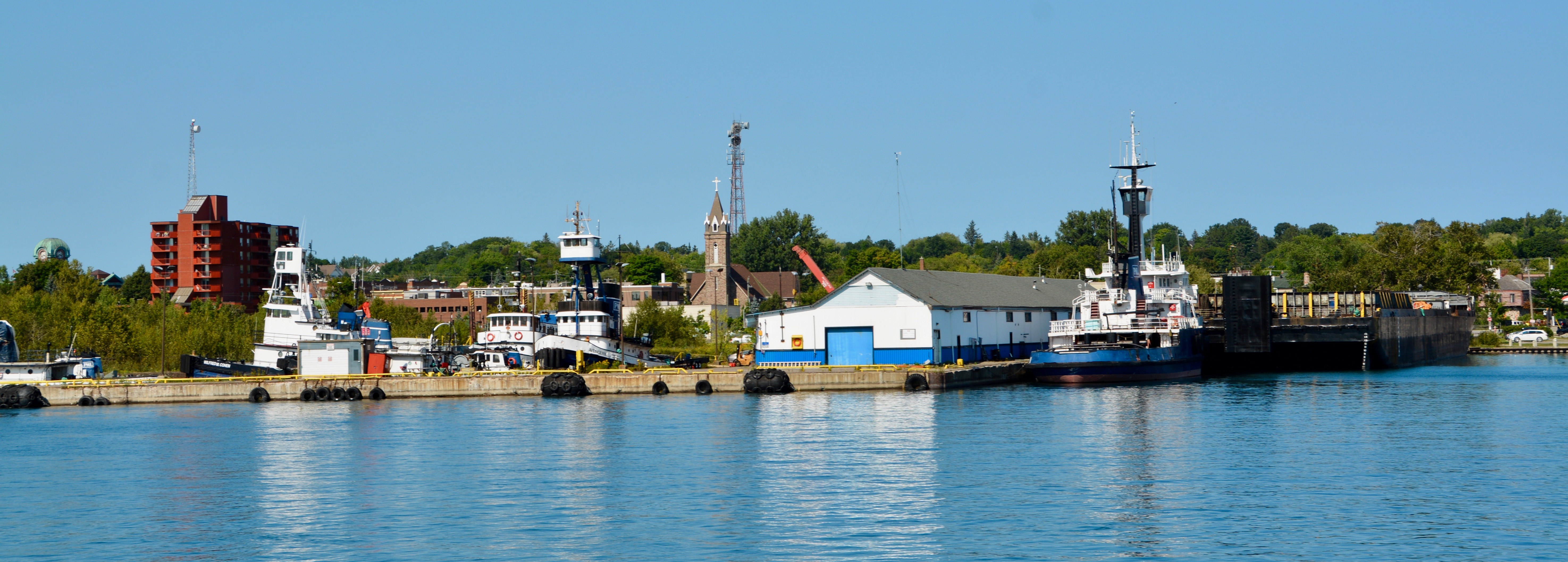
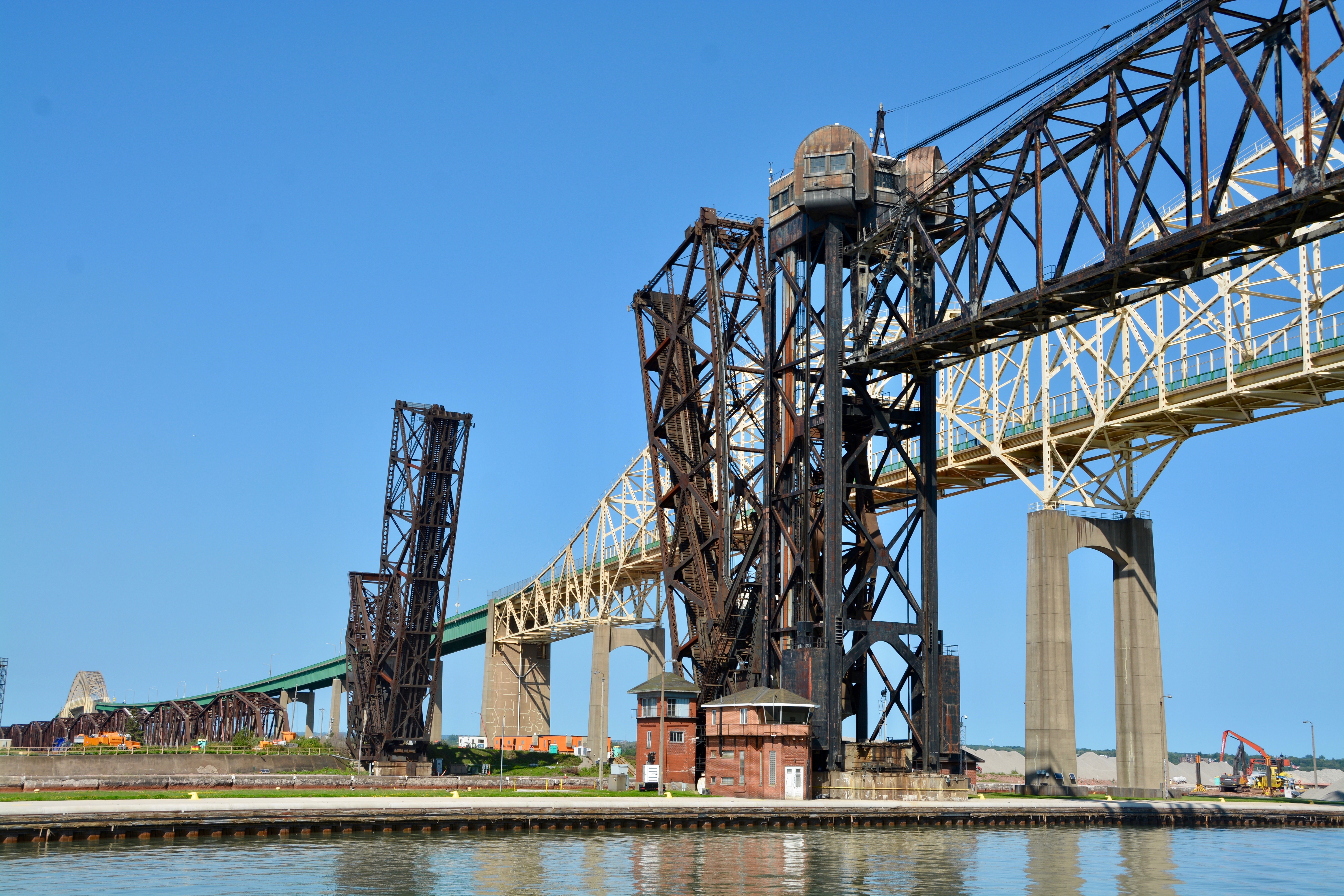
Traveling toward the locks from the tour boat dock, the State of Michigan is to your left; Canada is to your right. Sault Ste. Marie, Michigan is the smaller city with about 15,000 residents to its Canadian sister’s 80,000. Most of the landscape along the water’s edge on the American side is marine support and utility services. The city on the Canadian side bears the same name and is located in the Canadian Provence of Ontario. The two were once a single city until the treaty that ended the War of 1812 divided them. Today they are joined by the Soo Locks International Bridge.


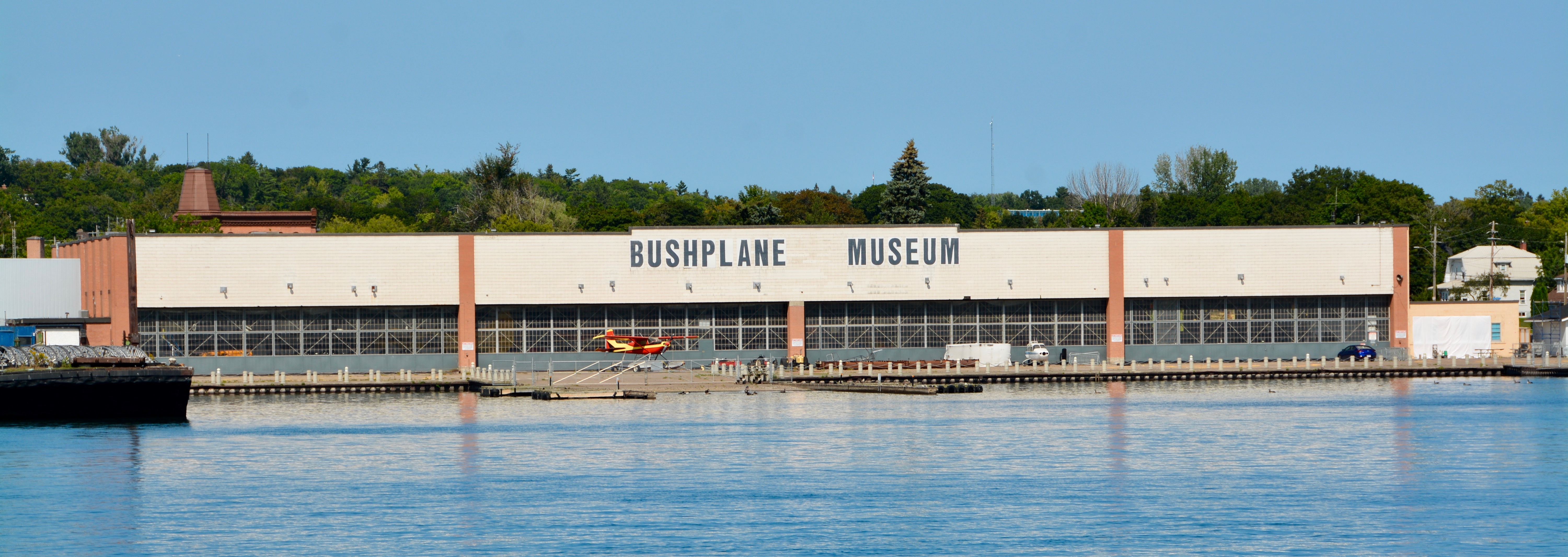
I have to admit that the Canadian side of the river was prettier. There was a manicured shoreline and a welcoming structure that reminded me of a circus tent. We also saw the Bushplane Museum. On the American side near our tour boat dock, we saw a bunker used to lift ships out of the water and facilitate repairs. There are also Coast Guard vessels and ships that assisted with the retrieval of the Edmund Fitzgerald of pop music fame.

The “SS Edmund Fitzgerald was an American Great Lakes freighter that sank in Lake Superior during a storm on November 10, 1975, with the loss of the entire crew of 29 men. When launched on June 7, 1958, she was the largest ship on North America’s Great Lakes, and she remains the largest to have sunk there. She was located in deep water on November 14, 1975, by a U.S. Navy aircraft detecting magnetic anomalies, and found soon afterwards to be in two large pieces.” Wikipedia.
The Edmund Fitzgerald was sailing under the American flag, but sank in Canadian waters. “The disaster is one of the best-known in the history of Great Lakes shipping. Gordon Lightfoot made it the subject of his 1976 hit song “The Wreck of the Edmund Fitzgerald“. The sinking led to changes in Great Lakes shipping regulations and practices that included mandatory survival suits, depth finders, positioning systems, increased freeboard, and more frequent inspection of vessels.” Wikipedia.
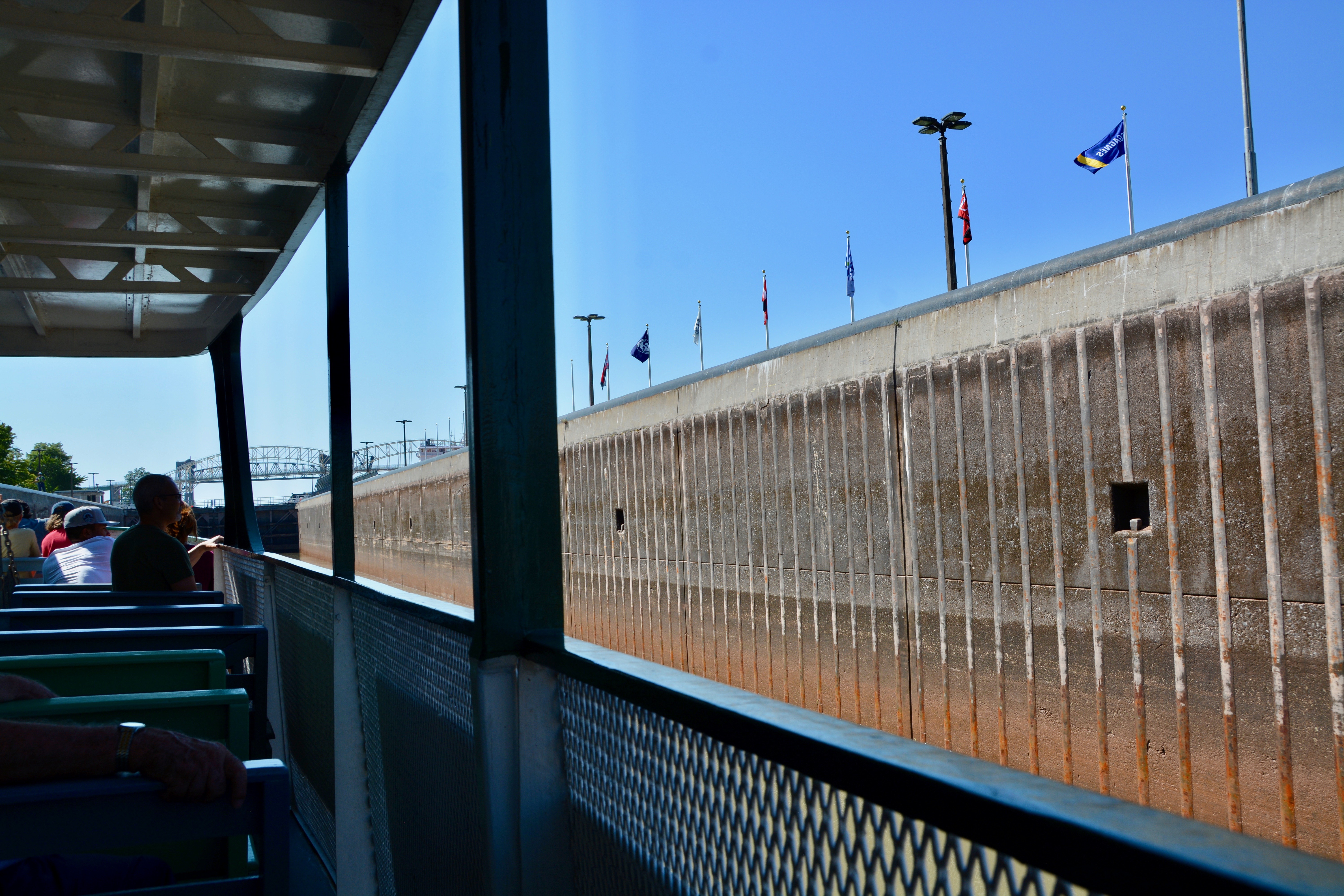


This side of the St. Mary’s River is the lower level so we entered the lock at a depth of 33 feet. The crew threw anchor lines up to the shore to attach us to the side. Hooks to tie off on were also visible on the concrete sides of the lock. I thought the locks were smooth, but you could see the ridges in the concrete as we entered. There was also a large freighter in the Poe Lock next to us. The water rose so smoothly if you weren’t watching the sides you wouldn’t even notice you were going up. The locks do not use pumps, but are activated by gravity.


When we were high enough, the gates opened on the opposite end and we headed out to pass underneath the International Bridge. Due to ongoing repairs, a cover had been removed and we were able to get a look at some of the gears that work the locks. We could also see the decay that betrays the age of these long-working structures. As we passed by the opening to the Poe Lock next to us, we could see the freighter inside. On the walkway between the Poe and the MacArthur, supports that will be used to secured the locks during the winter months had already been set out. The Soo Locks are closed from January 15 to March 25 for repairs.


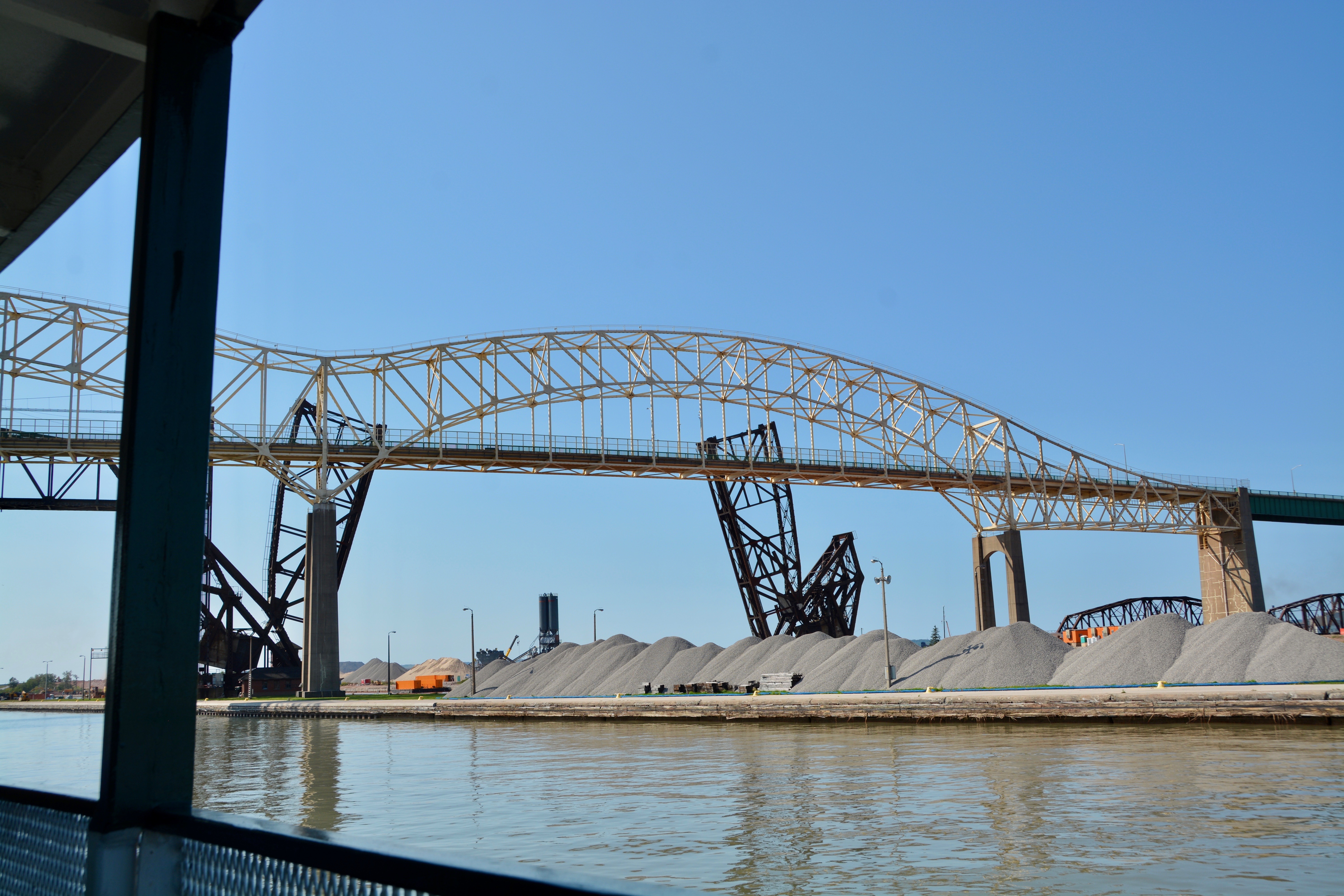
One of the most fascinating things I saw while passing under the Soo Locks International Bridge, was the railway line. Through one channel, the rail line splits and raises up on both sides to let ships pass. For the other channel, the railway line is lifted up instead. Even in inclement weather, an individual must climb up the outdoor ladder to the top to operate the controls to raise or lower the structure.


As we sailed out on the upper St. Mary’s River, we saw the dredging operations for the new deeper lock. Construction on the new lock is advancing, although I am not sure if the weather will halt work in the winter months or not.


Traveling a little farther on the river, we were able to see operations at a large iron ore production facility. Our captain’s brother-in-law works there and the captain has had the opportunity to tour the facility. He shared that it is quite impressive. We also could see the Canadian lock used mostly for recreational watercraft which is currently not in operation. The tour operator is looking forward to its reopening and I wondered if perhaps the tours often go through that lock on one leg of the journey.


It was late afternoon and a nice time to be on the water. It was not yet cool, in fact it was rather hot for being this far north. I had expected colder temperatures. The light played nicely off the water and we listened to the captain’s stories about animals that got caught in the lock. Given the number of visitors and the places they come from, I was surprised he assumed that everyone had seen a moose. Rounding the last bend for our return trip through the lock, he pointed out rocks that still had the holes where dynamite had be inserted from back when the older locks had been constructed.


We made a return trip through the MacArthur Lock. Beside us in the Poe Lock was the Rt. Honorable Paul J Martin, the large Canadian freighter we saw waiting its turn to pass through the lock when we were on the lower part of the River. There were fewer people on the viewing platform this late in the day.


We passed out of the locks and I spotted a few birds making their home on the lock gates. We got another lock at the Rt. Honorable Paul J Martin in the Poe Lock before making our way back down the lower St. Mary’s River toward the boat dock.

When we passed through Sault Ste. Marie earlier in the day one of the most intriguing things I saw was a long building so large I couldn’t photograph the whole thing except at an angle. I thought it was an old warehouse at first until I saw the sign. The older sign said Edison. The more modern one read the Cloverland Hydro Plant listing an original operation date of 1902. It is an impressive and beautiful brick building with wonderful glass windows from the Sault Ste. Marie side. At the end of the boat tour, I got a chance to see it from the water. It was even more beautiful from this vantage point. The captain pointed out that the arches were formed to resemble lighthouses, but only from the water side.

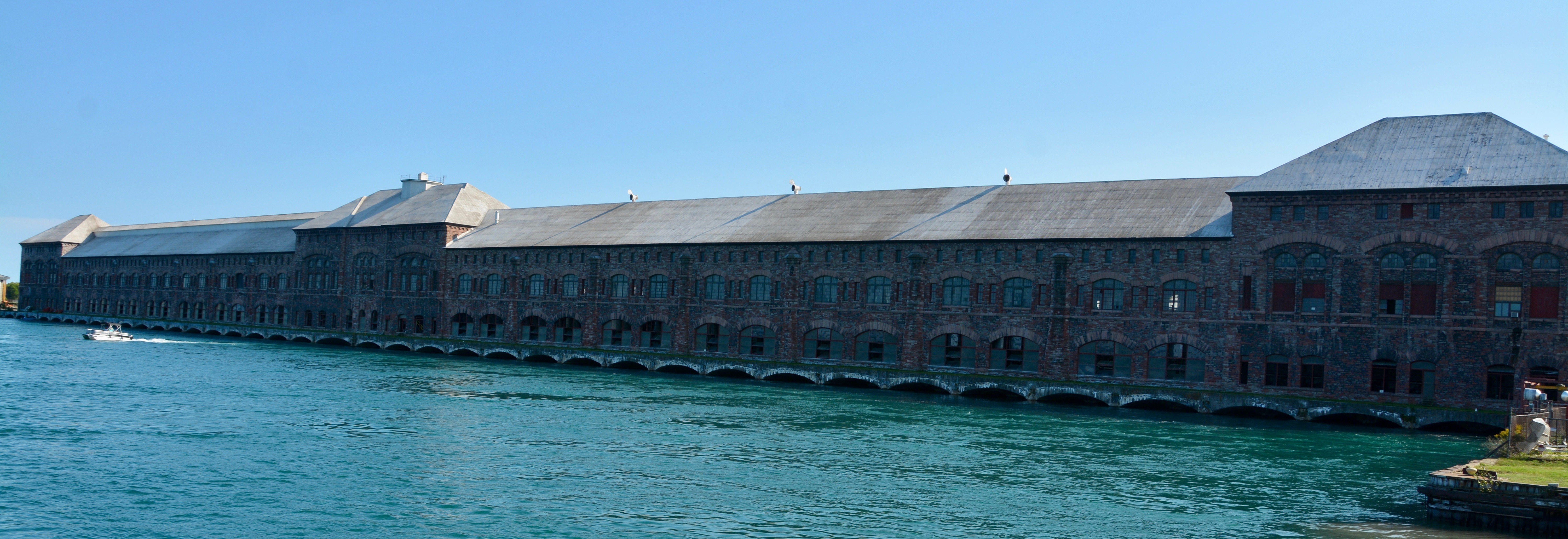
“At the time of completion, the plant was the second largest hydro facility next to Niagara Falls.” Contrary to my original thought, the plant is constructed of steel and red sandstone. The stone was excavated from the power canal which runs 2.25 miles under the city of Sault Ste. Marie. The plant itself is a quarter-mile long. There are actually 74, 3-phase generators in the plant operated by a team of 12 employees. It supplies 20% of the power for Michigan’s Upper Peninsula. Sault Ste. Marie, Pure Michigan

After disembarking, we drove back to St. Ignace. We will spend the night here in order to catch a ferry over to Mackinac Island in the morning. The island sits in the Straits of Mackinac and can be reached by ferry from St. Ignace on the upper peninsula and Mackinac City on the lower peninsula. Our plan is to ride the 9:30 ferry which goes under the Mackinac Bridge before going to the island. We have tickets, but the ride is first come, first served and there are no reservations taken.

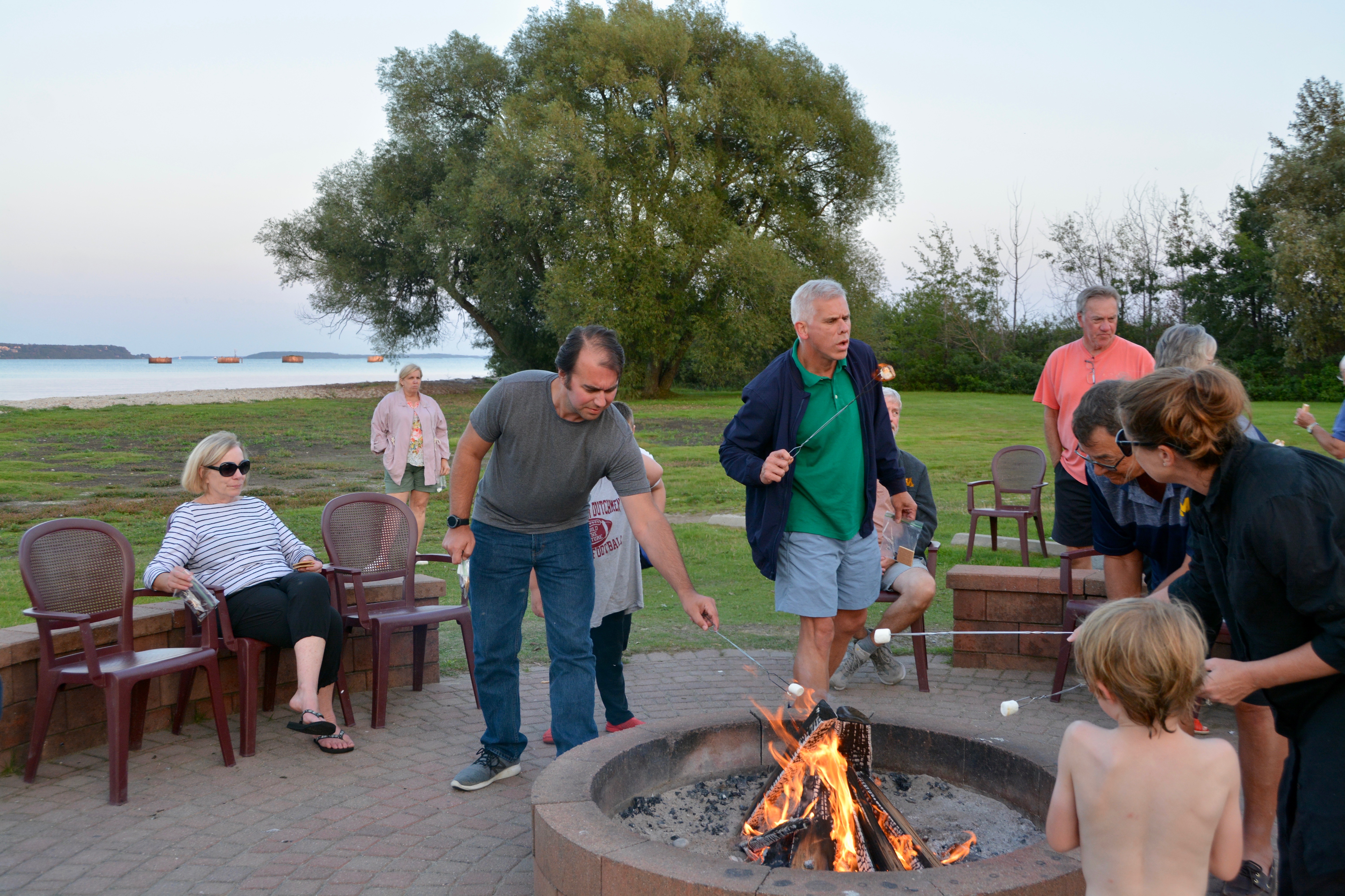
Our hotel in St. Ignace was close to the ferry launch and sat on the water. We had a partial view of the lake from our balcony. At 8 pm, Jack, Emma, and I went down to the rock beach for s’mores and the view. Mom was tired. It was a nice evening and a good end to a full day. Off on another Michigan adventure in the morning…

–Natasha
