


Our last port in the Arctic Circle is in Honningsvag, Norway, the northernmost city in mainland Norway. (I actually think this is an inaccurate description because Honningsvag is on an island, not the mainland.) In spite of its location, Honningsvag has a subarctic climate and does not get as cold as you might think. The city has about 2,245 inhabitants. “Honningsvåg was declared a city in 1996 by the municipal council of Nordkapp. National legislation was passed in 1997 that states that a Norwegian city must have at least 5,000 inhabitants, but since Honningsvåg was declared a city in 1996, it was exempt from this legislation. This makes it one of the smallest cities in Norway.”-Wikipedia


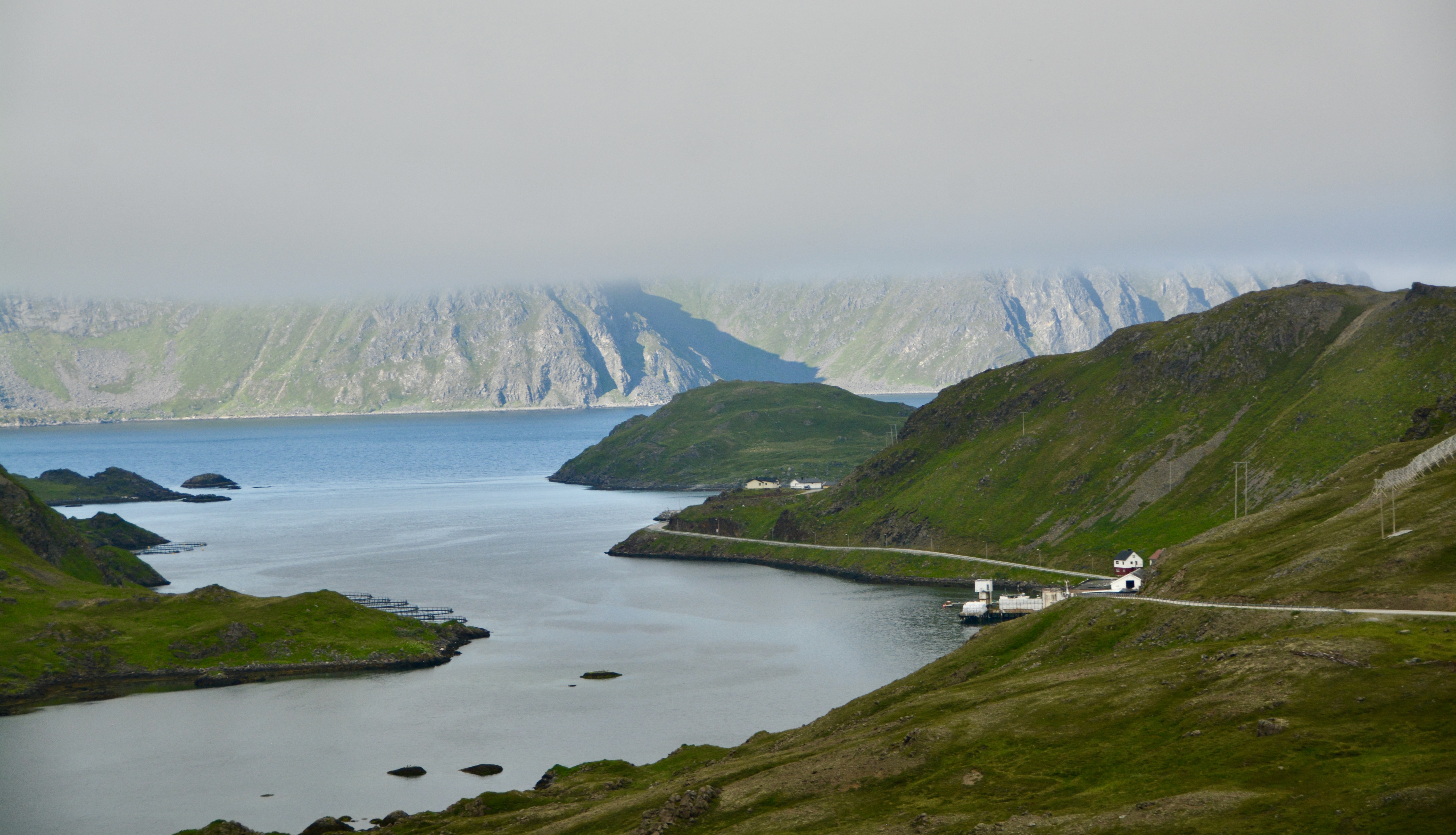
Honningsvag is a popular cruise ship stop in the summer. It is well known as a spot to experience the “midnight sun”, where the sun never sets in the summer. In the winter is a great jumping off point for seeing the northern lights. The city is situated at a bay on the southeastern side of the large island of Mageroya, while the famous Nordkapp, or North Cape, and its visitor center where we are going today are on the northern side of the island.

When not welcoming visitors, it is a tiny fishing village that had to be completely rebuilt after the second world war. Today it relies on fishing and tourism to support its economy.
This will be a short post because the entirety of our experience was a trip to and from the North Cape. About ten minutes before our arrival at the Visitor’s Center the fog began rolling in and the views became exceptionally limited. As we came back down, the mist followed us. As we sat at dinner, the fog just got thicker and thicker. No chance of seeing the northern lights on this trip.

The trip north on Mageroya was punctuated by vast stretches of land with no inhabitants except for the visitors in camper vans. The Visitors’ Center is at the northernmost point in Europe that can be accessed by car. To reach the most northern point, you hike in from the peninsula that sits next to it. We saw the parking area for the hikers: it was not nearly as close to the northern shore as the Visitors’ Center entrance.

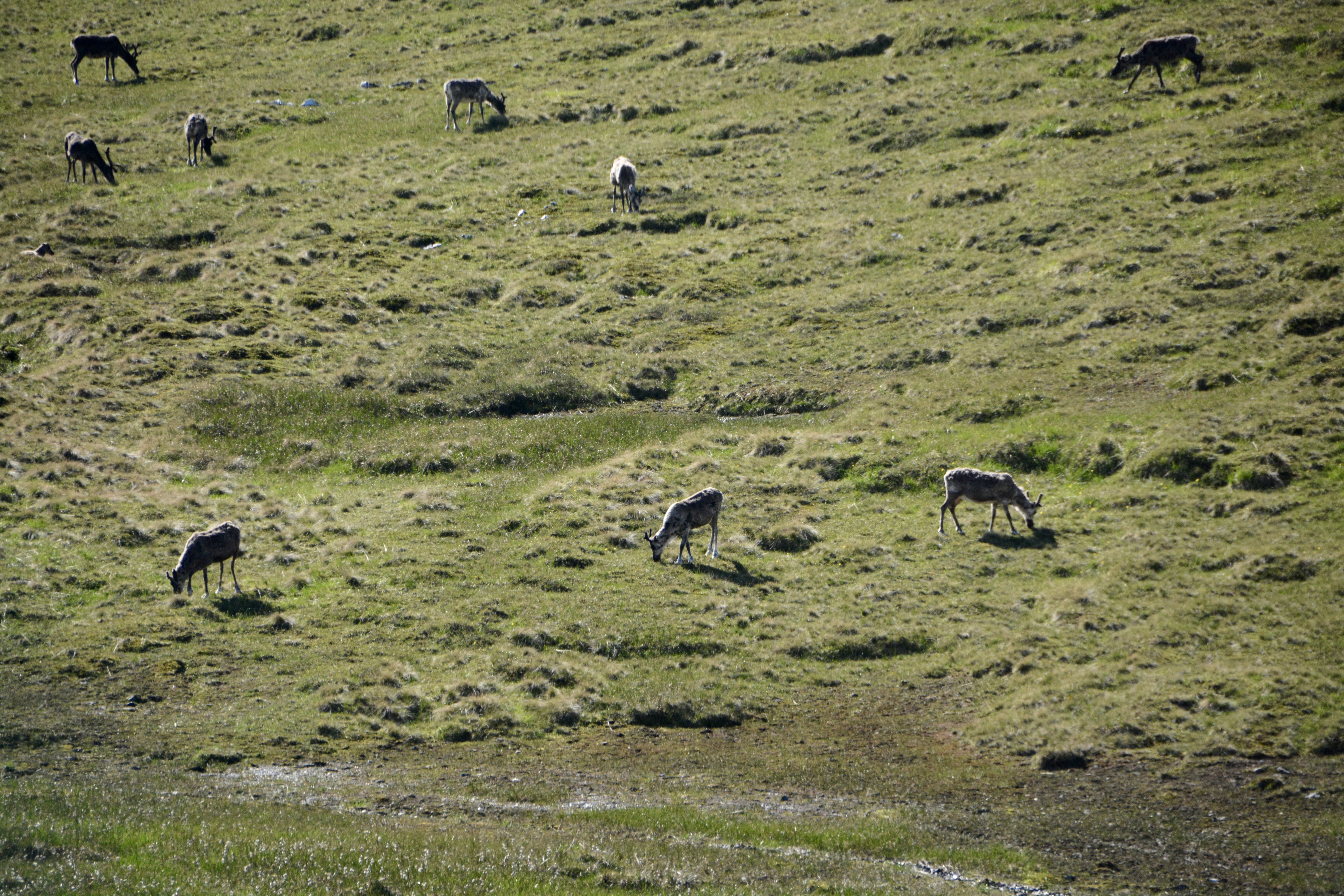
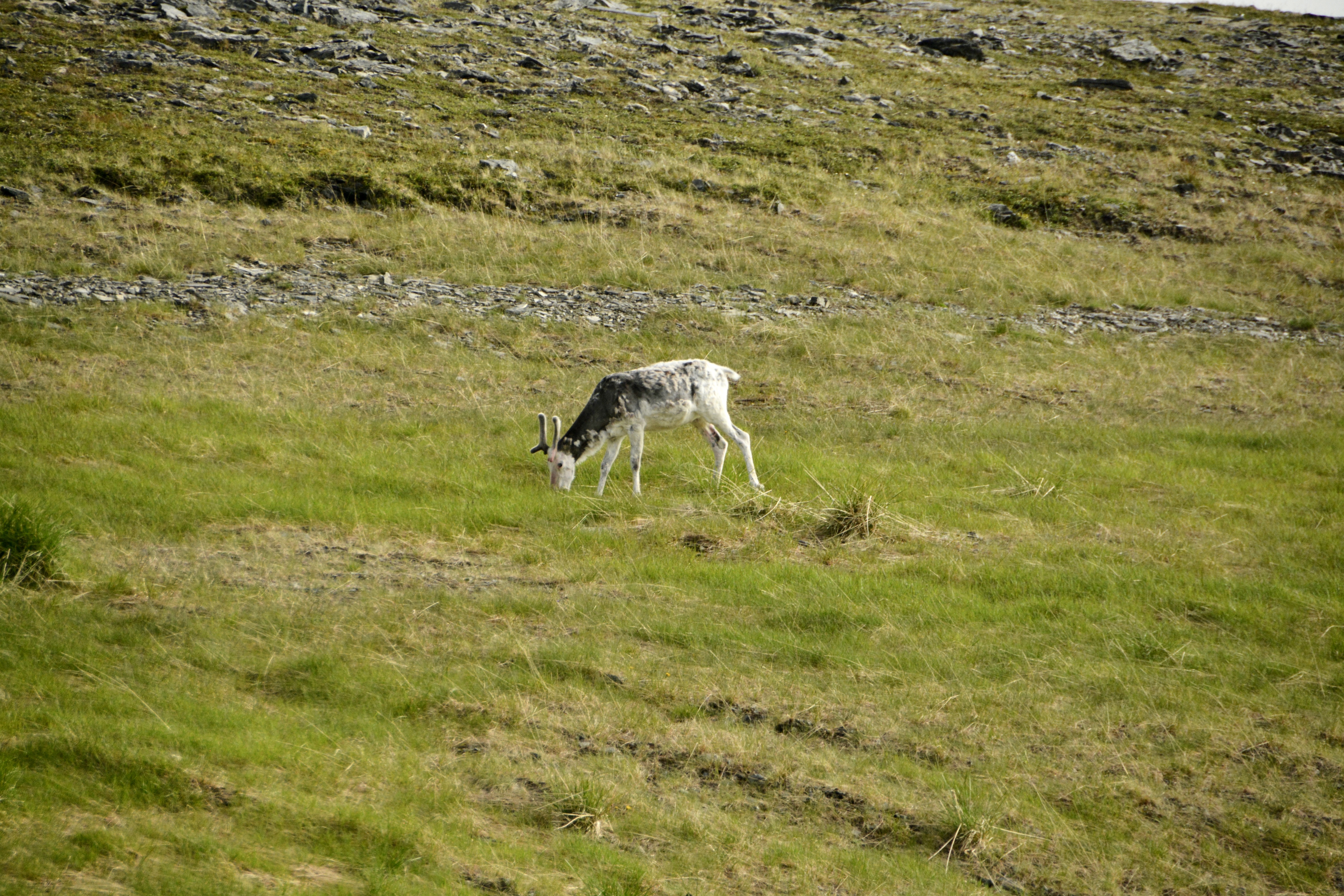
The highlight for me was the many reindeer that roamed freely across the land, and they were the subject of most of my pictures for the day. We saw them alone, in pairs, in large groups, and even a mother with her calf.


When we reached North Cape Hall, the Visitors’ Center, the fog was so thick that it was hard to even see the water. The structure was built in 1988 on the plateau. In addition to the view, attractions as the center include dioramas, a theater, a post office, a café, a restaurant, a bar, and a gift shop.

We started inside with what we thought would be an orientation video. However, there were no words which makes sense since they have visitors from all over the world. The photography in the video, which roughly follows the change of seasons through a calendar year, is gorgeous. There was some lovely photography of the northern lights to end the video; that will probably be my only experience with the lights despite my goals for this trip.

Our “excursion” was actually just a transfer, so we received no orientation on the bus. After the film and viewing the limited dioramas, we went outside to the globe that marks the far point of the plateau. While you could get a picture with the globe, you could barely see the water in the photos I took. This was a “just-so-I-could-say-I-have-been-there” excursion that lasted too long. It originally was to include a stop at a Sami camp, but that was eliminated.
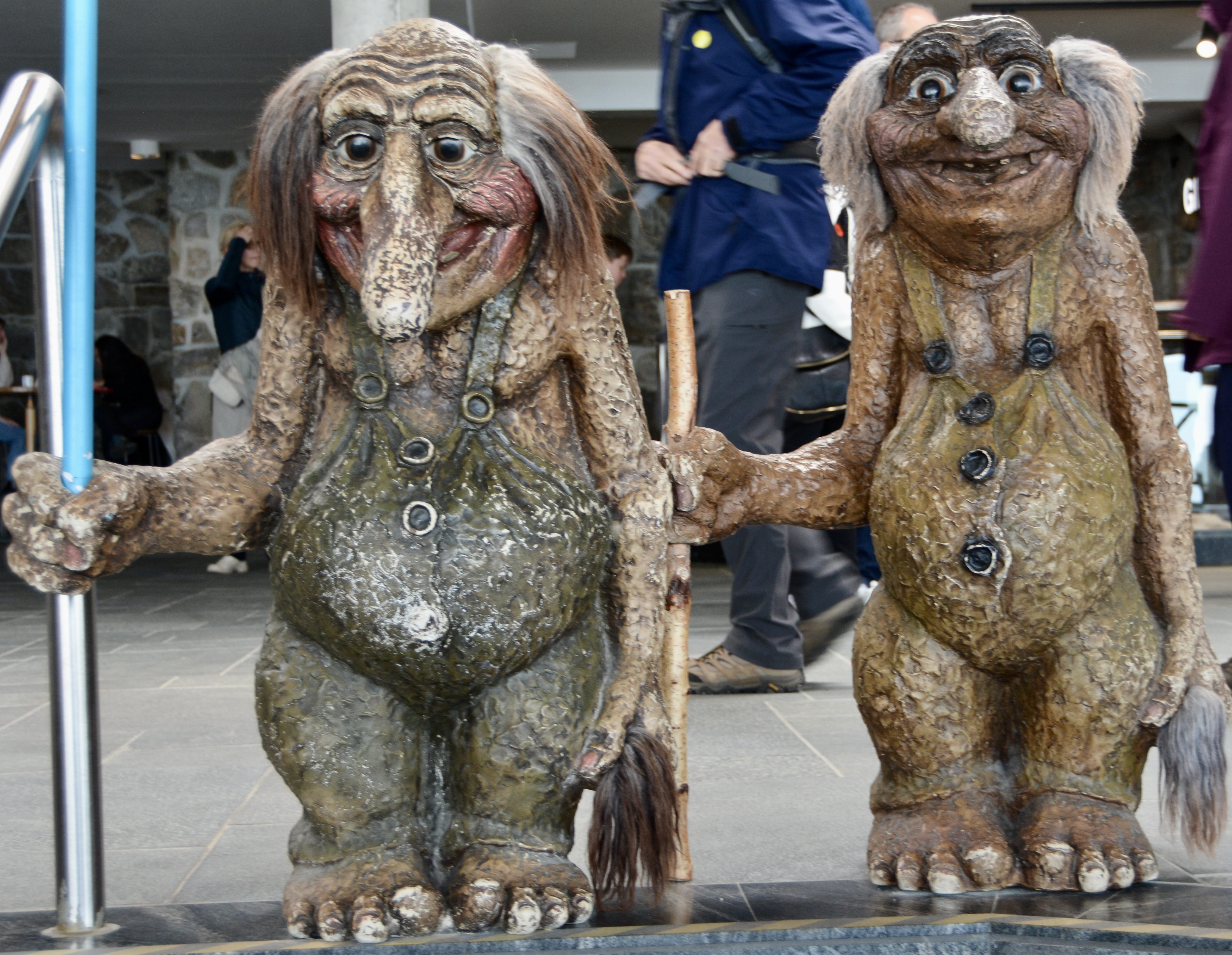
After spending a little time outside, the coldest I have been on this trip, we went inside and wandered through the gift shop, snapped some pictures with the troll statues, and decided to get a drink in the café. Unfortunately, it was only hot drinks and by then I was warmed up. They also had the heat up so high that even Boris (who has been rather cold on this trip) said he would rather sit outside.

I was going to take pictures of some of the outdoor art installations, but the fog had gotten even thicker. We pulled out the blanket we had just bought and waited for our bus to arrive. Apparently, the coaches were doing double duty, so we had to wait until the bus was moved and tagged with our transfer group number.

I got to see things from the other side on the way back down, but the fog was following us, and the views were not as good as those on the way up. Fortunately, we still saw some reindeer out and about.

For complete accuracy on the location, you should note that Nordkapp is often inaccurately referred to as the northernmost point of Europe. The neighboring Knivskjellodden Cape actually extends 1,450 m (4,760 ft) further north; that is the point you can reach by hiking out. Additionally, both points are situated on Mageroya Island which is connected to the mainland by a road. The northernmost point of mainland Europe is located at Kinnarodden, Cape Nordkinn, “which lies about 5.7 km (3.5 mi) further south and about 70 km (43 mi) to the east. That point is located near the village of Mehamn on the Nordkinn Peninsula. The northernmost point of Europe including islands, is hundreds of kilometers further north.” -Wikipedia

In other words, there was no real significance to the location we visited other than it is pretty far north. After today, we take two sea days to reach Kristiansand in Southern Norway. Relaxation ahead. –Natasha
